Hello steemchurch family, today's challenge corresponds to the strength of nature, we often surprise ourselves looking at the sky and discovering the shapes of the clouds, we are invaded by the curiosity to know more about them, and that is why we are going to tell all what is necessary to identify them.
Clouds are portions of air clouded by condensed water vapor in the form of liquid droplets, small, numerous, in crystallites of ice or in frozen spheres or by mixing of both elements.
The clouds are white because when the sunlight gives them, it disperses in all colors equally and reaches our eyes as white light. The more charged with water, the more sunlight will filter and appear darker.
At dusk the clouds turn red and orange due to the absorption of blue in the thick atmospheric layer that the rays of light have to cross in the twilight moments.
Classification of clouds
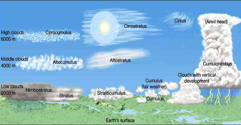
According to its height: high, medium, low clouds and clouds with vertical development.
- High clouds:
They form approximately between 7000 m and 13000 m
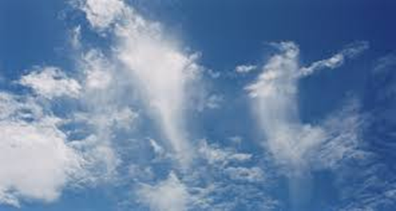
Cirrus: They are separate clouds in the form of white and delicate filaments. These clouds have a fibrous appearance, similar to the hair of a person, or a silky shine or both characteristics at the same time that give it its peculiar appearance. If they are isolated, they are a sign of good weather, but if they advance organized and progressively increase, they indicate an imminent change in time.
Cirrostratus: A thin layer of clouds, transparent, fibrous in appearance, which covers the sky in whole or in part and which generally produces the halo phenomenon. They are made up of very thin ice crystals, even more than those of the Cirrus. They do not usually indicate a change of time.
Cirrocumulus: They are constituted by ice crystals, by thin cotton clouds have a formation process similar to the Cirrus. This type of cloud is completely white and without shadows.
- Average clouds:
They develop approximately between 2000 m and 7000 m altitude. Here we can find:
The Altocumulus: clouds of water and ice with white and gray aspect, or both shades at the same time, with their own shadows, and are formed essentially by solid cotton-colored clouds, which present undulations or wide grooves in their lower part.
The Altostratus: They are mixed clouds of ice and water that can cover the sky totally or partially as a cloudy, gray or bluish layer, they allow to see vaguely the Sun.
- Low clouds:
They are below approximately 2000 m. Here we can find:
Strata: Cloud layer generally gray, with uniform base, general completely covers the sky. It is composed of small water droplets.
Stratocumulus: Mantle of gray or white clouds, or of both colors at the same time, that almost always have dark parts, cover all or great part of the sky.
They do not indicate changes of time and are associated with good weather when in summer they appear in the middle of the afternoon.
- Vertical development clouds:
They are produced as a result of the rapid rise of air masses. Here we can find:
The Cumulus: Isolated clouds, develop vertically in the form of domes or towers, and whose convex upper parts often resemble a cauliflower. The clusters correspond to the good weather when there is little environmental humidity and little vertical movement of the air but the clusters can acquire a large size, causing storms and intense downpours.
Cumulonimbos: They are amazacotada clouds and dense, with a considerable vertical development, in the form of mountain or huge towers. They have a mixed constitution of ice crystals and liquid water, they are almost always flattened with the shape of an anvil. They almost always produce a storm with rainfall in the form of rain or hail.
Psalm 19: 1
The heavens tell the glory of God, and the firmament announces the work of their hands.


Very nice content 😊
Thanks you @anamaris