Introduction first: I am a big geography and history nerd who loves drawing maps. All types of maps, from historic maps at all different times and stages of history to political maps of the current day. From city maps to country maps, and more. I have an instagram account along with Steemit where the same posts can be found, where I engage my followers to give their opinion about different political situations, or historical events.
The Indian subcontinent. Full of diverse people's, ethnicities, and religious diversity. There are 22 offical different languages on India alone, and not mentioning the unofficial local languages. There are over 800, and only in India! And their cultures, these all vary as well. Panjabis, Bengalis, Oriyas, Gujaratis, Manipuris, Tamil, you name it. The subcontinent is one of the most diverse places on the planet. And, not only it has many cultures, it has many truly beautiful and colorful cultures.
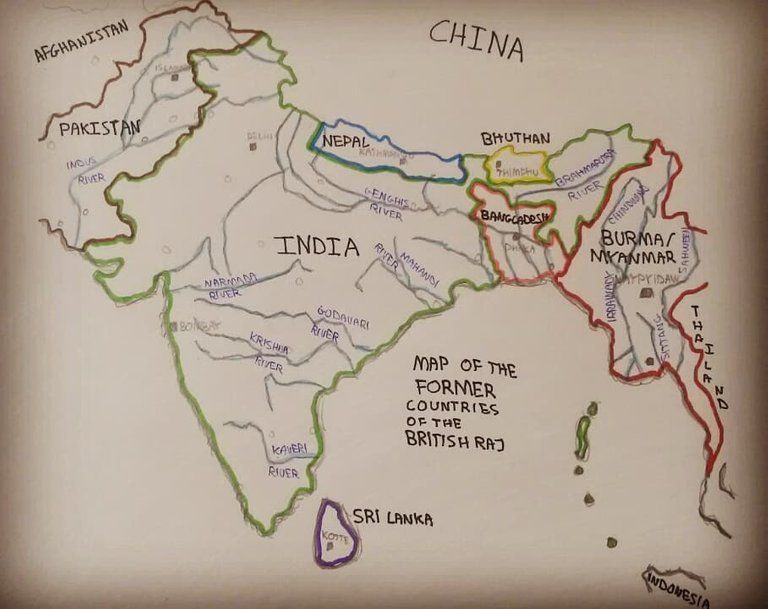
In this map, I highlighted the countries that were a part of the British Raj. This includes Burma, wich isn't exactly on the indian subcontinent or close to Hindi culture. I also drew the most important rivers of India, Nepal and Bangladesh: The Indus, The Marmada, The Godavari, The Krishna, The Kaveri, The Mahandi, The Ganges and The Brahmaputra. Burmese rivers aren't an exception either: Sittang, Irrawady, Salween, Mekong.
This map took me about 2 to 4 hours to make and detail. I love doing it, it's my hobby, and when I discovered Steemit, i simply couldn't refuse to get paid by doing my hobby! By doing what I love and sharing it. Can't be a better deal! This is my first but not last post in Steemit. I still have a long road ahead of me!