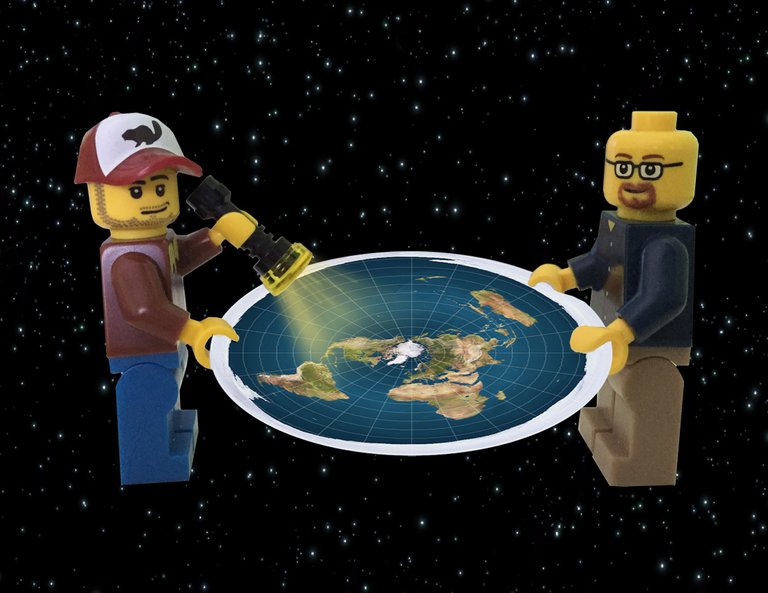
In a previous article we discuss the Bizarre Resurgence of People Who Believe the Earth is Flat, mainly based on the concept that the earth SEEMS flat, and therefore it is!
While they employ a bit of logic and reason at the beginning in their questioning of the round earth, they seem to lose all objectivity, logic, and scientific reasoning in their complete rejection of a round earth and subsequent adoption of the flat earth as their model of reality even though a flat earth model is a glaringly, incredibly worse model of reality than is a globe earth model, as we show on the page mentioned above.

As discussed, they end up building new theory on top of theory in order to overcome the shortcomings of each new explanation as to why their model is an obvious failure on its face. This ends up building a model of flat earth that more resembles a Rube Goldberg machine than a working viable model of reality.

At the very foundation of this Rube Goldberg model is, as might be expected, a map. And, as would be expected, this map is, well, of their depiction of flat earth. However, their foundational model falls apart immediately at first glance once one realizes not only the glaring errors in this basic map, but the fact that it’s not even a flat earth map at all, but that it’s actually a map of the GLOBE!
The Incredibly Preposterous Idea of Basing Your Flat Earth Model on a Globe Earth
In another article, we go into the Glaringly Obvious problems with the Flat Earth Map, but here we’ll mention just two of these problems and why they are significant. These two problems are that the flat earth map shows Antarctica, not as a southern polar continent, but as an ice rim that would need to be approximately 100,000 km in circumference. Another problem is that their map has the actual distances between points on earth become more and more incorrect the further away from the north pole you go and the closer to the ‘ice rim’ that you go.

These errors cannot be overcome. We KNOW that Antarctica is a southern polar continent that is approximately 14,000 miles in circumference, while their 'continent' shows a circumference of what would be approximately 62,000 miles; and we KNOW distances between major cities on earth, of which these distances are often 3-5 times larger on the flat earth map. However, it’s not the errors themselves that are so damning of the flat earth argument for the purposes of this article, but the reason WHY these errors occur on their map.
The reason these errors are present on a flat earth map is because their map is not a map of flat earth, but is actually an Azimuthal Projection Map based on a globe earth! What’s stupendously incredible is that flat earthers do not even seem to NOTICE that this is the case. Instead, they maintain that their map is a map of current reality! Or, in some cases, they just claim they do not ‘accept any one model’, but this is a complete logical ‘cop out’. They DO accept a model, it’s a model of flat earth! If they have any ability to understand science or logic, you cannot have rejected one model for another without first having a model to accept! And in the thousands of years of people hypothesizing a flat earth, the best model they can come up with is based on a globe!
The ‘Flat Earth’ Map is Just an Azimuthal Projection Map of a Globe!
Since the very beginning of mapmaking on the sphere that we live on, sailors have always realized the problem of mapping the earth properly. Two great advancements in mapmaking were the realization that the earth is a sphere, and the subsequent ability to map both longitude and latitude onto this sphere.
In thousands of years of flat earth thought
the best map the best flat earth minds have
been able to come up with is an
Azimuthal Projection map of a globe!
But the problems of mapping a 3 dimensional sphere onto a two dimensional map has always been a significant problem, distorting the size of many countries and thus making distances incorrect. But, since it’s easier to relay information via two dimensional models, humans have been attempting to come up with the best model possible in order to transmit this information as accurately as possible in books, atlases, and maps. While some of these models work better than others, the fact remains that all of them have significant errors.

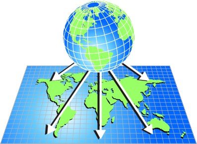
Enter the Azimuthal Projection Map. This type of map is one way of visualizing a globe earth on paper. It is done in a similar way that one might peel an orange if you were to leave the top intact and peel the rest of the orange peel so that the peel could be laid flat on a surface. What you’d have is a ‘map’ with the North Pole as a circle in the center and the South Pole in pieces at the ‘tips’ of all the peels. In order to make this look more like a map, one would take the empty spaces between the peels and fill them in with something, either ocean or continent, so that there were not a bunch of empty spaces.
If you did this exact same procedure with a globe and were able to ‘peel’ the globe ‘map’ off of the globe itself and lie the paper flat, what you’d have is approximately an Azimuthal Projection Map. The advantage of an Azimuthal Projection Map is that you can have all the correct latitudes and longitudes, although the DISTANCES between those points will not, necessarily, be accurate. But it’s a useful model for visualizing the earth... a spherical earth.
The Hilarious Secret About the Flat Earth Map
But back to the flat earth map. The map that flat earthers accept as a model of REALITY of life on earth and use as a 'model' for all of their thought experiments and graphic models, is merely an Azimuthal Projection Map! If you cannot see the incredible hilarious irony of this fact, I’ll explain it in more detail. Flat earthers REJECT a round earth, and claim that the earth is flat. Yet in thousands of years of belief in flat earth, despite knowing virtually EVERY distance between points on the planet, despite almost every one of these points having a known GPS coordinate such that even children can engage in playing an adventure game called ‘Geocaching’ where people will place specific items at specific GPS points around the earth and people use GPS to find these items, the BEST model of reality that flat earthers can come up with… is based on a GLOBE!!!
To make this even more hilarious, they also claim, as we mentioned previously, that the UN patrols all 60,0000 of the ‘ice rim’ of Antarctica in order to keep people from discovering the truth that the earth is flat. As evidence of this conspiracy and deception, they point to the symbol of the UN, and say that the UN uses a flat earth map as their symbol as a sort of 'hiding it in plain site' joke on humanity.

But what flat earthers MUST not be able to recognize, is that it’s not that the symbol of the UN is a flat earth, but that THEIR map is an Azimuthal Projection Map, as is the UN Symbol! Even the Wikipedia Entry for Azimuthal Projection Map uses both a current 'flat earth model' map and a UN symbol and describes them both as being examples of an azimuthal projection map! One can't take them seriously when Wikipedia even shows their flat earth map and calls it what it is.
This makes 100% of their thought experiments utterly and completely worthless because you cannot envision correct thought experiments using a model that is horribly flawed from the beginning. For instance, they hypothesize experiments of how the sun could rotate in the 'dome' above a flat earth to create the time zones that we see on earth. However, with distances horribly distorted, and New Zealand as big as the United States, it makes this thought experiment an exercise in eye-rolling hilarity on the many ways the thought experiment is fundamentally in error, rather than a proof of the feasibility of flat earth having the current time zones that it does.
The irony and hilarity of the flat earth model just keeps getting richer and richer the more you look into their ridiculous and hilarious claims that flat earth is reality, simply because it seems that way. Well, if you know anything at all, even their own MAP is not even a map of flat earth! That should tell you how incredibly untenable and ridiculous even the most basic of their claims are, and that these people should not be taken seriously when they can’t even produce the most basic of foundational models... without first using a globe!
Thanks for your contribution to the STEMsocial community. Feel free to join us on discord to get to know the rest of us!
Please consider delegating to the @stemsocial account (85% of the curation rewards are returned).
You may also include @stemsocial as a beneficiary of the rewards of this post to get a stronger support.