This is a follow up to the story:
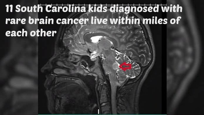
11 South Carolina kids diagnosed with rare brain cancer live within miles of each other (Please add your own info to this ongoing investigation)
Something has happened to the children in Mount Pleasant, South Carolina; 11 kids have been diagnosed with rare brain cancer and they all live within miles of each other. And now, local mothers are wondering if they are connected and what the cause might be. http://bit.ly/2vgKvaT
Parents Want Answers After 11 Kids Were Diagnosed with Similar Rare Brain Tumors in Mt Pleasant: http://bit.ly/2tQyCJj
I think it's time for us mothers to organize and create a database of all these cases, wherever they are.
We have no meaningful regulation of chemicals in this country. We're exposed to 82,000 chemicals, out of which the EPA has only tested a couple of dozen and regulated five.
It's incomprehensible that we've allowed it to get this far!
Cancer Cluster Investigations http://bit.ly/2uj6Szw
*Note: Mt. Pleasant is an area adjacent to Charleston, South Carolina.
CONNECT THE DOTS
Mt Pleasant, SC childhood brain cancer cluster
Dunes West Golf Club and surrounding homes were developed on land that was heavily mined for clay beginning in the 1700s. "In 1947, the land was sold to the O.L. Williams Veneer Company, Inc. (which later became part of Georgia-Pacific / Designation Wild Dunes). John Weiland acquired the property in 2005 to operate and develop the magnificent Dunes West Golf Club." http://www.golfsc.com/courses_Dunes-West-Golf-Club_Mount-Pleasant_638.html
Mount Pleasant, SC childhood brain cancers
Subdivisions were built on land that was heavily mined for clay beginning in the 1700s."Once a part of Boone Hall, Brickyard Plantation made literally millions of bricks a year and was one of the largest brickyards in the Lowcountry... Since brickmaking took a small workforce and reaped good profits, at one time or another almost every plantation on the Wando River had a brickmaking concern. .. Elm Grove Plantation, a Legare family holding which was about 9 miles from town and stretched from the Georgetown Stage Route (now Highway 17 North) to the Wando River. Today the lands are taken by Park West and the East Cooper airport. In the mid-1800s, it comprised 1,739 acres and was known for cotton and brickmaking." https://www.moultrienews.com/archives/our-historic-plantation-lands/article_3c3a6130-df90-57ff-a5bf-b647d06498e0.html
Mount Pleasant, SC - Most of the children who were recently diagnosed with brain cancer lived in three adjacent subdivisions, Park West, Dunes West, and Rivertowne. These subdivisions are built on land that was heavily mined for clay in 1700s and 1800s, when brickyards covered much of Mount Pleasant. Chemicals were used in mining for clay and in the brick making process. Historically, after clay was mined, the excavated pits were often used for waste disposal. http://abcnews4.com/news/local/parents-of-kids-with-rare-brain-cancer-believe-mount-pleasant-cases-are-rising-linked
Two home builders who have built housing developments on or next to former dumpsites are Kaufman & Broad (now KB Homes) and Lennar Homes.
Brickyard Plantation is just one of the neighborhoods in Mount Pleasant that was heavily mined for clay..513 acres was "first the plantation's brickyard and then brickyard to all colonial Charleston. At its peak the mid-1800s, this land produced 4,000,000 bricks annually." Chemicals are used in the brick-making process. Historically, after clay was mined, the pits were often used for waste disposal. http://amcs.ahn6.com/brickyardplantation/outside_home.asp
Georgia-Pacific owned land that is adjacent to residential neighborhoods and is now Mount Pleasant Regional Airport. http://www.gp-chemicals.com/Mining_Industry

I hope Mt. Pleasant, SC residents are not dissuaded from looking for the cause (or causes) of the childhood cancers. Government agencies have a long record of discounting cancer clusters that are really quite evident. Sadly, a high rate of cancer is not the only consideration when agencies find the number of cancer cases "isn't abnormal." Money and political connections (corruption) often play a part in their decision. http://bit.ly/2sUy9EB
Other possibilities to consider
Charleston AFB, SC is listed here: US Military Bases Known To Be Contaminated (ca. 1992)(PDF Document) http://www.gmasw.com/ao_bases.htm
SCARNG’s Headquarters Company of the 118th Infantry Regiment, which was for a long time located at the Guard facility at Mount Pleasant after 1963, has a long history dating back to the earliest of South Carolina’s infantry organizations.
When SCARNG was organized in 1947, the 188th was again reformed and assigned to the Low Country region, where Headquarters Company made its base in the West Wing of the Old Citadel in Charleston. Fifteen years later, the city of Mount Pleasant donated about six and a half acres of land to SCARNG for the purpose of constructing a new armory on the site for the Headquarters Company of the 118th. The armory officially opened in 1963
https://www.scguard.com/armories/mount-pleasant-complex/
Charleston Weapons Station is the only military installation in the continental U.S. with completely unencumbered explosive safety arcs. http://www.military.com/base-guide/naval-weapons-station-charleston
3 Superfund Sites found in the Mount Pleasant, SC http://www.homefacts.com/environmentalhazards/superfunds/South-Carolina/Charleston-County/Mount-Pleasant.html
52 Superfund Sites found in the Charleston, SC http://www.homefacts.com/environmentalhazards/superfunds/South-Carolina/Charleston-County/Charleston.html
Mount Pleasant, South Carolina Health Index
Air quality in Mount Pleasant, South Carolina is 67 on a scale to 100 (higher is better). This is based on new measures of hazardous air pollutants from the EPA, called the National Air Toxics Assessment. This analysis models respiratory illness and cancer risk down to the zip code level, providing better detail and insight than the previous analysis based solely on results from air monitoring stations.
Water quality in Mount Pleasant, South Carolina is 50 on a scale to 100 (higher is better). Note that this is a measure of Watershed quality, not the water that comes from your faucet. The EPA has stated that a healthy watershed is closely related to drinking water quality. The EPA has a complex method of measuring watershed quality using 15 indicators such as pH, chemicals, metals, and bacteria.
Superfund index is 84 on a scale to 100 (higher is better). The EPA’s Superfund program is responsible for cleaning up some of our nation’s most contaminated land. Our index is based on the number of active Superfund sites (over 15,000 in the United States), with particular attention paid to those on the National Priorities List which pose the greatest health danger. http://www.bestplaces.net/health/city/south_carolina/mount_pleasant
For much of the 20th century the Ashley River waterfront in Charleston's Neck Area was crowded with factories that fouled the environment while producing fertilizer and treating lumber.
Arsenic and lead contaminated the soil where fertilizer was produced because the manufacturing process involved storing sulfuric acid in lead-lined tanks. Creosote and dioxin from treating wood crept into the groundwater, the marsh, and the high ground. Methane and pesticides leaked from an old county landfill.
The toxic chemicals rendered the land unfit for habitation, and even for industrial use, environmental regulators would later conclude.
The problems were little known or understood during the middle of the century, but by the 1990s many sites along the river had made the U.S. Environmental Protection Agency's national list of toxic properties and one was a Superfund site - a national top priority cleanup. http://www.postandcourier.com/news/special_reports/addressing-a-century-of-pollution-million-and-countless-tons-of/article_cff48040-e737-5e04-bc80-89325daaf457.html
How clean is Charleston Water? http://charlestonecorealtor.com/2014/06/charleston-tap-water/
Environmental: The Neighborhood is home to three Superfund Environmental Sites and over 30 potential Brownfield Sites – areas where hazardous waste has been abandoned or left without controls to protect residents (US EPA). Most of Charleston is at or near sea level due to its location on the coast. Much of the area is subject to flooding or storm surges. The area is bounded by two rivers (Ashley River on the west and the Cooper River on the east) that are tidally influenced, meaning the level of water will rise and fall based on the tide. Wetlands are located at the edge of the peninsula and the rivers. Much of the runoff from the industrialized area has degraded aquatic habitats and surface water quality. (BCDCOG, Partnership for Prosperity: A Master Plan for the Neck Area of Charleston and North Charleston). http://charlestonpromise.org/neighborhood/facts-stats/
Turf Wars: How Safe Are The Fields Where We Play?
In 2014, I saw Amy Griffin's list. Five years before, the former U.S. women's national team goalkeeper and current University of Washington goalkeeper coach had started gathering a list of athletes who had played on crumb-rubber synthetic turf and had been diagnosed with cancer. She started the list when two goalkeepers she knew with lymphoma had suspected it may be from "those black dots." Then, other goalkeepers Griffin knew and coached were revealed to have cancer.
"I kept asking people, 'Don't you guys think it's weird?' Does someone think it's weird that all these goalkeepers have cancer ... and there are only one or two per team?" Griffin said. "I don't ever remember even hearing the word 'lymphoma' 10 years ago. And now the fact that I know so many people, and these aren't the people that I'm meeting at children's hospital or the people that are reaching out to me. These are people that, that I know."
In 2014, the list was 38 players long -- most of them soccer players, and many of those, goalkeepers. Suddenly, with my own 8- and 6-year-olds playing on synthetic turf, pausing and playing on seemed irresponsible. I needed to know more. I needed to know what is in turf.
Griffin's list of athletes with cancer who have played on synthetic turf now stands at 200 athletes, 158 of whom are soccer players. Of those soccer players, 101 are goalkeepers. Eighty of the athletes on Griffin's list have some form of lymphoma.
In 2015, Brown was part of a study aimed at determining the makeup of crumb rubber. In the 14 samples tested, 12 known carcinogens were found. Half of the 96 chemicals found were not government tested. The study also found irritants and PAHs (known carcinogens). Which leads many parents and athletes to ask the obvious next question: Are these fields safe?
TAKING ACTION
Cancer Cluster Investigations http://bit.ly/2uj6Szw
CANCER CLUSTERS IN AMERICA: http://bit.ly/2tl5gB5
Health Alert: Disease Clusters Spotlight the Need to Protect People from Toxic Chemicals http://on.nrdc.org/2t9J95i
Reporting on Cancer When Causes Remain Elusive: http://bit.ly/2ufXmgM
The Devil is in the Detail
The problem with cancer clusters: http://bit.ly/2uY2unn
Making a cancer cluster disappear: http://bit.ly/2tllEBq
Cracking Open a Cancer Cluster: http://bit.ly/2ufn1GA
A Cancer Cluster Is Tough to Prove: http://nyti.ms/2ta4JXv
North Carolina Produces Flawed Study to Dismiss Cancer-Cluster Fears Near Duke Energy Coal Plants: http://bit.ly/2t9Tuhx
THE PEOPLE’S REPORTING REGISTRY
Community Healthbook is a website created by Erin Brockovich to enable individuals and communities to post and share information about not only environmental but medical device, whistleblower and pharmaceutical drugs gone wrong issues in your community.
The site allows individuals to post and share information with Erin and other community members for the purpose of allowing communities to better harness information that will provide individuals and their families with additional data and information that will aid them in their quest for solutions. https://www.communityhealthbook.com/
We have lots of reasons for concern...
We got a brita pitcher but you can't use that for everything.