A dude called Plato tells some stories about some islands.
“This power came forth out of the Atlantic Ocean, for in those days the Atlantic was navigable; and there was an island situated in front of the straits which are by you called the Pillars of Heracles; the island was larger than Libya and Asia put together, and was the way to other islands, and from these you might pass to the whole of the opposite continent which surrounded the true ocean; for this sea which is within the Straits of Heracles is only a harbour, having a narrow entrance, but that other is a real sea, and the surrounding land may be most truly called a boundless continent. Now in this island of Atlantis there was a great and wonderful empire which had rule over the whole island and several others, and over parts of the continent, and, furthermore, the men of Atlantis had subjected the parts of Libya within the columns of Heracles as far as Egypt, and of Europe as far as Tyrrhenia.” - Timaeus
“We should recall at the very beginning that, in very rough terms, it was some 9,000 years since the time when a war is recorded as having broken out between the peoples dwelling outside the pillars of Hercules and all those dwelling within.”
“But now because of earthquakes it has subsided into the great Ocean and has produced a vast sea of mud that blocks the passage of mariners who would sail into the great Ocean from Greek waters and for this reason it is no longer navigable.” - Critias
Plato got the story from Solon 638 – c. 558 BC
9000 + 2638 = 11638 years ago.
About 11600 years ago North America and Northern Europe was covered in ice about 2 miles high.
Ice cores from both the arctic and antarctic show that over about 10 years temperature rose by about 8 degrees celsius. When that happened all that ice that was above the sea line melted, and the oceans rose by about 110 meters.
Ice cores looks like this

The three lines are three different locations tested. The left side is today as you goes to the right it goes back about 120 000 years. Each point on the graph is 5 years. On the red graph it's easier to see. About 11800 years ago there was two spikes up. That is the when the glaciers melted, the second one, the first one was the start of a period called the Younger Dryas. Before that it was pretty cold and changed temperature a lot. Since then we have had it pretty warm and consistent.
The graphs are measuring the amount of oxygen in the ice. When ice freezes at different temperatures a different amount of oxygen is trapped in the ice. So the amount of oxygen in the ice can be used as a proxy to figure out what temperature it was when the ice froze. The deeper you dig the older the ice so can you graph it over time.
From this
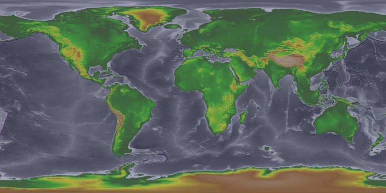
To this
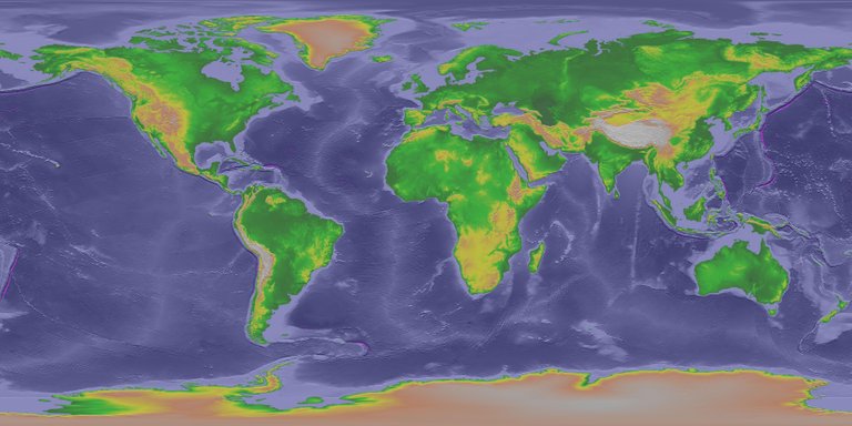
https://www.ngdc.noaa.gov/mgg/topo/globega2.html
When glaciers melt you can get an ice dam. Continent sized glaciers can get large ice dams and when they break, Well God floods the earth.
If we go west from the Strait of Gibraltar( Plato calls Straits of Heracles) we get to an area of islands called Azores. It's about half way to canada on the lower sea level maps. Azores is located on the mid atlantic ridge, which is also a fault line.
Plato said “But now because of earthquakes it has subsided into the great Ocean and has produced a vast sea of mud that blocks the passage of mariners who would sail into the great Ocean from Greek waters and for this reason it is no longer navigable. “
Maybe there was an earthquake on a faultline at the same time most of europe was melting. Those waters following over europe would probably bring a bunch of mud. And raise the sea levels everywhere. The islands of the Azores would be the mountain tops. The areas holy people would hang out in their temples.
Take a look at this map
The light blue is shallow water. There would have been a lot of land out there when the sea levels were lower and an earthquake hadn’t wrecked the place.
If most the population lives on the coast and the coast is now 110m under water, there there is probably going to be a bunch of stuff under the water.
They found 140 of these pyramids in just one area of one island, you can’t really date rock the way you can date dead things. Could have been built a long time ago.
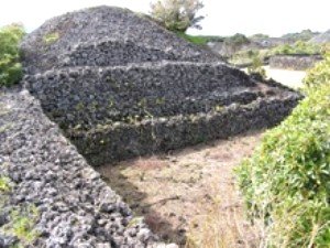
http://portuguese-american-journal.com/pico-new-archeological-evidence-reveals-human-presence-before-portuguese-occupation-azores/
This one has inside chambers.
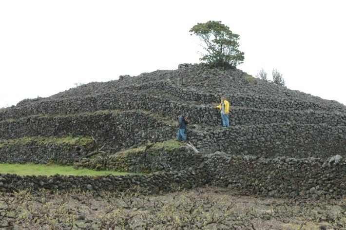
http://portuguese-american-journal.com/pico-new-archeological-evidence-reveals-human-presence-before-portuguese-occupation-azores/
Some weird ass holes
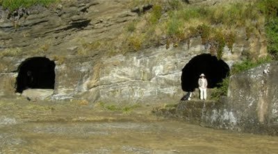
http://portuguese-american-journal.com/archeological-findings-in-the-azores-spark-controversy-%e2%80%93-update/
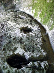
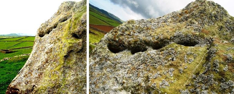

Excellent
https://www.google.com.au/maps/@37.7053814,-25.4431409,634m/data=!3m1!1e3?hl=en
Congratulations @pandas4science! You have completed some achievement on Steemit and have been rewarded with new badge(s) :
Click on any badge to view your own Board of Honor on SteemitBoard.
For more information about SteemitBoard, click here
If you no longer want to receive notifications, reply to this comment with the word
STOPSTOP
Notifications have been disabled. Sorry if I bothered you.
To reactivate notifications, drop me a comment with the word
NOTIFY