If you have any doubt about how great and complex nature is, study a little about geology, you will immediately realize that it is a very interesting and extensive science, trying to understand how all mountain formations originated, for example, through the rocks that compose them give us an idea of the changing dynamics that has occurred on our planet for millions of years.
Geology is important for civil engineering, unquestionably we can not build without knowing where we will place the structures, so this subject is fundamental in our training, today I would like to share with you, some images and part of what we learned in one of the field trips, where we visited some geological formations in a two-day tour from the State of Merida to the State of Trujillo, Venezuela.
In this trip we visited some interesting sites where we were able to observe the different types of rocks, their characteristics, among other relevant aspects.
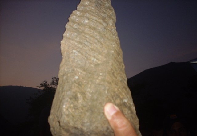
We left at 5 am from the city of Merida, heading to Boconó, a beautiful town in Trujillo State, our first stop would be a few kilometers away in a sector called Los Guáimaros. In this place we were able to observe the predominance of phyllite rocks, a metamorphic rock, as you can see in the photograph, it is of dark color, with many folds, for being of clayey and ductile origin.
The orientation, direction and dip of the foliation planes is stable and favorable for the slope of the road. My geology professor Jorge Carrero explained to us that some of the reasons why a phyllite rock with a dip of 40 degrees remains stable is that these rocks were formed in Mesozone, therefore, their metamorphism is medium.
Si tienes duda de lo grandiosa y compleja que es la naturaleza, estudia un poco acerca de la geología, te darás cuenta de inmediato que es una ciencia muy interesante y extensa, tratar de entender cómo se originaron todas las formaciones montañosas, por ejemplo, a través de las rocas que las componen nos dan una idea de la dinámica cambiante que se ha dado en nuestro planeta por millones de años.
La geología es importante para la ingeniería civil, indiscutiblemente no podemos construir sin saber dónde emplazaremos las estructuras, por eso esta materia es fundamental en nuestra formación, hoy quisiera compartir con ustedes, algunas imágenes y parte de lo que aprendimos en una de las salidas de campo, donde visitamos algunas formaciones geológicas en un recorrido de dos días desde el Estado Mérida al Estado Trujillo, Venezuela.
En este recorrido visitamos algunos sitios interesantes donde logramos observar los distintos tipos de rocas, sus características, entre otros aspectos relevantes.
Salimos a las 5 am desde la Ciudad de Mérida, rumbo a Boconó, un hermoso pueblo del Estado Trujillo, nuestra primera parada seria a pocos kilómetros en un Sector llamado los Guáimaros. En este lugar logramos observar que predominaban las rocas filita, una roca metamórfica, como pueden apreciar en la fotografía, es de color oscuro, con bastantes pliegues, por ser de origen arcilloso y dúctil.
La orientación, rumbo y buzamiento, de los planos de foliación es estable y favorable para el talud de la carretera. Mi profesor de Geología Jorge Carrero nos explicó que algunas de las razones que facilita que una roca filita con un buzamiento de 40 grados permanezca estable es que estas se formaron en Mesozona, por lo tanto, su metamorfismo es medio.
Phyllite Rock - Roca Filita
Sector los Guimaros, Estado Mérida
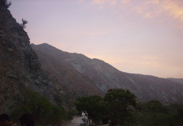
The city of Merida is located on an alluvial terrace, in the following images, in addition to the sunrise we can see part of its formations, it is interesting to know that each level of the terraces corresponds to a deglaciation, being the level next to the river the most recent material. This terrace consists of 5 levels, being the level 2 and 3 more consolidated, this thanks to the fact that in this area the climate is semi-arid, otherwise there would be many gullies. One of the most important geological faults in Venezuela, known as the Boconó Fault, divides these formations.
La Ciudad de Mérida, se encuentra situada sobre una terraza aluvial. En las siguientes imágenes, además del amanecer podemos ver parte de sus formaciones, es interesante saber que cada nivel de las terrazas corresponde a una desglaciación, siendo el nivel aledaño al río el material más reciente. Esta terraza consta de 5 niveles, el nivel 2 y 3 más consolidados, esto gracias a que en esta zona el clima es semiárido, de lo contrario se produciría muchas cárcavas. Una de las Fallas geológicas más importantes de Venezuela, conocida como la Falla de Boconó, divide estas formaciones.
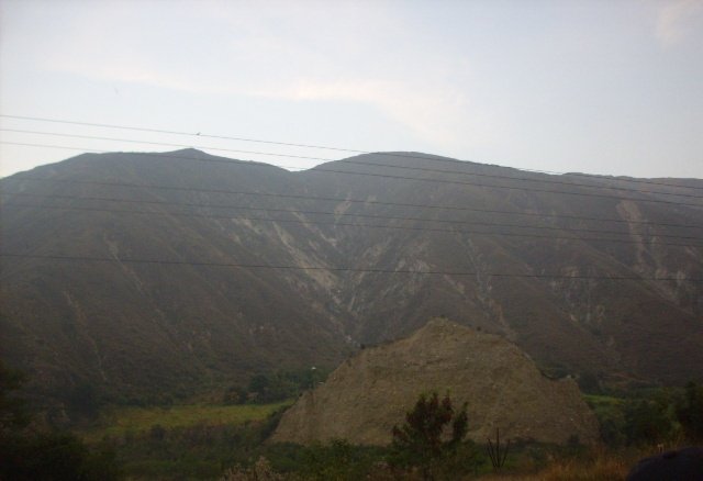
Our second stop was the Anís Sector, here is the limit between the Sierra Nevada formation, composed of Schists and Gneisses and the Mucuchachí Formation, which consists of slates and phyllites, these rocks were metamorphosed part of them in the Mesozona and part of them in catazona, It is common that where there are slates, there are also many gullies and landslide scars. This type of rock is easily weathered.
Nuestra segunda parada fue el Sector el Anís, aquí se encuentra el límite entre la formación Sierra Nevada, compuesta por Esquistos y Gneises y la Formación Mucuchachí, que consta de pizarras y filitas, estas rocas se metamorfizarón parte de ellas en la Mesozona y parte de ellas en catazona, también se puede encontrar pizarras y lutitas este material se degrada con facilidad y da origen a procesos erosivos en las montañas, es común que donde existan pizarras , existan también muchas cárcavas y cicatrices de deslizamientos, este tipo de roca se meteoriza con gran facilidad.
El Anís, Mérida - Venezuela
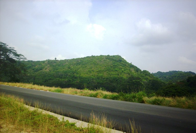
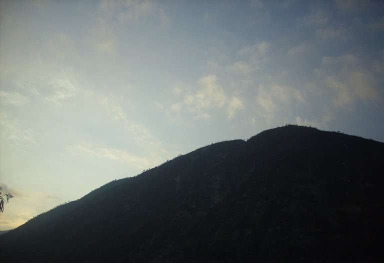
In the mountains of the following image, known as Cerro San Felipe, they built 3 of the 4 tunnels, which communicate the city of Merida with other states, this only tells us that the rocks of this formation is of great hardness. The base of the hill is granite, in the central part limestone and shale, on this side, there are no geological faults, I wonder then: how did all that material conglomerate there?
En las montañas de la siguiente imagen, conocido como Cerro San Felipe, construyeron 3 de los 4 túneles, que comunican la ciudad de Mérida con otros Estados, esto solo nos dice que las rocas de esta formación es de gran dureza. La Base del Cerro es de granito, en la parte central caliza y pizarras, de este lado, no existen fallas geológicas, me pregunto entonces: ¿cómo se conglomero todo ese material ahí?.
Cerro San Felipe, Mérida, Venezuela
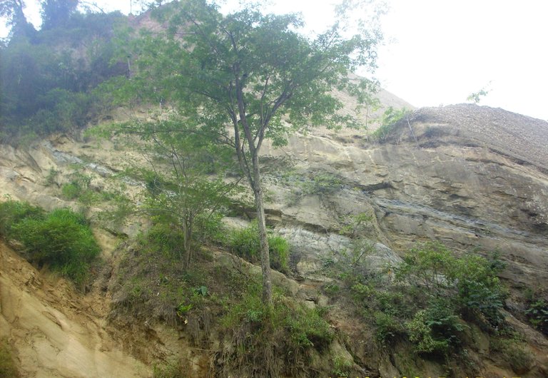
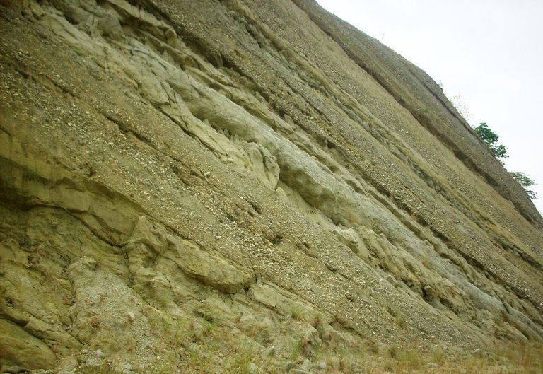
We continue the tour, knowing different formations of the State of Merida, until we reach Isnotu located in Trujillo, another Andean State of Venezuela, in the following image we have a slope where at first glance you can see a series of layers or parallel planes, composed of sedimentary rocks such as sandstone, according to the explanation of our teacher, this is due to climatic changes, as heavy rainfall delayed the process of consolidation and the formation was rising if it became rock, thus facilitating erosion. We see material with conglomerate sediment, layers of sandstone and shale.
Seguimos el recorrido, conociendo distintas formaciones, del Estado Mérida, Hasta llegar a Isnotú ubicado en Trujillo otro Estado Andino de Venezuela, en la siguiente imagen tenemos un talud donde a simple vista puedes ver una serie de capas o planos paralelos, compuesto por rocas sedimentarias como la areniscas, de acuerdo a la explicación de nuestro profesor, esto se debe a los cambios climáticos, ya que las fuertes precipitaciones retrasaban el proceso de consolidación y se iba levantando la formación si hacerse roca, facilitando así la erosión. Vemos material con sedimento conglomerado, capas de areniscas y lutita.
Isnotú, Trujillo Venezuela
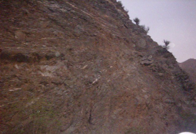
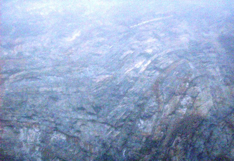
Before reaching our destination Boconó, we found another formation called "Peñas Altas", located on the Santa Ana road, when we arrived here it was around 6 pm, it was raining and it was cloudy, so the picture is a little blurry, however we can notice that the synclinal folds are perfectly visible. This was the formation that I liked the most, here predominates the sandstone intercalated with shale, the shale when it metamorphoses, gives place to the slate and this gives place to the clay, this when it meteorizes again it moves undulating this process is called Solifluxion and this is why these folds are originated. This is impressive and it takes many years to form.
Antes de llegar a nuestro destino Boconó, encontramos otra formación llamada "Peñas Altas". ubicada en la carretera Santa Ana, cuando llegamos aquí era alrededor de las 6 de la tarde, llovía y estaba nublado, por eso la fotografía está un poco borrosa, sin embargo podemos notar que se ven perfectamente los pliegues del tipo sinclinal. Esta fue la formación que más me gusto, aquí predomina la arenisca intercalada con lutita, la lutita cuando se metamorfiza, da lugar a la pizarra y esta da lugar a la arcilla, esta cuando se meteoriza nuevamente se mueve onduladamente este proceso se llama Solifluxión y es por esto que se origina estos pliegues. Esto es impresionante y para que se forme pasan muchísimos años.
Boconó, Estado Trujillo
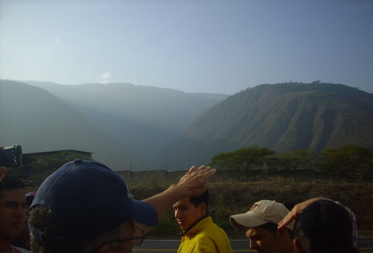
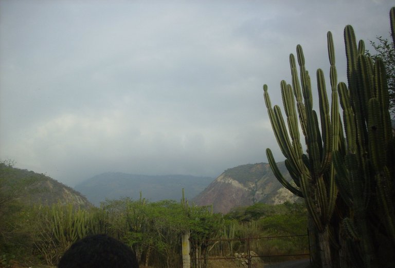
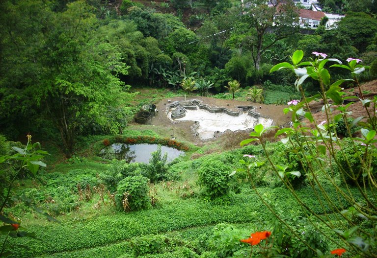
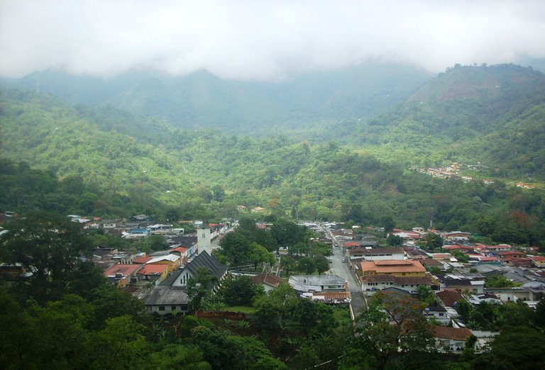
Undoubtedly this field trip was an unforgettable experience, so I wanted to share it with you, the Boconó Fault is one of the most important faults in Venezuela, I loved to know some of the formations that it crosses. I say goodbye with this beautiful view of the Campo Elias Community. Trujillo State Venezuela.
Sin duda está salida de campo, fue una experiencia inolvidable, por eso quise compartirla con ustedes, La Falla de Boconó es una de las fallas más importantes de Venezuela, me encanto conocer algunas de las formaciones que esta atraviesa. Me despido con esta hermosa vista de la Comunidad de Campo Elías. Estado Trujillo Venezuela.
This is my entry to the wonderful contest: Amazing Nature: FREE THEME - #2/7/22, for more information you can check out the following link:
Esta es mi participación al maravilloso concurso: Amazing Nature: TEMA GRATIS - #2/7/22, para mayor información puedes darle un vistazo al siguiente enlace:
Campo Elías, Trujillo Venezuela
All photographs in this publication are my own and were taken by me with my Siragon camera. The information was provided by Engineer Jorge Carrero, professor of Geology at Universidad de los Andes, during the field trip, complemented with my notes from my classes with the same professor.
Translation done at DeepL.
Todas las fotografías de esta publicación son propias y fueron tomadas por mí con mi cámara siragón. La información fue suministrada por el Ingeniero Jorge Carrero, profesor de Geología en la Universidad de los Andes, durante la salida de campo, complementada con mis apuntes de clases con el mismo profesor.
Some sources to consolidate information
Algunas fuentes para consolidar la información
Geological aspects of the Flor de Patria Highway
Traducción realizada en DeepL.


Congratulations @doriangel! You have completed the following achievement on the Hive blockchain and have been rewarded with new badge(s):
Your next target is to reach 27000 upvotes.
You can view your badges on your board and compare yourself to others in the Ranking
If you no longer want to receive notifications, reply to this comment with the word
STOPTo support your work, I also upvoted your post!
Hi! It's a nice review. BTW, could you please provide some sources to check out the info and to learn more about this?
Yes, of course. I will edit the post and add them.
Oye me gustó mucho las fotografías. Tienes razón cuando mencionas lo maravilloso que es la geología, es una ciencia muy extensa y que estudia muchos de las factores para la formación de los relieves, y muchos fenómenos naturales vemos en nuestro día a día. Pero no solo eso, sino que además también la formación de nuestro planeta,la importancia de las rocas y minerales para desarrollo económico de un país, entre muchas cosas más.
Me gustó el post, soy ING. Geólogo y me gusta ver esta clase de contenidos por acá. Saludos!
Muchas gracias. Es así, la geología es muy importante en el desarrollo de los países, además es muy interesante y extensa como dices. Yo solo vi los aspectos básicos y como se aplica en la ingeniería civil. Algo muy básico comparado con todo lo que tu carrera implica.
Thanks for your contribution to the STEMsocial community. Feel free to join us on discord to get to know the rest of us!
Please consider delegating to the @stemsocial account (85% of the curation rewards are returned).
You may also include @stemsocial as a beneficiary of the rewards of this post to get a stronger support.
Thank you very much for the support.
Thank you for entering the contest.
It's good to know what we're stepping on and if we're not going anywhere :-)
Thanks a lot. Thanks a lot. AceIt is good to know more about where we live.
I agree. When we know what is around us, we can be more considerate of our surroundings.
Study of rock formation most interesting to learn, thanks for sharing photographs along with facts and fault lines in the region.
!LUV
@joanstewart(2/10) gave you LUV. tools | wallet | discord | community | <><
HiveBuzz.me NFT for Peace
Thanks to you for reading my post, I appreciate your comment and support. If the rock formations are interesting to study. If the rock formations are interesting to study. It was a pleasure to share my experience with you.
Little knowledge gleaned over the years on my side, always nice to learn from someone who is better informed.
Thanks to you for reading my post, I appreciate your comment and support. If the rock formations are interesting to study. If the rock formations are interesting to study. It was a pleasure to share my experience with you.