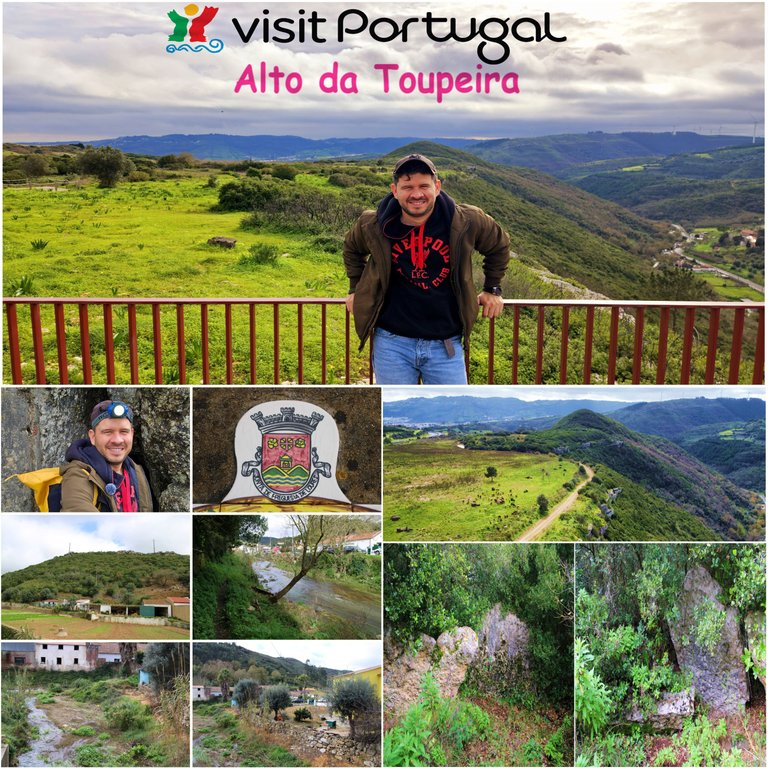
Hello fellow travelers! Today I bring you a wild adventure, we will travel 20km north of Lisbon to the Parish of Lousa which in turn belongs to the municipality of Loures, there we will take a trail of approximately two hours to reach an "Anta" whose translation is: dolmen, which was built on the mountain "alto da toupeira", this area is millions of years old and has several cave formations that were inhabited in prehistoric times, Enjoy my experience.🚙🗺️
Hola amigos viajeros! hoy les traigo una aventura salvaje, viajaremos 20km hacia el Norte de Lisboa a la Freguesia de Lousa que a su vez pertenece al municipio de Loures, alli vamos a realizar un sendero de aproximadamente dos horas para llegar a un "Anta" cuya traduccion es: dolmen, que fue construido en el montana "alto da toupeira", esta zona tiene millones de anos y presenta varias formaciones de cuevas que fueron habitadas en la prehistoria, Disfruta mi experiencia.🌍🌷
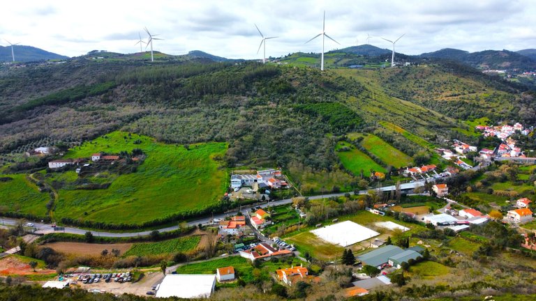
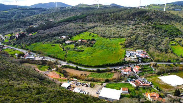
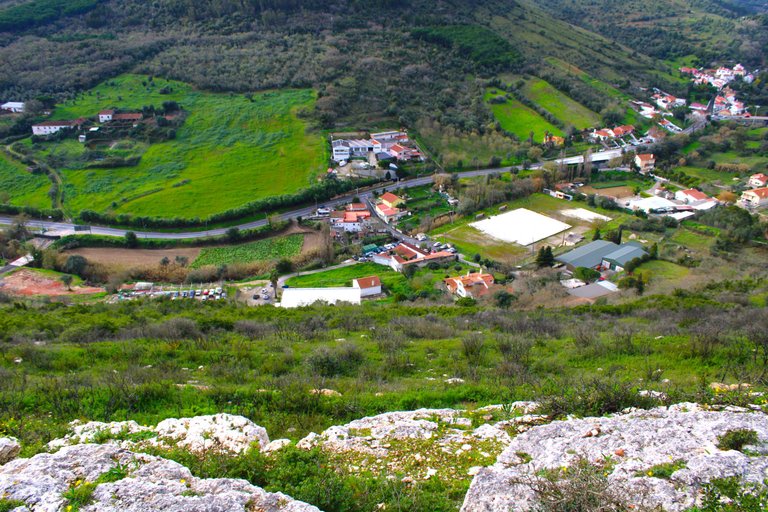
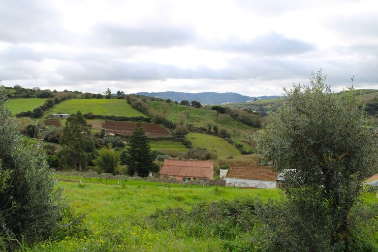
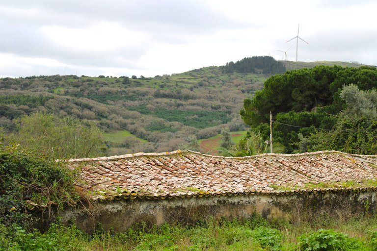
Village "Torre dos Trotes"🗺️🚙/Aldea "Torre dos Trotes"🌍🧭
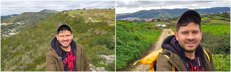
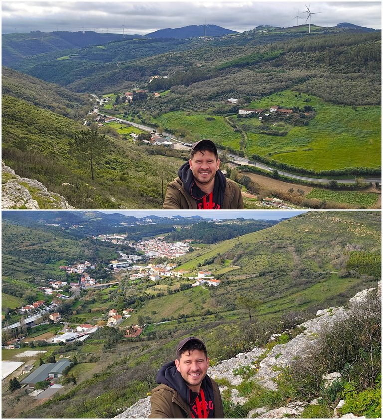
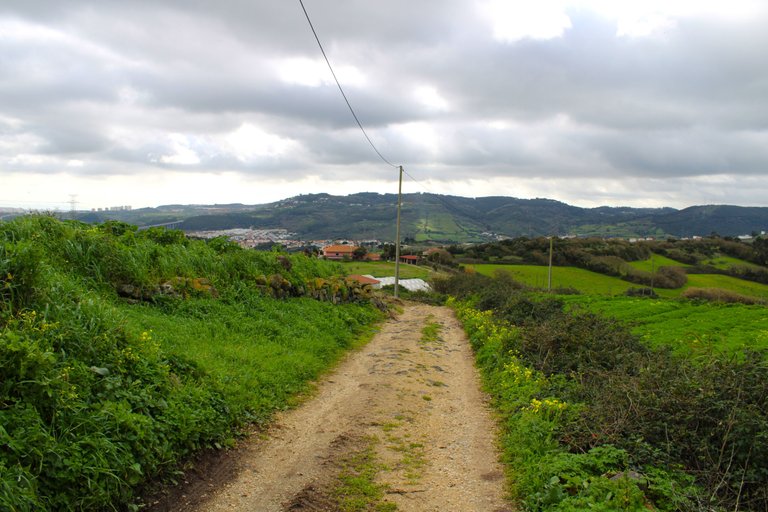
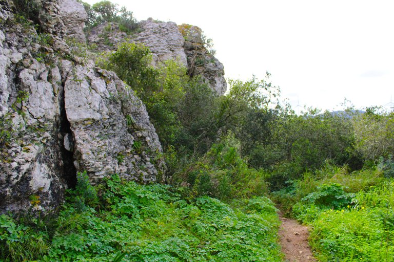
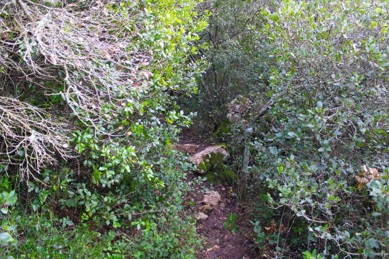
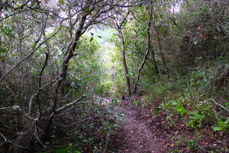
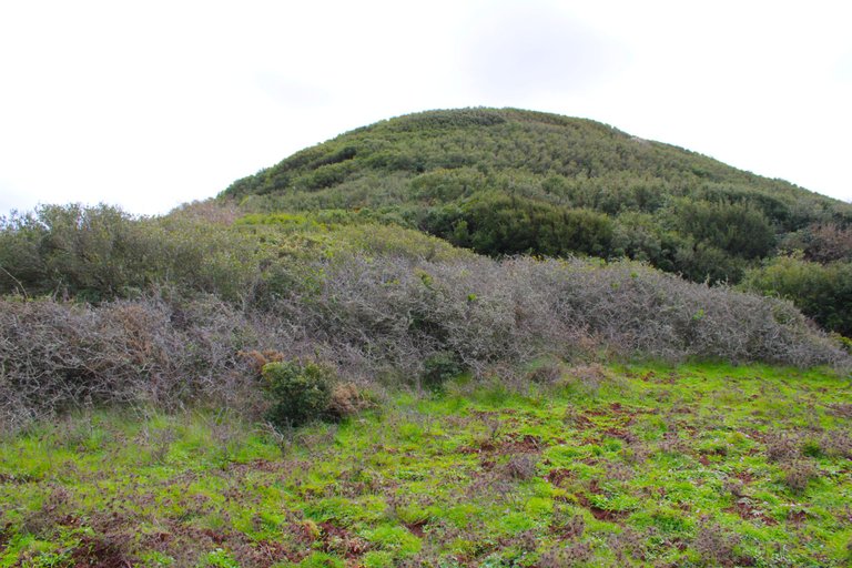
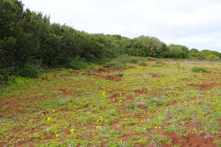
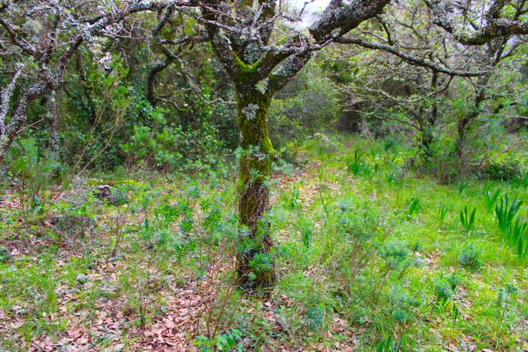
Here begins my walk about 4km towards "Alto da Toupeira" which is the mountain you see in the background in the first photo, it was two and a half hours of walking and hiking until reaching that area, we went from being on the main road to climbing 310 meters which is the highest point of the mountain range, in winter this journey is not suitable for everyone and you must be properly equipped, hiking boots are important because that entire area is mud.📸⛰️
Aqui comienza mi caminata a unos 4km hacia "Alto da Toupeira" que es la Montana que vez de fondo en la primera foto, fueron dos horas y media de caminata y excursion hasta llegar a aquella zona, pasamos de estar en la carretera principal hasta subir 310 metros que es el punto mas alto de la sierra, en invierno esta travesia no es apta para cualquier persona y debes ir debidamente equipado, las botas de excursion son importante pues toda esa zona es barro.🌍🚩

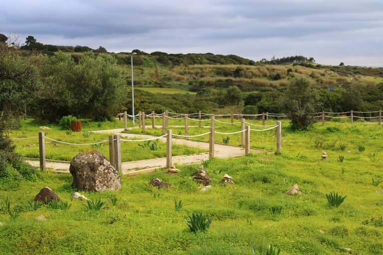
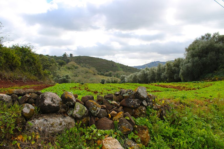
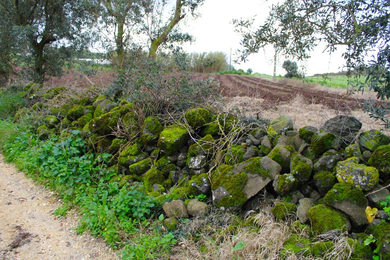
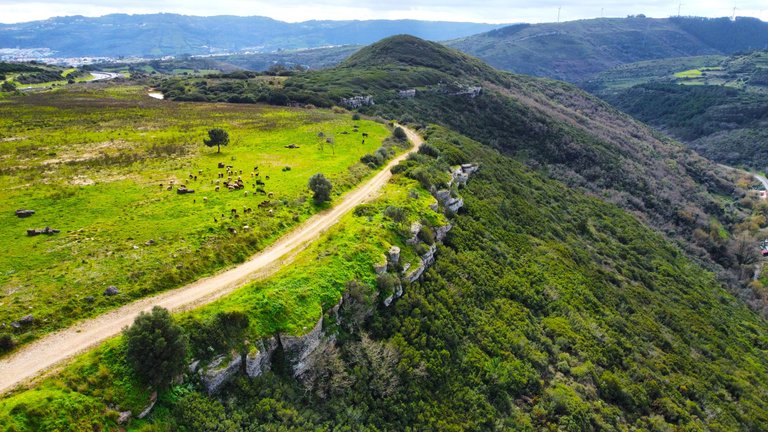
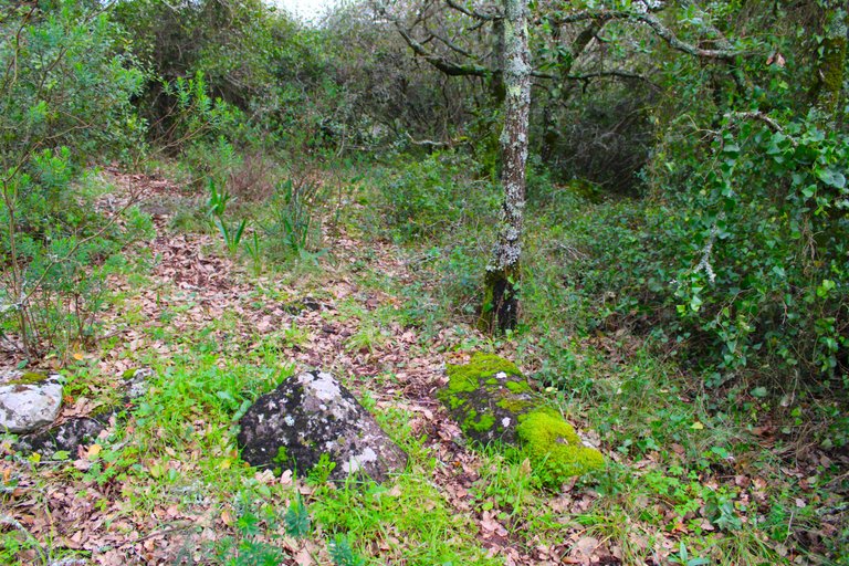
Many of these areas were inhabited from the 18th century onwards, so they are not the oldest in Loures, such as the village of "Torre dos Trotes", which is characterized by beautiful landscapes and is located between the Bucelas and Lousa mountain ranges. Agriculture predominates and few tourists dare to visit the area, however there are many walks and good things to see.🧭⛰️🏕️
Muchas de estas zonas fueron habitadas a partir del siglo XVIII por tanto no son las mas antiguas de Loures, tal como lo es la aldea "Torre dos Trotes" caracteristica de hermosos paisajes y se encuentra entre las sierras de Bucelas y Lousa, predomina la agricultura y pocos son los turistas que se atreven a visitar la zona sin embargo hay muchas caminatas y cosas buenas para ver.🌄⛺
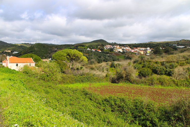
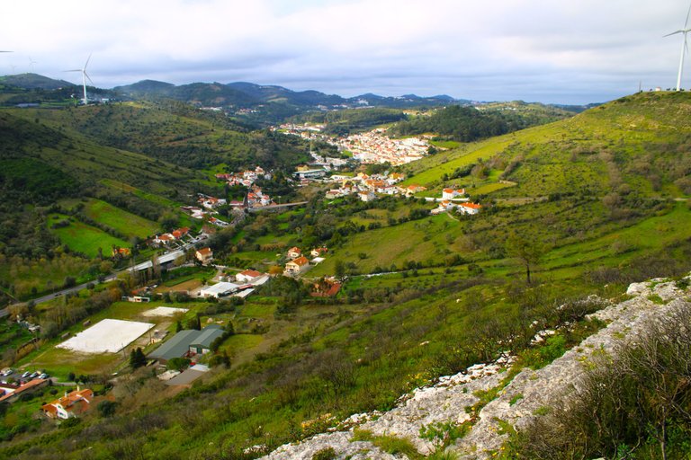
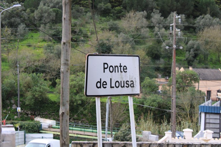
Village "Ponte de Lousa"🗺️🚙/Aldea "Ponte de Lousa"🌍🧭
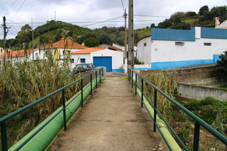
This village is one of the oldest in Loures, unlike "Torres dos Trotes", there are several theories as to how old it is. The first is that the name comes from the fact that the kings of Portugal had a warehouse here where they kept the "lousas" of the kings, which can be translated as plates, glasses, very expensive and ornate tableware. The other theory about the origin of the village's name is based on archaeology and is that the first people to arrive in Portugal may have settled in caves throughout the area, that is, more than 4,000 years before Christ. The "Lousa bridge" also refers to a bridge that divided the village from a river that no longer exists.🚩📸
Esta aldea si es una de las mas antiguas de Loures a diferencia de "Torres dos Trotes", hay varias teorias de cuan antigua es, la primera se cree que el nombre se debe a que los reyes de Portugal tenian aqui una almacen donde guardaban las "lousas" que se puede traducir a los platos, vasos, vajillas muy costosa y ornamentadas, la otra teoria del origen del nombre de la aldea es basada en arqueologia y es que las primeras personas en llegar a Portugal pudieron asentarse en cuevas por toda la zona osea hace mas de 4000 anos antes de Cristo, lo del "puente de lousa" tambien se hace referencia a un puente que dividia la aldea de un rio que ya no existe.🧔🏻♂️🧔🏻♀️
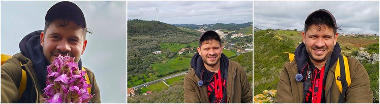
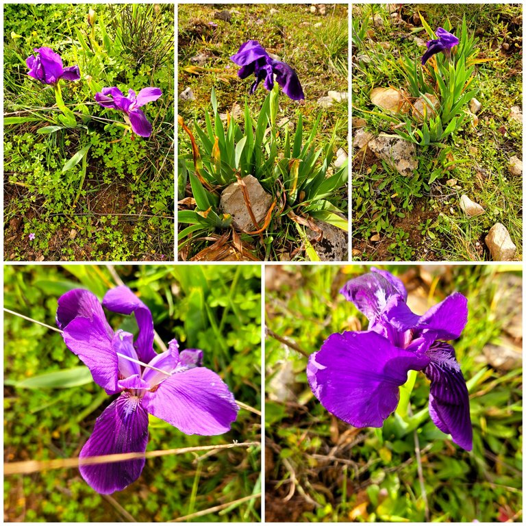
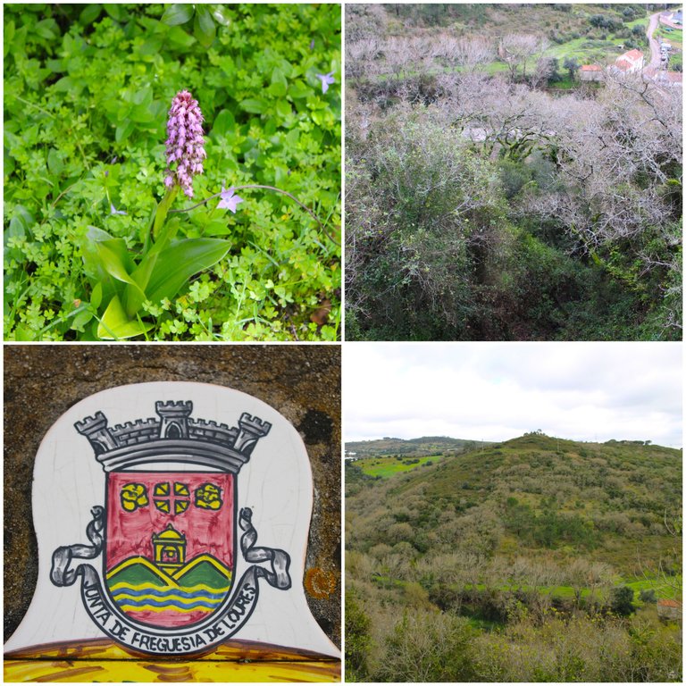
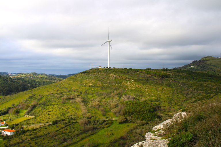
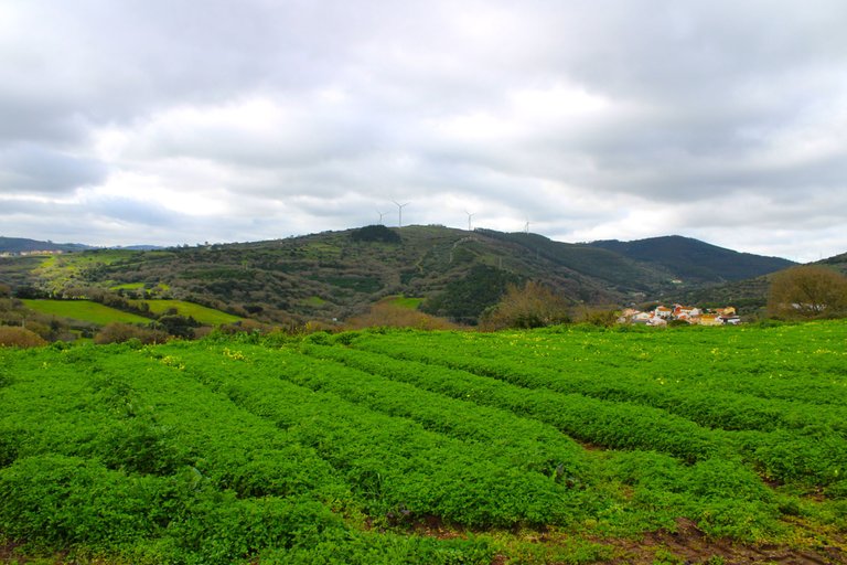
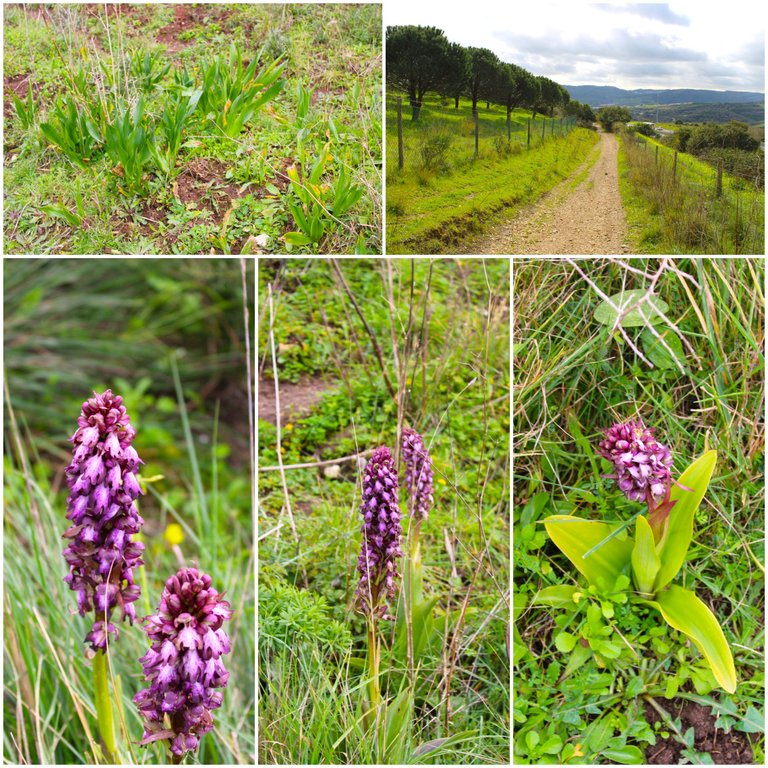
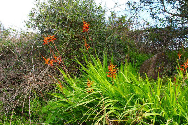
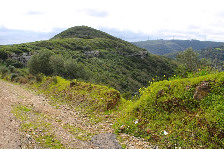
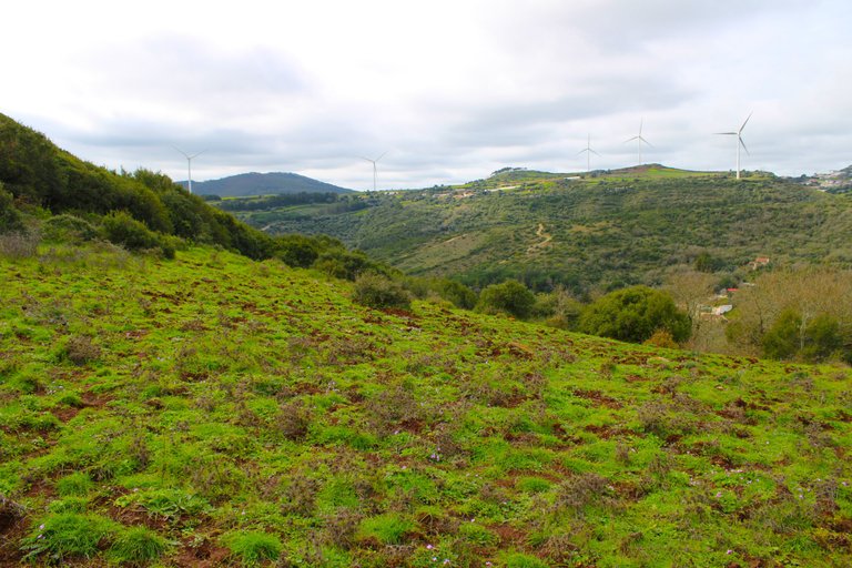
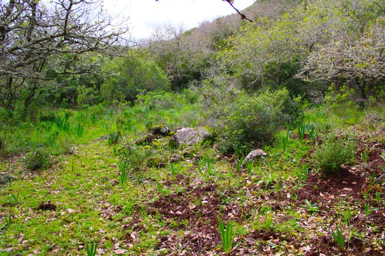
At this time of year we begin to see some orchids and lilies blooming, which makes the landscape quite picturesque and beautiful. If you are a fan of places with an abundant biodiversity of animal and plant species, then the "Serra Alto da Toupeira" is a perfect destination for you. I recommend visiting the village of Ponte de Lousa, which I have already published about in the past. The route I took went up the mountain for a change and to be able to see the other side of the Lousa valley.🚩📸🧭
A esta epoca del ano comenzamos a ver floresciendo algunas orquideas, lirios lo que hace que el paisaje sea bastante pintoresco y bonito, si eres fan de lugares con una abundante biodiversidad de especies de animales y plantas entonces la "serra alto da Toupeira" es un destino perfecto para ti, te recomiendo visitar la aldea de Ponte de Lousa que por cierto ya publique sobre ella en el pasado, la ruta que tome es subiendo por la montana para variar y poder ver el otro lado del valle de Lousa.🌷🚙🌍
"Lousa Valley" viewpoint🗺️🚙/Mirador "Vale de Lousa"🌍🧭
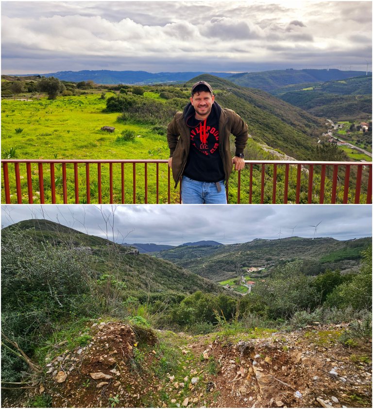
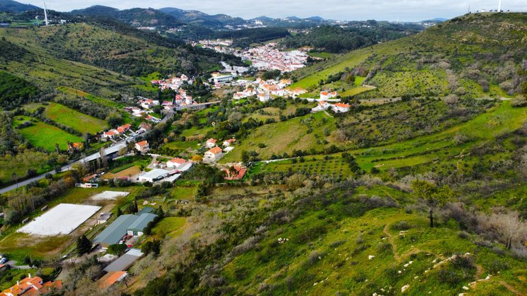
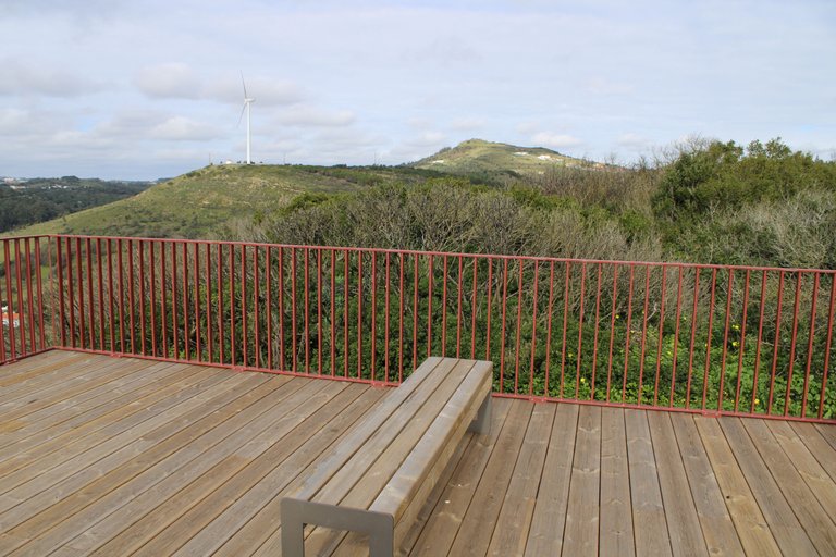
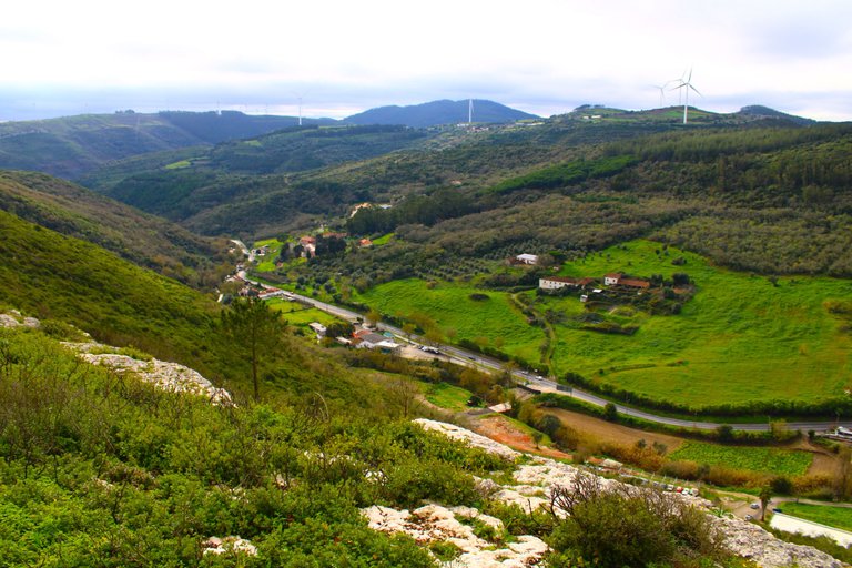
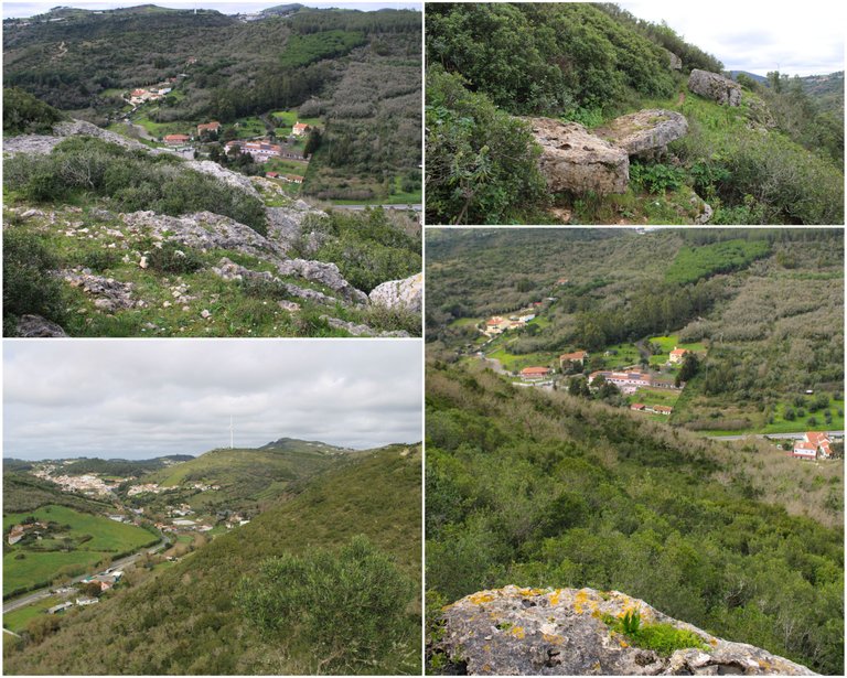
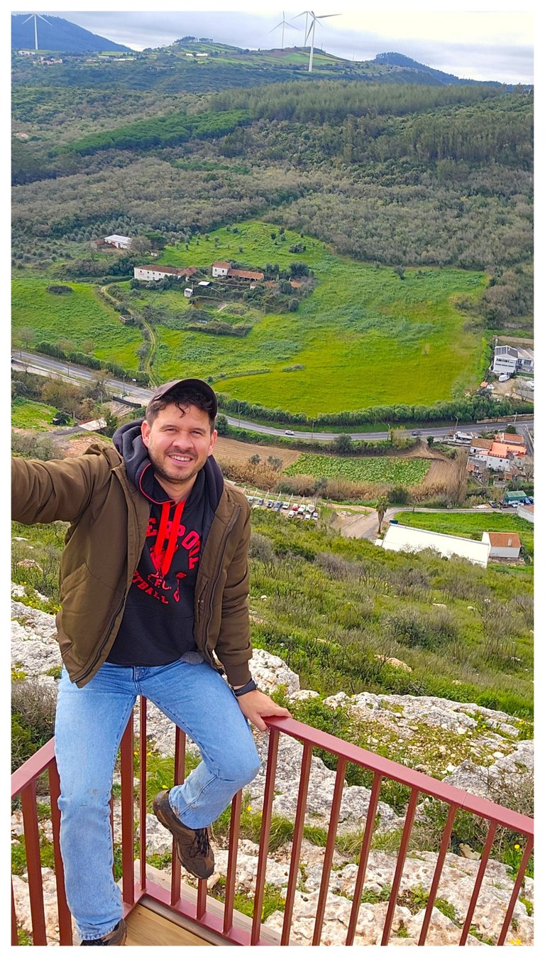
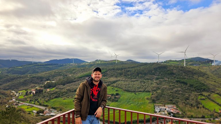
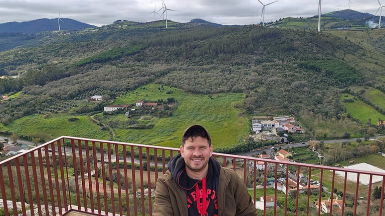
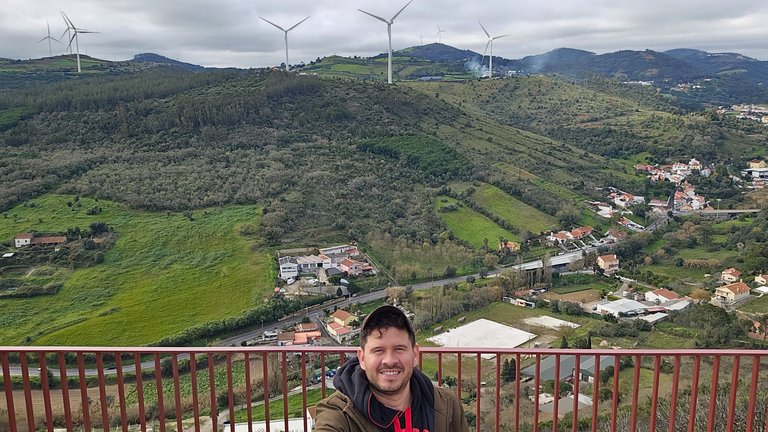
I arrived at one of my favorite stops of the day and it is the "Vale de Ponte de Lousa" viewpoint, which is nothing more than a construction that is in one of the highest points of the mountain range "Alto da Toupeira", at more than 250 meters high we have a beautiful 180 degree view of all the valleys in the area, it was recently rebuilt and opened to the public after it burned down last year, it has some wooden benches so you can come and relax and enjoy the scenery.🌍
Llegue a una de mis paradas favoritas del dia de hoy y se trata del mirador "vale de ponte de Lousa", el cual no es mas que una construccion que esta en uno de los puntos mas altos de la sierra "Alto da Toupeira", a mas de 250 metros de altura tenemos una hermosa vista de 180 grados de todos los valles de la zona, recientemente fue reconstruido y abierto al publico pues se quemo el ano pasado, tiene unos bancos de madera lo que puedes venir a relajarte y disfrutar del paisaje.📸🌄
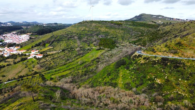
Road to "Alto da Toupeira"🗺️🚙/Camino a "Alto da Toupeira"🌍🧭
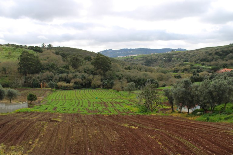
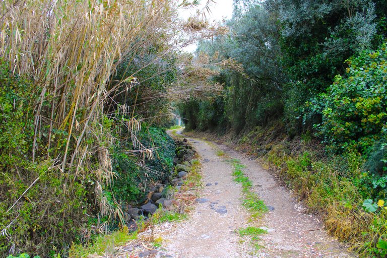
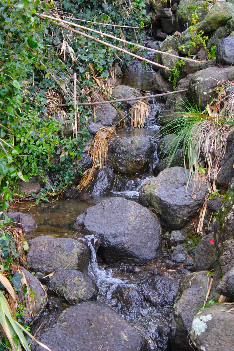
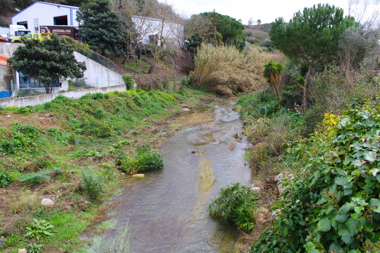
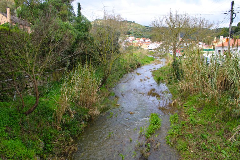
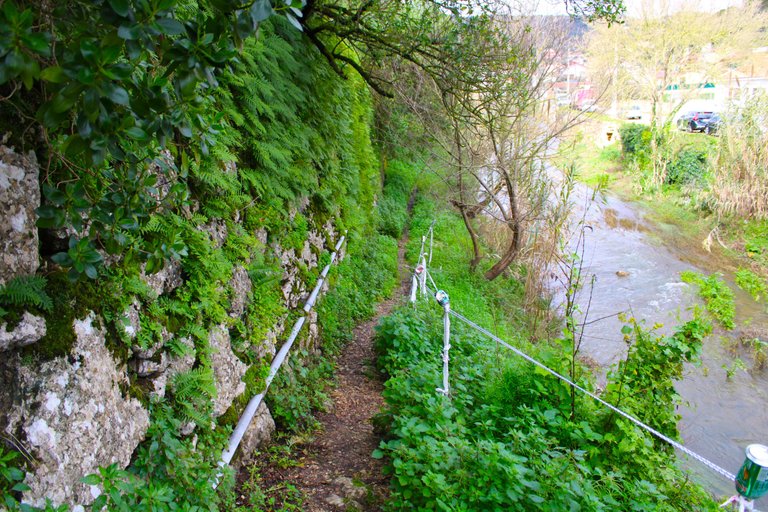
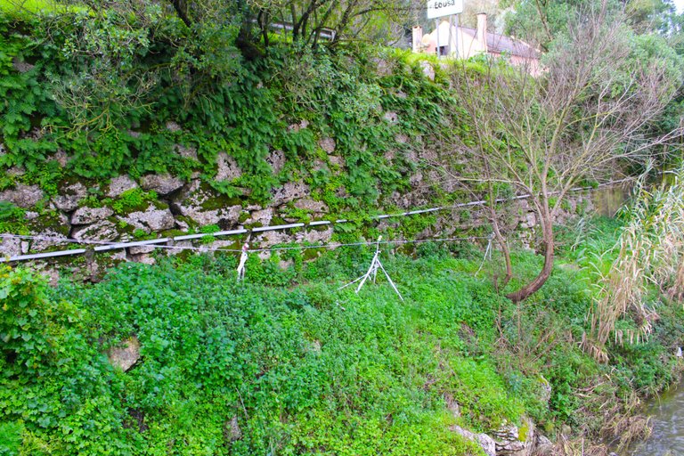
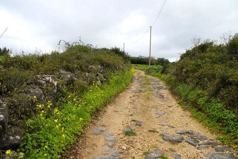
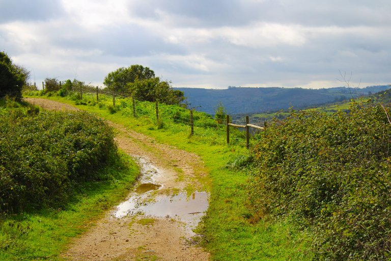
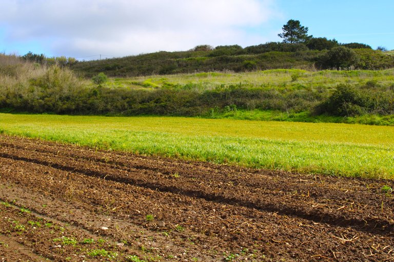
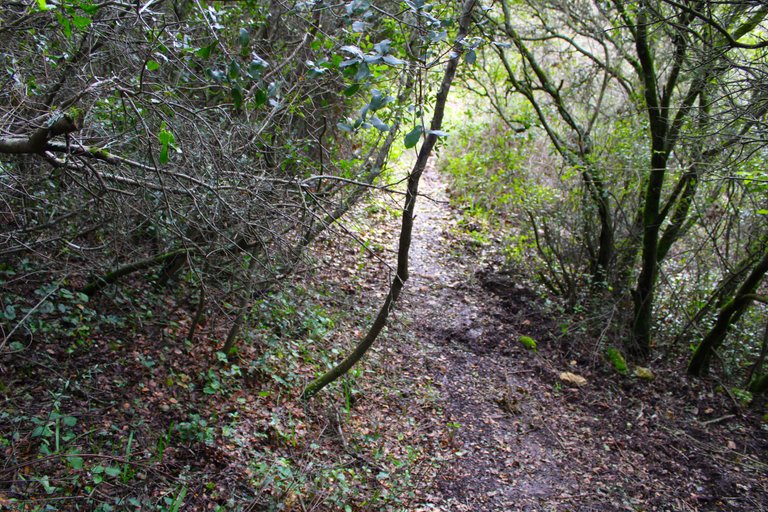
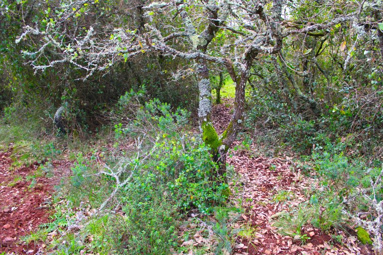
After the viewpoint I took a detour to learn more about the village of "Pte de Lousa", I walked along sandy paths while small streams accompanied me, which are essential to maintain the irrigation of the crops of the local residents. It is the weekend and I see many people passing by here on bicycles, the truth is that the terrain is suitable for these sports.🚙🌷
luego del mirador tome un desvio para poder conocer mas la aldea de "Pte de Lousa", pase por los caminos de arenas mientras me acompanaban pequenos riachuelos que son indispensables para mantener los riegos a los cultivos de los moradores locales, es fin de semana y veo muchas personas paseando por aqui con bicicletas, la verdad el terreneno se presta para esos deportes.🚩📸
Characteristics of "Alto da Toupeira"🗺️🚙/Caracteristica de "Alto da Toupeira"🌍🧭
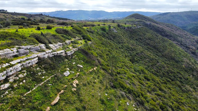
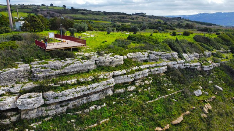
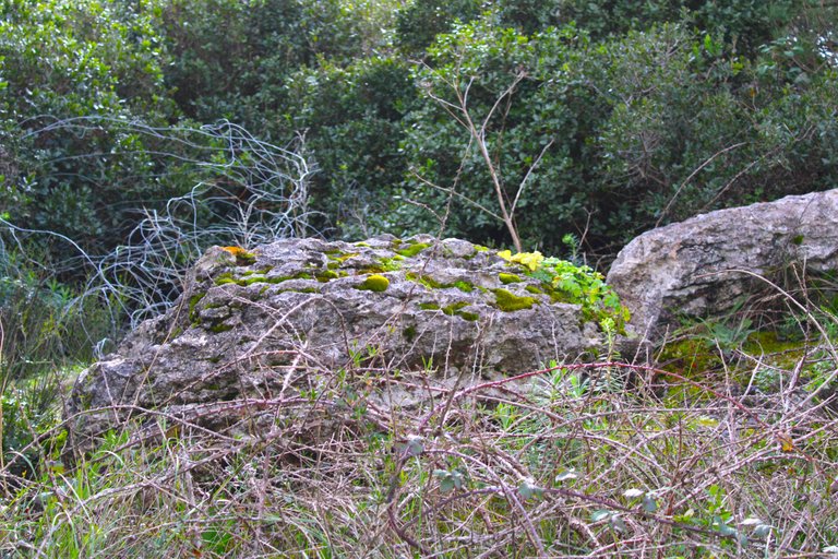
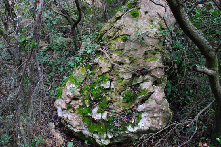
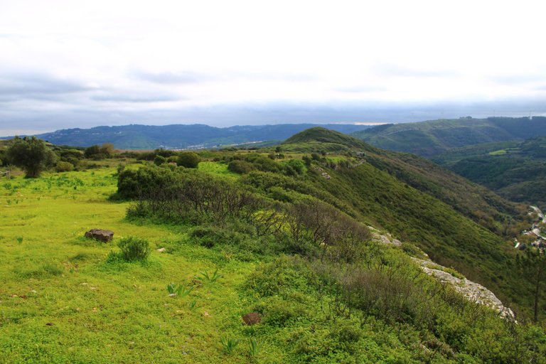
Here we see a clear example of a limestone cornice that stands out from any part of Lousa, and it is our final destination "Alto da Toupeira", a beautiful example of a landform. We can see at the top of the mountain an example of Cenomanian, characteristic of the upper Cretaceous period more than one hundred million years ago. Below this layer we find another Cenomanian-Albian, 90-100 million years old, at the base of the mountain there is marine evidence which indicates that there was a shallow tropical sea nearby.🧑🏻🦯➡️👨🏻🏫
Aqui vemos un claro ejemplo de cornisa calcarea que resalta desde cualquier parte de Lousa, y se trata de nuestro destino final "Alto da Toupeira", hermoso ejemplo de geoforma, podemos ver en la parte superior de la montana un ejemplo de Cenomaniano caracteristico de la epoca cretacea superior hace mas de cien millones de anos. Debajo de esta capa conseguimos otra Cenomaniano-albiano, 90-100M anos, en la base de la montana hay evidencias marinas lo que corresponde que cerca de aqui habia un mar tropical poco profundo.⛺🌄
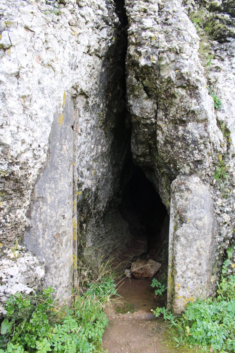
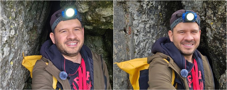
In search of the secret Dolmen "anta do toupeiro"🗺️🚙/En busca del Dolmen secreto "anta do toupeiro"🌍🧭
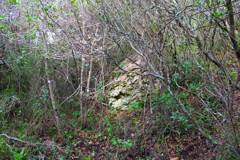
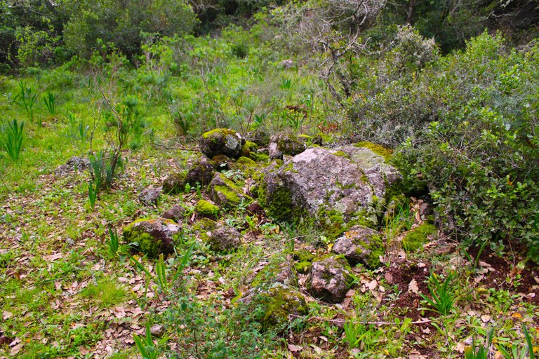
Now that we have explored the mountain caves, I am looking for a secret place where we will find a very well preserved Dolmen called "Anta do Alto da Toupeira" that was built more than 6 thousand years before Christ, this would correspond to before "Homo" our species Sapiens sapiens, what I noticed is that getting the entrance to the dolmen is almost impossible hehe🧔🏻♂️🧔🏻♀️
Ahora que ya exploramos las cuevas de la montana voy en busca de un lugar secreto donde conseguiremos un Dolmen muy bien conservado llamado "Anta do Alto da Toupeira" que fue construido hace mas de 6mil anos antes de Cristo, esto corresponderia antes del "Homo" nuestra especie Sapiens sapiens, lo que note es que conseguir la entrada del dolmen es casi imposible jeje👨🏻🏫👨🏻🏫
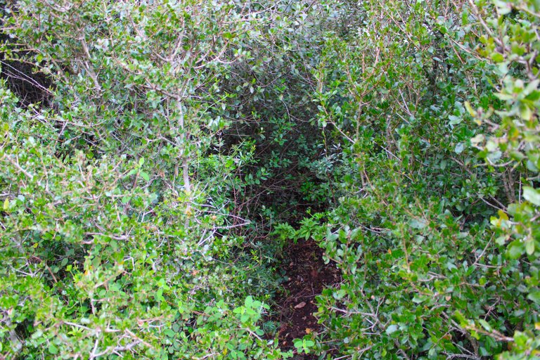
Entrance to the dolmen
Entrada del dolmen
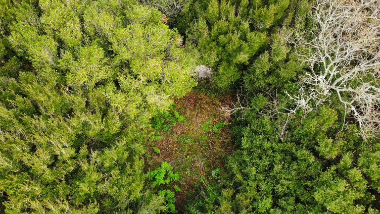
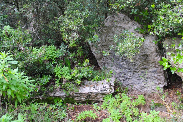
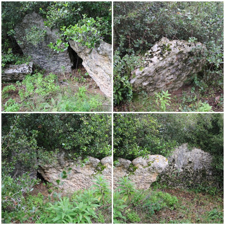
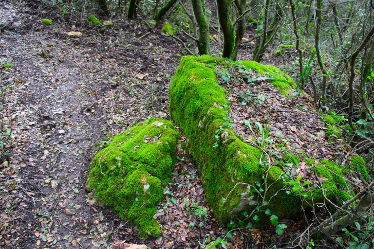
The dolmen is hidden in a small forest south of the "salemas" cave, in 1959 it was identified that the dolmen is a polygonal necropolis the dimensions are 5.5x5. It has a maximum height of two meters and is built by five limestone stones that were from the upper Cretaceous, buried here where I am were found an axe, an arrowhead, a stone idol and a pendant all are exhibited in the geology museum of Lisbon!👨🏻🏫🧔🏻♀️🧔🏻♂️
El dolmen esta oculto entre un pequeno bosque al sur de la cueva "salemas", en 1959 se identifico que el dolmen es una necropolis poligonal las dimenciones son 5,5x5. Tiene una altura maxima de dos metros y esta construido por cinco piedras calizas que eran del cretacico superior, enterrados aqui donde estoy se encontraron un hacha, una punta de flecha, un idolo de piedra y un colgante todos estan exhibidos en el museo de geologia de Lisboa!📸
https://en.wikipedia.org/wiki/Anta_do_Alto_da_Toupeira

DNA is an organization to foster and DENSIFY NATURE-APPRECIATION which aims to establish REPORTS OF BIODIVERSITY DATA that is contributed by all of us Hiveans and subsequently cataloged.
Therefore DNA searches for HIGH-QUALITY posts that aim to DESCRIBE and determine the BIODIVERSITY AROUND YOU with added EXPLANATIONS and INFORMATION. For these informative posts they offer a CURATION SERVICE using the @dna.org account. It is also a CURATION TRAIL. Just add the #dna TAG if you think that any of your posts is what they are looking for.
THANKS FOR READING ME (PHOTOS AND VIDEOS OF MY PROPERTY) / GRACIAS POR LEERME FOTOS Y VIDEOS DE MI PROPIEDAD🙂🧠🦾👍

 https://www.youtube.com/@UnMaracuchoSueltoEnPortugal
You can check out this post and your own profile on the map. Be part of the Worldmappin Community and join our Discord Channel to get in touch with other travelers, ask questions or just be updated on our latest features.
A trip that is fun and has challenges, amazing natural beauty. I am one of those who enjoy climbing👍👍
Thanks so much
¡Qué aventura, @biologistbrito! 🚶♂️⛰️ Dos horas de caminata, barro hasta las orejas y encima 310 metros de subida… ¡Ya sudé solo de leer! Pero valió la pena por esas vistas brutales. Me encantó lo del “Anta”, aunque en Perú eso significa otra cosa... 😂
!discovery 30
🥰
:)
This post was shared and voted inside the discord by the curators team of discovery-it
Join our Community and follow our Curation Trail
Discovery-it is also a Witness, vote for us here
Delegate to us for passive income. Check our 80% fee-back Program
Amazing place, very beautiful👍
Thanks:)
You are welcome, friend.
Vê-se um lugar maravilhoso!
Que interesante lugar!
Travel Digest #2466.
Become part of our travel community:
- Join our Discord
Hiya, @ybanezkim26 here, just swinging by to let you know that this post made it into our Honorable Mentions in Your post has been manually curated by the @worldmappin team. If you like what we're doing, please drop by to check out all the rest of today's great posts and consider supporting other authors like yourself and us so we can keep the project going!Saludos amigo, hermoso el paisaje que nos muestra a través de tus fotografías, hay una parte parecida a La Colonia Tovar acá en Venezuela, se ve que es una zona agricola
¡Enhorabuena!
✅ Has hecho un buen trabajo, por lo cual tu publicación ha sido valorada y ha recibido el apoyo de parte de CHESS BROTHERS ♔ 💪
♟ Te invitamos a usar nuestra etiqueta #chessbrothers y a que aprendas más sobre nosotros.
♟♟ También puedes contactarnos en nuestro servidor de Discord y promocionar allí tus publicaciones.
♟♟♟ Considera unirte a nuestro trail de curación para que trabajemos en equipo y recibas recompensas automáticamente.
♞♟ Echa un vistazo a nuestra cuenta @chessbrotherspro para que te informes sobre el proceso de curación llevado a diario por nuestro equipo.
🥇 Si quieres obtener ganancias con tu delegacion de HP y apoyar a nuestro proyecto, te invitamos a unirte al plan Master Investor. Aquí puedes aprender cómo hacerlo.
Cordialmente
El equipo de CHESS BROTHERS