Hello hivers of this #Worldmappin comunity.I approach to read the beautiful post that you share and I also take the opportunity to share mine with you all.
One of my favorite places to visit, in my time as a translator and tour guide, was always Baracoa.
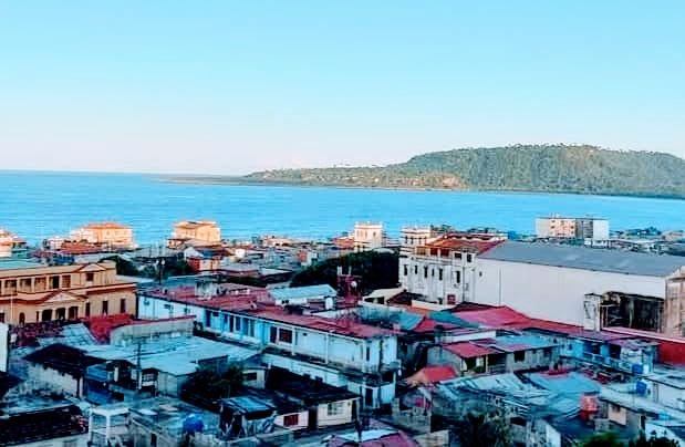
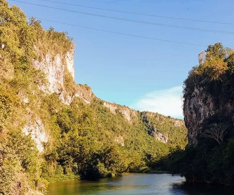
It is a city settled between the sea and the mountain.The beauty and uniqueness of its small beaches of very white sands that bloom throughout the north coast, are always adorned with lush vegetation and lush coconutos in addition to the deltas of transparent rivers that descend from the heart of the mountain, to complete the beautiful landscape of the area.
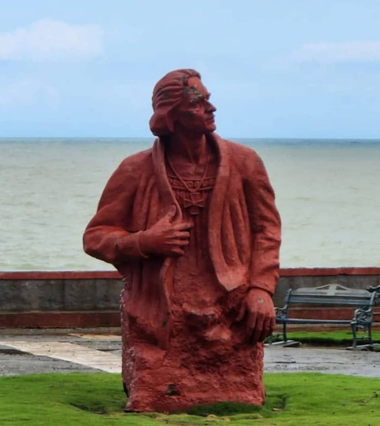
The city was founded as the First Village of Cuba back in 1511 and it was named Our Lady of the Assumption of Baracoa. From its own foundation, the place became a strategic point of access and control to that territory, so the Spanish authorities provided the place of a defensive set that had a site in the area of the boardwalk that was linked underground, by a tunnel system, with the strength of La Punta, located in the Bay a little more east, and with a barracks on the top of the mountain, known as El Castillito. ( which is now a touristic place)
With this small defensive complex, a small provision of soldiers repelled most pirate attacks.
Although the architectural characteristics of the city are also very picturesque, which I prefer to highlight, in addition to the kindness of its people, that are the benefits of their natural environment.
I will begin by telling you in this regard, that it does not enough a post to summarize the many details of its prodigal geography, so I will try to focus on those who impressed me the most.
From the dreaded "Farola", a name that receives an imposing mountain on which slides a highway that serves as access to the city from land, coming from south to north. Since we begin climb we notice the exclusive of the local landscape.
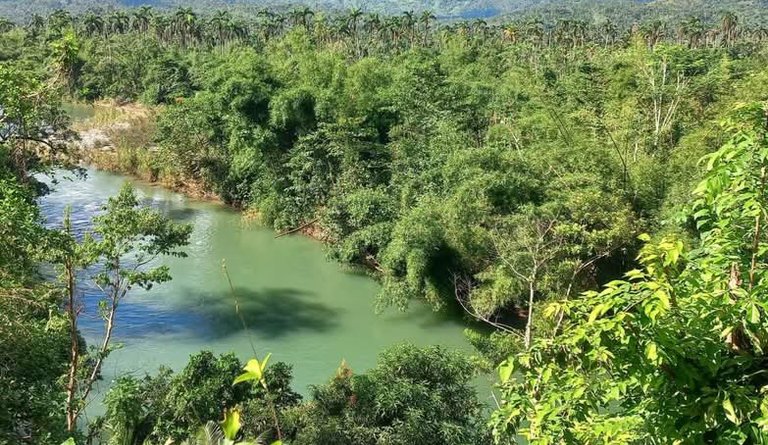
Many are the rivers that go through the entire landscape, including: rio Miel, yumurí and the strong Toa.
Leaving the city to the west, it is a natural tunnel in La Loma, known as "the passage of the Germans" and that serves as viaduct in the direction to Maisí.
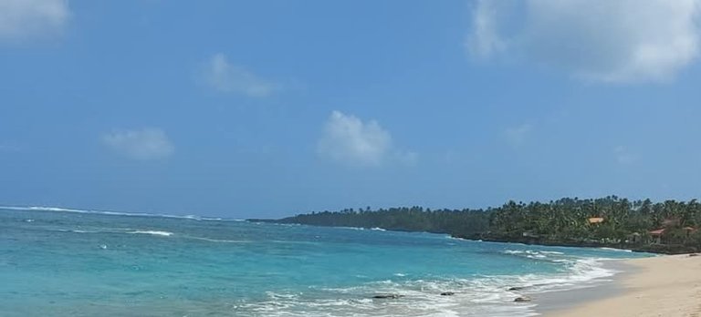
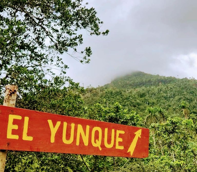

To the west, along the road it is located the Maguana's beach and also going to the west, but twisting a little towards the south and following the course of the Toa river, ( against the flow) we can reach the Yunque hill, a natural reserve where very arborescent ferns stand out, a lot of native vegetation and the colorful polyimites.
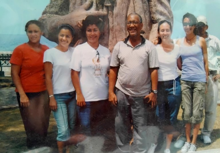
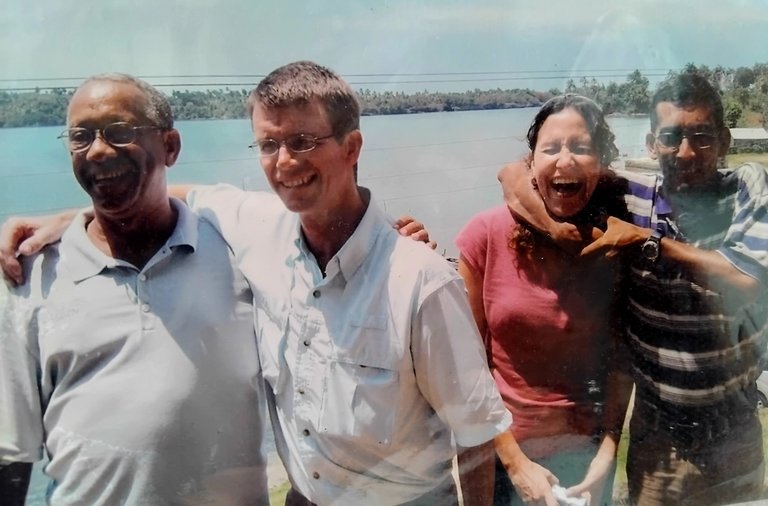
The photos that I share here were taken on different dates and trips, in them, in addition to the mentioned sites, some friends who were members of the work team appear, which a few of them are no longer in this world, to them, this post is especially dedicated.
It is all for now ny dear friends, but before concluding, I would like to recommend you, in case you are aimed to visit this paradise, that you come prepared for its hard geography and at the same time its
humid and warm climate.
Thanks for reading. See you in comments.
This post is free of AI.
The images are mine.
Español
Baracoa: un paraíso natural
Un saludo a todos los hivers de esta comunidad de #worldmappin. Me acerco para leer los hermosos post que ustedes comparten y aprovecho para compartir los míos con ustedes.
Uno de mis lugares favoritos para visitar, en mis tiempos como traductor y guía turístico, siempre fue Baracoa.
Se trata de una ciudad asentada entre el mar y la montaña. La belleza y singularidad de sus pequeñas playas de arenas muy blancas que florecen a todo lo largo de la costa norte, siempre adornadas con exuberante vegetación y frondosos cocoteros además de los deltas de transparentes ríos que descienden del corazón de la montaña, para completar el bellísimo paisaje de la zona.
La ciudad fue fundada como primera villa de Cuba, allá por el año 1511, y recibió el nombre de Nuestra Señora de la Asunción de Baracoa. Desde su propia fundación, el lugar se convirtió en un punto estratégico de acceso y control de ese territorio, por lo que las autoridades españolas dotaron al lugar, de un conjunto defensivo que contaba con un emplazamiento en la zona del malecón que se enlazaba bajo tierra, por un sistema de túneles, con la fortaleza de La Punta, ubicada en la bahía de bolsa un poco más al este y con un cuartel en lo alto de la montaña, conocido como el castillito.
Con este pequeño complejo defensivo, una también pequeña dotación de soldados repelía la mayoría de los ataques
Aunque las características arquitectónicas de la ciudad son también muy pintorescas, lo que prefiero destacar, además de amabilidad de su gente, son las bondades de su entorno natural.
Comenzaré por decirles en este respecto, que no alcanza un post para resumir los muchos detalles de su prodiga geografía, por lo que intentaré centrarme en aquellos que más me impresionaron.
Desde la temida Farola, nombre que recibe una imponente montaña sobre la que zigzaguea la carretera que sirve de acceso a la ciudad desde tierra de sur a norte, se empieza a notar lo exclusivo del paisaje local.
Muchos son los ríos que atraviesan todo el paisaje, entre ellos: el Miel,el Yumurí y el caudaloso Toa.
Saliendo de la ciudad hacia el oeste se encuentra un túnel natural en la loma, conocido como " el paso de los alemanes" y que sirve como viaducto en dirección a Maisí.
Hacia el oeste, a lo largo de la carretera se encuentran la playa de Maguana e iendo también hacía el oeste, pero torciendo un poco hacia el sur y siguiendo el curso del Toa, a contracorriente, podemos llegar hasta el maciso del Yunque, una reserva natural donde sobresalen altísimos helechos arborescentes, mucha vegetación autóctona y las coloridas polimitas.
Las fotos que aquí les comparto fueron tomadas en diferentes fechas y viajes, en ellas además de los sitios mencionados, aparecen algunos amigos que fueron miembros del equipo de trabajo, de los cuales ya unos pocos de ellos ya no están en este mundo, a ellos va dedicado este post especialmente.
Es todo por hoy queridos amigos, pero antes de concluir, quisiera recomendarles, por si se animan a visitar este paraíso, que vengan preparados para su accidentada geografía y su clima húmedo y cálido a la vez.
Este post es libre de IA.
Todas las fotos utilizadas son de mi propiedad.
Travel Digest #2464.
Become part of our travel community:
- Join our Discord
Hiya, @lizanomadsoul here, just swinging by to let you know that this post made it into our Honorable Mentions in Your post has been manually curated by the @worldmappin team. If you like what we're doing, please drop by to check out all the rest of today's great posts and consider supporting other authors like yourself and us so we can keep the project going!That place really looks like paradise! I like the river, the forest, and finally the sea... Beautiful views and, as I can see, you had a lot of fun with your friends!
I have picked this post on behalf of the @OurPick project! Check out our Reading Suggestions Posts!
Please consider voting for our Liotes HIVE Witness. Thank you!
You can check out this post and your own profile on the map. Be part of the Worldmappin Community and join our Discord Channel to get in touch with other travelers, ask questions or just be updated on our latest features.
Congratulations @daddyvaldes! You have completed the following achievement on the Hive blockchain And have been rewarded with New badge(s)
Your next target is to reach 7000 upvotes.
You can view your badges on your board and compare yourself to others in the Ranking
If you no longer want to receive notifications, reply to this comment with the word
STOPCheck out our last posts:
Un sitio donde siempre he querido ir, que belleza
Irás querida,
Y ojalá que sea con nosotros.
Uno de los sitios imprescindibles a visitar y al que aún no he logrado llegar.
Espero algún día poder transitar por sus costumbres y vivencias cotidianas de su calles y paisajes.
Ten fe, mi bro, y sucederá.
Wow the nature and the place is so peaceful and clean.
Yes, it Is, and there is so much I couldn't tell this Time and show you through pictures; the snails, the plants and so many places. Maybe next post. Thanks for comenting.
Gracias por estas maravillosas imagenes.
Desearçia volver a esta bella Isla, con gente tan parecida a nosotros los venezolanos.
Estuve al otro extremo.
Pero espero que mi sueño pueda cumplirse pronto.
Saludos y bendiciones.Hola, amigo @daddyvaldes
Gracias hermano, por la lectura, el comentario y los buenos deseos. Ojalá y podamos recibirte por acá. Nuestro oriente es cálido y hermoso. Abrazos.
Gracias mi hermano, @daddyvaldes
Tengo buenos amigos en Baracoa desearía visitar ese Ciudad algún día hermosas fotos.
Gracias amigo, ojalá puedas vivir esa experiencia. Te aseguro que las imágenes solo te ofrecen una vaga idea de la belleza que encierra ese lugar.
Bellísima la Primada de Cuba, aún no llego a ese punto de la geografía pero ciertamente es uno de mis sueños turísticos. Gracias por mostrar algo de la maravilla que es Baracoa en tu post.
Tenemos que inventar algo e irnos de viaje turístico literario a Baracoa.