Hello hello my dear traveling community, how are you doing? I have returned after some time to share my experiences and traveling places with you as I always do, I hope I can enjoy it as much as I do and I hope you have a beautiful weekend. 💕
Hola hola mi querida comunidad viajera, ¿como les va? He vuelto después de algún tiempo para compartir mis vivencias y lugares viajeros con ustedes como siempre lo hago, espero puedan disfrutarlo tanto como lo disfruto yo al igual que espero que tengan un hermoso fin de semana. 💕
Most of my trips are made on the road 🚗 either for work or on this occasion on vacation with my dear family, here I was with my uncles and we were heading to Colombia exactly to Bogotá for a family trip and something different. Our route began from Maracaibo, Zulia state, Venezuela in my uncle's Explorer truck and since I am an expert with GPS, I had to be co-pilot with him and thus take the opportunity to have great photos of the landscape.
La mayoría de mis viajes los realizo en carretera 🚗 bien sea por trabajo o en esta ocasión en vacaciones junto a mi querida familia, aquí me encontraba con mis tíos y nos dirigíamos a Colombia exactamente a Bogotá para un viaje familiar y algo diferente. Nuestra ruta comenzó desde maracaibo, estado zulia, Venezuela en la camioneta Explorer de mi tío y como yo soy experta con el GPS me correspondía ir de copiloto junto a él y así aproveche para tener fotos geniales del paisaje.

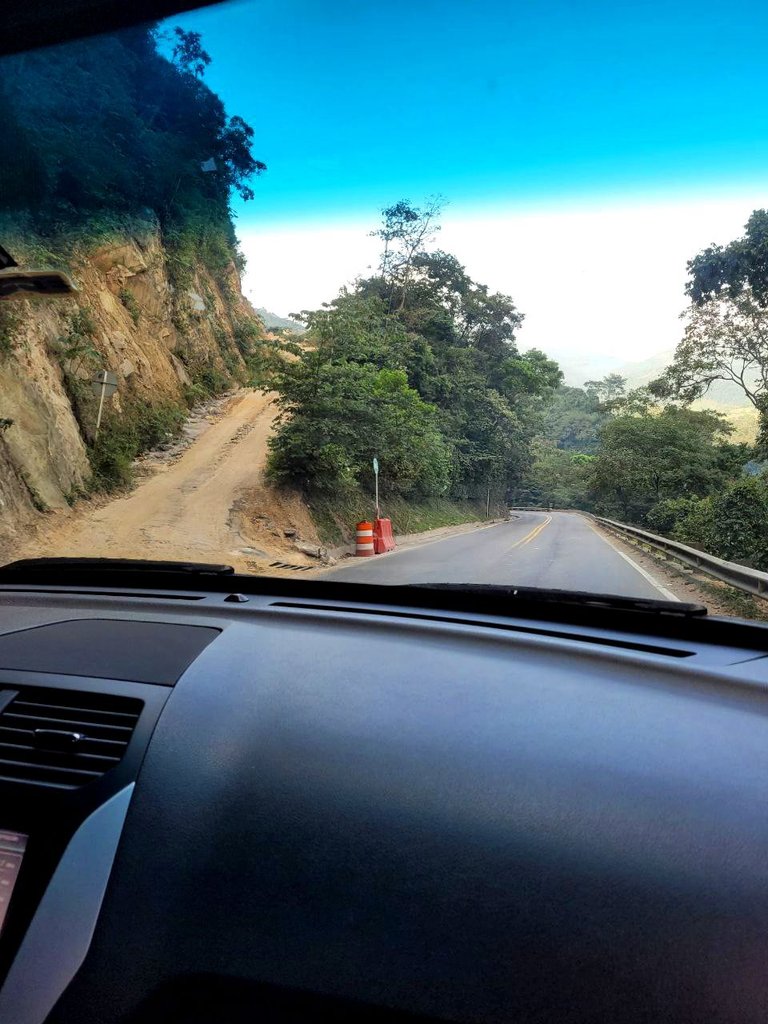
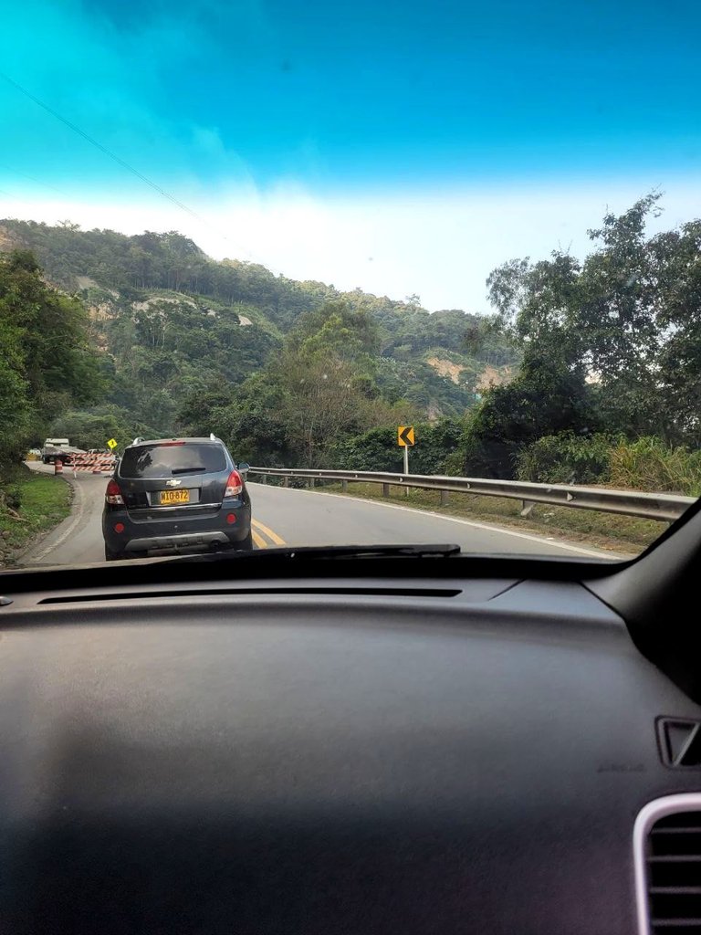
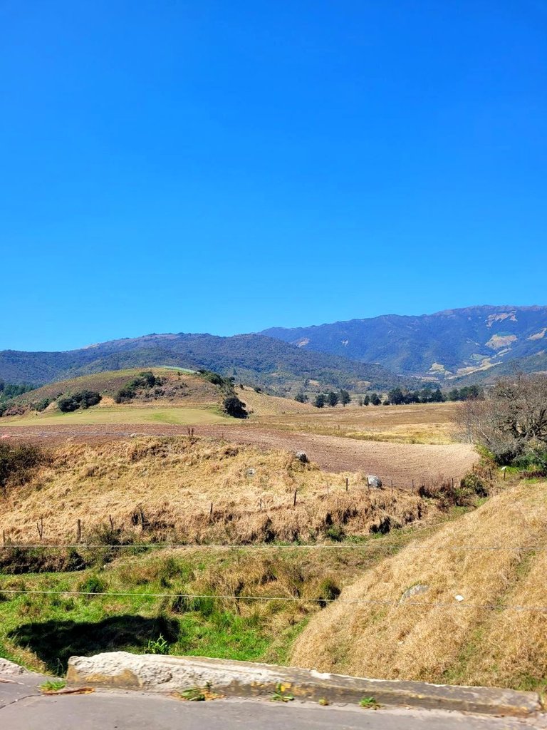
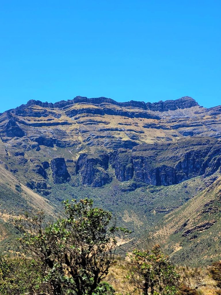
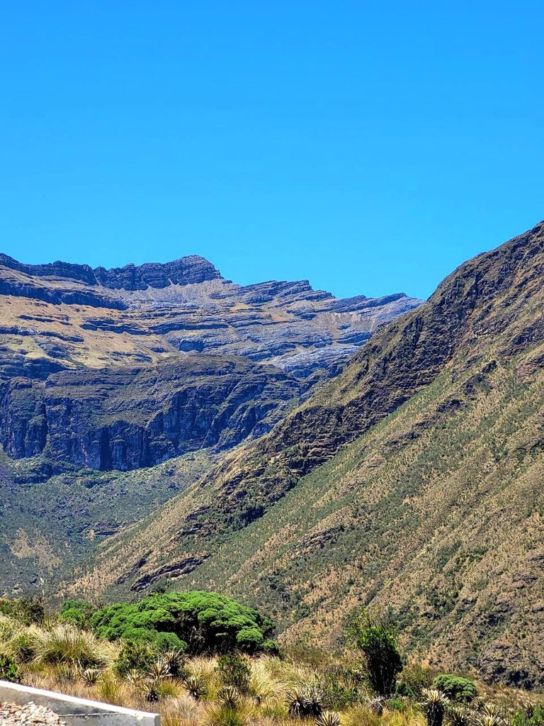
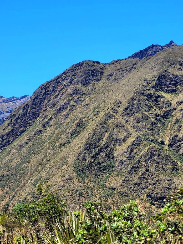
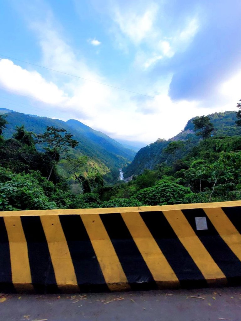
We started this trip with the best of possible vibes and super organized and trusting God a lot that nothing would happen on the way since it is a very long trip, so we brought drinks to stay hydrated, we brought food so as not to make stops and so on. not to waste time and much less have to spend money, as we advanced the road was beautiful, there we are surrounded most of the time by mountains since that is still part of the Andes so I had a beautiful panorama with the best of the colors and a really healthy air to breathe.
Este viaje lo empezamos con la mejor de las vibras posibles y super organizados y confiando mucho en Dios de que nada sucediera en el camino ya que es un viaje muy extenso, así que llevamos bebida para estar hidratados, llevamos comida para no hacer paradas y así no perder tiempo y mucho menos tener gastos de dinero, a medida que avanzábamos el camino era hermoso, ahí estamos rodeados en la mayor parte del tiempo de montañas ya que eso aun es parte de los andes así que tenia un panorama hermoso con el mejor de los colores y un aire para respirar realmente sano.
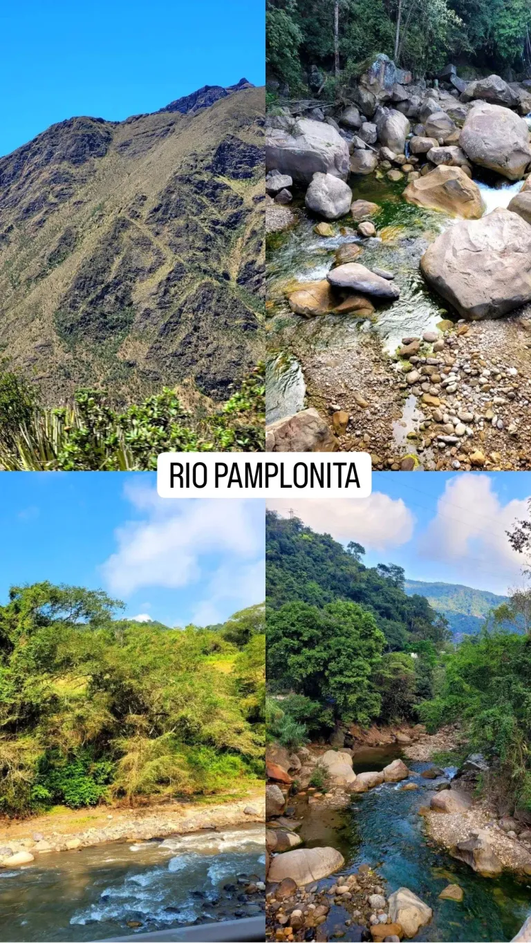
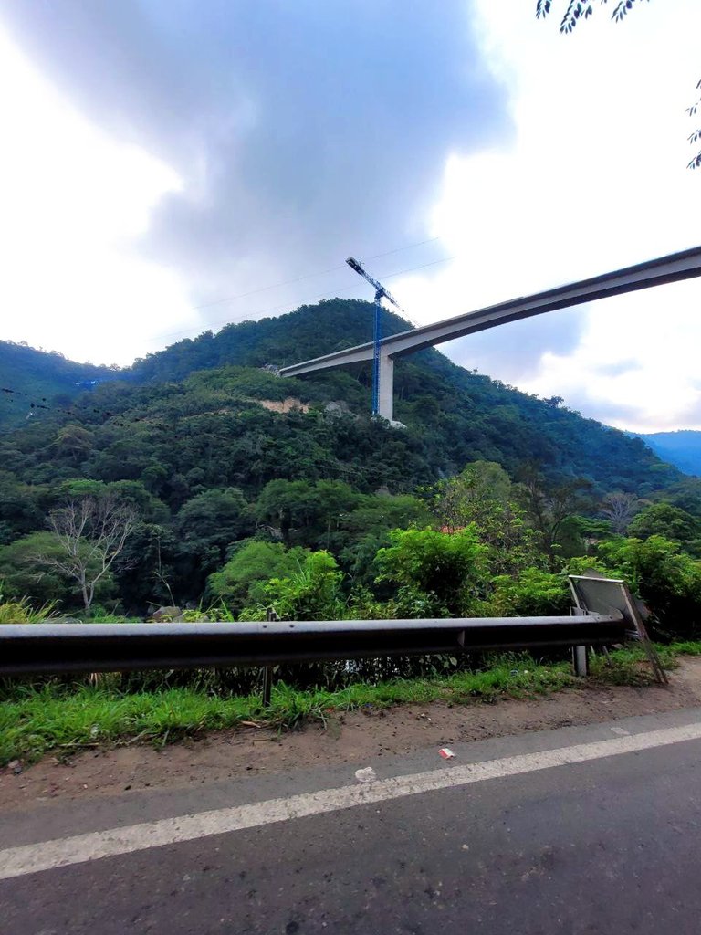
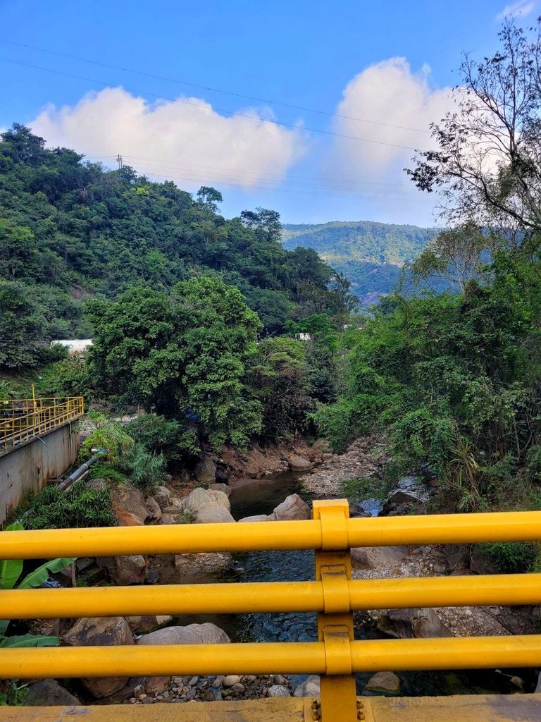
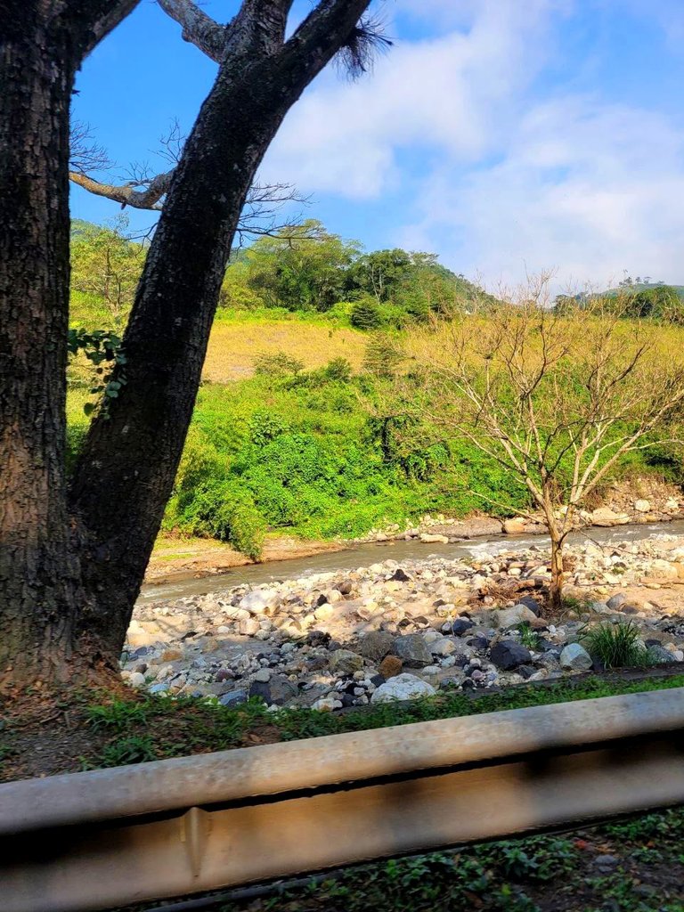
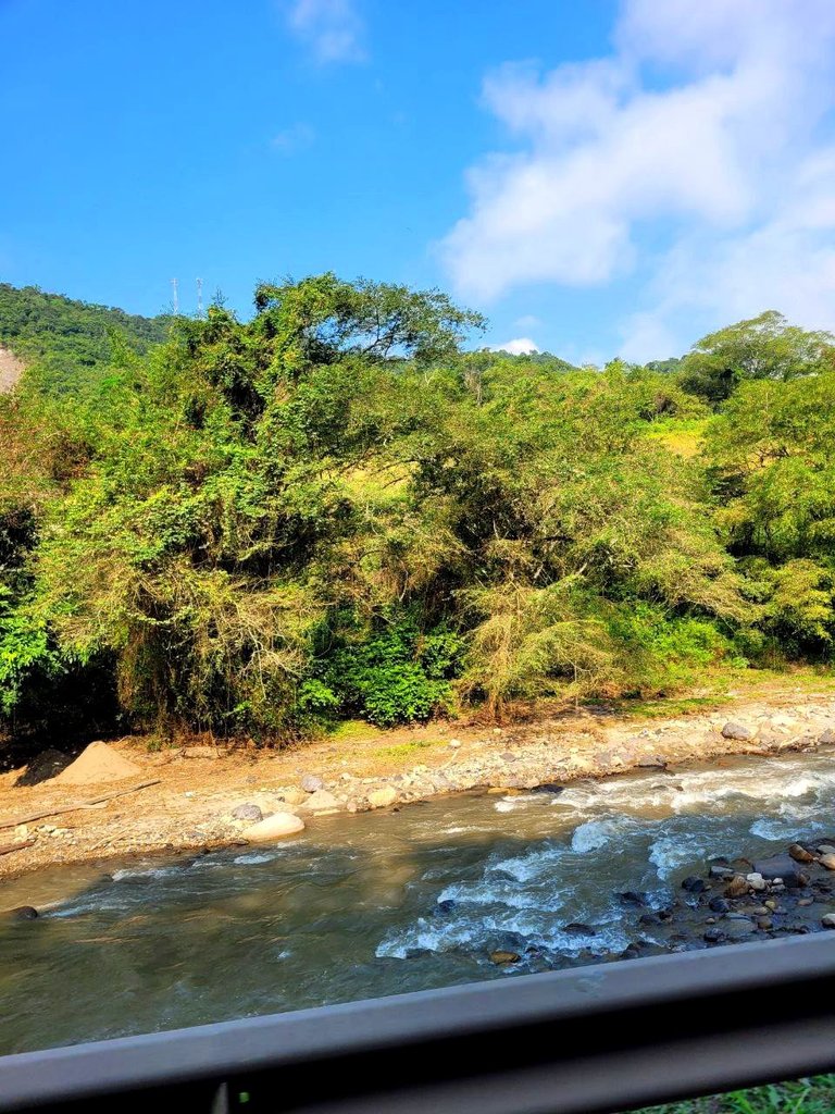
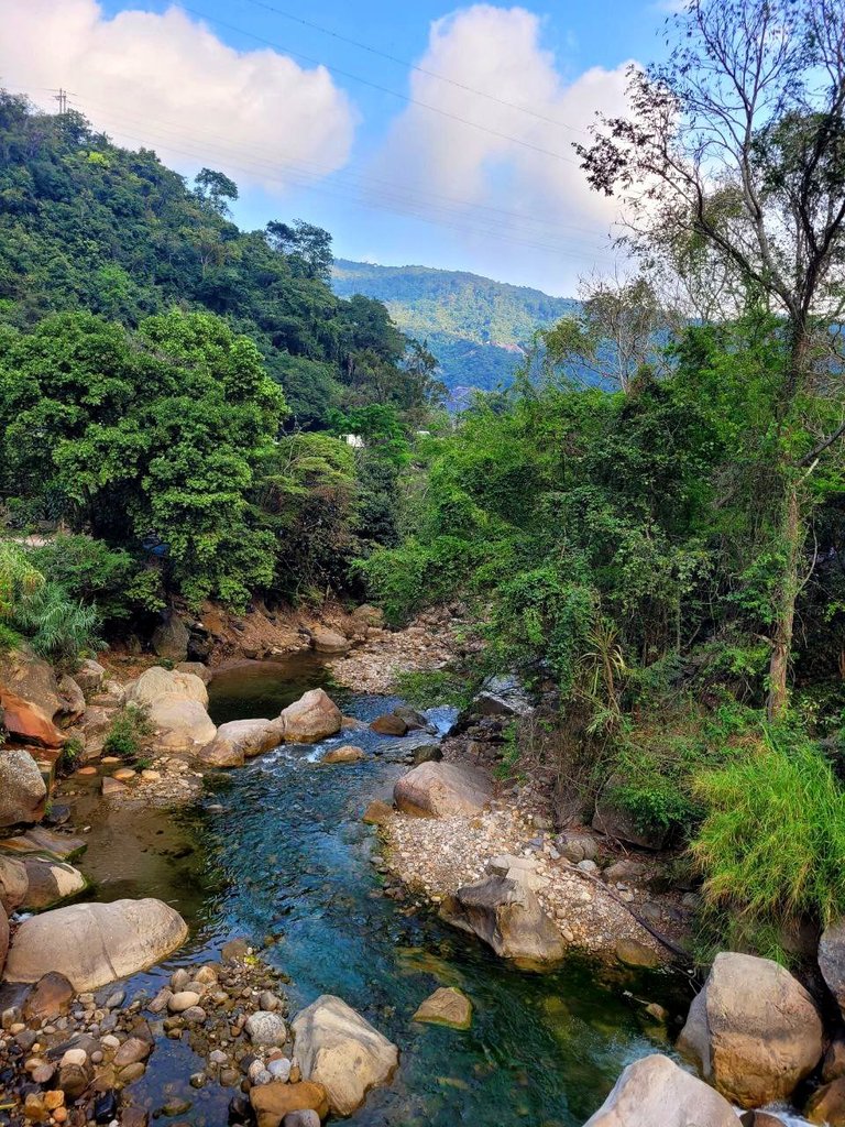
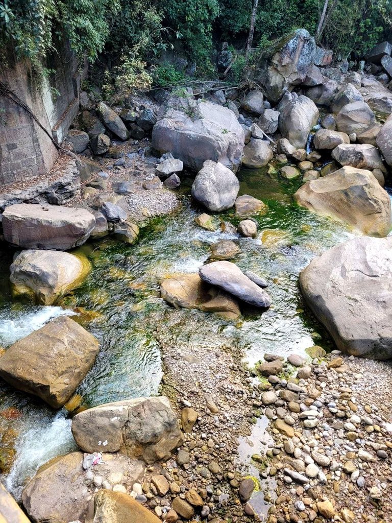
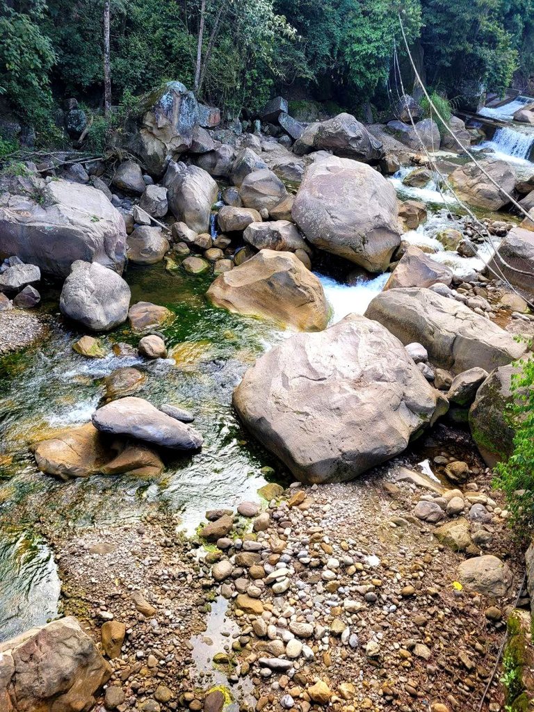
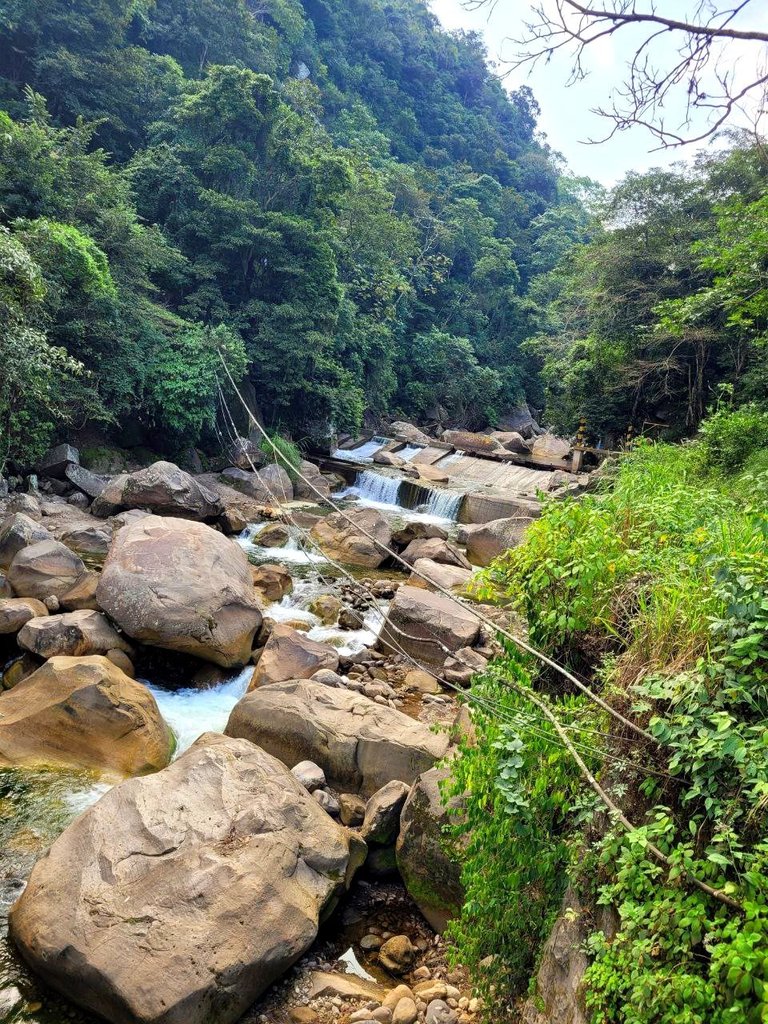
In much of our journey, the Pamplonita River accompanied us on the edge of the road, which no longer lets us know that we are inside Colombia since it flows in that direction, this river which is located at an altitude of 1500 meters above sea level and It is part of the great Catatumbo River, we made a short stop to photograph the place. According to what I managed to investigate, this river is contaminated, because the sewage is deposited right there due to the lack of the municipality.
It has its source in Cerro Altogrande at 3300 meters above sea level and flows right into the Zulia River 🏔 it has a length of 160 km, on the banks of this river there are several towns, many of which can be seen from the car, such as Pamplona, Pamplonita, Cucuta ,
The truth for me is a river that at first glance you would think is clean and healthy because it looks good and the climate makes you want to enter more. This is one of the rivers with the most pollution, according to what I read, the city of Cucuta throws 722 liters into it. of sewage every second into the river which is too much, according to there are projects in the pipeline and I hope that they will be able to put them into practice because this place is undoubtedly beautiful.
En gran parte de nuestro recorrido a nuestro lado al orilla de la carretera nos acompaño el río pamplonita el cual ya no hace saber que estamos dentro de Colombia ya que fluye en esa dirección, este río el cual se encuentra a una altitud de 1500 msnm y es parte del gran río Catatumbo, realizamos una pequeña parada para poder fotografiar el lugar. Según lo que logré investigar este río está contaminado, debido a que las aguas negras se depositan justo ahi por falta del municipio.
Tiene su nacimiento en cerro altogrande a 3300 msnm y desemboca justo en el rio zulia 🏔 tiene una longitud de 160 km, en las orillas de este río se encuentran varias localidad muchas de ellas las observe desde el automóvil, como pamplona, pamplonita, cucuta,
La verdad para mi es un río que a simple vista pensaría que esta limpio y sano porque el luce bien y el clima hace que quieras entrar más este es uno de los ríos con mayor contaminación según leí la ciudad de cucuta arroja en el 722 litros de aguas residuales cada segundo al río lo cual es demasiado, según hay proyectos en puertas y espero que logre colocarlos en practica porque sin duda es hermoso este lugar.
The photographs are of my authorship taken with my Samsung Galaxy s20 cell phone and edited with the Instagram application, the translation of the text is done using this medium: Deepl. You can reach me through my account
Instagram
Las fotografías son de mi autoría tomadas con mi celular Samsung Galaxy s20 y editadas con la aplicación Instagram la traducción del texto la realice utilizando este medio: Deepl. Pueden ubicarme por medio de mi cuenta de
Congratulations, your post has been added to WorldMapPin! 🎉
Did you know you have your own profile map?
And every post has their own map too!
Want to have your post on the map too?
What a wonderful natural place ❤️❤️
Gracias por compartir tu viaje a través de tan hermosas fotografías, me han dado unos enormes deseos de hacer un viaje por carretera.
Nature is always amazing. And in your post we can see original beauty of nature. And also one thing I must say. Your photography skills are wow.
Wow beautiful pictures 😍😍
Travel Digest #2263.
Become part of our travel community:
- Join our Discord
Hiya, @ybanezkim26 here, just swinging by to let you know that this post made it into our Honorable Mentions in Your post has been manually curated by the @worldmappin team. If you like what we're doing, please drop by to check out all the rest of today's great posts and consider supporting other authors like yourself and us so we can keep the project going!