A GREAT GREETING TO ALL.
MEMORIES OF MY WALK THROUGH THE GEOGRAPHY OF THE SUCRE STATE.
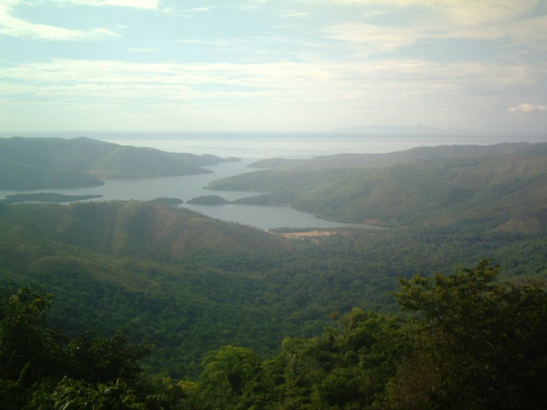
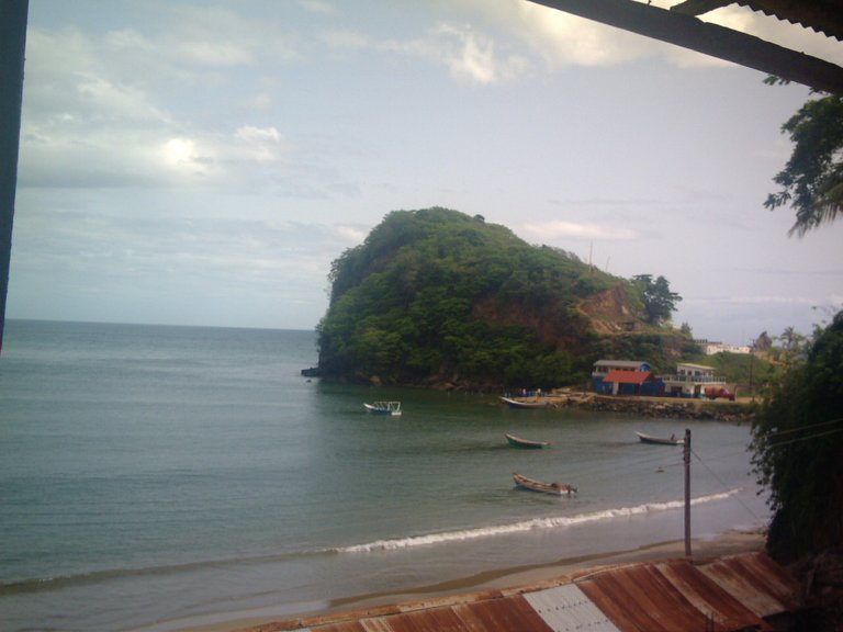
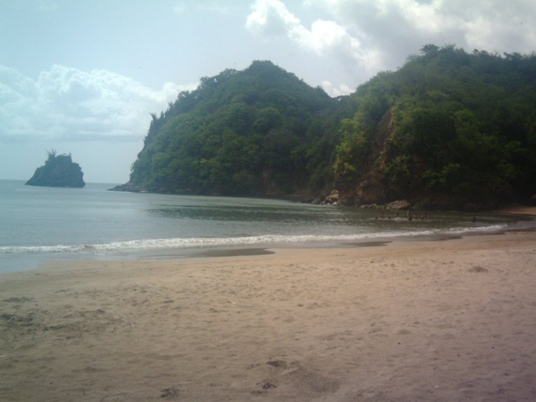
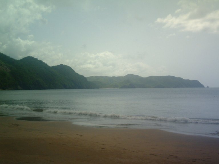
To begin with, I share with you images of the beautiful landscape of Mochima from the Cumana-Puerto la Cruz national highway. I hope you like it. Mochima tourist site par excellence for having some of the best beaches in this Caribbean Country..
UN GRAN SALUDO A TODOS.
MEMORIAS DE MI PASEO POR LA GEOGRAFÍA DEL ESTADO SUCRE.
En esta oportunidad compartiré recuerdos de una caminata que hice en el Estado Sucre ubicado en el Oriente de mi País Venezuela que estaba rodeado de costas a partir de la carretera nacional Cumaná-Puerto la Cruz pasando los quince Municipios de dicho Estado Oriental hasta llegar a la localidad de Macuro ubicada en el municipio de Valdés que recibe el nombre de Guiria, representando a dicha población uno de los primeros lugares donde arribaron los buques de guerra de los españoles, comandados por Cristóbal Colón, lo que permitió él a descubrir América hace más de 500 años.
Para empezar, les comparto imágenes del hermoso paisaje de Mochima desde la carretera nacional Cumaná-Puerto la Cruz. Espero que te guste. Sitio turístico de Mochima por excelencia por tener algunas de las mejores playas de este país caribeño.

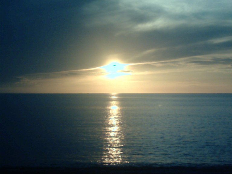
This image shows the sunset at dusk from the beach of San Luis, the bordones sector in the city of Cumana Capital of the Sucre State Cradle of the Great Marshal of Ayacucho Antonio José De Sucre said city is considered Firstborn of the American Continent for being the first place where the Colon ships arrived to discover the American continent.
Esta imagen muestra el atardecer al atardecer desde la playa de San Luis, sector de bordones en la ciudad de Cumaná Capital del Estado Sucre Cuna del Gran Mariscal de Ayacucho Antonio José De Sucre dijo que la ciudad es considerada Primogénita del Continente Americano por ser la primer lugar donde llegaron los barcos de Colón para descubrir el continente americano.
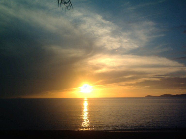
Segunda imagen de la Puesta del sol en Cumana Estado Sucre.
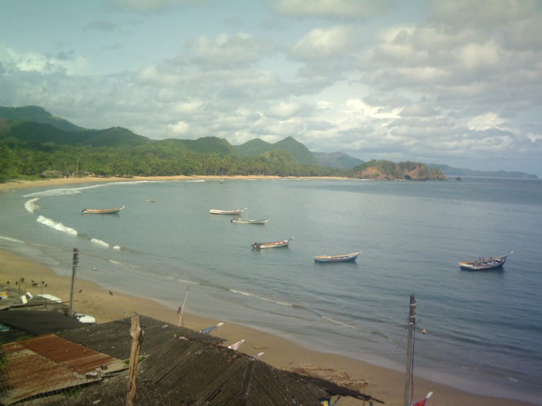
This image shows images of the beach of the town of Santa Fe, located on the Cumana highway –Puerto la Cruz is a town that lives from artisanal fishing, a place where cava-type trucks buy fish to take them to the interior of the country. plant lots of fruits and vegetables.
Esta imagen muestra imágenes de la playa del pueblo de Santa Fe, ubicado en la carretera Cumaná - Puerto la Cruz es un pueblo que vive de la pesca artesanal, un lugar donde camiones tipo cava compran pescado para llevarlos al interior del país. . Plante muchas frutas y verduras.
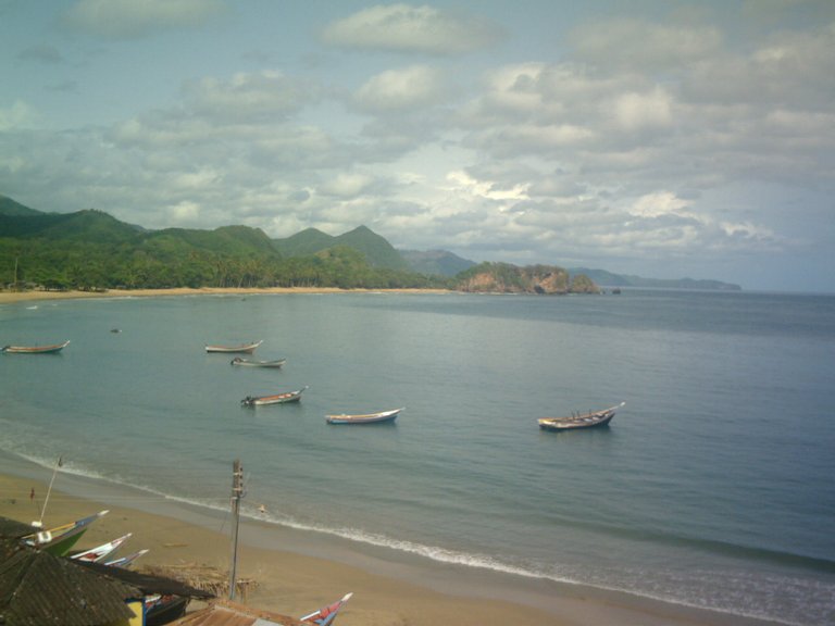
Población de Santa Fe.
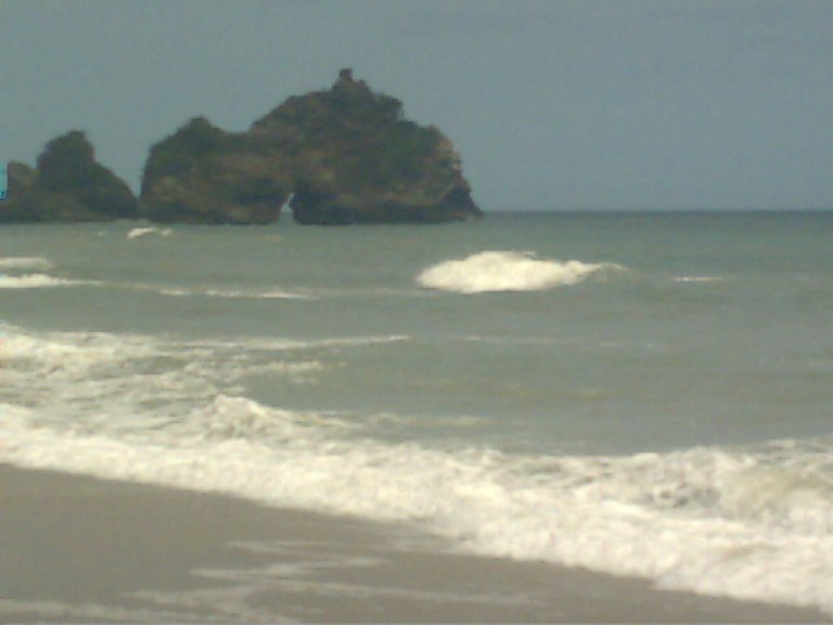
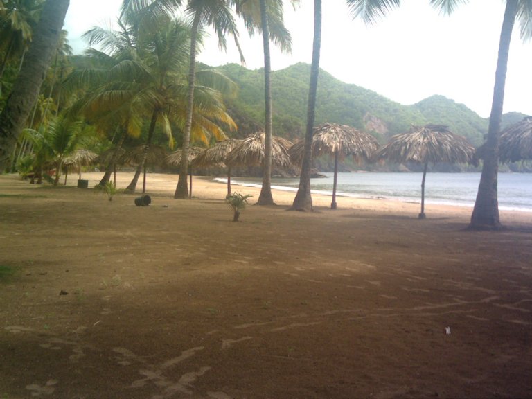
This image represents San Juan de las Galdonas Beach, one of the best Beaches in the country and is very visited by tourists in high holiday seasons such as carnival, Easter, it is located in the Municipality of Arismendi, the Paria Peninsula near Rio Caribe.
Esta imagen representa la Playa San Juan de las Galdonas, una de las mejores Playas del país y es muy visitada por turistas en temporadas altas de festividades como carnaval, Semana Santa, se encuentra ubicada en el Municipio de Arismendi, Península de Paria cerca de Río Caribe.
Playa las Galdonas.
Playa las Galdonas.
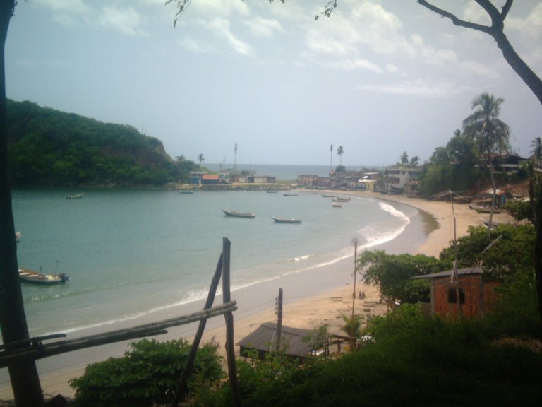
I share images of Playa medina, considered one of the most beautiful beaches in Venezuela and one of the most visited, which is located in the Paria Peninsula, Arismendi Municipality, 56 km from Carúpano, between Río Caribe and San Juan de las Galdonas.
Comparto imágenes de Playa medina, considerada una de las playas más hermosas de Venezuela y una de las más visitadas, la cual se encuentra en la Península de Paria, Municipio Arismendi, a 56 km de Carúpano, entre Río Caribe y San Juan de las Galdonas.
Playa Medina.
Playa Medina.
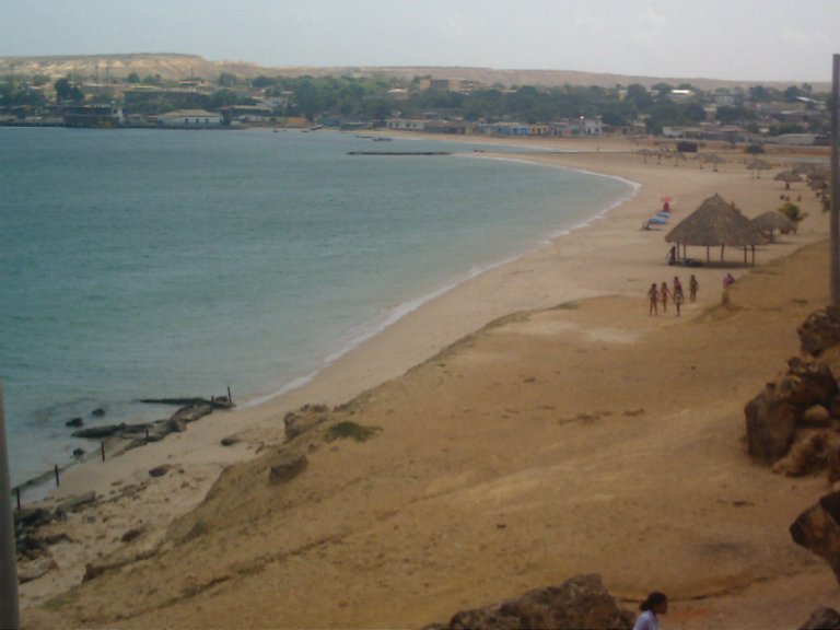
Population of Araya Municipality Cruz Salmerón Acosta This peninsula can be reached by land by taking the Cumaná-Carúpano highway, entering Cariaco and then taking the highway to Chacopata also by sea, through tapaítos, boats that take only 20 minutes to arrive to Manicuare from the city of Cumaná.
Población del Municipio Araya Cruz Salmerón Acosta A esta península se puede llegar por vía terrestre tomando la carretera Cumaná-Carúpano, ingresando a Cariaco y luego tomando la carretera a Chacopata también por vía marítima, a través de tapaítos, lanchas que demoran solo 20 minutos en llegar a Manicuare desde el ciudad de Cumaná.
Península de Araya.

@tipu curate
Upvoted 👌 (Mana: 70/80) Liquid rewards.