From my shirt, through the sea, up to the skies -- that day, it was all blue.
This photo was taken somewhere on our way to Cape Bojeador Lighthouse in Burgos, Ilocos Norte. I asked everyone in the vehicle if we could forgo the AC that day, and they agreed. I was able to enjoy the refreshing smell of sea, though the strong winds decidedly turned my hair into bird's nest LOL.

a quick break
After quite an adventurous morning in Bacsil Onse Reef Sand Dunes (see my post, the sand dunes that took my breath away), we dropped by quickly to Malacañang of the North. I... didn't really enjoy it for reasons I'm not so energetic enough to share, and also because it was such an anticlimactic destination after the action-packed 4x4 ride through the Sand Dunes. It's a place that's just... there.
Our group decided to have brunch at a nearby store, but it was really expensive for the food that they serve. Maybe we're just really sensitive about food? LOL.
a lighthouse
📍 Cape Bojeador Lighthouse, Burgos, Ilocos Norte
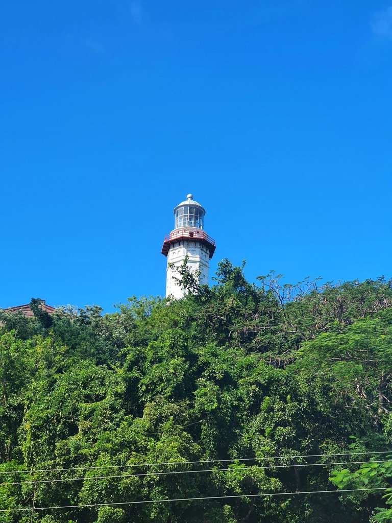
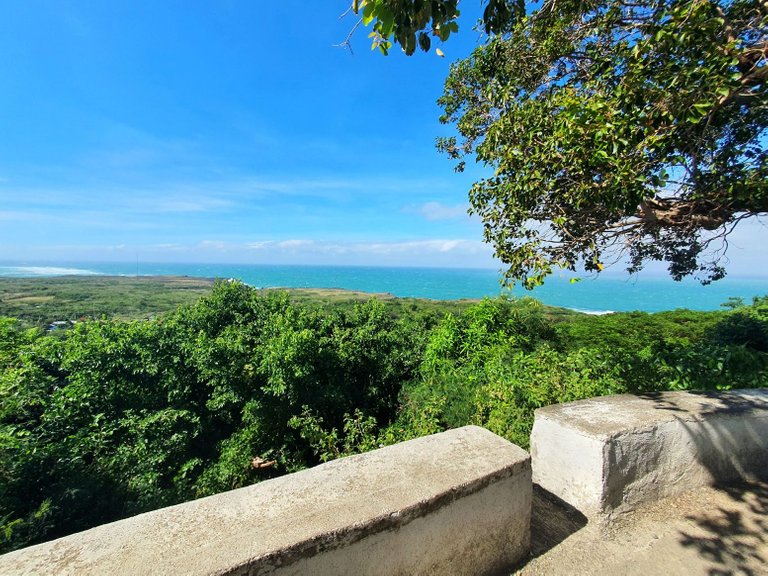
Our next stop that day was about 1 hour and 11 minutes away from Paoay, Ilocos Norte. It's called the Cape Bojeador Lighthouse. It was first lit in 1892 and overlooks the very beautiful Cape Bojeador.
To get there, we had to walk uphill the Vigia de Nagpartian Hill, where the lighthouse was situated. It was quite steep. I don't think it was such a long distance, but the steepness might make the walk (or hike) a little challenging. Unfortunately, that was the day I decided to wear slip-on slippers, so it was quite difficult for me. (One of my uncles had to get down immediately -- the change in elevation got him sick, and we were scared his heart problems might worsen should he stay.)
The walk might be tiring, but it was definitely refreshing. There were so many trees, and the wind blowing everywhere is, I'm not kidding, very calming. It also helped a lot that we were greeted by this very scenic sight of the Cape Bojeador. Everything was so blue, I wish I could just stay there.
The adults weren't keen on getting inside the lighthouse, but the kids were. I volunteered to accompany the kids inside, but unfortunately, we were not allowed inside the lighthouse tower.

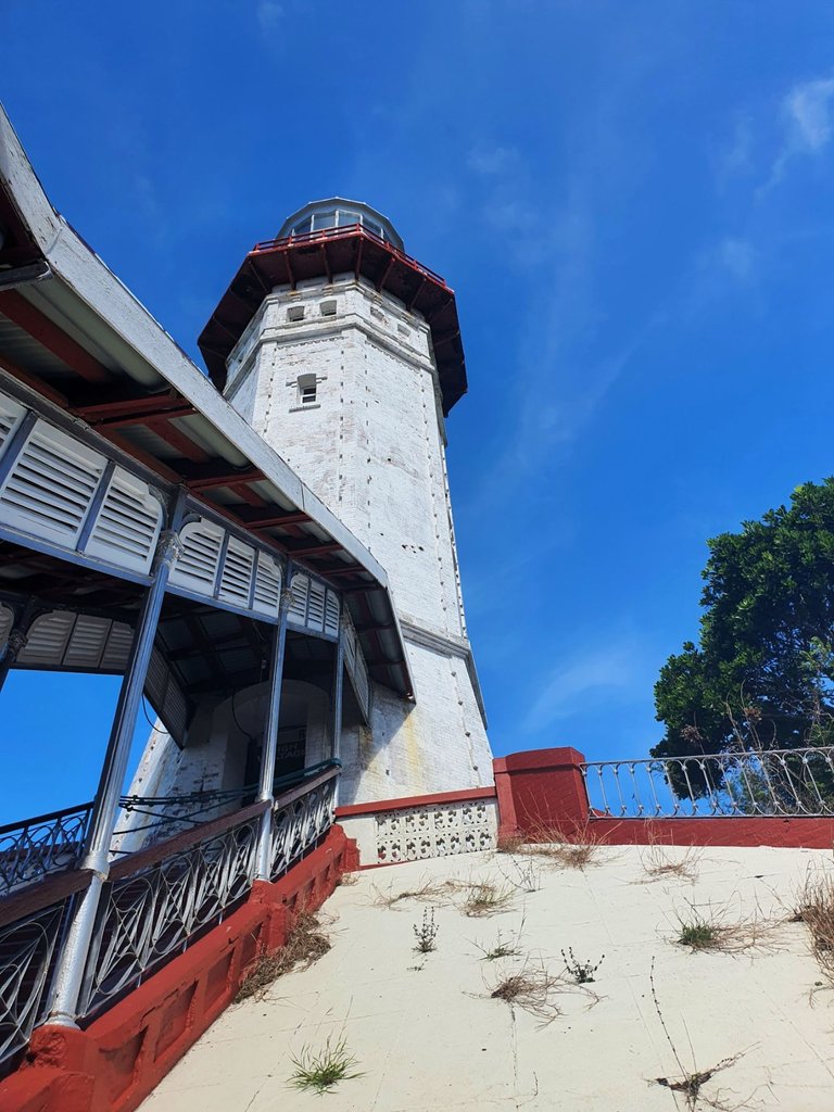
From the national highway, where vehicles lined up for parking (right side road), we hiked up to the lighthouse. The entrance is that forking road at the top right.

Entrance for the kids was free, but adults have to pay around Php 10, if I remember correctly. Like the Malacañang of the North, there wasn't much to do inside. There was a really great view of the blue skies and sea, though!
Apparently, even after over a century, the Cape Bojeador Lighthouse still serves ships that enter the Philippines from the north. I think that's amazing.
the rock formation that blew me away.
I think we were really still in a high from the 4x4 ride at the Sand Dunes, so just taking pictures felt underwhelming. We didn't stay long in the lighthouse. Soon, we drove around half an hour (or less, maybe) to our next destination.
📍 Kapurpurawan Rock Formation, Burgos, Ilocos Norte
I'm not sure, so take this with a grain of salt, but I believe Burgos is well-known for its windmills. On our way to the Kapurpurawan Rock Formation, we were greeted by gigantic windmills lined up the coast.
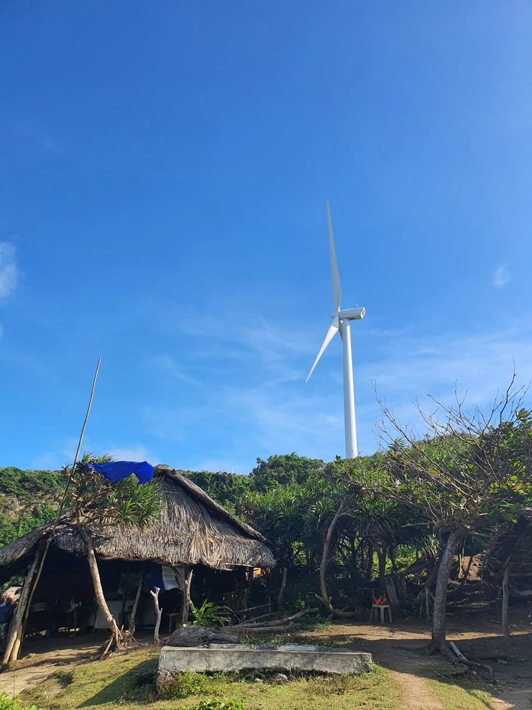
I honestly thought it was going to be boring again, but we walked a lot. Again! And this time, I really, really enjoyed the trek.
After walking past the long lines of parked vehicles, we were greeted by many different stores in nipa huts selling various souvenirs. Some were very interesting. In fact, my two uncles bought matching cowboy hats. 😆 Talk about bromance. (It also happened that they are both Bisaya who married my Southern Tagalog aunts, so they have shared brotherhood or something. 😅)
Anyway, after getting through the long lines of stores, we found that we could actually go down this pretty steep set of stairs that leads to the rock formations.
My cousins weren't so happy about the height, but we were there to experience new things, so we went for it and got down. Boy am I glad I don't have kids -- I don't think I would want to be looking after little kids while going down these stairs!
 |  |  |
There were two ways to go to the actual rock formation.
- By horse. No, I didn't want to. It felt like the horses were very, very overworked and stressed. Heck, they even made a business out of taking pictures while sitting on a horse and not actually riding one. I mean... why? Is my moral compass the one that's wonky??
- By foot. Ah, another exercise, but one I couldn't pass off. I wanted to do it, even if on slippers. I would also get to enjoy the scenery much better this way, and take on the beauty of everything in my own pace. I also wouldn't have to worry about a horse or something.
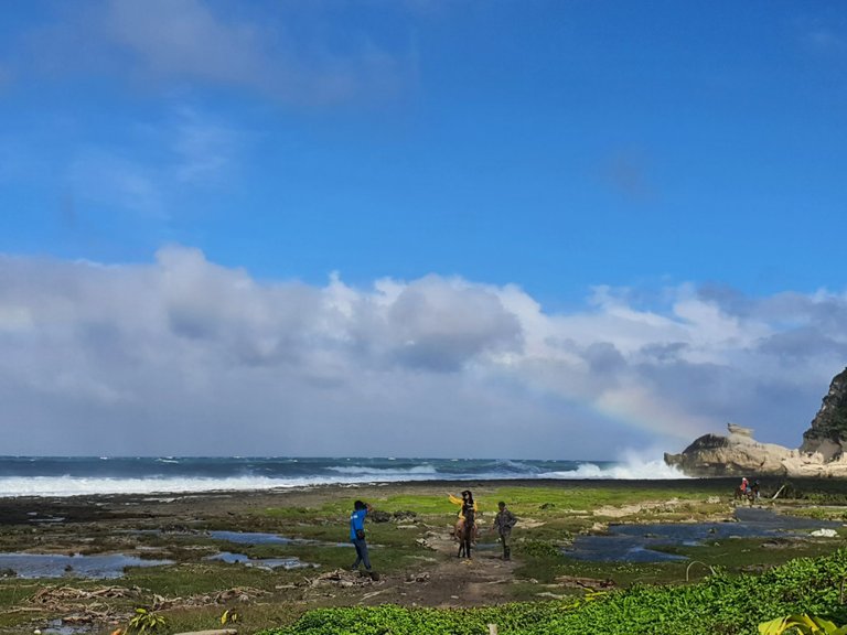
See that white rock formation to the right of the photo below? That's only one of our targets. We aim to go behind it, where a lot of other views are waiting.
While walking, we kind of just grouped up with another group of strangers. It was a shared experience, I guess? The walkway was very, very rocky. It didn't help that cold wind blew at full strength, literally taking me with it from time to time. (That night, I found that I had a couple of bruises and scrapes from falling and tripping a number of times.)
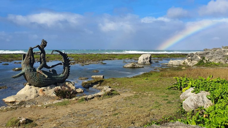
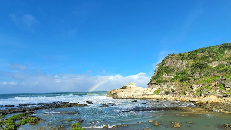
Somewhere during our trek, we found statue of an alligator (or crocodile? I still couldn't tell the difference) and a man. I initially thought it was a mermaid statue. I think it was really nice, especially with the rainbow in the background. I was supposed to take a photo of the alligator mouth spewing out the rainbow, but I just felt the group of tourists behind us so I hurried up and just shot this.
We got up close to the formation that was visible from the entrance, and it was seriously beautiful. It was dangerous to get closer, though, because the waves were incredibly strong and big.

Eventually, we got to the other side of the formation, but the winds just got much, much stronger. I swear, my aunt and I had to hold each other if we didn't want to fall off and into oblivion.
We managed to catch up with one of my uncles at that point, who still had so much energy left in him. I swear, I was just talking to him one moment, turned to my aunt for a few to talk, and when I looked back, he was gone. LMAO.
I saw him walking and jumping rocks with my cousins and some of the kids, and I might just have a heart attack. I didn't take them to be daredevils, but they apparently were. 😭 I was so anxious about their safety that we ended up taking pictures here and there.
Here's one of myself and one of my aunts, stuck to the side of one of the rock formations, because otherwise, we'd be blown away by the winds. I had sand all over me and muddy residues all over my feet and parts of my legs, the bruises and scratches I found that night started to make sense.
My cousin's husband was starting to feel sick, and my cousin was, too. 😩 I thought I was the sickly one. Turns out I got really healthy after all these years LOL.
I turned again to find my uncle and the other kids, only to find them right across us, to the other formations. My anxiety went up a couple of notches. Thankfully, one of the tourist guides found them and actually reprimanded them. It turned out that because that area was so dangerous, it was really just off-limits. 🤷♀
Here's my daredevil of an uncle taking a selfie of himself.

Please, don't do what my uncle and cousins and some of the kids did. Be kind to yourself and save yourself the trouble. LMAO.
and off to the northernmost area of Luzon island.
At that point, it was around 4 PM. If we wanted to get to our next B&B in time before sunset, we had to leave. Just that... I didn't know that our B&B will be in Pagudpud, Ilocos Norte. It is the northernmost settlement in Luzon.
Upon the knowledge, I had the realization that I... actually witnessed both ends of Luzon Island. The southernmost in Matnog, Bicol, and now in Pagudpud. I never thought I would get to have the opportunity in this lifetime, so I was sincerely floored.
Eventually, though, the weather was starting to get bad. Like, really bad. There was almost zero visibility in driving because besides the rain getting strong, it was getting very cold, too. There was fog everywhere. Still, we tried to drive through the Patapat Viaduct.
📍 Patapat Viaduct, Pagudpud, Ilocos Norte
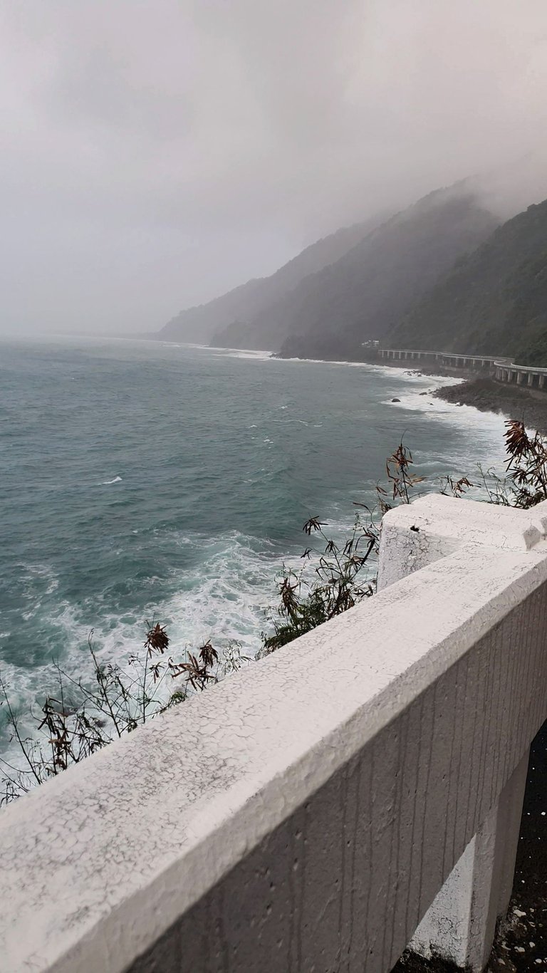
It was a very long ride, and while it was scenic, it felt ominous watching the fog and the strong and loud waves.
The huge nerd that I was, I took the opportunity to let my family know that we were literally just a sea away from the Babuyan Islands, then Batanes, then Taiwan. They didn't believe me. 😆 (It's true, though!)
the end of day 2
That was the end of our second day of Ilocos trip. We were supposed to take a swim in a resort in Pagudpud, where we were also staying, but the bad weather didn't let us. We were told that by the resort management that they had to forbid everyone from taking a swim as the bad weather took a life that morning.
The weather got so bad, it felt like a storm was brewing. Electricity also cut off. We thought that it was OK that we didn't get to swim. We were still able to witness so many beautiful things, regardless.
That night, before getting to sleep, my aunt and I were talking. We were to leave for home the next day, but we were literally about 500 km away from home, and it would take over 10 or 12 hours of continuous driving.
So I told her I haven't been to Baguio, the summer capital of the Philippines. Like ever. Like a miracle, she said, "OK! Let's do a Day 3, then leave for home in Day 4."
And so, the trip didn't end just yet. 😉
Daily Travel Digest #1807.
Become part of our travel community:
- Join our Discord
- Learn more about our travel application
Hiya, @LivingUKTaiwan here, just swinging by to let you know that this post made it into our Honorable Mentions in Your post has been manually curated by the @pinmapple team. If you like what we're doing, please drop by to check out all the rest of today's great posts and consider supporting other authors like yourself and us so we can keep the project going!very good your photos and landscapes, enjoy it looks very fun 😀
thank you! and yes, i had fun during the trip! would definitely love to go back :)
Wioow great you had an awesome family trip in Ilocos! It is one of the places I have to check in my bucketlist :)
it was pretty awesome! if you do decide to travel to ilocos norte, you might want to drop by the onse reef sand dunes and kapurpurawan rock formations -- they're my favorites from the trip!
Surely @erang , thanks for these reco :)
Congratulations, your post has been added to Pinmapple! 🎉🥳🍍
Did you know you have your own profile map?
And every post has their own map too!
Want to have your post on the map too?
pretty good place
Congratulations @erang! You have completed the following achievement on the Hive blockchain And have been rewarded with New badge(s)
Your next target is to reach 1250 upvotes.
You can view your badges on your board and compare yourself to others in the Ranking
If you no longer want to receive notifications, reply to this comment with the word
STOPCheck out our last posts:
Support the HiveBuzz project. Vote for our proposal!
Hi @erang, your post has been upvoted by @bdcommunity courtesy of @rehan12!
Support us by voting as a Hive Witness and/or by delegating HIVE POWER.
JOIN US ON
Omg! So beautiful place and come on hahaha I think I would also have a heart attack to see people I care about playing jumping rabbits in a place like that.
The place is majestic, I'm not there but I can smell the sea.