Every adventure is bound to have its own share of misadventures, reminding us that no matter how well-planned or exciting it may be, we must always be prepared for unexpected situations and willing to adapt to changing circumstances. By embracing uncertainty and facing challenges with resilience and flexibility, we can make the most of every adventure and even find unexpected joy and meaning in the journey.
Although we had initially planned to conquer the highest mountain in the Philippines, Mt. Apo (2,954 MASL), a natural calamity hindered our adventure. However, we did not let this setback stop us from exploring other exciting possibilities. We decided to trek up nearby peaks such as Mt. Kalatungan and Mt. Wiji, which are also among the highest mountains in the Philippines.
Our adventure began with an early flight to Davao's Francisco Bangoy International Airport, but we encountered a slight hiccup. One of our organizers realized that she had left her valid ID at home, which was essential to board the plane. With boarding time approaching, we had to think quickly and arranged for the ID to be delivered to the airport via a motorcycle delivery app.
Luckily, it arrived on time, but we were quite anxious that she might not make it. We found her running towards the boarding gate, and we all breathed a sigh of relief.
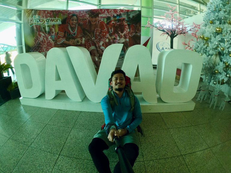
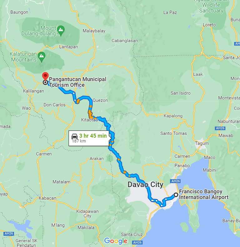
After an hour's flight, we arrived in Davao. From there, a van picked us up and drove us to the registration area in Pangantucan, Bukidnon.
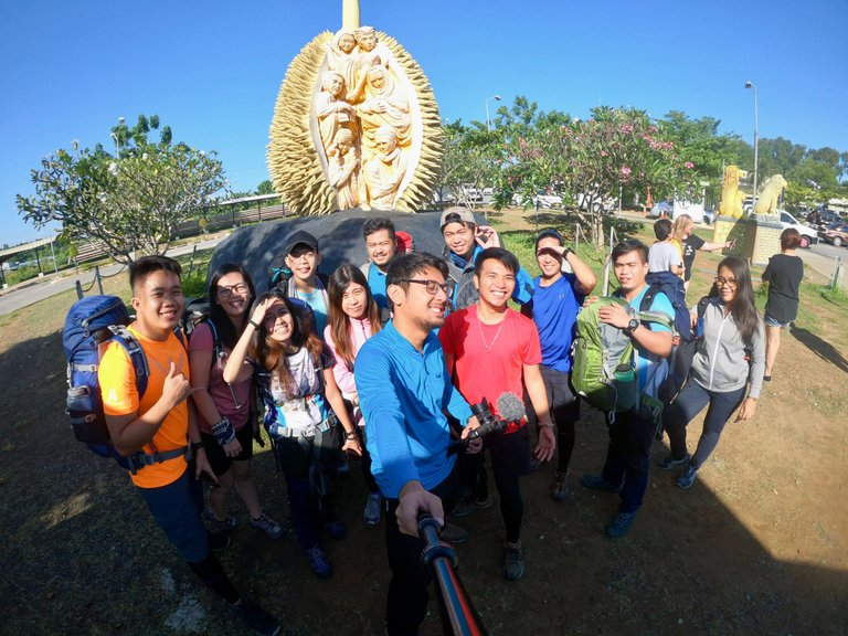
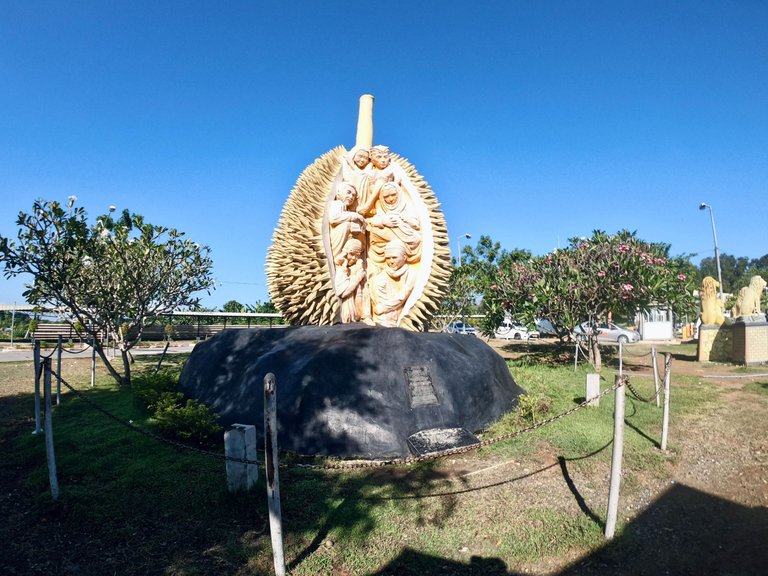
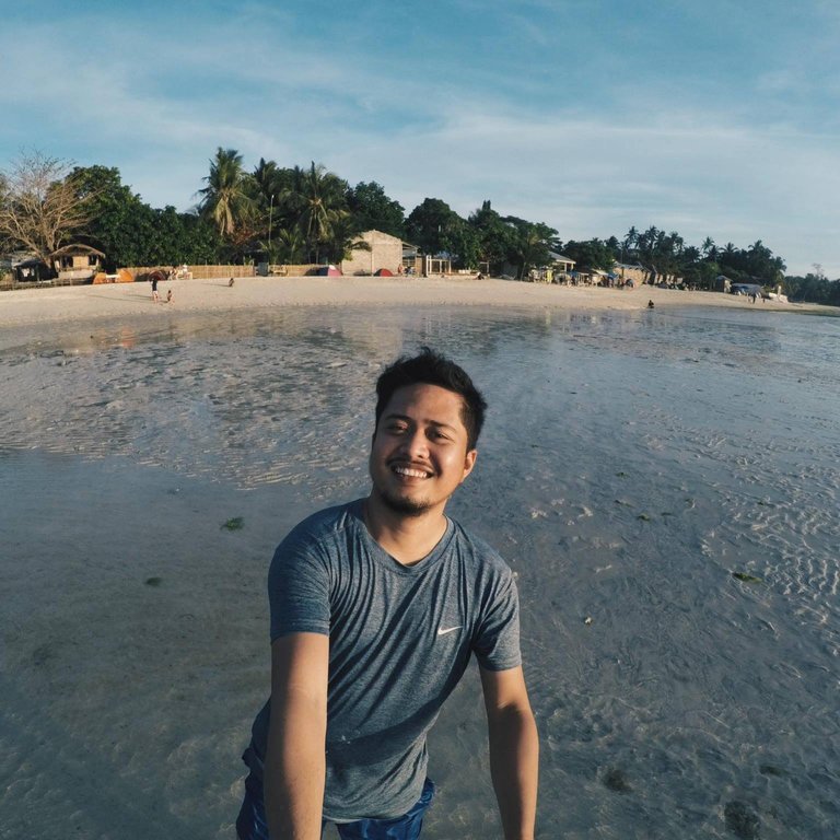
Pangantucan Tourism Office
187 kilometers from the airport, we arrived at the Pangantucan Tourism Office for our registration and orientation, where we were briefed on the dos and don'ts and learned about how the tribal communities living there perform a ritual offering of a live chicken to the mountain deities before the climb.
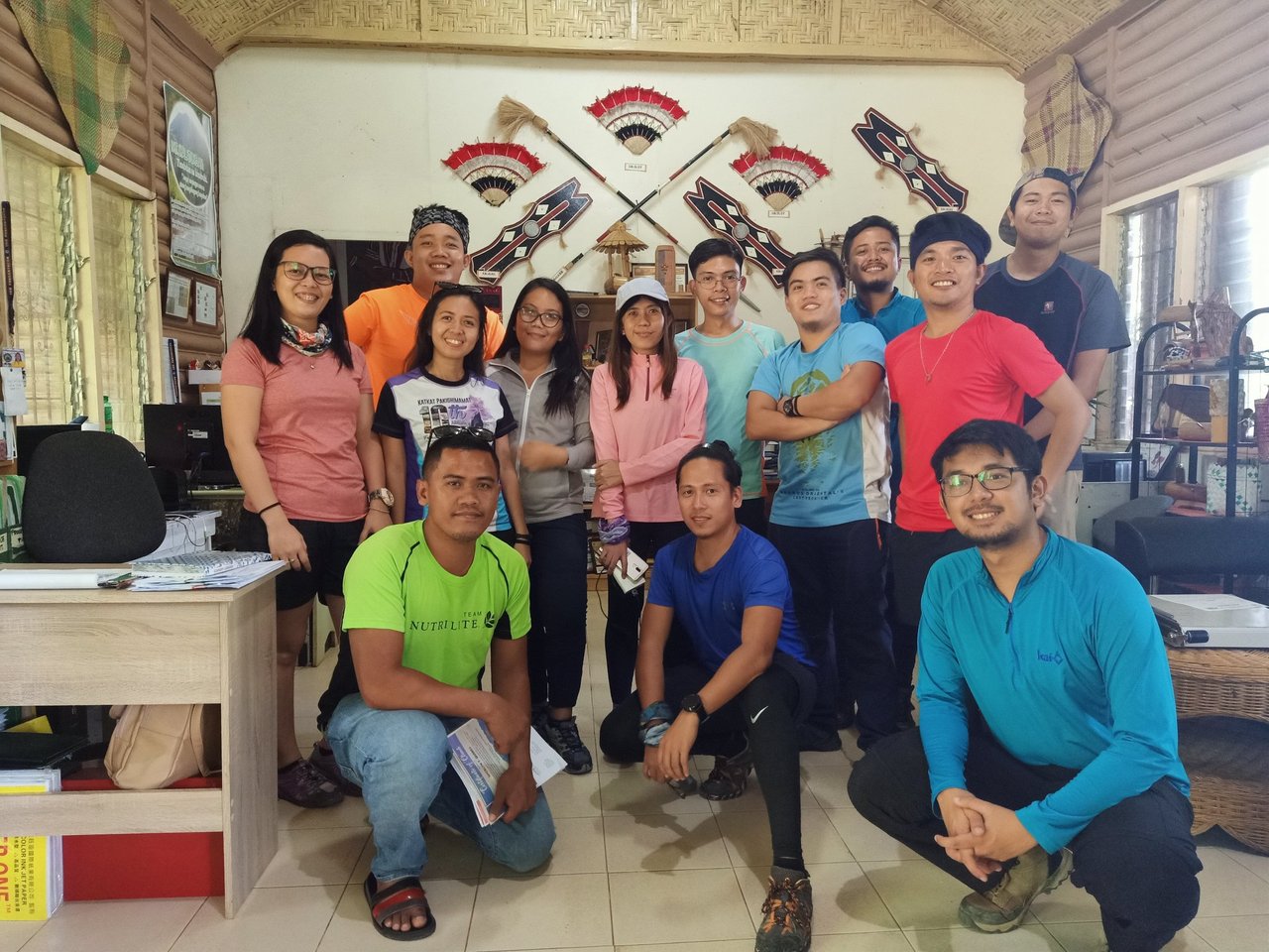
Photo credits to @zanbarluado
Arduous Ascent To The Philippines' 5th Highest Peak
After the orientation and taking the mandatory group picture, we headed back to the van and proceeded to the actual jump-off point at Brgy. Mendis Gymnasium, which is about 8.5 kilometers away from the Tourism Office.
We arrived at Brgy. Mendis around 4:30 PM, with a dark cloud looming in the background. The local chief decided to perform the ritual while we were on the way to the view deck.
|
|
|
|---|---|
|
|
|
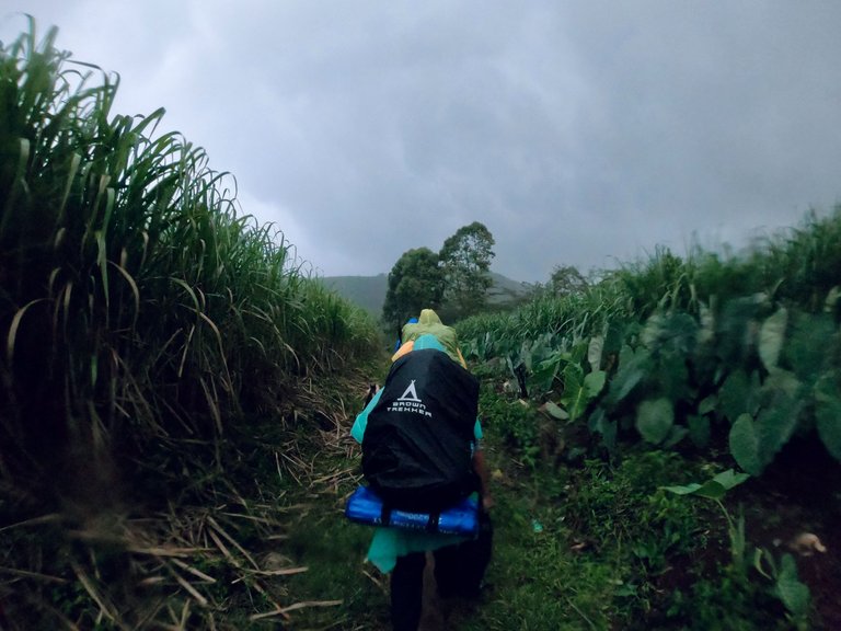
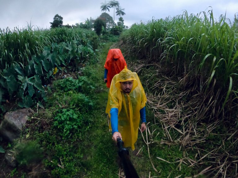
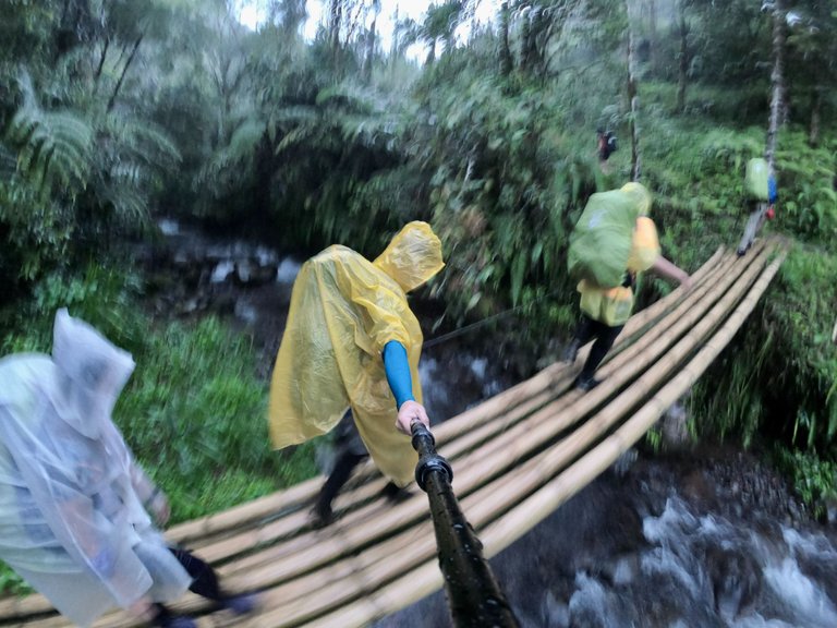
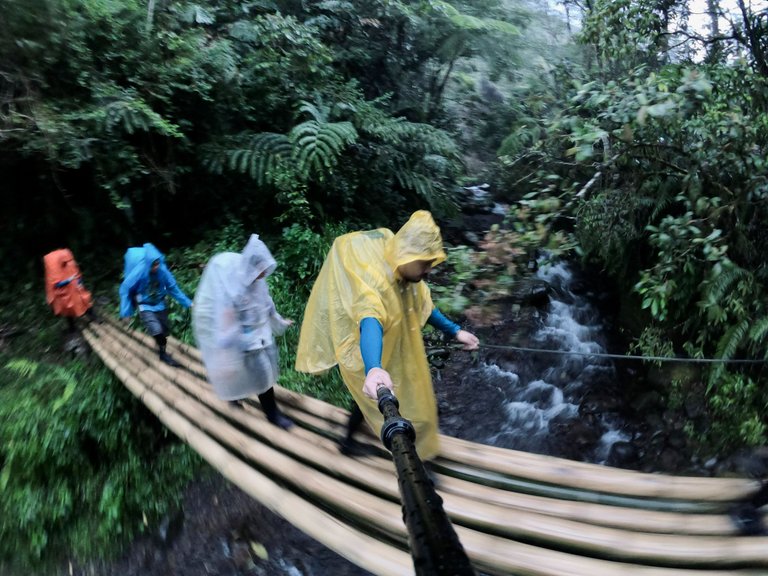
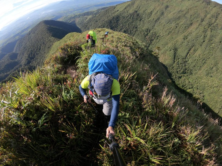
Our hike began at 5:00 PM, with us wearing ponchos and rain jackets. Just a few meters away from the gymnasium, it started to rain heavily. As it grew darker, the rain persisted, and the trail became wet and created a lot of deep puddles. We had to be careful not to fall on them. Our friend John had a hard time as he kept falling on the puddles, but his long legs saved him. LOL.
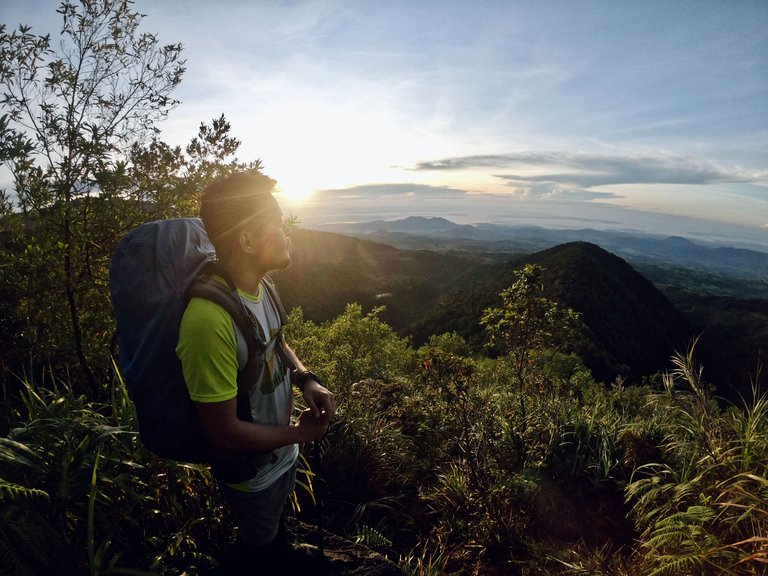
Viewdeck
The 2-storey view deck is located 3.6 kilometers from Brgy. Mendis Gymnasium and stands at around 1,607 MASL.
Despite having our rain jackets and ponchos on, we were still soaking wet when we arrived at the view deck. We immediately took off our wet clothes and hung them on the second floor of the deck, where we were also going to sleep that night. While we were getting comfortable and preparing our beds, the guides were busy preparing our dinner in the kitchen below.

Photo credits to wanderingfeetph
Conquering Mt. Kalatungan Peak
After dinner, we quickly tucked ourselves into our sleeping bags. The deck had a roof but no walls, so we had to keep warm with our jackets inside our sleeping bags. We ended the night early as we had to wake up at 2:00 AM the next day.
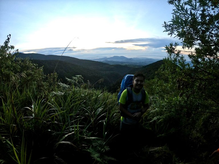
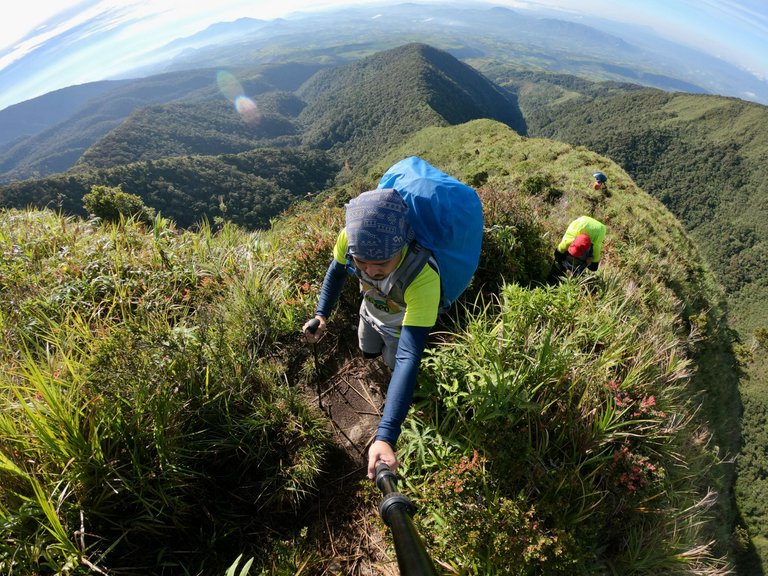
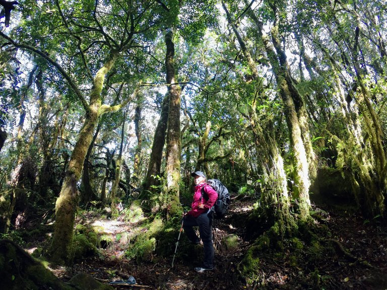
I was awakened by the noises made by my friends preparing their things at 2:00 AM, and the guides had already prepared our lunch. We started our ascent past 3:00 AM, and I was a little scared of the steep ascent through Buko-buko sa Anay. Although I had read a lot of blogs about Mt. Kalatungan prior to the climb to prepare myself for the actual climb, it was different once we were on the trail.
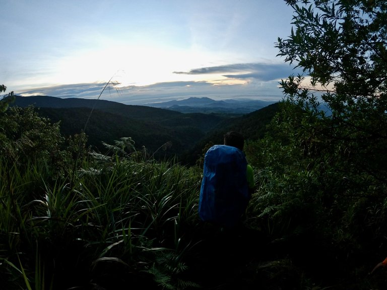
CJ and I were on the sweeper team with one of our guides, either Kuya Babu or one of the other guides. The first part of the trail was a subtle ascent into the forest, but we could not see anything except for the parts illuminated by our headlamps.
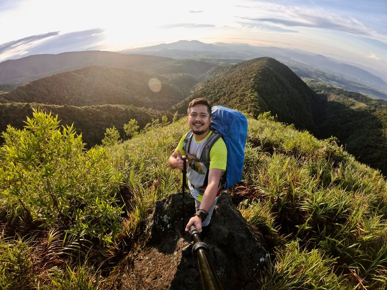
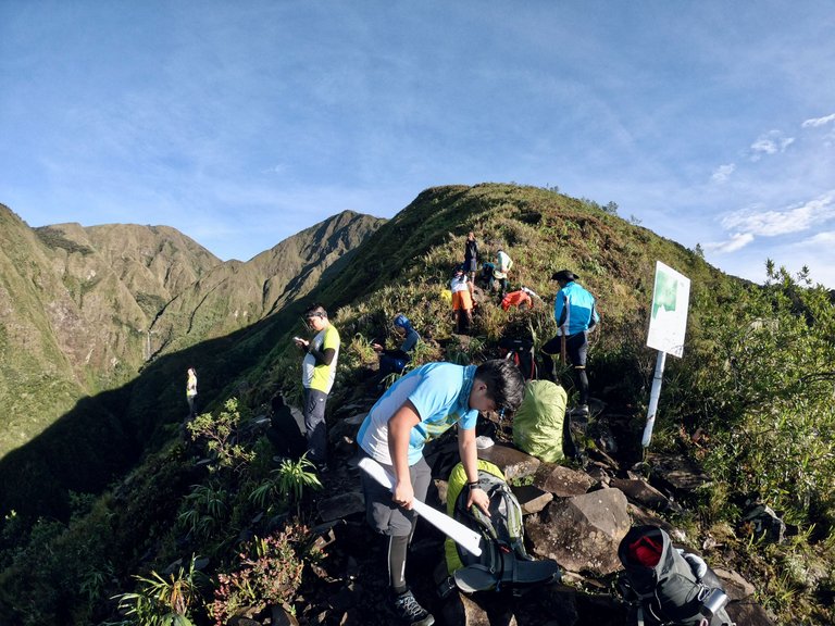
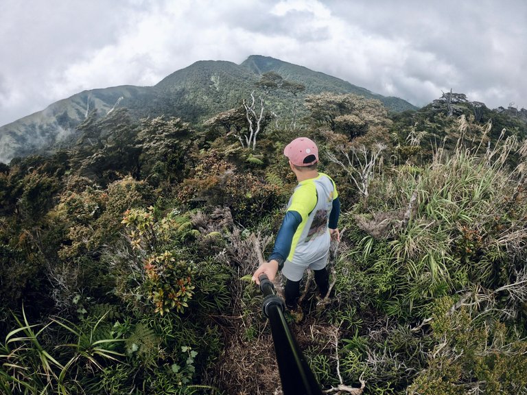
Kikikoka Peak
After walking 1.21 kilometers from the Viewdeck, we reached Kikikoka Peak (1,907 MASL). However, since it was still dark, we decided to press on. From there, we could already see the surrounding mountains in the distance.
|
|
|
|---|---|
|
|
|
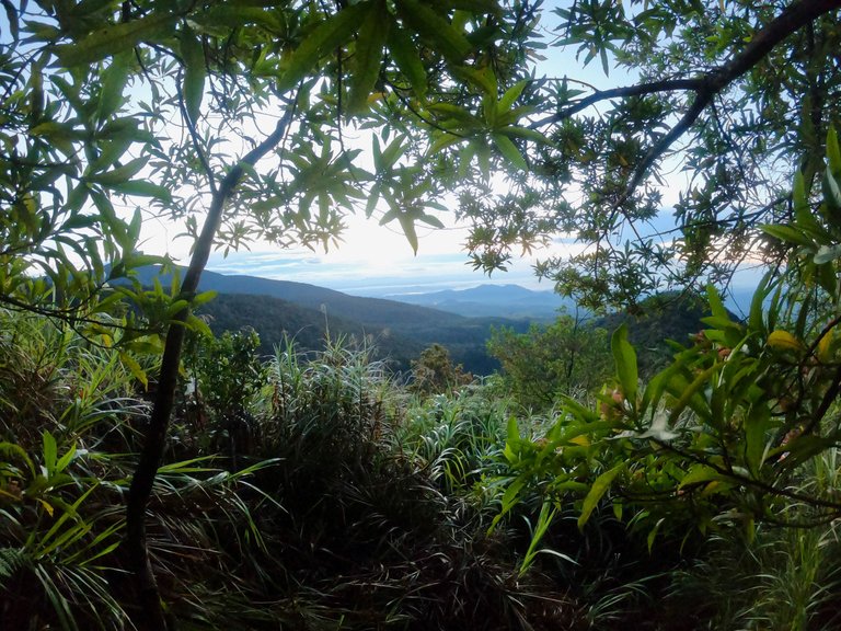
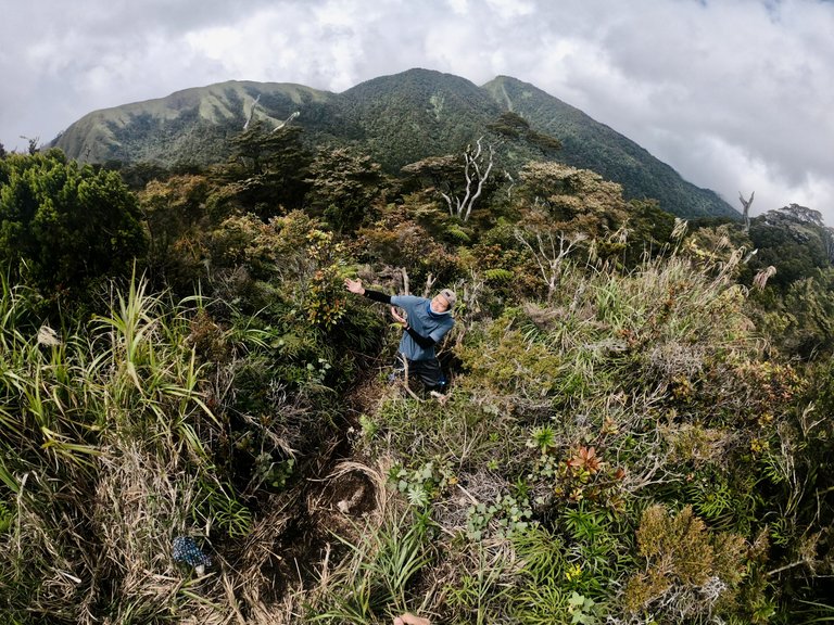
I was amazed by the stunning beauty of the mountains, which was intensified by the colors of the sunrise.
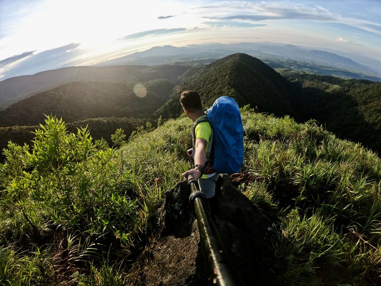
It left us in awe and made us pause for a moment to appreciate its magnificence.
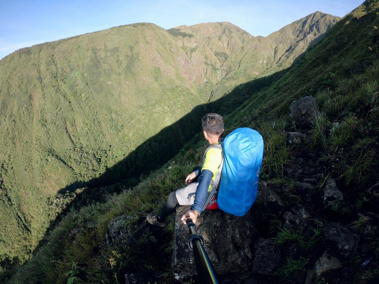
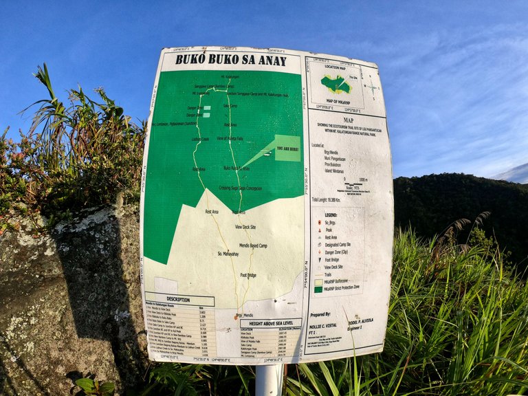
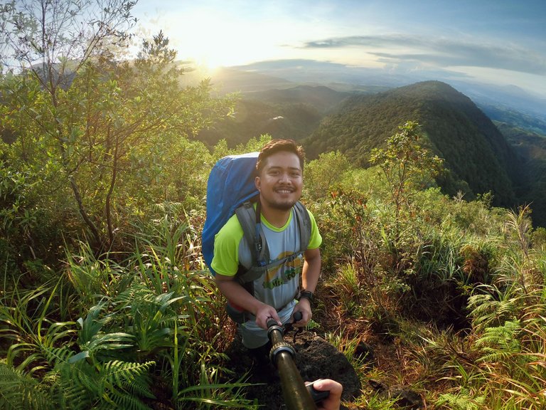
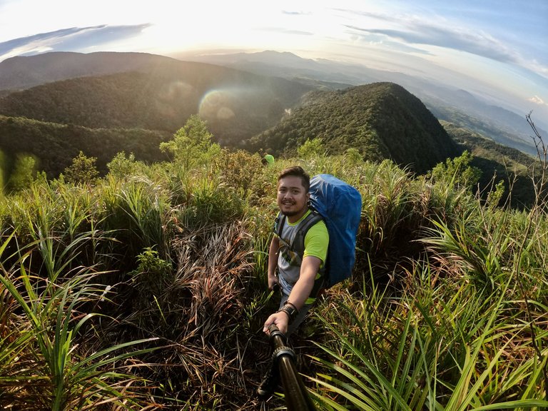
Buko-buko sa Anay
In less than 1 kilometer from Kikikoka Peak, we reached the entrance of Buko-buko sa Anay (2,003 MASL).
We hiked for a few hundred meters until we reached the viewdeck overlooking Muleta Falls (2,184 MASL).

Photo credits to Shiela Mae Genita Piscos
Mt. Kalatungan (Buko-buko sa Anay)
After taking group pictures with the falls, we continued our hike.
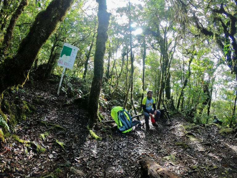
The grueling ascent continued and 2.13 kilometers from Buko-buko sa Anay, we reached Sako Camp (2,497 MASL).
Although we were supposed to rest there, we decided to proceed straight to the Junction Area that leads to Kalatungan Summit.
Junction Sanggaya Camp-Kalatungan Summit
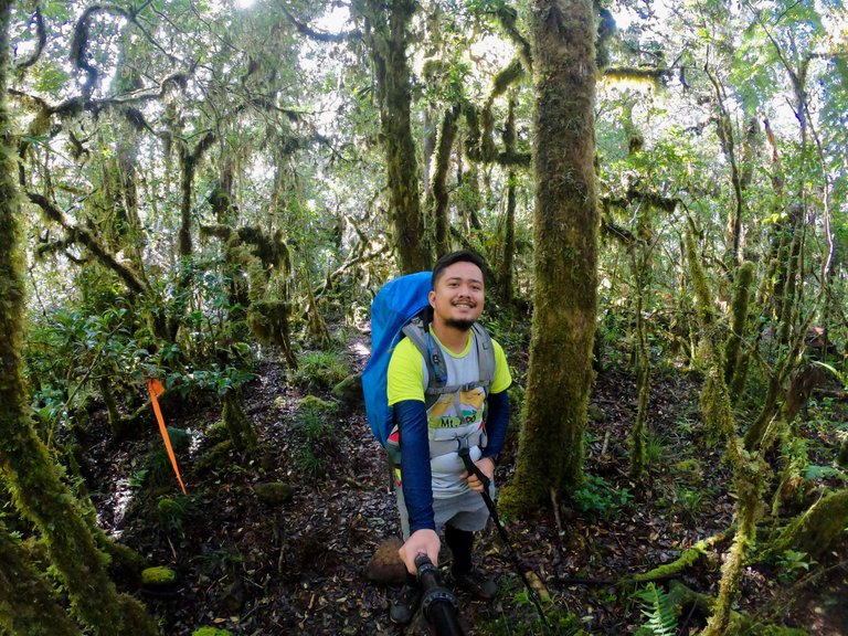
After leaving Sako Camp, we soon reached the Junction, which was located less than a kilometer away. One of our guides was waiting for us there, and we left our bags behind to continue our trek to the summit. Along the way, we passed through a long stretch of mossy trees, which added to the mystical atmosphere of the place.
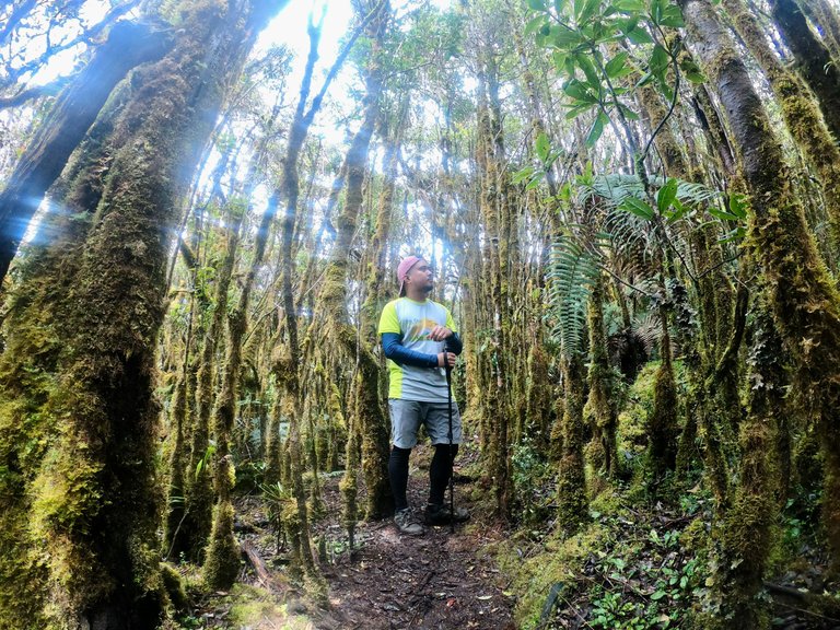
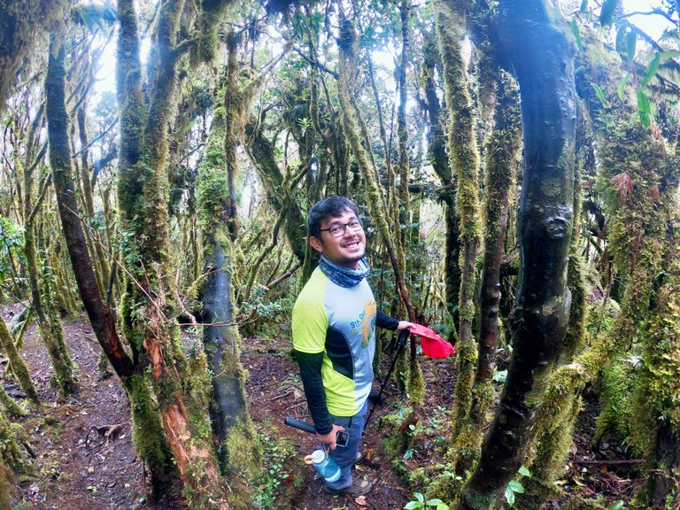
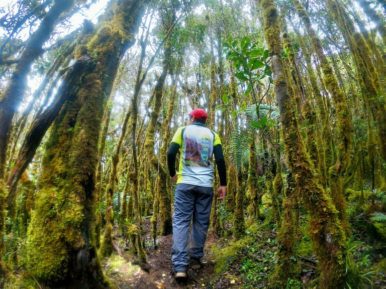
We paused for a minute to take some pictures with the enchanting forest.
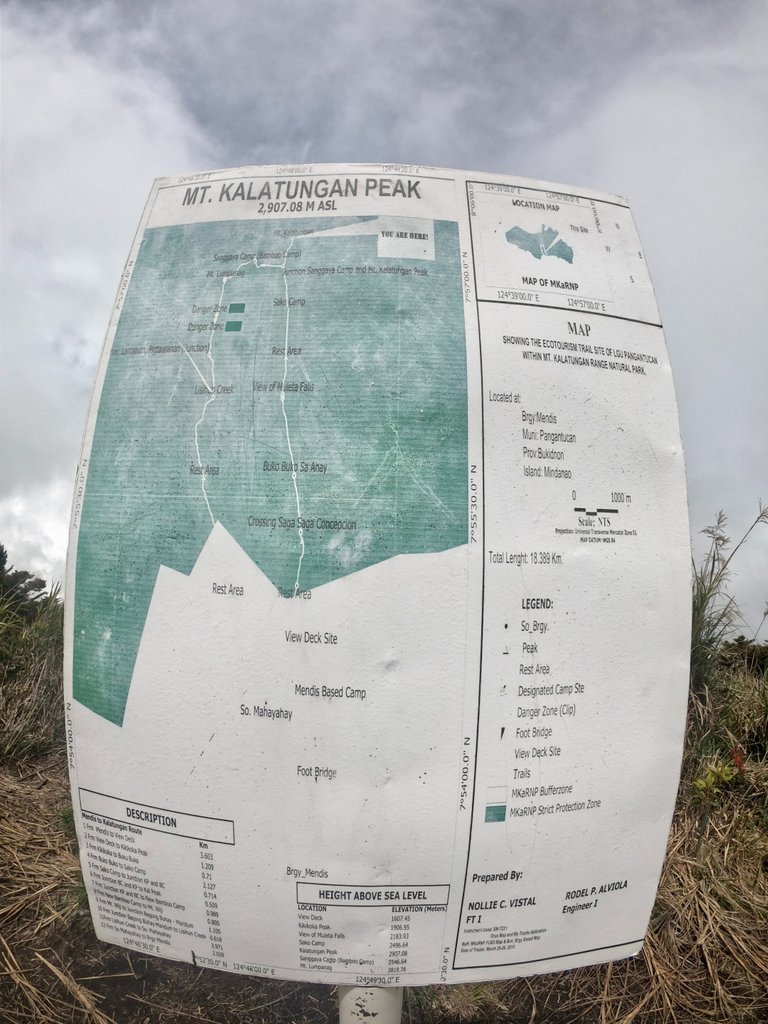
Kalatungan Peak
Mt. Kalatungan is the fifth highest mountain in the Philippines, with an elevation of 2,880 MASL.
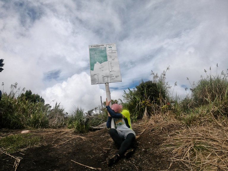
After trekking 500 meters from the Junction, our group finally reached the peak. We took turns snapping photos with the summit sign.

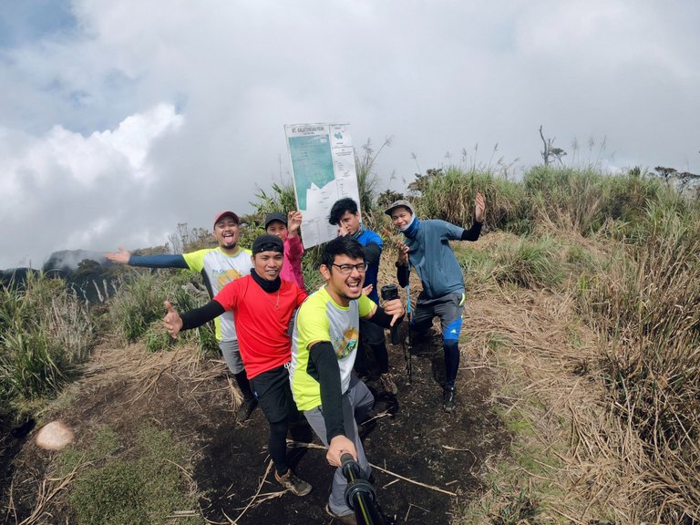
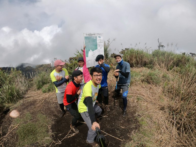
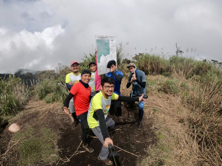
And I even hugged the pole in disbelief that I had made it to the top. LOL
Once we finished taking pictures, we headed back to the Junction Area. However, our journey wasn't over yet as we still had to descend several hundred meters to reach Sanggaya/Bamboo Camp. But that's a story for another time.
The rewards earned on this comment will go directly to the people( @sudeon ) sharing the post on Twitter as long as they are registered with @poshtoken. Sign up at https://hiveposh.com.
HAHAHAH congrats on the climb! It was quite a trip due to the weather but I'm glad you saw the sunrise, iba pa rin ang itsura ng araw pagnasa bundok ka mismo, no?
yes! iba talaga pag nasa taas ka hehehe
Wow it's seems like you have much fun over there and made a lot of memories.
yes we did :-)
Nature has its own way of saying not to go to Mt. Apo that time but it gives you another option. You still enjoyed the Wonderful view given by nature.
You had a great time and it make me miss hiking too. I used to go with the young people hiking before.
yes, maybe its not my time yet to conquer mt. apo
Don't worry I know there are still a lot of time to be there, there were still opportunity coming soon.
Awesome adventure jud ni! My last major climb until this date. hahaha! Dapat imoha nawng sa peak ang cover photo ani ser arc!
hahaha wala man koy nawng bi
Great, I enjoyed all watching your photography it's really looks wonderful the mountains view looks awesome,yes having adventures in our lives gives the best experiences and improve self competency
absolutely! 😆😃
That was a great adventure. The mountains have lush greenery and looks so lively. I wonder have you seen any animal or snakes there?
we spotted an eagle flying above us but no snakes though 😄
A worth to remember travel! One of a kind. The views and photos are exquisite. Kanindot!😍
Salamat 😁🙏
Daily Travel Digest #1847.
Become part of our travel community:
- Join our Discord
- Learn more about our travel application
Hiya, @ybanezkim26 here, just swinging by to let you know that this post made it into our Honorable Mentions in Your post has been manually curated by the @pinmapple team. If you like what we're doing, please drop by to check out all the rest of today's great posts and consider supporting other authors like yourself and us so we can keep the project going!Thank you, @ybanezkim26 @pinmapple 💪
You're welcome! 🤗
@kev.incredible Sir you have made an adventure sir I am glad to see that we both have same profession I am also Data analyst python developer I love much more and my supports for you sir .
thank you for the support @ahmadfaraz1
This was one of my favorite major climbs. It was tiring but so much fun. Soo glad we got to see the Muleta Falls that a lot of hikers weren't able to. 💛
Mao! It's definitely at the top of my favorite list too.
It must have been a great delight to finally arrive at the top after a long hike haha. Amazing scenes 😊
Thank you ☺️☺️☺️
such an amazing travel!
Thank you 🙏 ☺️
Congratulations, your post has been added to Pinmapple! 🎉🥳🍍
Did you know you have your own profile map?
And every post has their own map too!
Want to have your post on the map too?
We provide many services on top of hive, supportive to both hive and actifit vision. We've also partnered with many great projects and communities on hive.
We're looking for your vote to support actifit's growth and services on hive blockchain.
Click one of below links to view/vote on the proposal:
Congratulations @kev.incredible! You have completed the following achievement on the Hive blockchain And have been rewarded with New badge(s)
Your next target is to reach 8000 upvotes.
You can view your badges on your board and compare yourself to others in the Ranking
If you no longer want to receive notifications, reply to this comment with the word
STOPCheck out our last posts:
Support the HiveBuzz project. Vote for our proposal!
A hike that i would like to go.
Next time invite me. Haha
Great pics.
haha thank you 😄
Congratulations on this post, I too am a big lover of nature walks, nature helps us forget about all the everyday stress.
Thank you also for taking the time to read and comment 🙂