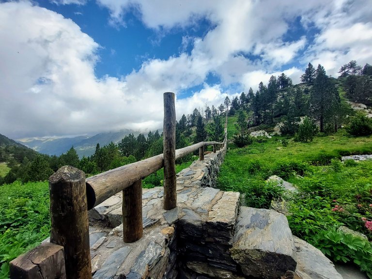
Day two of our Pyrenees hike in Andorra started out with a bang. My nausea had completely vanished overnight and we had great weather in the morning to start our day.
We finished our breakfast at Refuge Borda de Sorteny and were ready to go by 9am.
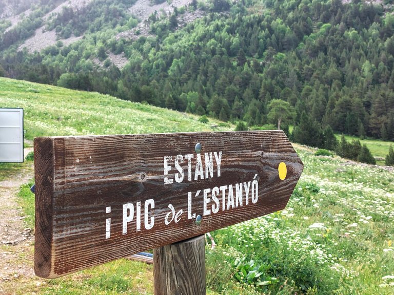
A sign right outside the mountain hostel pointed us in the right direction - to the Peak of Mount Estanyó.
The refuge is located at 1965 meters above sea level and we would be hiking almost another 1000 meters up the mountain, to and elevation of 2915m.
In other words, "it's all up hill from here."
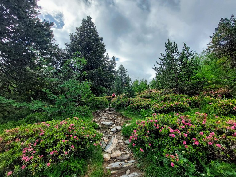
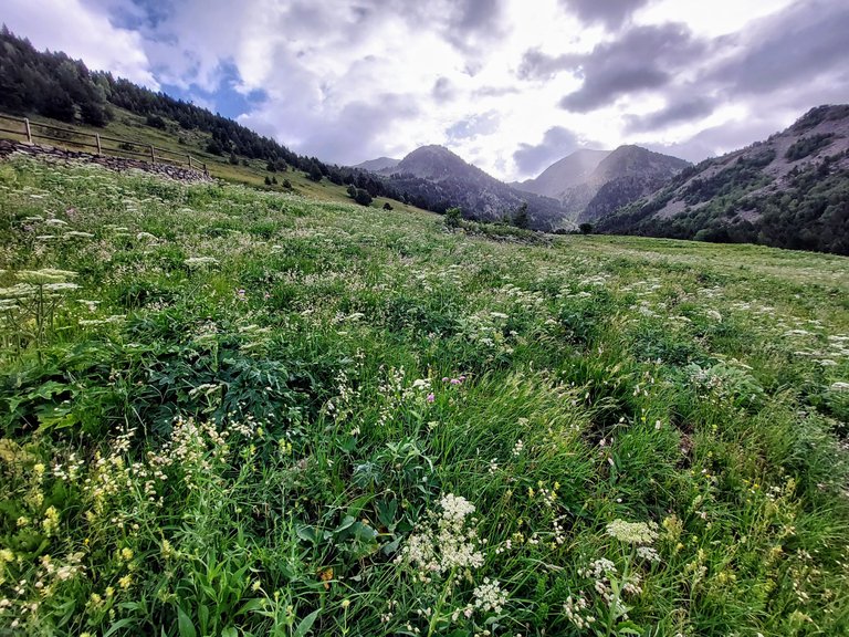
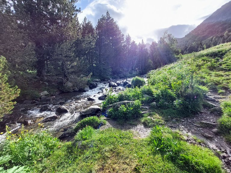
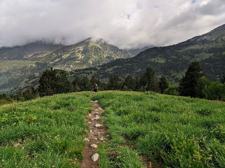
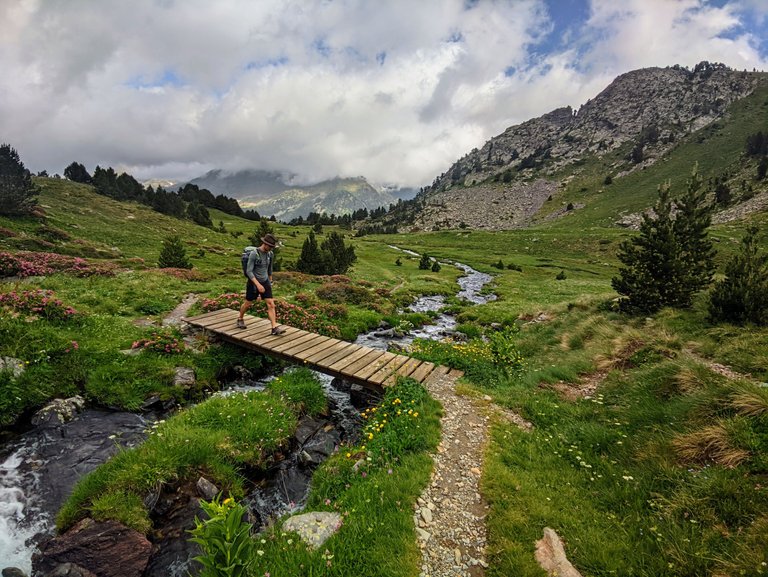
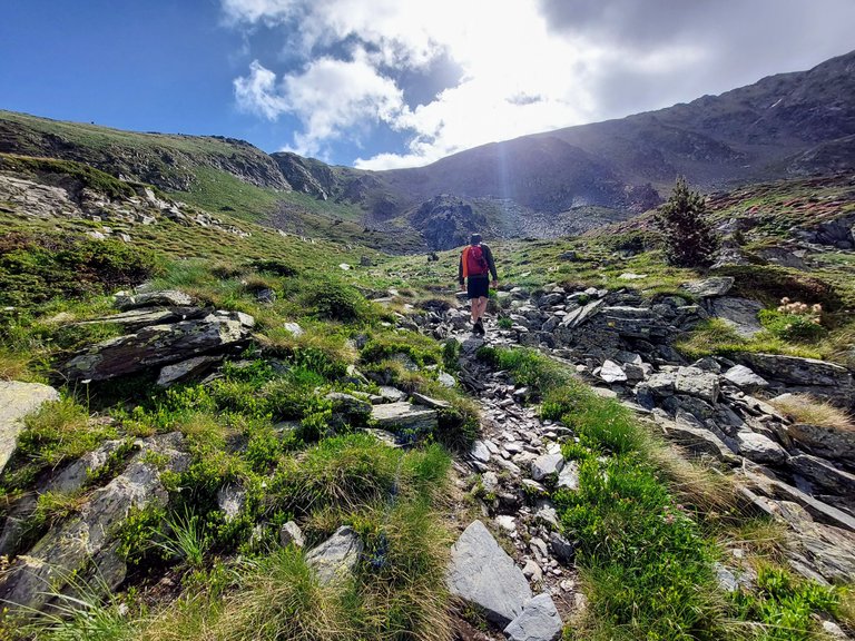
Through trees and creeks and over fences we travelled.
A major plus of staying high on the mountain is that it helps your body acclimate to the higher altitudes. I noticed that fairly early on that day.
After getting through the initial pre-exercise inertia and into a walking rhythm, I noticed that the climb had much less of an impact on me compared to the day before.
There were of course many moments of feeling exhausted that day,
but given the straight uphill climb of that initial peak hike, I was expecting to be much more tired than I actually was.
I attribute that to being a little more acclimated on day two.
I still wasn't as fast as my friend, but at least I was able to stay within sight of him at all times.
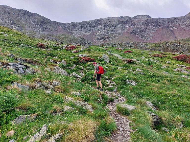
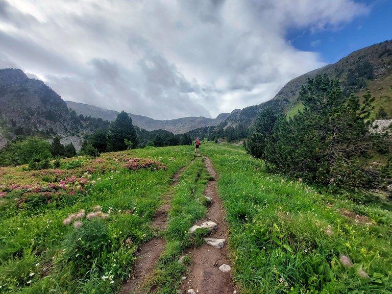
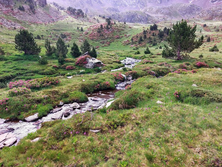
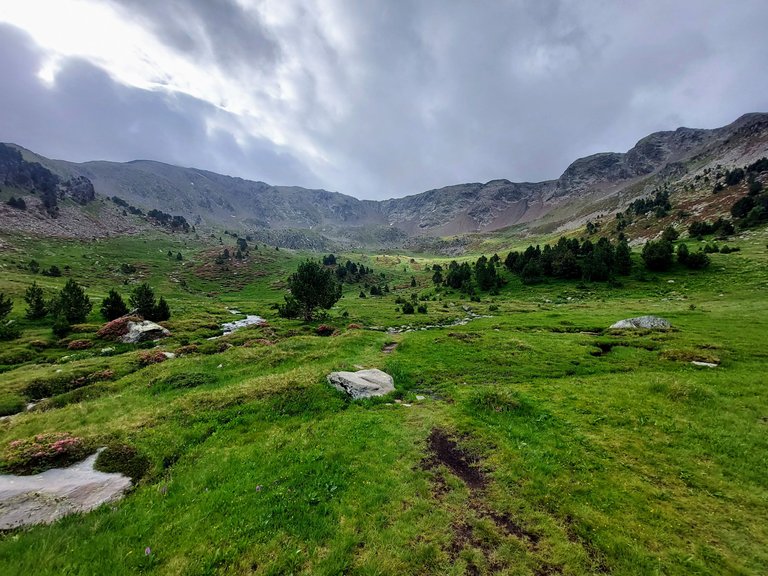
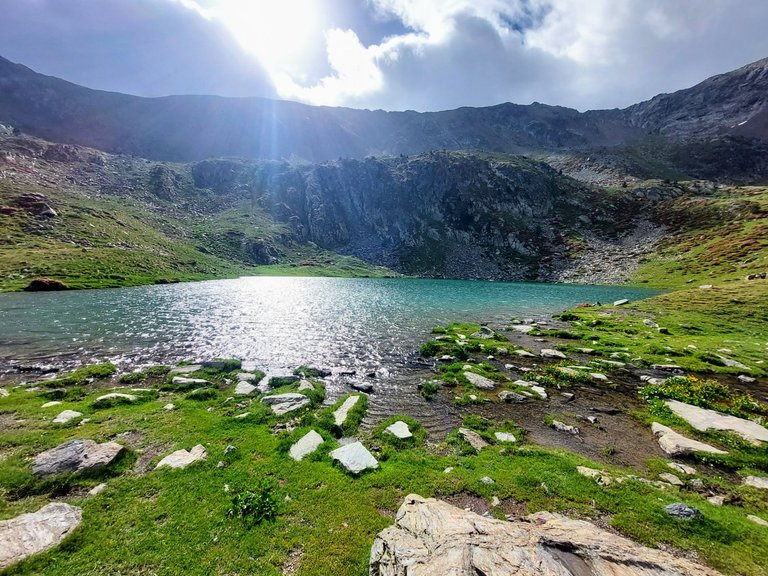
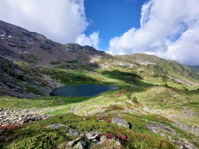
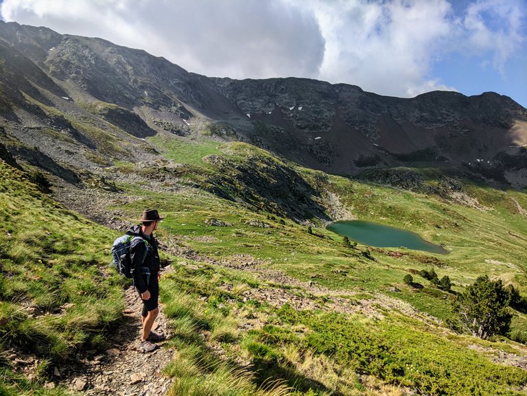
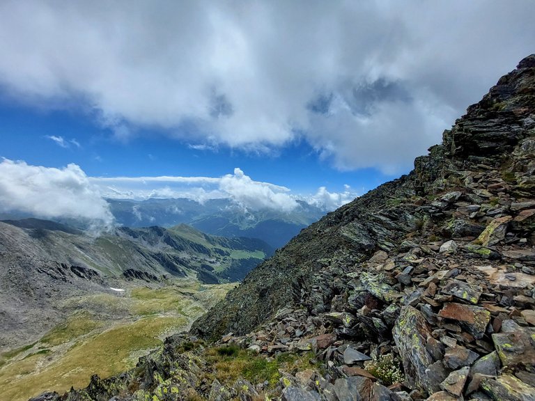
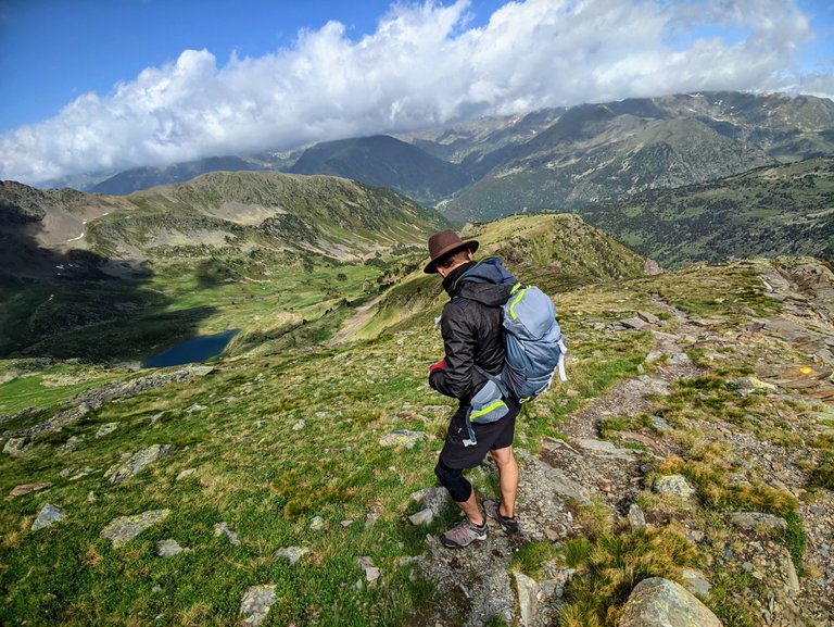
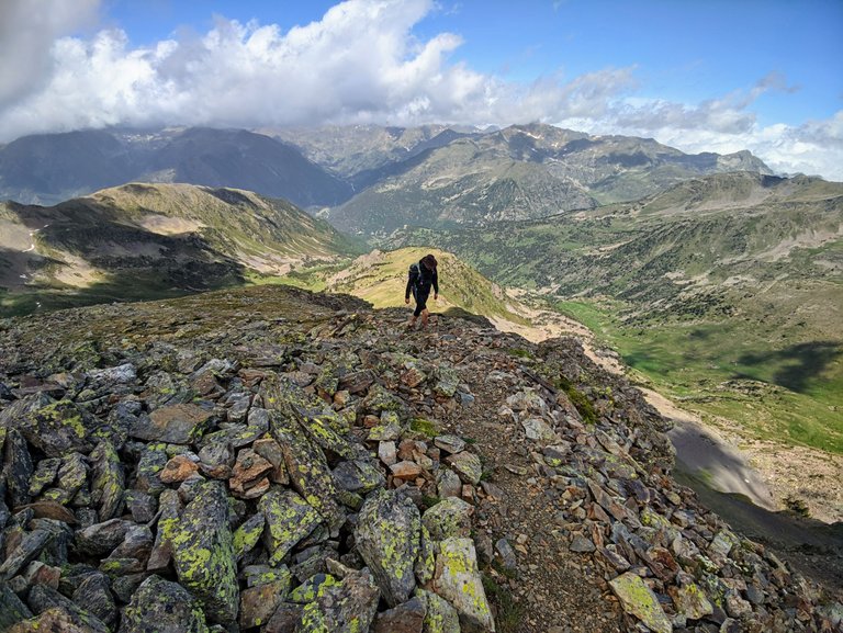
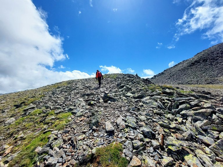
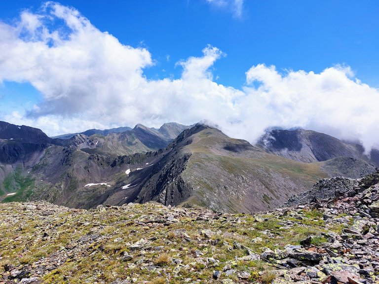
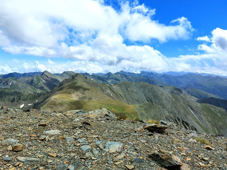
Our first landmark for the day was lake Estanyo, a small body of water set within a bowl-like valley way up on the mountain.
It was just over that last little hill in the photo above.
Looking back in the other direction you can see that this was a particularly beautiful location.
One last push and we were there.
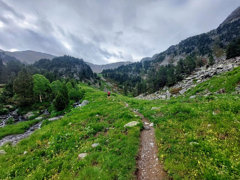
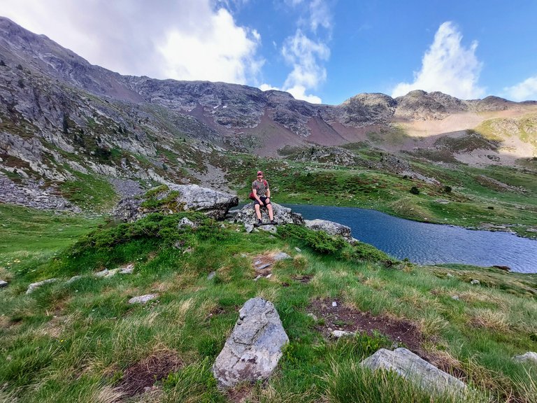
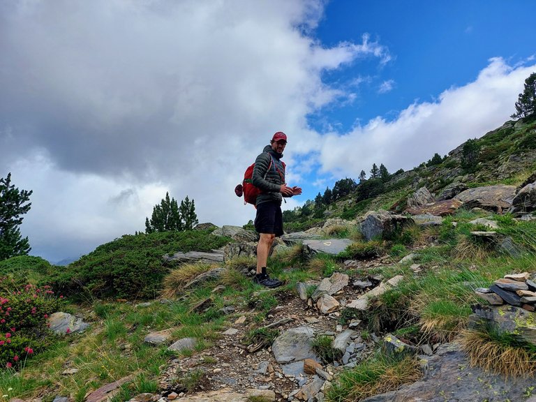
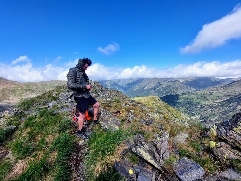
We kept going a little further before stopping for our first short break of the day.
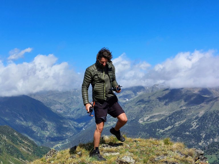
Time to pause for some photos.
Notice the sweat marks on my back and my horrendous posture once again. I'm hoping that is just an anomaly from the camera angle. Yeesh, I look like a cave man.
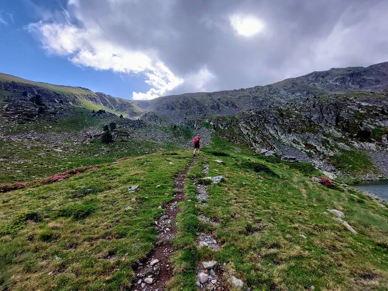
Okay, continuing on.
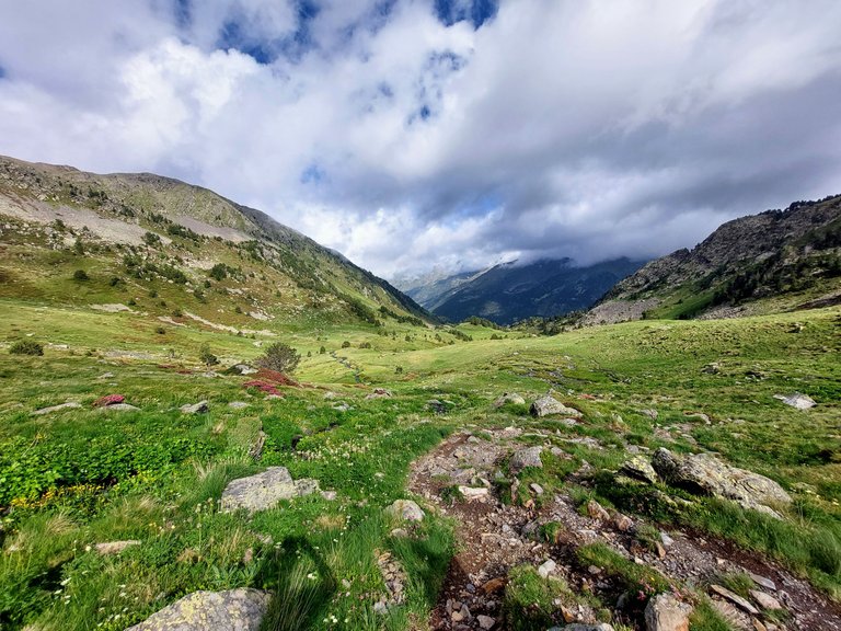
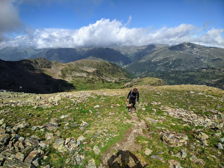
Looks like we were following the yellow dot trail again that day.
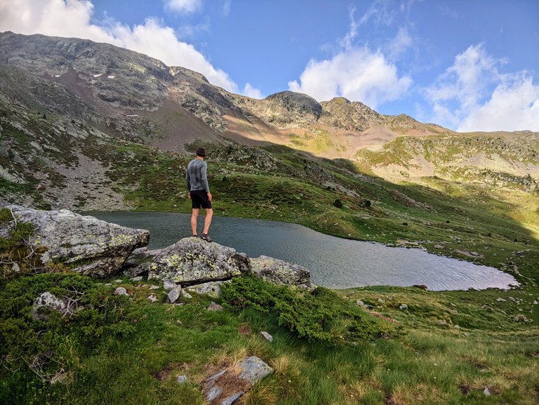
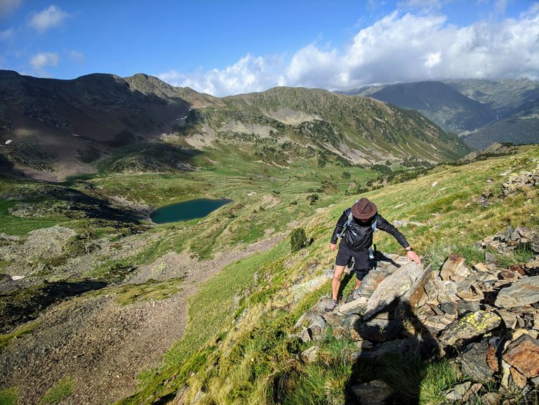
A brief stop to look back at the lake from above.
Ooooo so pretty.
I look at that photo (above) and think, "It would have been better if the clouds hadn't cast a shadow on the water."
There's no pleasing me, is there?
Okay, quiet people, he's explaining something.
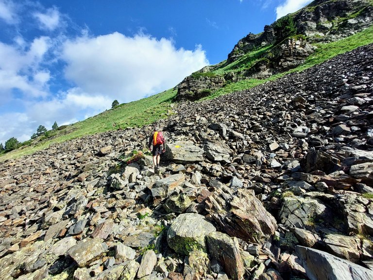
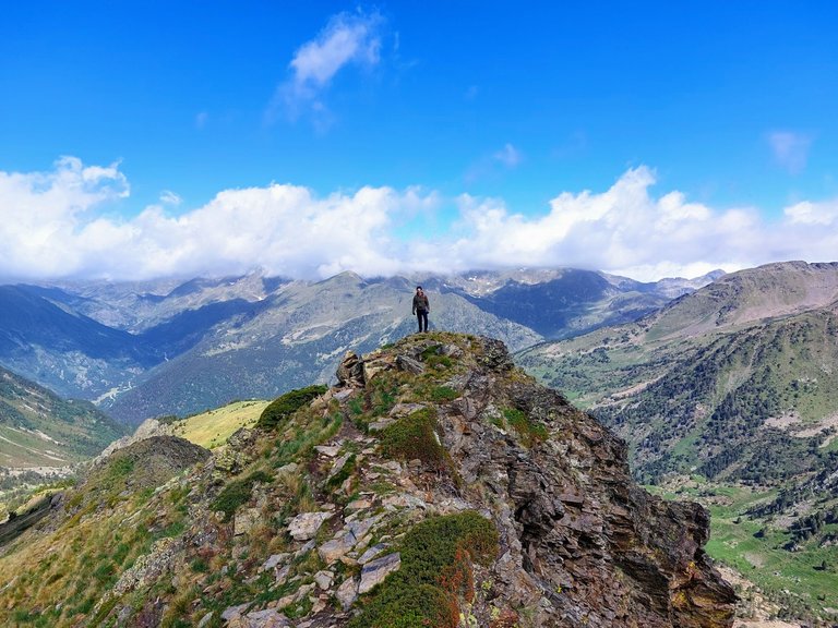
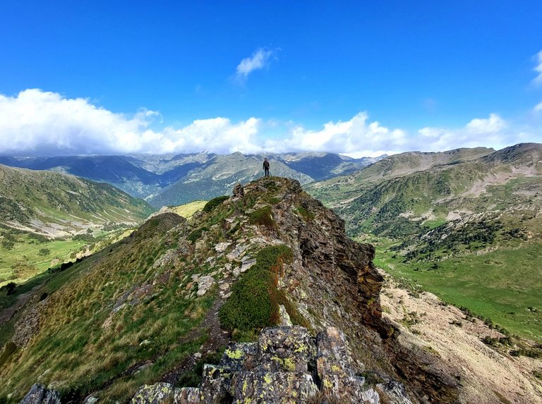
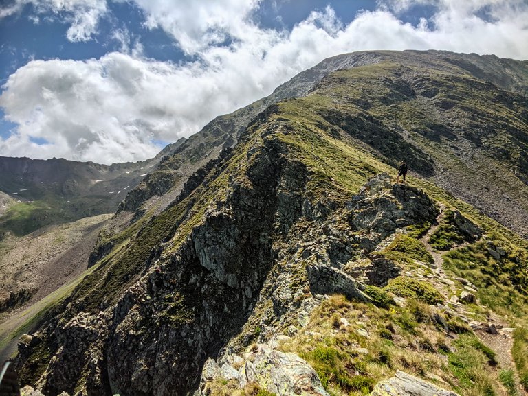
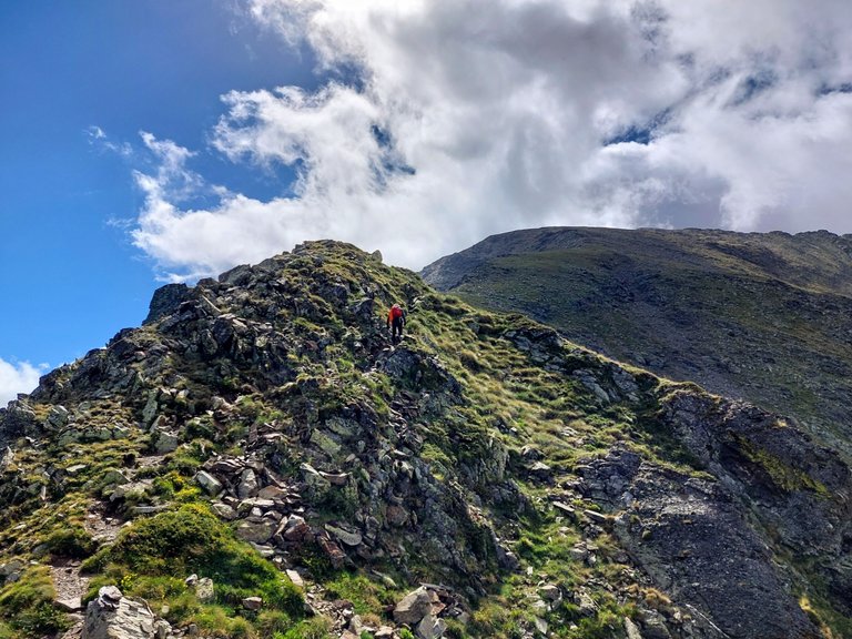
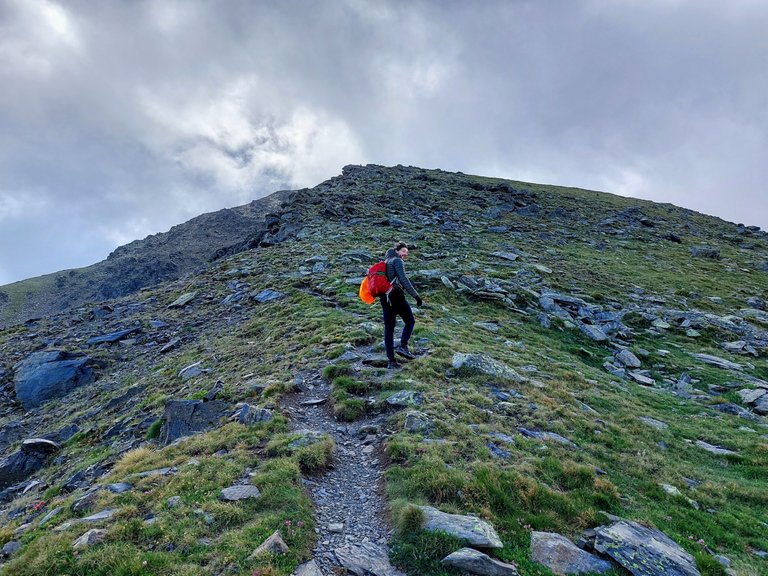
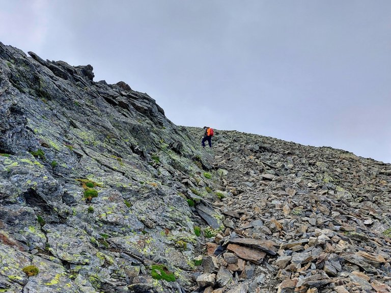
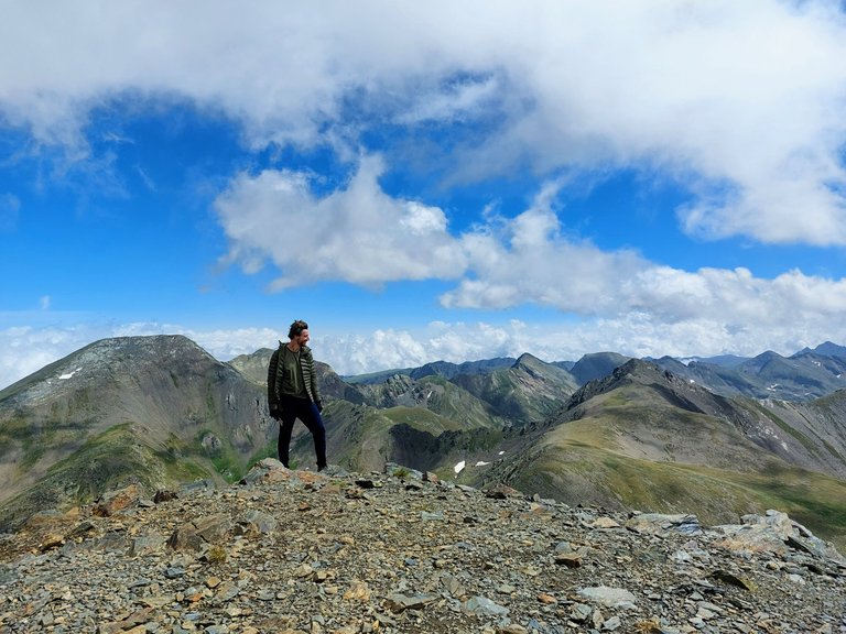
We are working our way up to a ridge now.
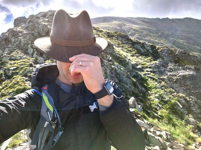
Annnnnd, "We made it!"
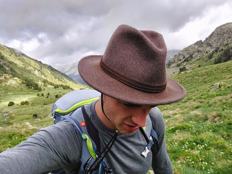
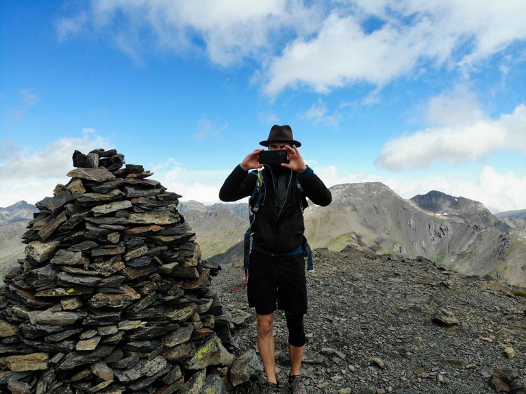
Me: "It's windy as fuck up here. I better hold onto my hat and take a selfie."
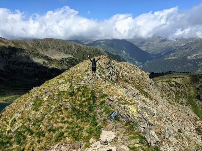
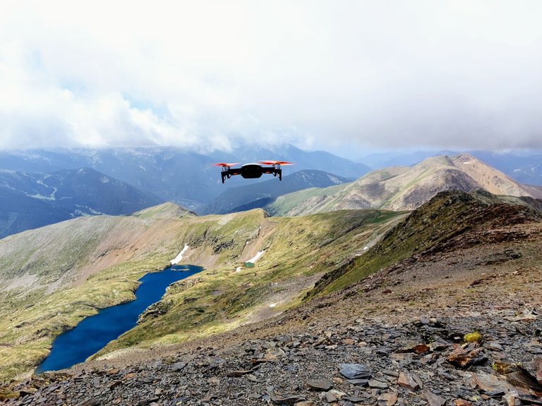
Okay while my friend pulls out his drone (that's right we have drone images!)
I'll just sit and take another selfie let me just block my face again
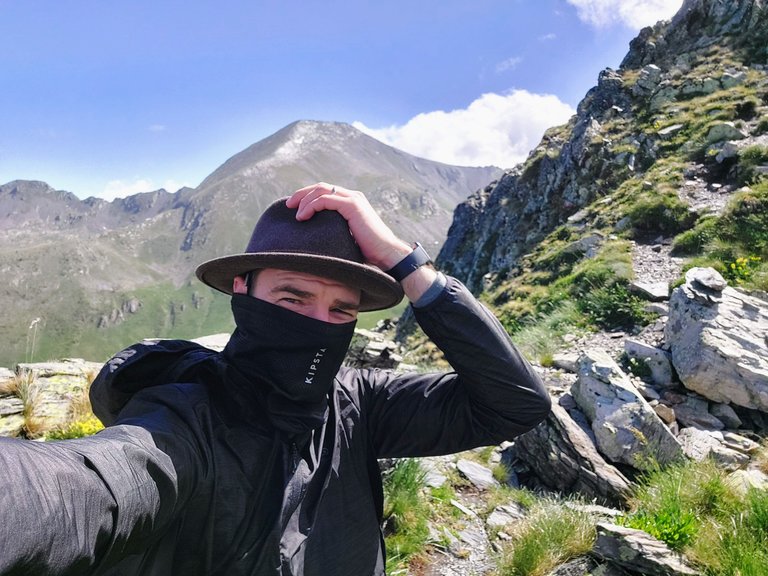
It was super windy in that location and much much colder than below the ridgeline. I was surprised that the drone could fly in wind like that but my friend said that it was fine.
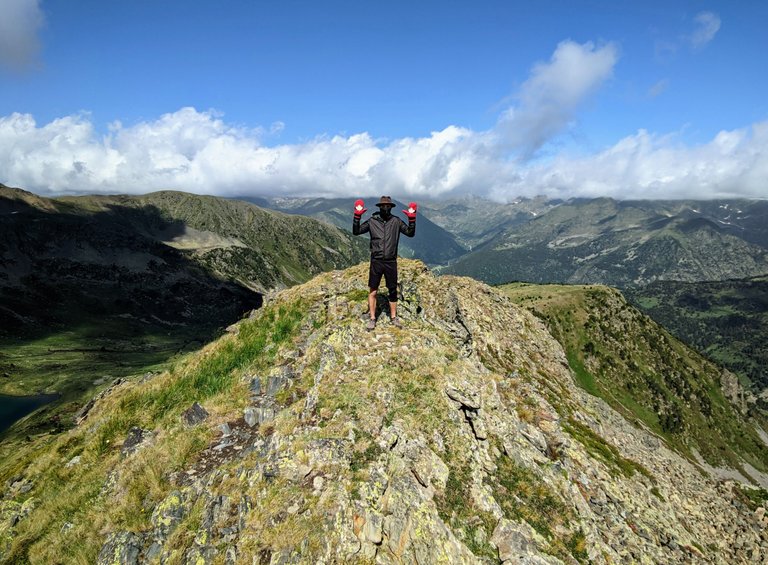
Time to put on my quintessential Canadian wool mittens. They are great for the warmth that they provide,
and for taking triumphant photos on mountain ridges.
Drone image above Obviously.
Catches the thing right out of the air.
Okay we're done here.
Me: "Wait. Stay here while I climb the ridge a bit to take a photo of you standing on that small peak."
Points upwards. "Afterwards, you can take a photo of me from where you're standing. Deal?"
These are the conversations that you have on mountains when you have a Hive blog or a social media page.
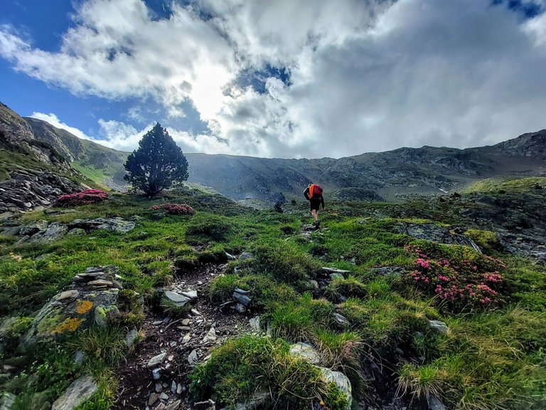
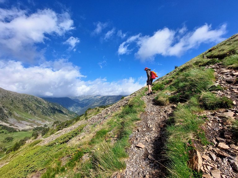
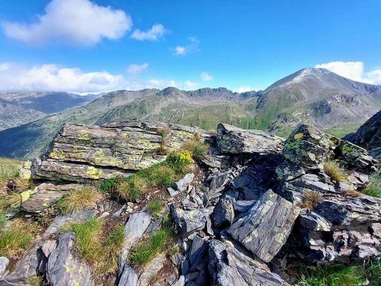
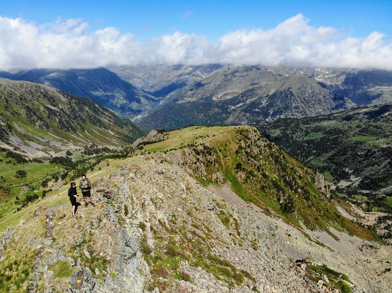
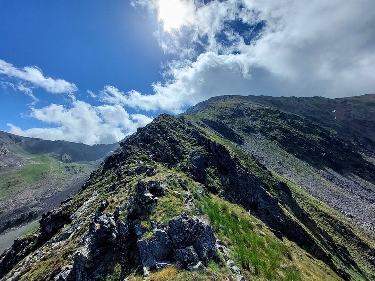
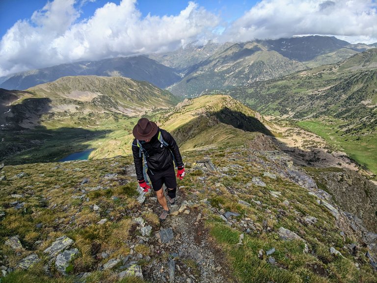
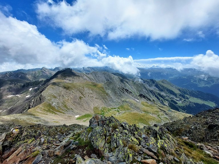
We are actually still a long ways away from the summit at this point.
There's still grass and moss and lichen on the ground.

Hell, you can still see the lake to one side at this point.
We're going up, up, up,
Going up, up, up,
Going up, up, up,
I'm on fye-yar... I'm just realizing that those aren't the actual lyrics to the the song "Light em up" by Fall out Boy.
I like my version better though.
I actually sing crap like that in my head when I'm hiking. Or I say mantras similar to Dory in the movie Finding Nemo, "Just keep climbing, just keep climbing."
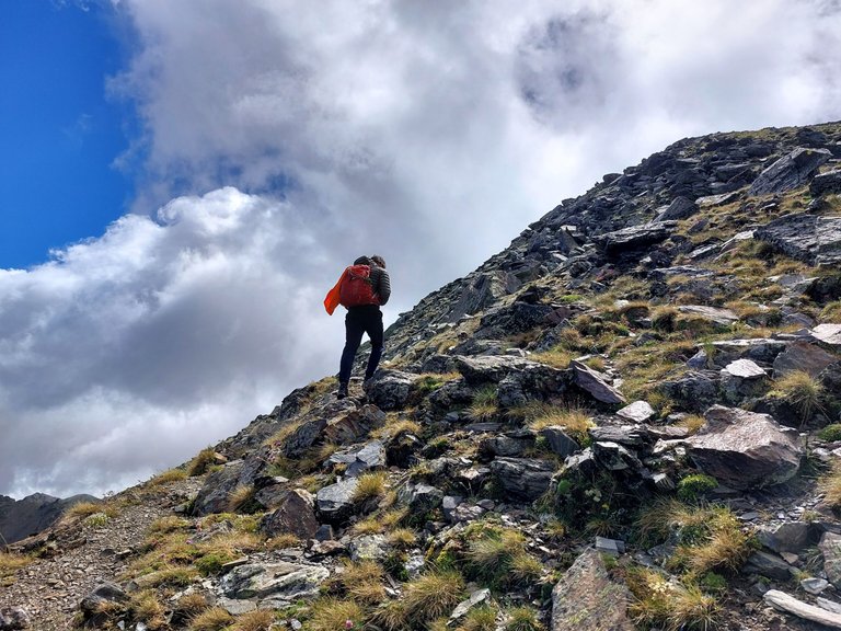
Well, the grass is almost gone so I think we are getting close now.
Just around that bend,
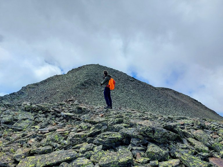
and up that last rocky hill.
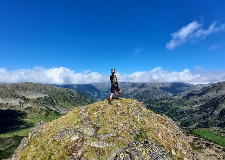
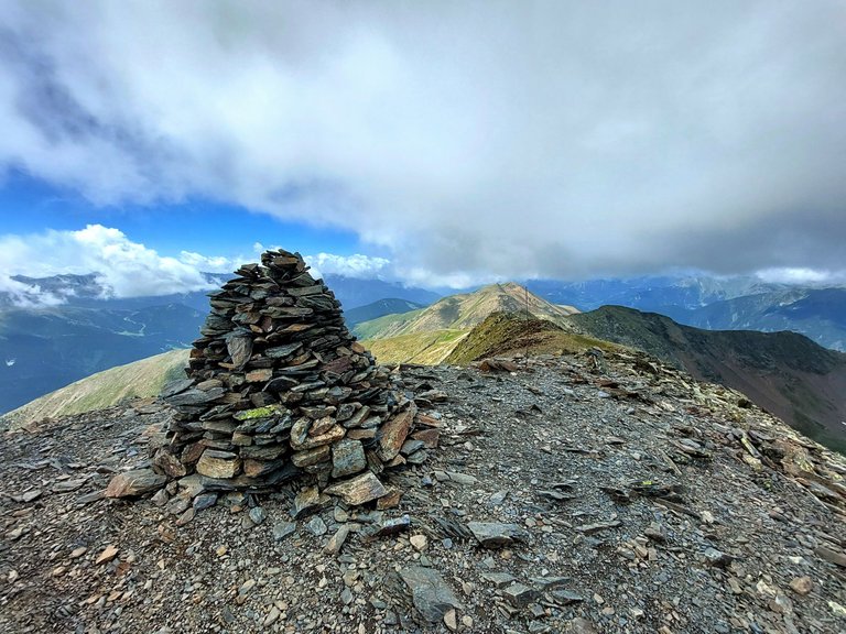
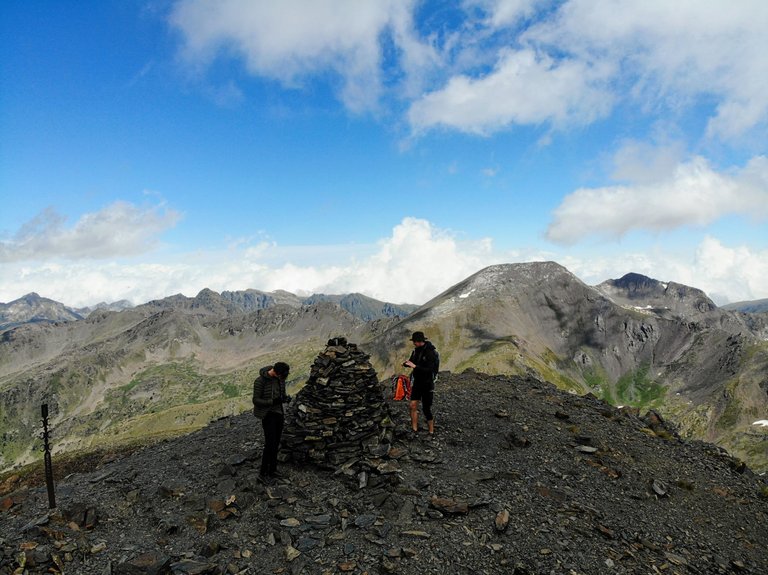
And just like that we reached the summit.
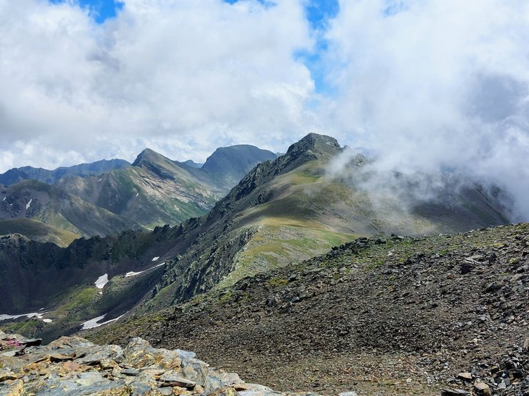
At an elevation of 2915m, the summit of Mount Estanyo is the second highest peak that I've hiked to. Schilthorn was the highest at 2970m.
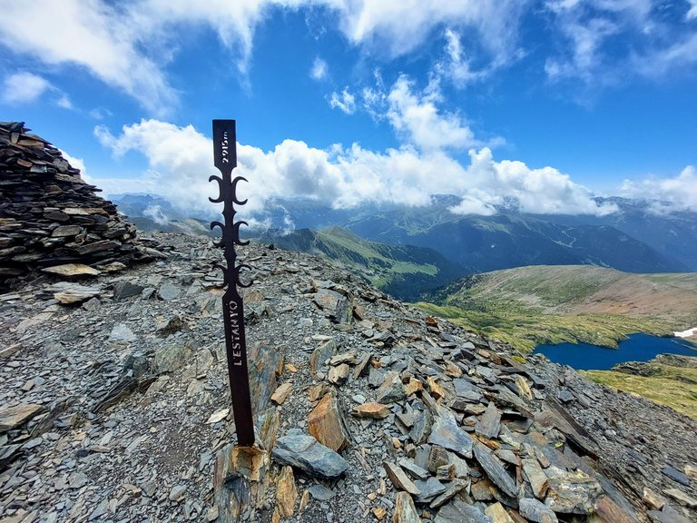
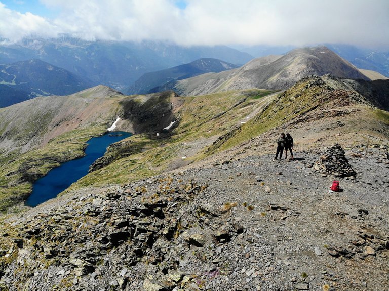
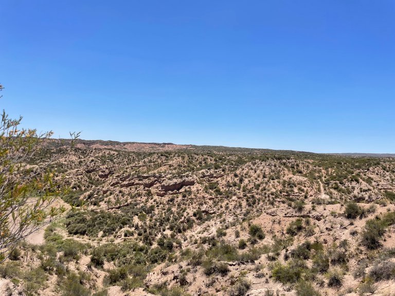
You can see another lake in some of the photos. That wasn't the same one from before and I'm not sure what that one is called.

Here is a look at the surroundings from the peak.
We stopped to take a few photos of course,
and a few more drone shots.
Here is one of me taking a photo of the drone while the drone takes a photo of me. That one wasn't even planned.
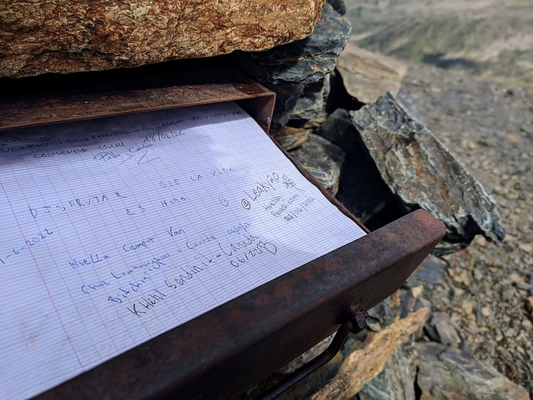
Okay, time to etch our names into the history books.
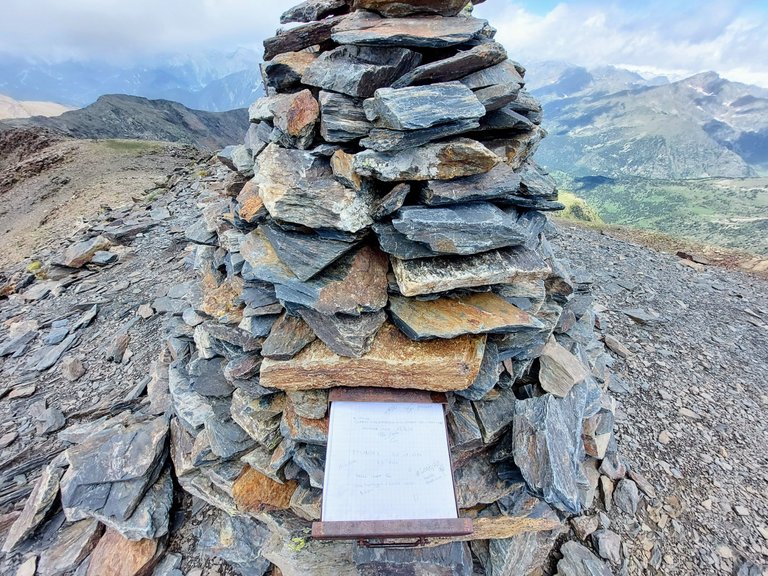
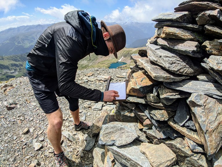
I signed it Leaky20 and plugged #HiveBlog and #PeakD. Just doing my part in marketing, trying to bring more people to the platform.
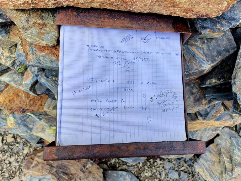
Funny enough, a fellow Canadian had hiked to the peak only a few days before us - or was it a few months? I never know what comes first in Canada, the day or the month. It always seems to change. Anyway, Chaz Lamborgini was feeling "Bitchin" that day, with four exclamation points (!!!!). "I hear you Chaz!!!!"
If I am remembering correctly, this portion of the hike took us around 3 hours to complete. We left the refuge at 9am and summited around 12pm (give or take a little). This was only the start of our day though. We still had approximately 8 hours of hiking left to do in order to make it over to our next refuge. But that will be a story for another day.
The rewards earned on this comment will go directly to the people( @aplusd ) sharing the post on Twitter as long as they are registered with @poshtoken. Sign up at https://hiveposh.com.
That's quite the achievement. I never thought of taking a drone up the top of a mountain for a photo. You get some really cool shots that way!!
Yeah we got some good photos and videos but I'm surprised he carried it up. It added quite a bit of weight and took up space. I wouldn't have done it myself but I'm glad he did lol 😆
Yeah, it would have made it that bit more strenuous but well worth it!
Really? Lucky you! My vertigo would probably make me fall or wanna fall.
Well, you must be fitter than you thought!
Aww 😎
The photos are stunning. You make me wanna experience this:)))
Yeah, staying on thr mountain wouldn't help with vertigo unfortunately.
Thanks! I'm glad you liked them 😁
Dang dude that was quite the hike. I so envy you two-legged people.
Yeah it was quite the hike that day. We had a lot more to go afterwards too.
Wow!! What a wonderful place!! You have to see my hiking in the province where I live, lol, it’s exactly the opposite.
I love the green mountains and the river!! I can imagine that’s a place full of different sounds, like water, birds, the wind. What a beautiful experience!!
I'm trying to think of the opposite of this 🤔... flat...and...sandy? 😂
It was a ngreat experience. Thanks for stopping by
Lol, extremely dry 😂
Okay I see. That could be a nice hike still though. Just bring lots of water to drink lol
Wow this post is amazing with so many beautiful pictures and your narration.
I laughed and sweated with you too hahaha. I even felt a little vertigo when you were on a rocky peak and the drone did its job.
I'm glad you liked it. The Peak was pretty big so there was no way of falling off or anything like that.
Wow! First, congrats on making it to the top. That is a great accomplishment. Second, wow that is incredible scenery. Make that climbing up, up, up more bearable. :) That is great that your altitude sickness was better the next day. oh and way to make a shout out for Hive and PeakD!!
Thanks. It was a pretty challenging day. This was just the start of it.
Just trying to do my part 😂 😁👍
I will say it and I will keep repeating it, the Pyrenees are beautiful! Both the French and the Spanish, I've travelled them on my bike but I've never done it hiking, and seeing your publication it's worth it. I loved it!
Yeah they are super beautiful. Biking them would be cool. Lots of work though. I'd have to train hard to do a trip like that.
WOW !!!, amazing place, the nature and especially the river looks relaxing.
It was a pretty incredible climb indeed. Thanks for stopping by.
Congratulations, your post has been added to Pinmapple! 🎉🥳🍍
Did you know you have your own profile map?
And every post has their own map too!
Want to have your post on the map too?
Discord Server.This post has been manually curated by @steemflow from Indiaunited community. Join us on our
Do you know that you can earn a passive income by delegating to @indiaunited. We share 100 % of the curation rewards with the delegators.
Here are some handy links for delegations: 100HP, 250HP, 500HP, 1000HP.
Read our latest announcement post to get more information.
Please contribute to the community by upvoting this comment and posts made by @indiaunited.
It was a great climb and indeed, you made it to the top! Congratulations to all of you! Great sceneries and nice angles of shots😍....but I didn't see any tall trees around. 🤔
Thanks 😁
Yeah there weren't many trees that high up. We were way above them.
Daily Travel Digest #1733.
Become part of our travel community:
- Join our Discord
- Learn more about our travel application
Hiya, @ybanezkim26 here, just swinging by to let you know that this post made it into our Top 3 in Your post has been manually curated by the @pinmapple team. If you like what we're doing, please drop by to check out all the rest of today's great posts and consider supporting other authors like yourself and us so we can keep the project going!Brings back memories of 45 years ago - even though we were not hiking. I remember the stunning scenery.
It's a very beautiful country surrounded by mountains. I'm a sucker for mountains