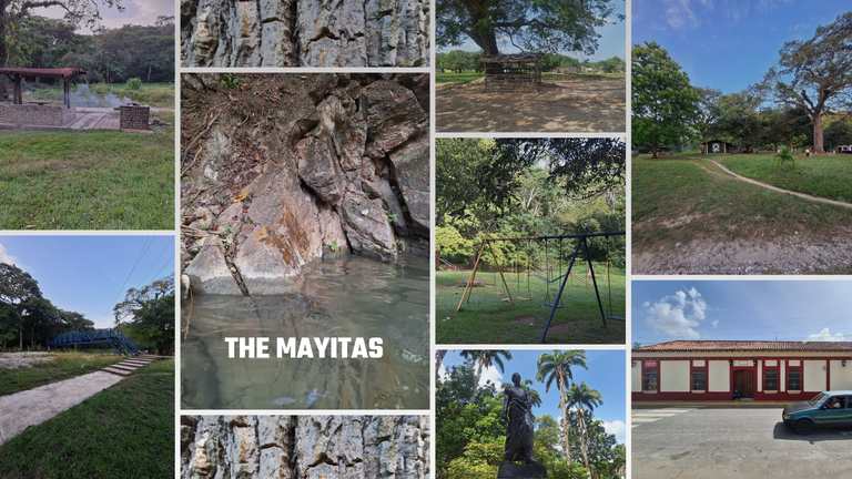
This is a trip I had planned to write about for a long time, but I kept postponing it. I traveled to Sarare to visit The Mayitas, or The Mayitas Recreational Park (it’s actually a green lung with a notable water flow). I should mention that this getaway was a family adventure. I went with my entire maternal side of the family and my brother. We left Barquisimeto at 9:00 a.m., Venezuela time.
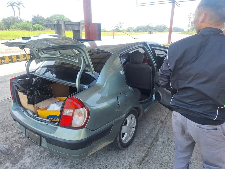
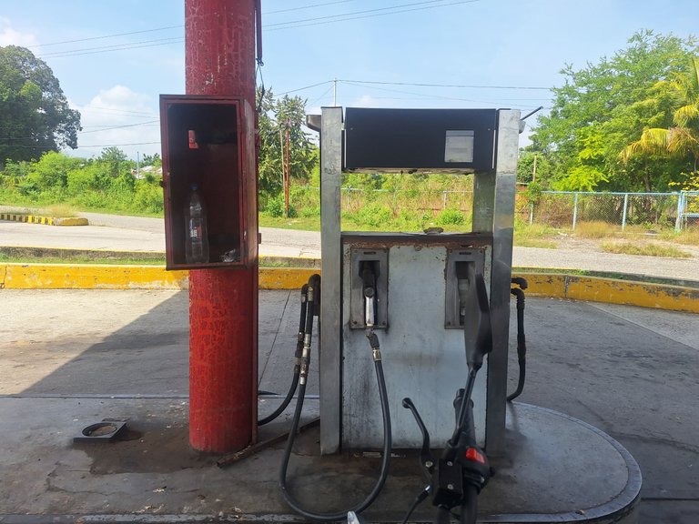
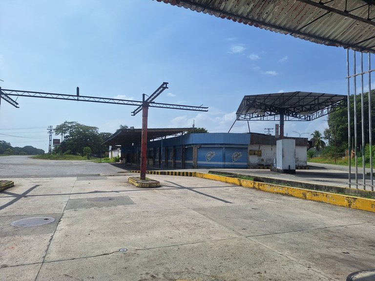
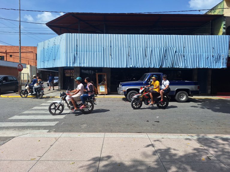
We took the road connecting Barquisimeto to Gamelotal, then reached Torrellero before crossing into the town of Sarare. We made a quick stop at a gas station, which, unfortunately, was out of service due to the current situation. Although the local businesses were operating, they were closed that day because it was not a working day.
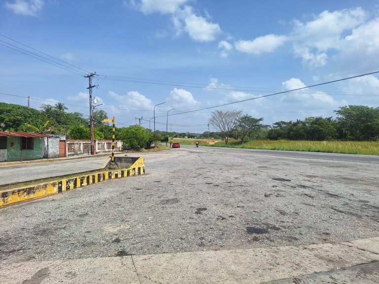
What struck me about stopping there was seeing a gas station out of service in the country with the largest proven oil reserves. Despite this, we continued on our way. We stopped to meet up with other family members who were coming in another car.
 |  |  |
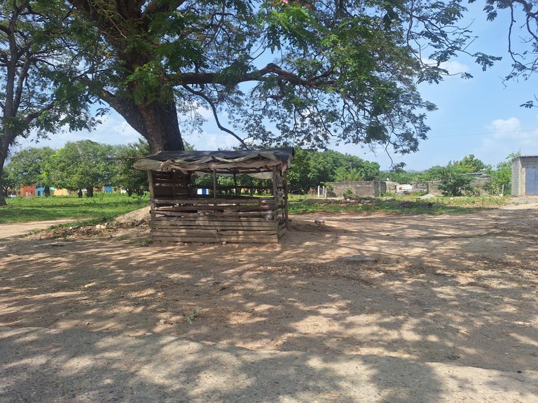
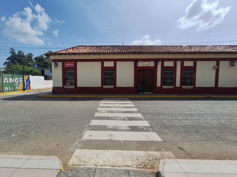
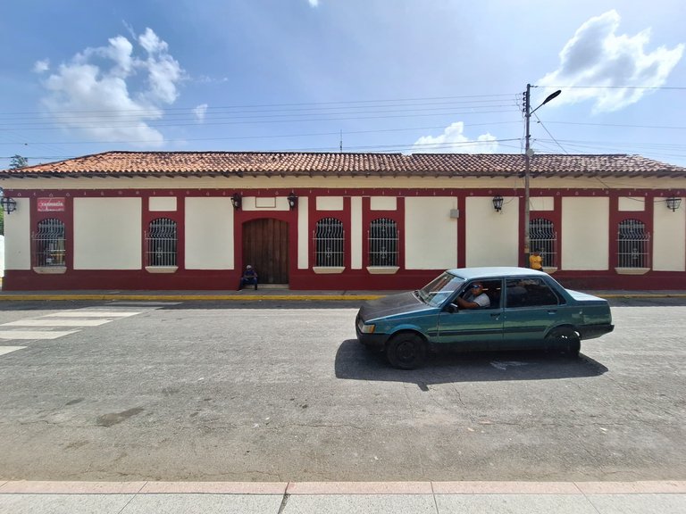
We continued along the road into the town of Sarare. I took the opportunity to take a photo of the place. What caught my attention was a wooden structure, a kind of local shop. Things like this still exist in more typical, local areas.
We then arrived in the center of Sarare, where I went into a bakery to buy a sack of charcoal that we had forgotten for the barbecue. The bakery was near the Bolivar Square. I believe I mentioned before that all towns in Venezuela have a Bolivar Square, reflecting the country’s respect for the Liberator (though not specifically the Father of the Nation).
 |  |
 |  |
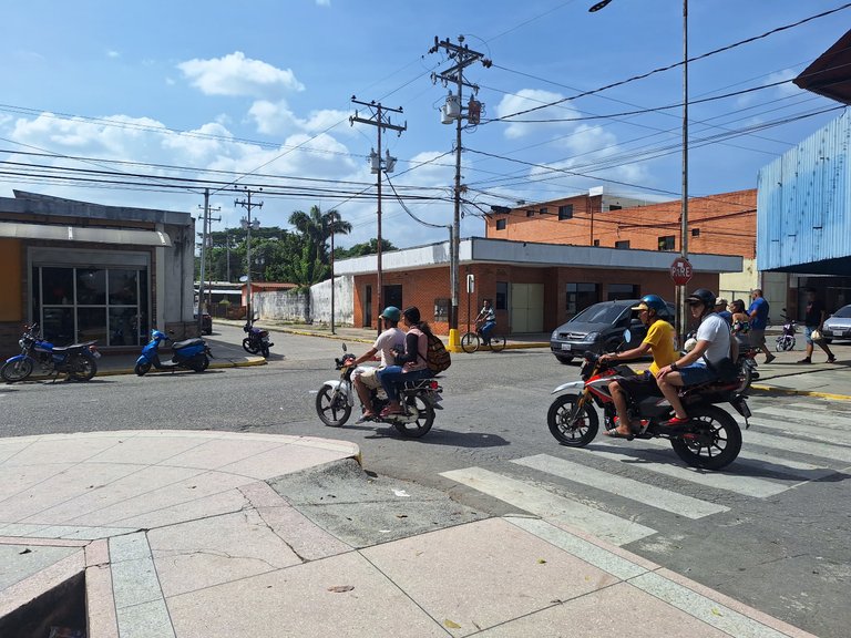 |  |
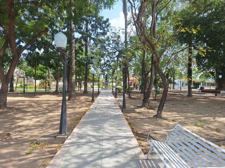
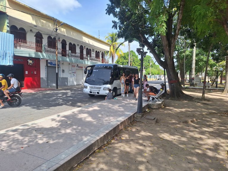
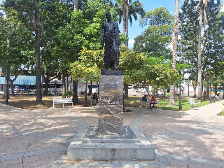
In some of the photos, you can see the bus in which part of my family came. Everyone got off to explore the surroundings and relax for a bit. The atmosphere in the town center is really striking, with many people around.
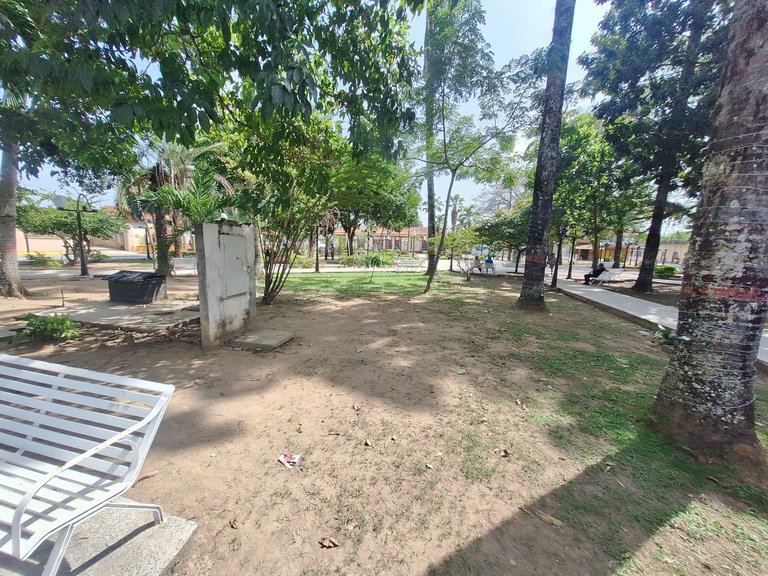
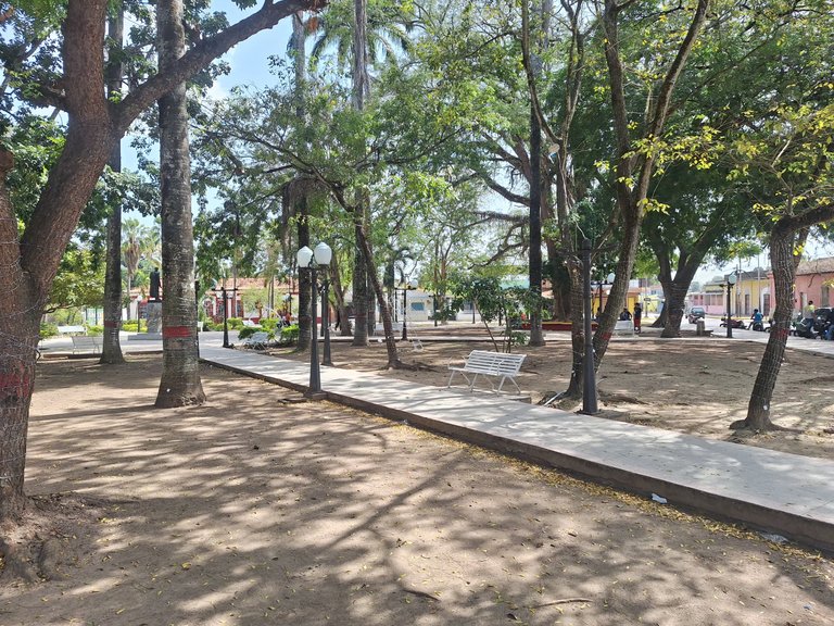
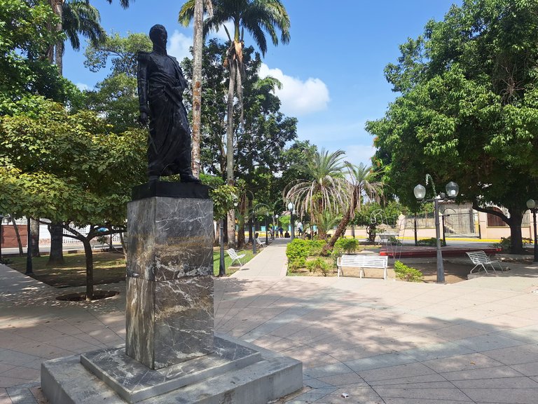
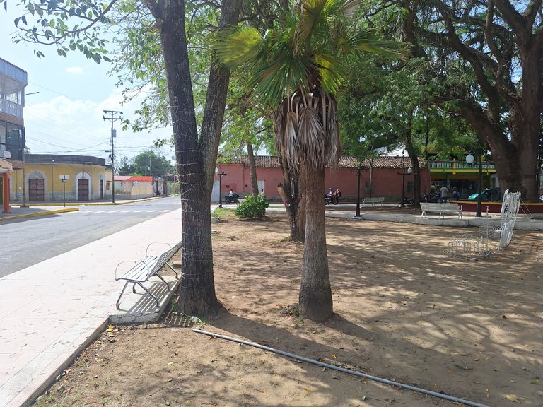
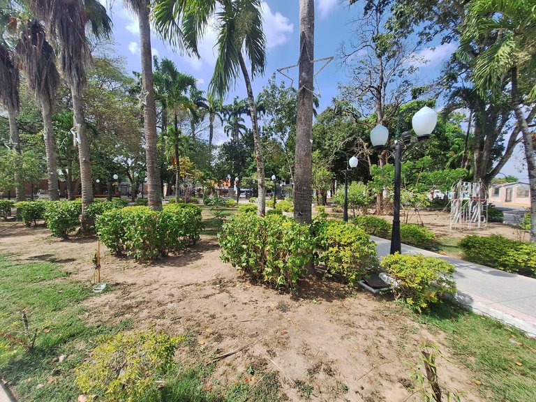
The Bolivar Square had the same layout as most Venezuelan town squares. I walked through it to see the surroundings. I liked that the bushes were huge, and the square was well-kept.
 |  |
 |  |
 |  |
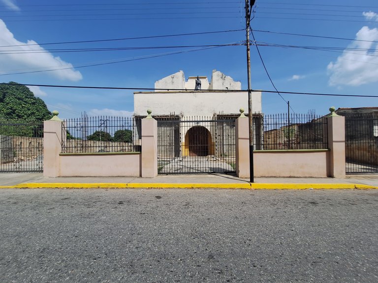
On one side of the square was the church. It was in very poor condition and was closed. I regretted the state of the church, as it had an old architectural design. At first glance, it must have been built after Venezuela’s independence from Spain or in the early 1900s.
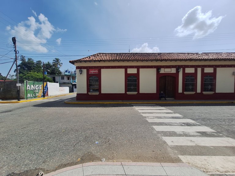
On another side of the square, I found a building I liked. It was colonial in style and the only one well-preserved. It stood out the most among all the buildings surrounding the square. In fact, this building housed the town hall or municipality of Sarare.
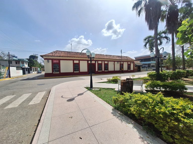
Without a doubt, the traditional and cultural atmosphere in that space was striking, mainly due to the building's design, which was the only one that retained its architectural identity.
 |  |
 |  |
 |  |
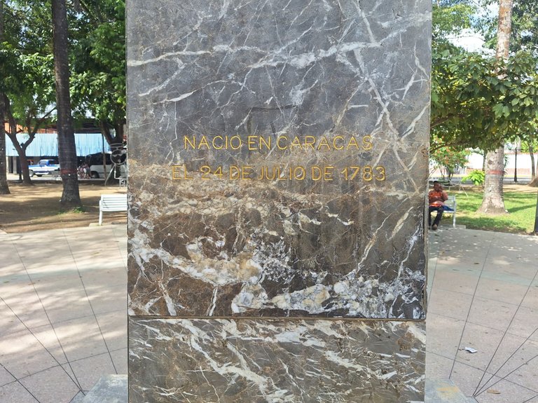
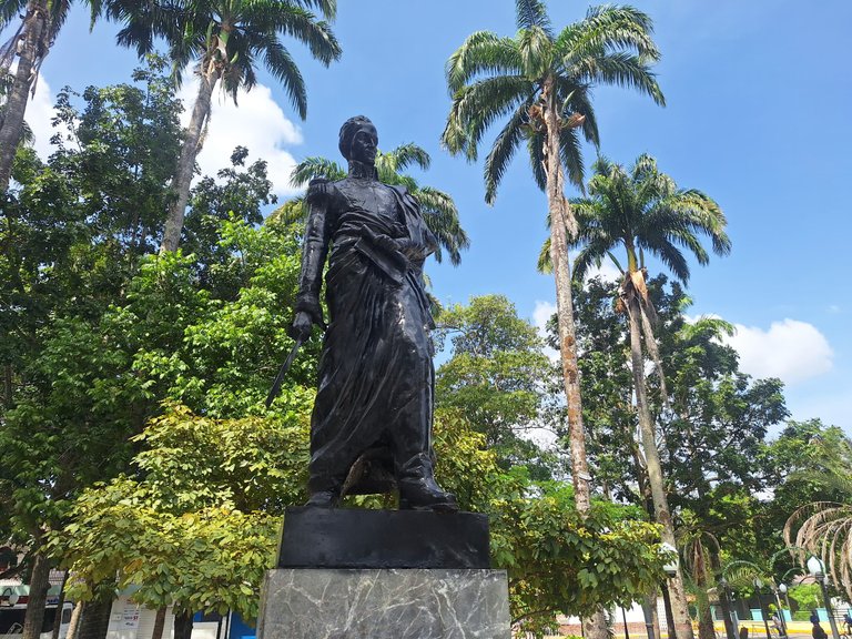
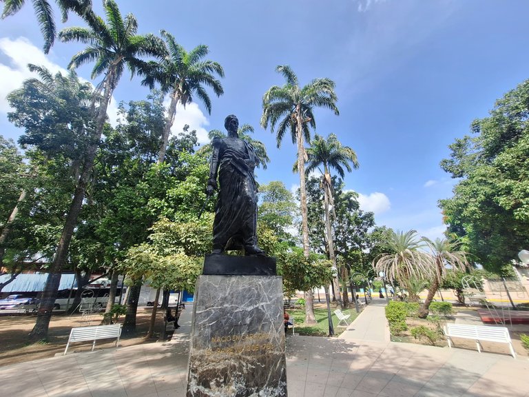
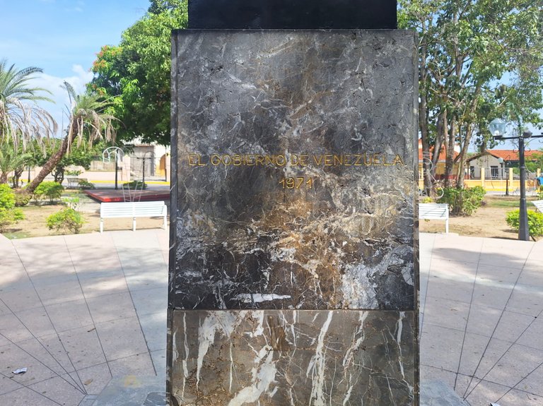
I walked through the Bolivar Square and took some photos of the sculpture. The plaza was built in 1971 by the Venezuelan government; it's notable.
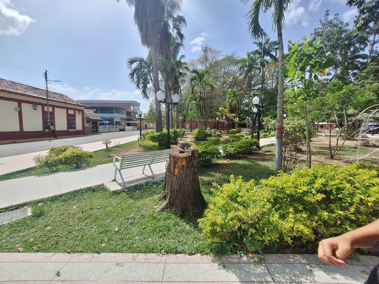
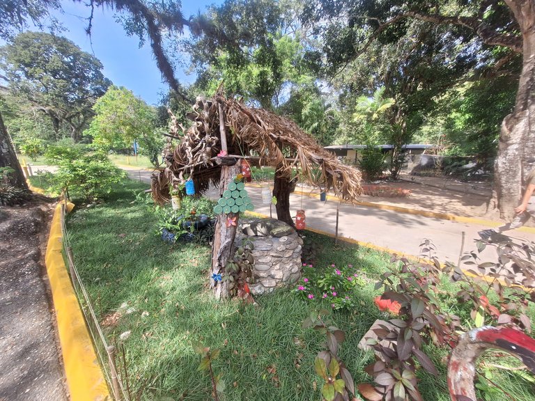
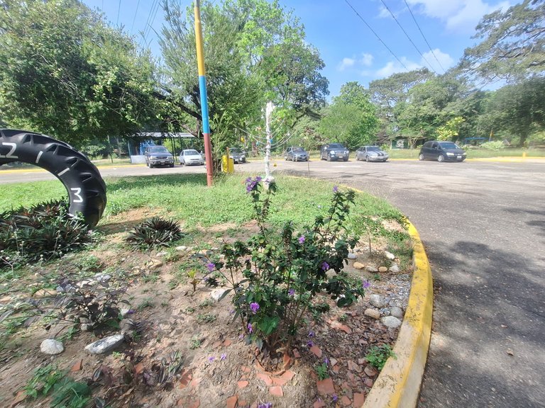
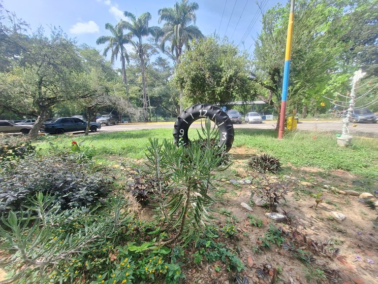
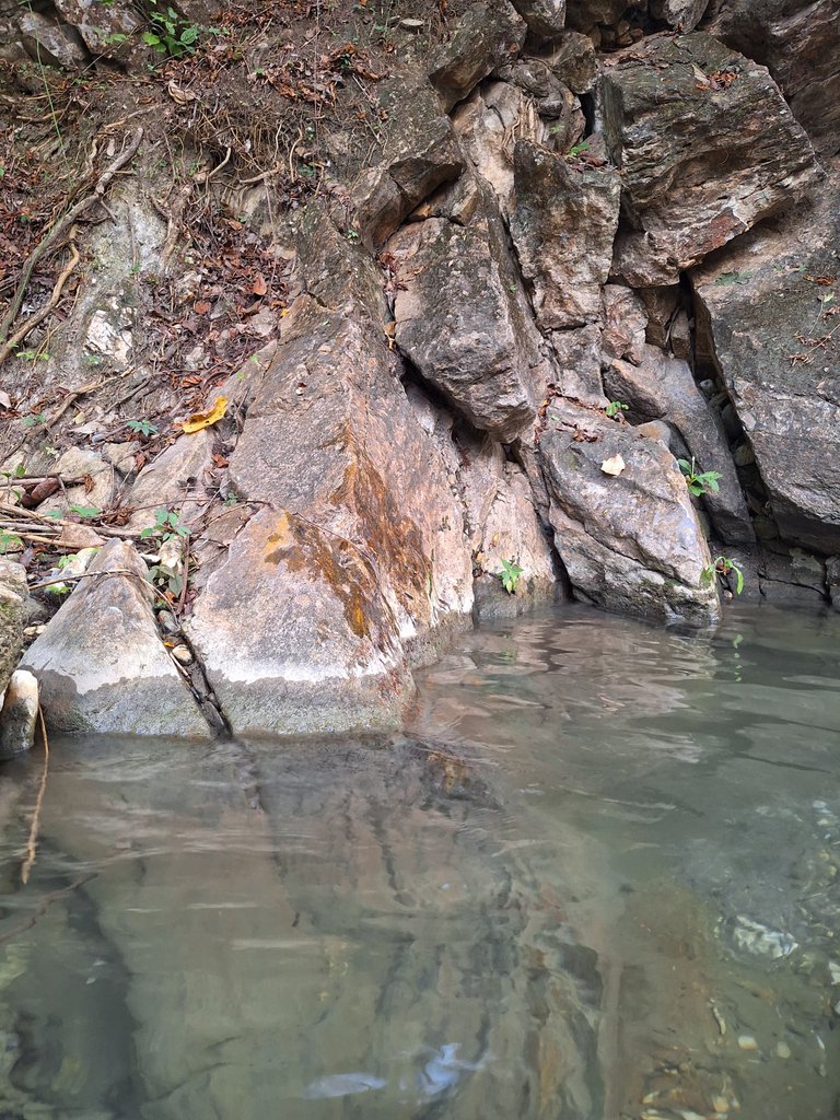
After this brief tour, we continued toward The Mayitas, which is located at the end of the town of Sarare. Upon entering, I encountered a kind of well, something to attract the children’s attention. The entrance fee for The Mayitas is 2 USD (or HBD) per vehicle. For buses, the fee is 5 USD (or HBD). As it is a protected park managed by INPARQUES (a state institution), it opens from 8:00 a.m. to 5:30 p.m.
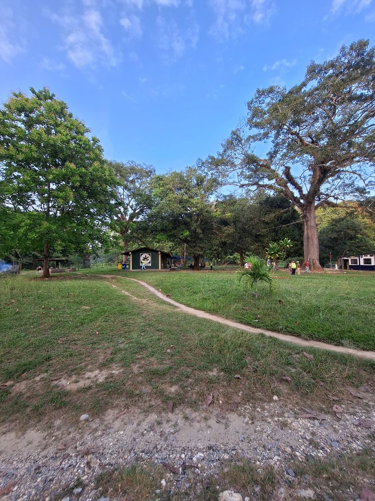
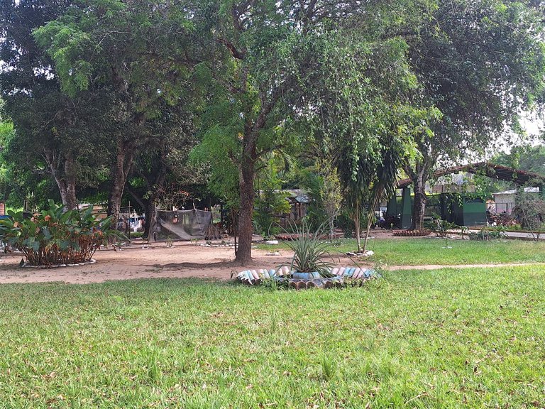
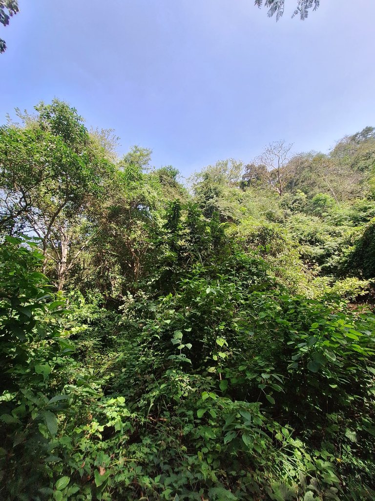
At the entrance, there are many large trees. Also, the presence of plant life is incredibly beautiful. Everything in that place is wonderful.
 |  |
 |  |  |
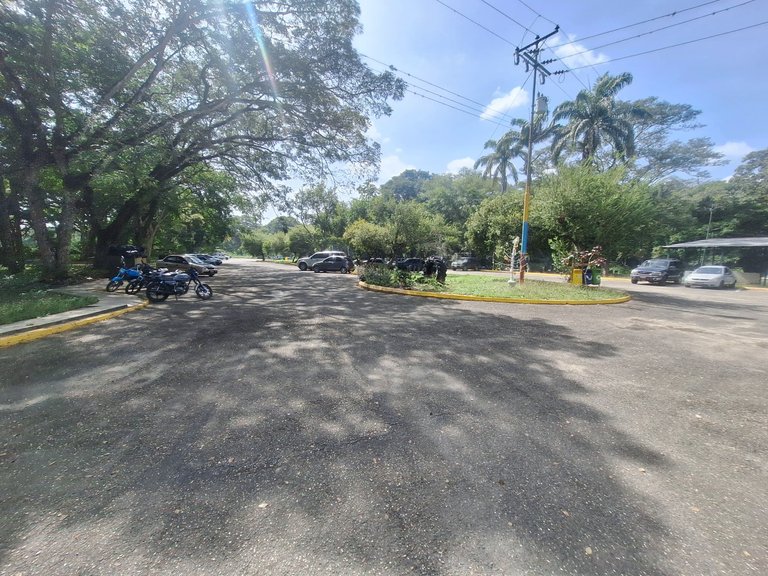 |  |
After paying and parking the cars, I started observing the surroundings. I walked slowly to see what the entrance area was like. According to one of my uncles, we were going to one of the wells located farther in the park, deep in the interior of The Mayitas.
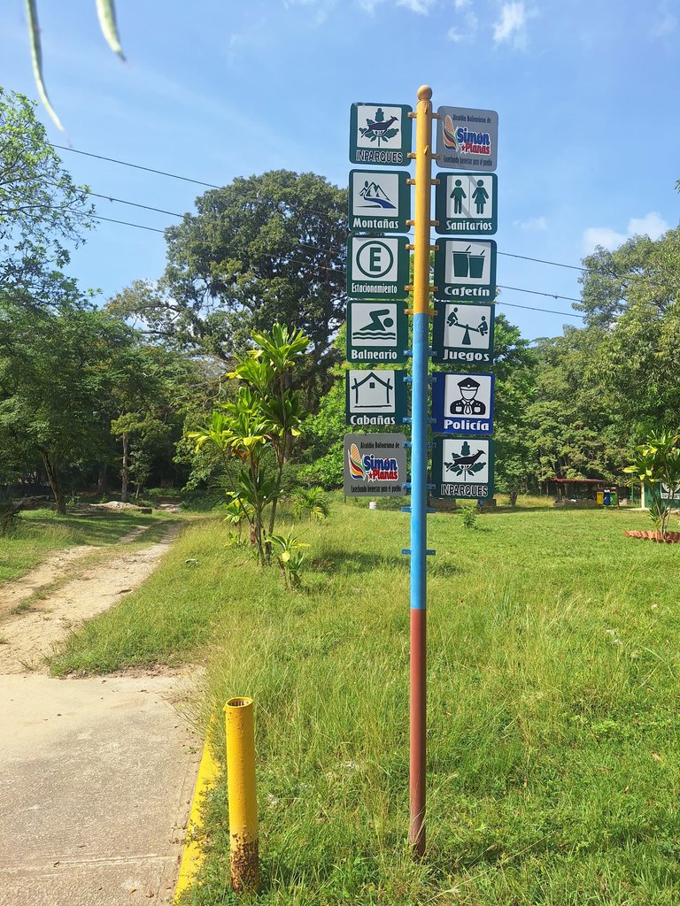
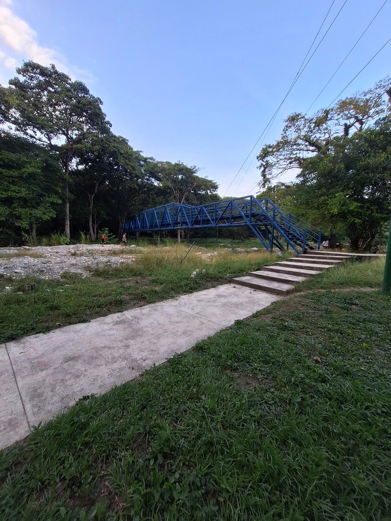
I came across signs indicating what the park had to offer. When I saw the bridge, I remembered that my mom had brought us here once. We hadn’t returned since because my sister almost drowned when she was four years old. It was a chaotic moment, but fortunately, nothing serious happened. I hadn’t remembered this (I asked my mom, and she confirmed it was the same place).
 |  |
 |  |  |
 |  |
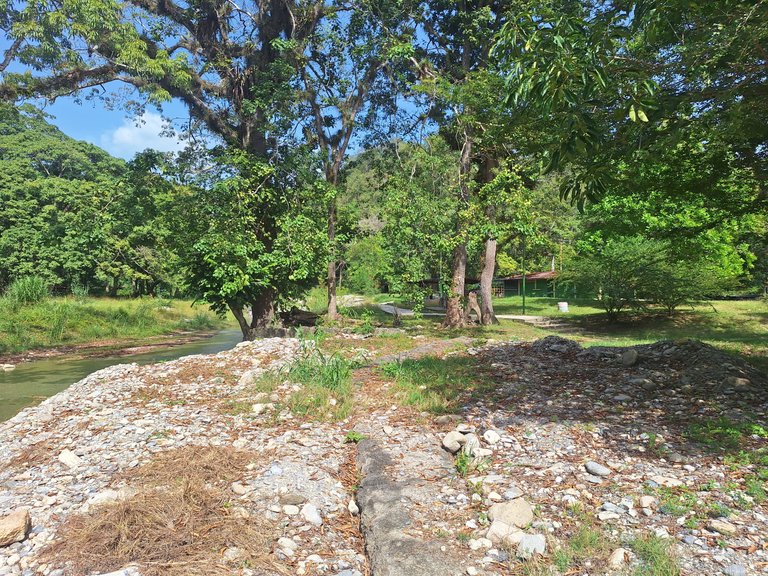
To recap: I continued exploring the park and noticed there were all kinds of trees, and everything was very well-preserved. I also walked closer to the bridge while my family unloaded everything from the vehicles.
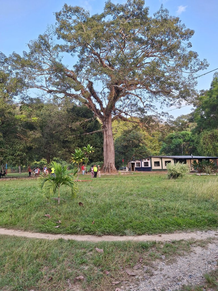
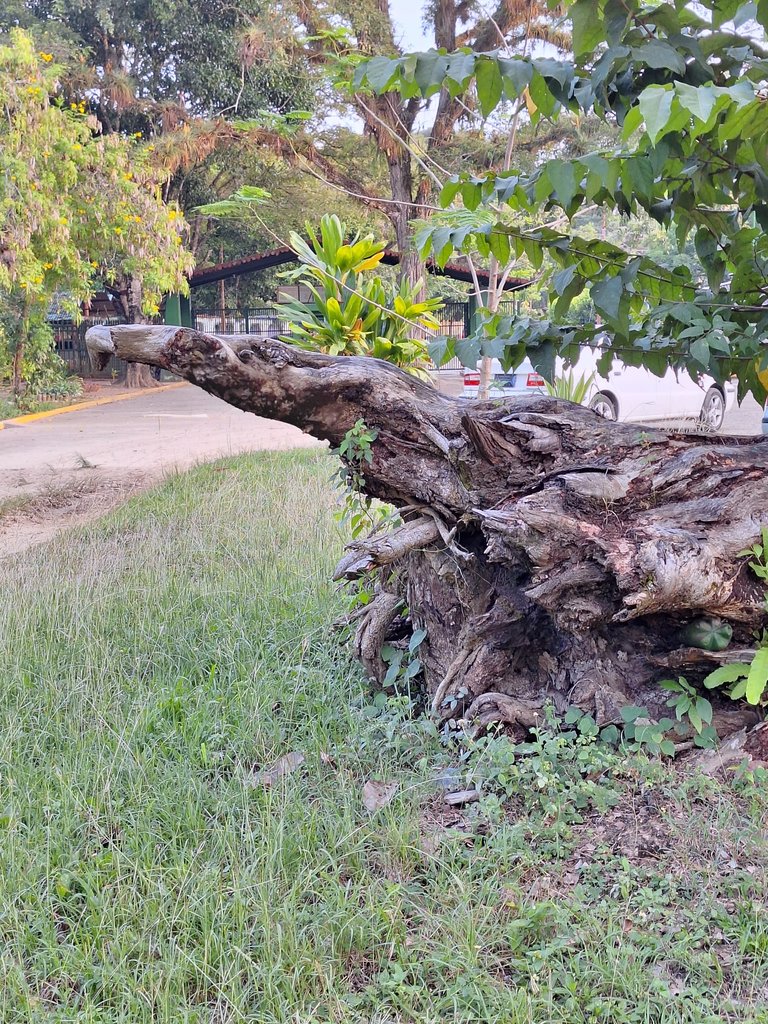
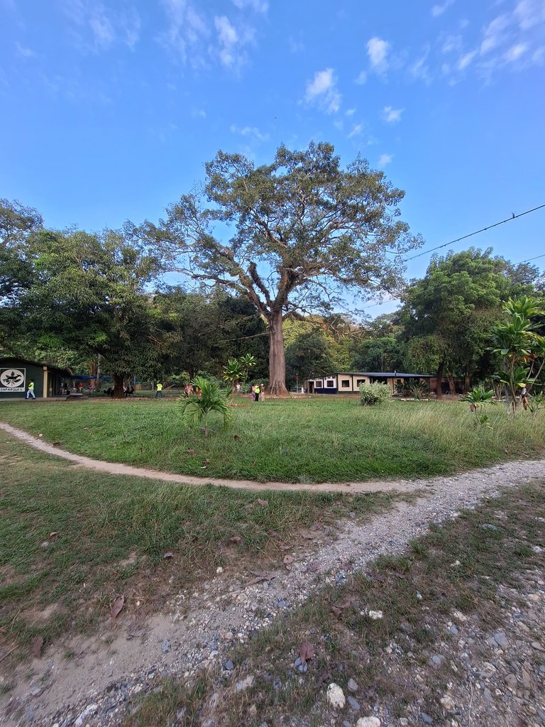
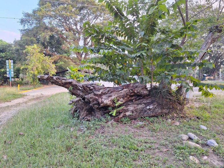
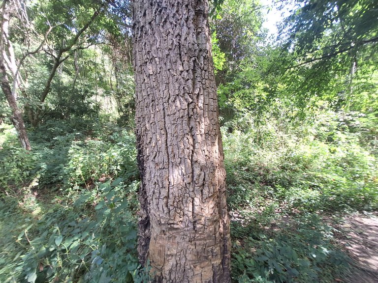
The park has all sorts of interesting elements. I came across an enormous bush. Its trunk was very thick.
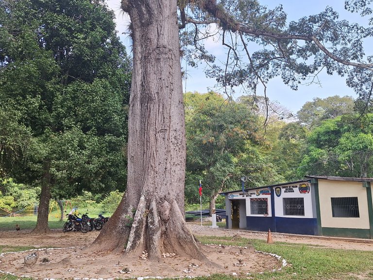
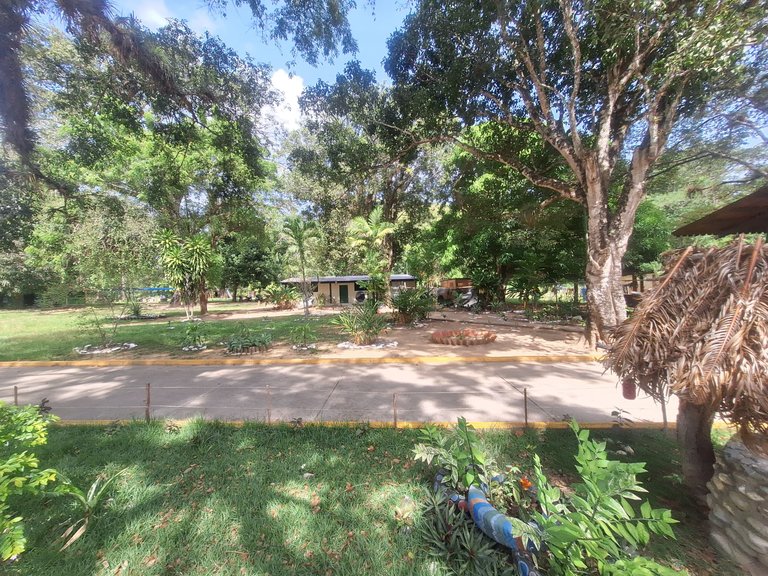
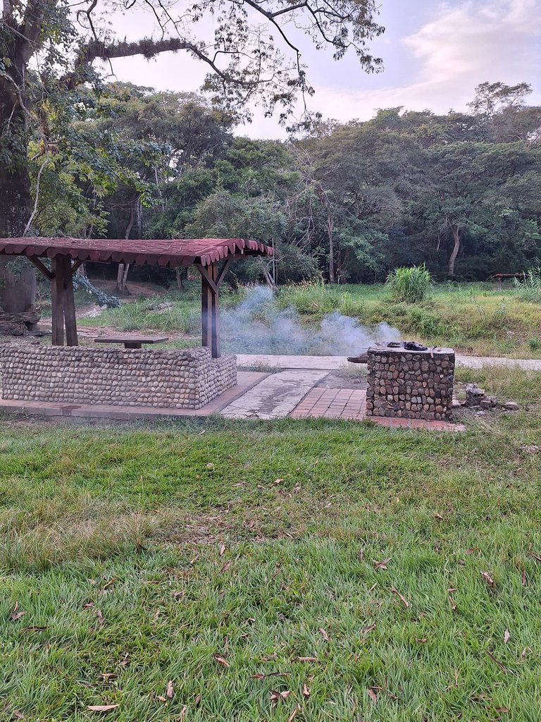
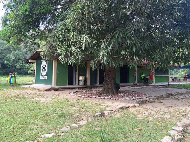
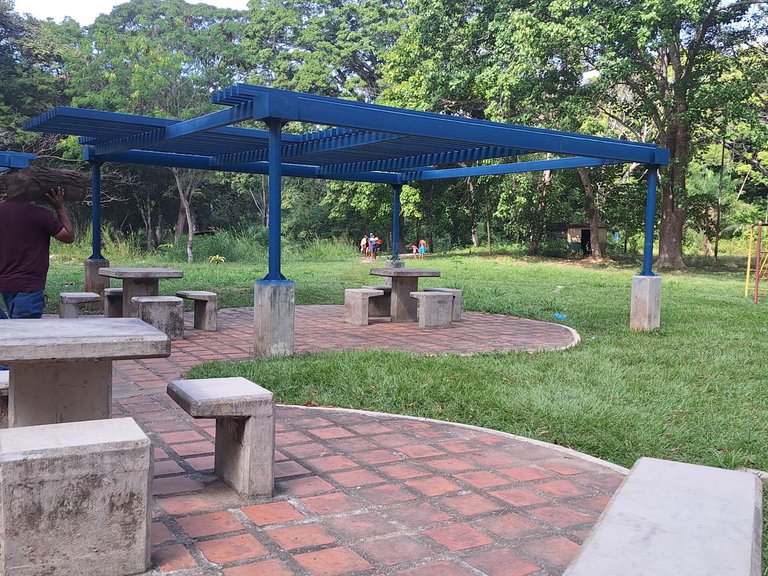
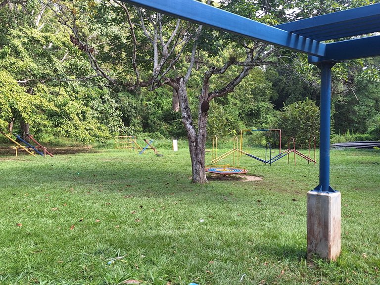
What I liked was that the small architectural interventions didn’t interfere with the bushes. They related to the environment in a simple way. They aren’t remarkable buildings, but they do integrate well with the surroundings.
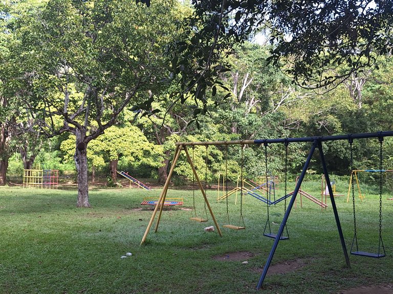
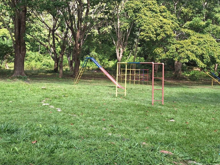
The Mayitas also has a park for children to play. Naturally, my cousins played for a while, but it was just a brief moment. The park had interesting features that captivated them.
 |  |
 |  |
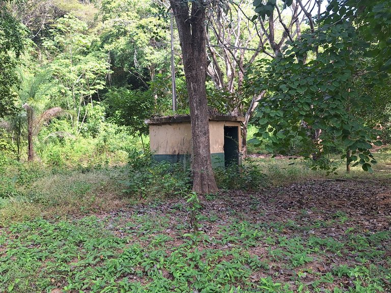
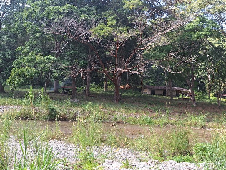
Not everything is perfect; in the distance, I saw a house, or something similar, in bad condition. It was most likely abandoned for a long time.
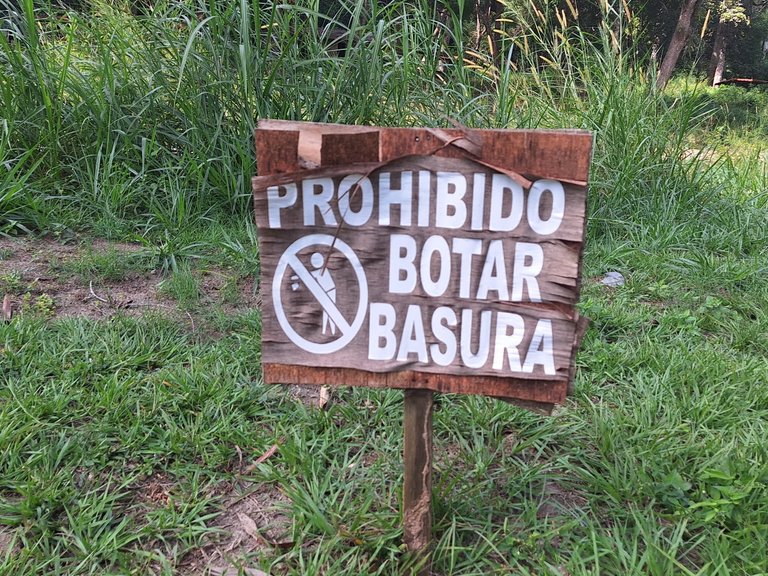
I found a sign that read: “No littering.” This was important to me, as we must take care of the environment. Be a good citizen.
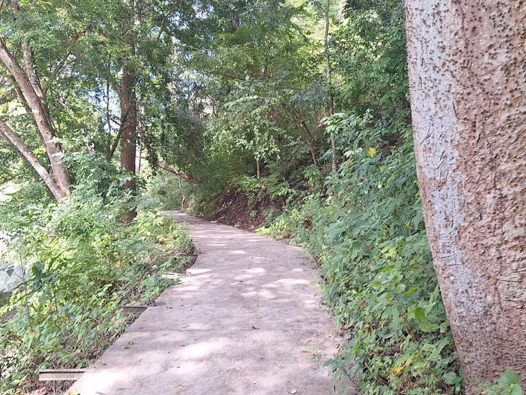
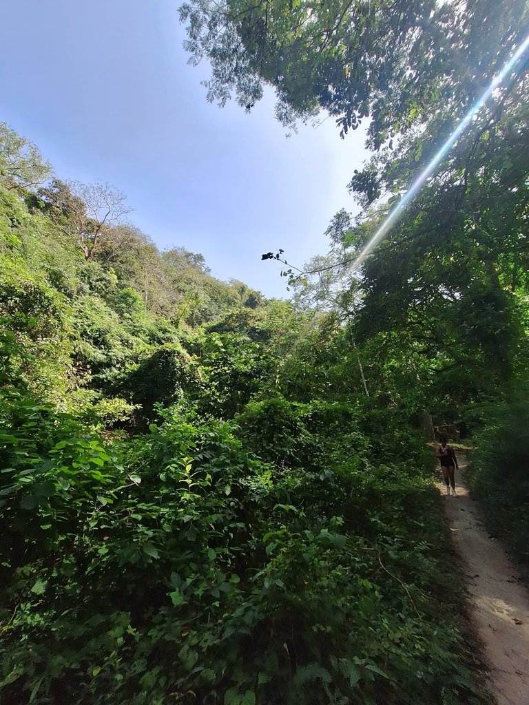
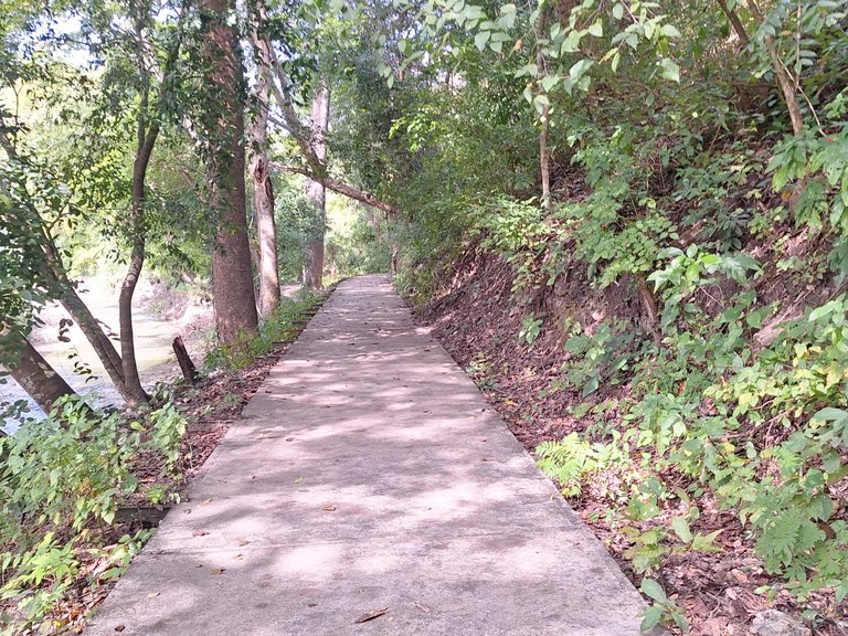
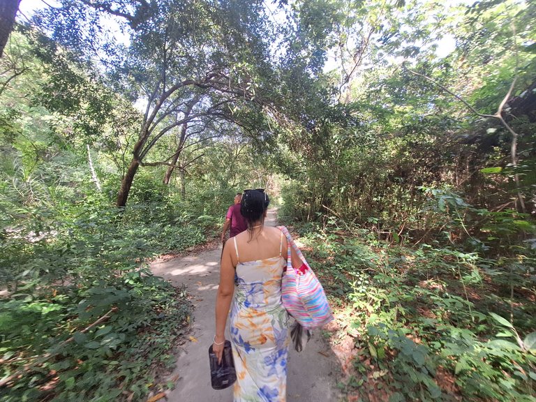
At this point, I returned to the parking lot to help move the items, and we began our journey toward our destination. There was a cement curbside. It seemed the idea was to connect the curbside with the entire park so that tourists could venture into it.
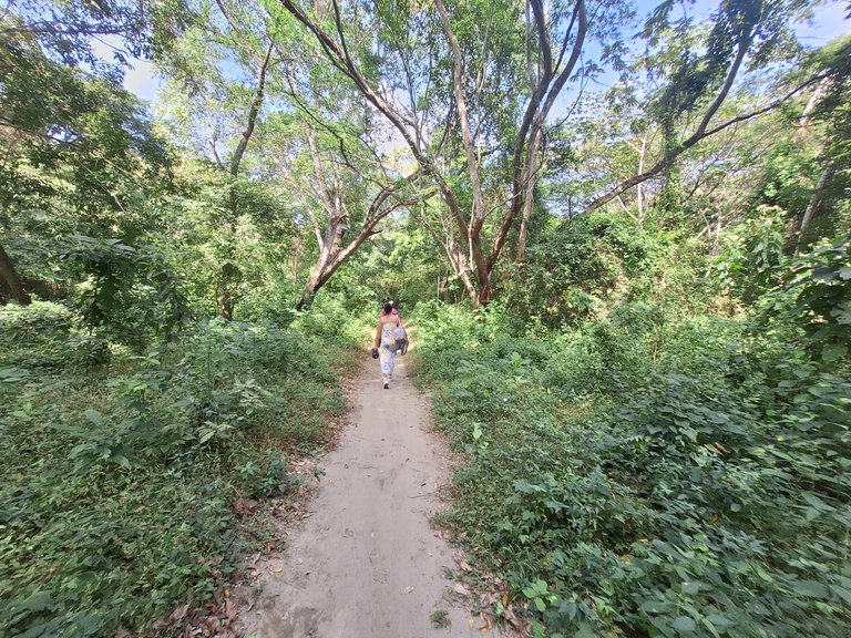
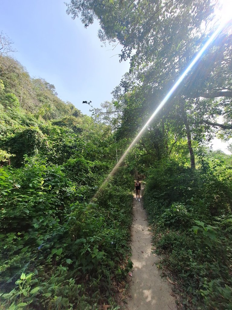
This curbside was impressive because it was full of giant bushes. Taller than the ones at the entrance of The Mayitas. Unfortunately, the cement path wasn’t complete, but there was a dirt trail that followed a similar path. We guided ourselves through it.
 |  |
 |  |  |
 |  |
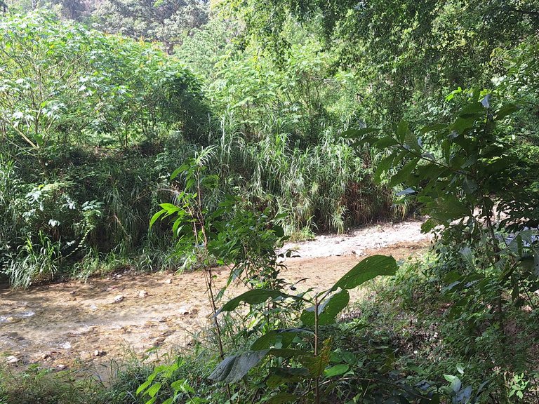
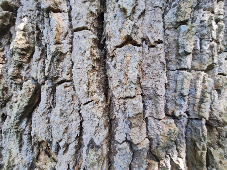
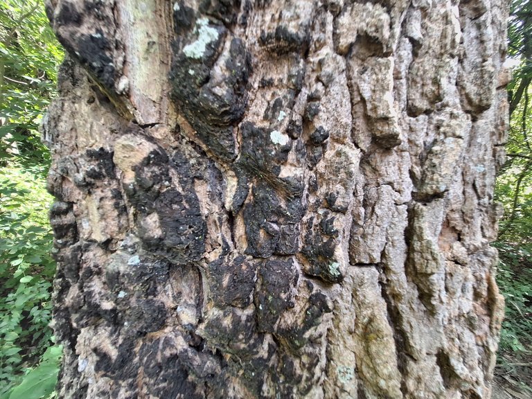
As I walked, I encountered all kinds of trees. The view there was beautiful. So incredible that I can’t put it into words.
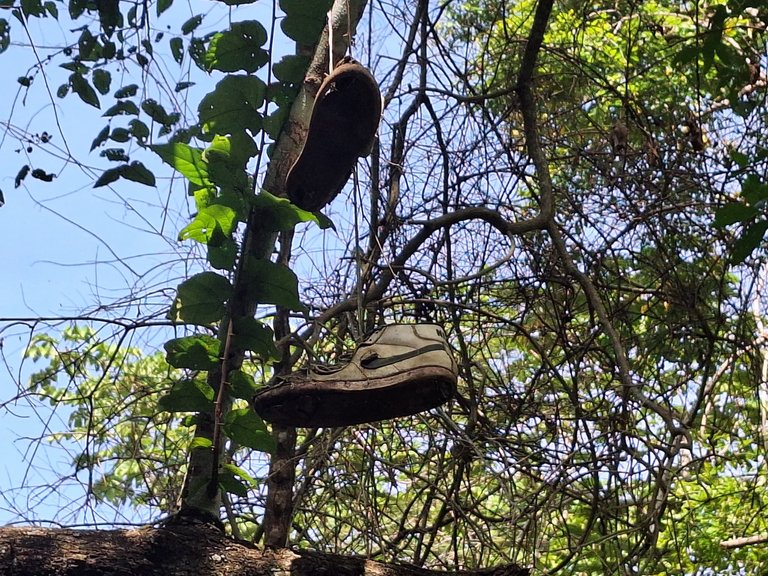
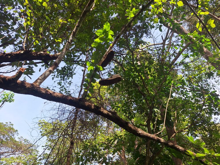
We walked for about 20 minutes. Along the way, we saw some shoes hanging; it felt like a scene from a movie—maybe a horror movie!
 |  |
 |  |  |
 | 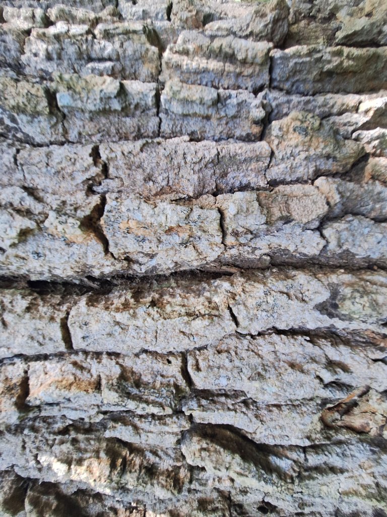 |  |
The trees had different thicknesses. I took some photos while walking. In reality, our destination was far from the entrance, but we finally reached the spot where we would set everything down.
Is that all? Well, no, there’s more to tell. I only reached the first part and entrance of the The Mayitas River or The Mayitas Park. So, this will continue in the next post.
Original content by @neruel. All rights reserved © 2025. Images: Samsung Galaxy A54. Translation and grammatical corrections: ChatGPT - DeepL - LanguageTool.
SPANISH VERSION (click here!)
Las Mayitas – Sarare: Parte 1
Este es un viaje que tenía planeado escribir desde hace tiempo, pero lo había postergado. Viajé a Sarare para ir a Las Mayitas o al Parque Recreacional Las Mayitas (en realidad, es un pulmón vegetal con un notable afluente de agua). Debo destacar que esta escapada fue una aventura familiar. Así que, que fui con toda mi familia materna y mi hermano. Salimos de Barquisimeto a las 9:00 a.m., hora Venezuela.
Tomamos la vía que conecta Barquisimeto con Gamelotal hasta llegar a Torrellero para luego cruzar al pueblo de Sarare. Hicimos una parada rápida en la estación de combustible, que lamentablemente, debido al contexto, no funciona. Aunque los locales comerciales sí están operativos, ese día estaban cerrados porque no era día laborable.
Lo crítico de habernos detenido allí fue ver cómo una estación de combustible no funcionaba en el país con las mayores reservas probadas de petróleo. A pesar de ver eso, nosotros seguimos nuestro camino. Paramos allí, para reencontrarnos con otros familiares que venían en otro carro.
Seguimos la vía para entrar al pueblo de Sarare. Aproveché para tomar una fotografía del lugar. Me llamó la atención porque era una especie de local hecho de madera. Cosas como esta aún existen en las partes más comunes y locales.
Posteriormente, llegamos al centro del pueblo de Sarare, donde entré a una panadería para comprar un saco de carbón que nos había faltado para hacer la carne asada. La panadería estaba en los alrededores de la Plaza Bolívar. Creo que escribí hace tiempo que todos los pueblos en Venezuela poseen una Plaza Bolívar, lo que refleja el respeto que el país tiene por el Libertador (aunque no específicamente el Padre Fundador).
En algunas de las fotografías se puede ver el autobús en el que venía una parte de mi familia. Todos se bajaron para ver los alrededores y relajarse un rato. La dinámica en el centro del pueblo es realmente llamativa; hay presencia de muchas personas.
La Plaza Bolívar tenía el mismo diseño que la gran mayoría de las plazoletas venezolanas. Me adentré en ella para ver los alrededores. Me gustó que los arbustos eran inmensos y que la plaza estuviera limpia.
En una de las laterales de la plaza estaba la iglesia. Estaba en muy mal estado; además, se encontraba cerrada. Lamenté el estado de la iglesia, ya que noté que tenía un diseño arquitectónico longevo. A simple vista, debió ser construida después de la independencia de Venezuela de España o a principios de 1900.
En otra parte de la plaza, encontré un edificio que me gustó. Era de estilo colonial y el único que se encontraba bien conservado. Además, el que más resaltaba entre todos los alrededores de la plaza. En efecto, el edificio perteneciente a la municipalidad o alcaldía de Sarare.
Sin lugar a dudas, el efecto tradicional y cultural en ese espacio era muy llamativo, principalmente por el modelado del edificio, que era el único que mantenía su identidad arquitectónica.
Me adentré en la Plaza Bolívar y tomé algunas fotografías de la escultura. La plaza fue construida en 1971 por el gobierno venezolano; es notable.
Luego de hacer este breve recorrido, seguimos el camino hacia Las Mayitas que está al final del pueblo de Sarare. Al entrar, me encontré con una especie de pozo, algo para llamar la atención de los niños. La entrada en Las Mayitas es de 2 USD (o HBD) por vehículo. En el caso de los autobuses, son 5 USD (o HBD). Al ser un parque protegido y administrado por INPARQUES (una institución del estado), abre de 8:00 a. m. hasta las 5:30 p.m.
En la entrada, hay muchos árboles inmensos. Además, la presencia de materia vegetal es increíblemente hermosa. Todo es maravilloso en ese lugar.
Luego de pagar y estacionar los carros, comencé a observar los alrededores. Caminé poco a poco para ver cómo era la parte de la entrada. Según uno de mis tíos, iríamos a uno de los pozos que estaban en la parte más lejana o interna de Las Mayitas.
Me encontré con un letrero o señalizadores que indicaban lo que había en el parque. Al ver el puente, recordé que mi mamá nos trajo una vez a este lugar. Tampoco habíamos vuelto porque mi hermana casi se ahoga cuando tenía 4 años. Fue un momento caótico; afortunadamente, no pasó a mayores. Era algo que no recordaba (pregunté a mi mamá y ella me confirmó que era ese lugar).
Recapitulo: seguí recorriendo el parque y noté que había todo tipo de árboles y que todo estaba muy bien conservado. También me acerqué al puente mientras mi familia bajaba todas las cosas de los vehículos.
En el parque hay todo tipo de elementos llamativos. Me encontré con un arbusto inmenso. Su tronco era muy grueso.
Algo que me gustó es que las pequeñas intervenciones de carácter arquitectónico no interferían con los arbustos. Se relacionaban de manera sencilla. No son edificios notables, pero sí tienen una buena integración con el medio ambiente.
En Las Mayitas también había un parque para que los niños jugaran. Obviamente, mis primos jugaron un rato, pero fue algo momentáneo. El parque tenía escenas llamativas que envolvían.
No todo es perfecto; a lo lejos vi una casa o algo así en mal estado. Lo más probable es que estuviera en desuso desde hace mucho tiempo.
Me encontré con un aviso que decía: “Prohibido botar basura”. Algo importante para mí, ya que debemos cuidar el ambiente. Sé un buen ciudadano.
En este punto, regresé al estacionamiento a ayudar a trasladar las cosas y comenzó el recorrido hacia nuestro destino. Había una caminería de cemento. Al parecer la idea era conectar la caminería con todo el parque para que los turistas pudieran adentrarse en él.
Esta caminería era impresionante porque estaba llena de arbustos gigantescos. Más altos de los que estaban en la entrada de Las Mayitas. Lamentablemente, el camino de cemento no estaba completo, pero sí había una secuencia de uno de tierra. Nos guiamos a través de él.
A medida que caminaba, me encontraba con todo tipo de árboles. La vista allí era hermosa. Tan increíble que no puedo definirla con palabras.
Caminamos unos 20 minutos aproximadamente. En el camino, nos encontramos con unos zapatos colgados; parecía una escena de película: ¡Quizás una de terror!
Los árboles tenían espesores distintos. Tomé algunas fotografías mientras caminaba. Realmente, nuestro destino estaba lejos de la entrada; pero finalmente llegamos al lugar donde colocaríamos las cosas.
¿Esto es todo? Pues no, hay otra parte que contar. Solamente llegué a la primera parte y entrada del río Las Mayitas o parque Las Mayitas. Por eso, esto continuará en una próxima publicación.
Contenido original de @neruel. Todos los derechos reservados © 2025. Imágenes: Samsung Galaxy A54. Traducción al inglés y corrección gramatical: ChatGPT - DeepL - LanguageTool.
Posted Using INLEO
Travel Digest #2465.
Become part of our travel community:
- Join our Discord
Hiya, @ybanezkim26 here, just swinging by to let you know that this post made it into our Honorable Mentions in Your post has been manually curated by the @worldmappin team. If you like what we're doing, please drop by to check out all the rest of today's great posts and consider supporting other authors like yourself and us so we can keep the project going!Hi, @ybanezkim26 thanks so much for stopping by. It's an honor for me to be in Travel Digest #2465, greatly appreciated for the support.
Big hug. :)
Un bonito recorrido para llegar al parque las Mayitas, me gustó el kiosko de madera, son comunes en los pueblos, los zapatos colgados en el árbol son curiosos.
Saludos!
¡Hola, amiga! Que bueno que tomaras en cuenta esos detalles, el kiosco, una curiosidad extrema, típico de este tipo de localidades. En cuanto a los zapatos, escena de terror definitivamente. Abrazo. :)
You can check out this post and your own profile on the map. Be part of the Worldmappin Community and join our Discord Channel to get in touch with other travelers, ask questions or just be updated on our latest features.
Thank you very much for this. We are back in the ring. :P
❤️
Congratulations @neruel! You have completed the following achievement on the Hive blockchain And have been rewarded with New badge(s)
Your next target is to reach 52000 upvotes.
You can view your badges on your board and compare yourself to others in the Ranking
If you no longer want to receive notifications, reply to this comment with the word
STOPCheck out our last posts:
Que lindo lugar, que bueno que en Venezuela aún se conserven estos pulmones vegetales. Me encantan esos viajes familiares! 😍
Es un lugar encantador, precioso para racionar y conocer diferentes realidades. Hay una segunda parte, es algo largo. Los viajes familiares son lo mejor.
You must be an architect to have analyzed this buildings in this manner. I do not know much about building, but these ones seems amazing to me. The natural surrounding captivates me most about this place. I enjoy the post generally, thank you so much @keritroberts for sharing...
I am not an architect, but I am an urban planner. That's why I have knowledge of the subject. Thanks for stopping by, I'm glad you liked it.
That's amazing
You are much welcome