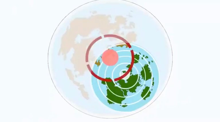
This is the most important map for flat Earth.
The green is where we are today. The red dot is the “True North”. The red lines are magnetic north that constantly shift. 2160 years per astronomical cycle and 25,920 years for one full cycle.
Ice walls are constantly melting and forming clockwise as the magnetic poles shift (with sun and moon which are mere reflections for the filament), the lit area.
As the years progress as we shift into various ages, Australia region, closest to the border of the filament will freeze over first.
To get to the red dot the True North to get to the land beyond, need celestial navigation because the compass will not tell you where it is as the entirety of the boundary are “magnetic south”.
To confirm this theory, tilt angle to Polarius should be the same, but position of Sun and Moon should change overtime right?