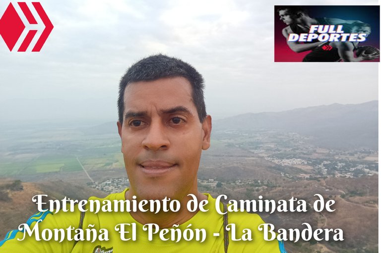
Greetings friends of Hive and @fulldeportes, today I am going to share with you my mountain walking training that I do on the El Peñón - La Bandera route, in the community of San Francisco de Asis, Zamora municipality, Aragua state.
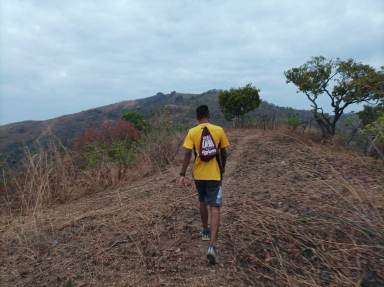
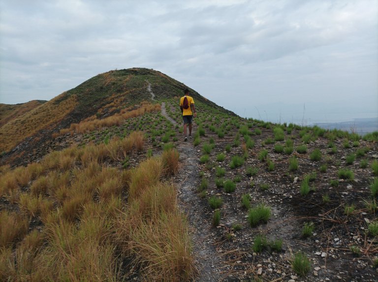
Cabe destacar que el día de hoy me levanté muy temprano para trasladarme a la comunidad de San Francisco de Asis, al llegar mi hermano me estaba esperando con un taza de café, tenía más de cuatro meses que no subía está montaña, salimos a las 6 y 23 minutos, activando la aplicación Strava, iniciamos desde la avenida Bolívar, para después tomar el sector Rancho Grande, recorriendo como 1K, para después desviarnos y comenzar a adentrarnos al cerro de El Peñón. La montaña se observa un poco seca y quemada por los incendios.
It should be noted that today I got up very early to go to the community of San Francisco de Asis, when I arrived my brother was waiting for me with a cup of coffee, I had not climbed this mountain for more than four months, we left at 6:23 minutes, activating the Strava application, we started from Bolívar Avenue, and then took the Rancho Grande sector, traveling about 1K, and then turned off and began to enter the El Peñón hill. The mountain looks a little dry and burned by the fires.
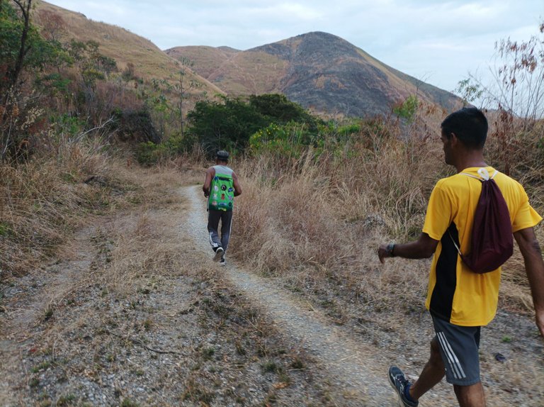
Después continúe avanzando y completar los primeros 2K, en 25 minutos con 15 segundos, esta ruta es bastante fuerte porque las subidas son seguidas,el clima estaba fresco y ya estaba aclarando, mantuvimos un buen ritmo en este recorrido que es bastante exigente, en la última subida sentía que me faltaba más velocidad porque mi hermano iba adelante marcando el paso, al completar los 3K, los pase en un tiempo de 38 minutos.
Then continue advancing and complete the first 2K, in 25 minutes and 15 seconds, this route is quite strong because the climbs are continuous, the weather was cool and it was already clearing, we maintained a good pace on this route that is quite demanding, on the last climb I felt that I needed more speed because my brother was ahead setting the pace, upon completing the 3K, I passed them in a time of 38 minutes.
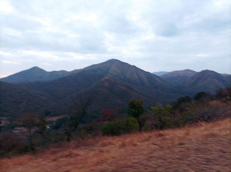
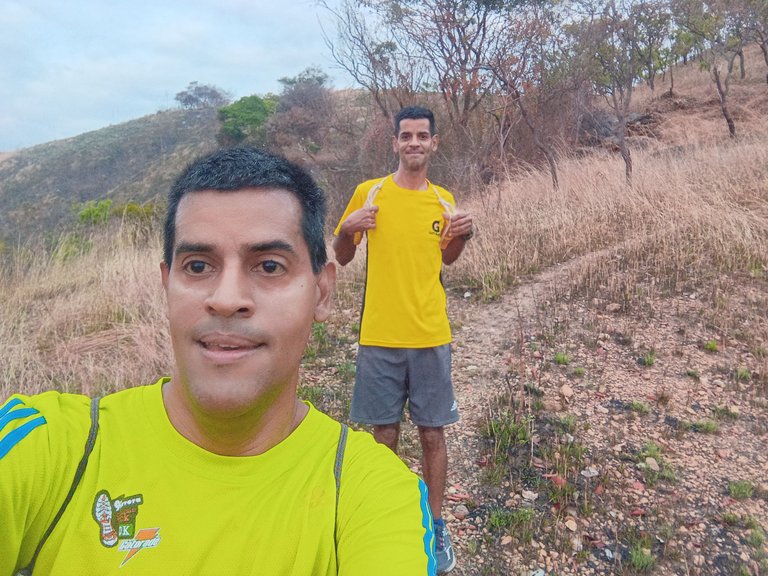
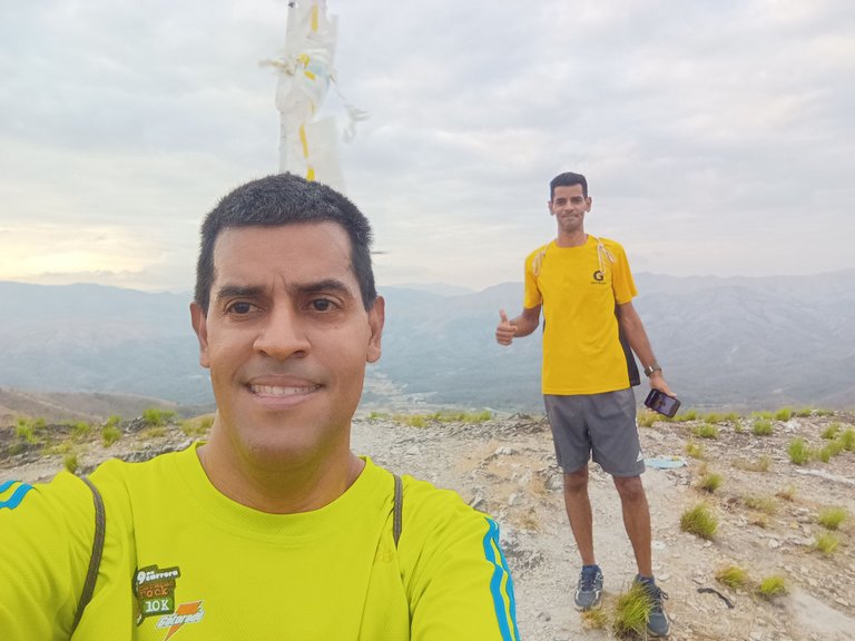
Luego nos hidratamos, para continuar y llegar a la cantera El Peñón, donde ya podíamos ver de frente la montaña cuya subida es bien empinada, encontrando a un corredor que estaba entrenando, en la parte alta está una bandera, a medida que iba subiendo sentía que la piernas se iban a desmayar por el esfuerzo, a pesar de esto trate de mantener el mismo paso de mi hermano, quedándome unos metros detrás de él, llegamos a la cima de este cerro La Bandera en un tiempo de 1 hora con una distancia de 4.79K.
Then we hydrated ourselves, to continue and reach the El Peñón quarry, where we could already see the mountain whose climb is very steep, meeting a runner who was training, at the top there is a flag, as I was climbing I felt that my legs were going to faint from the effort, despite this I tried to keep the same pace as my brother, staying a few meters behind him, we reached the top of this La Bandera hill in a time of 1 hour with a distance of 4.79K.
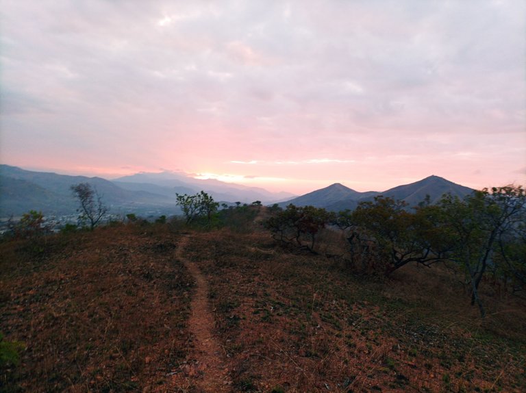
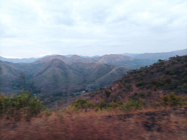
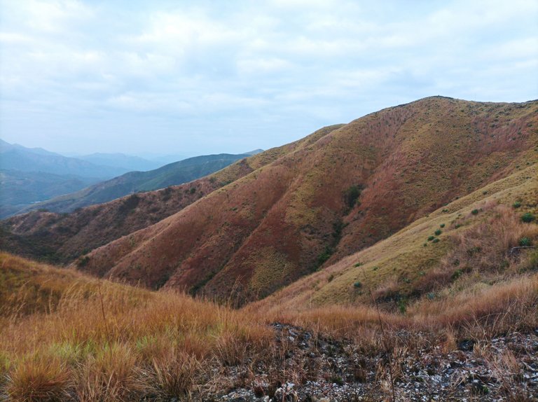
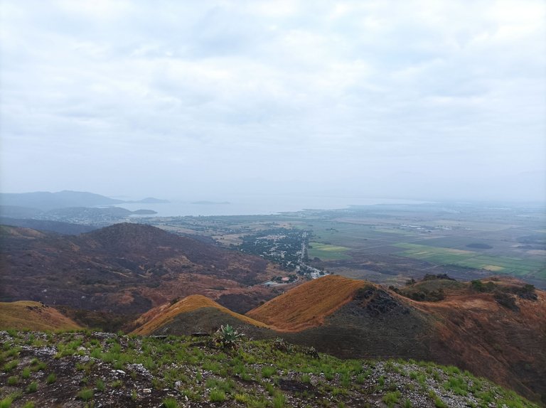
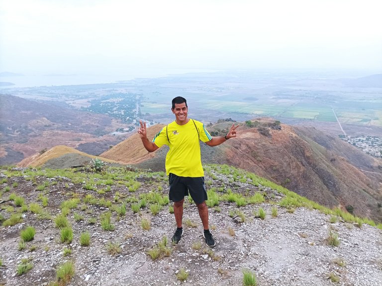
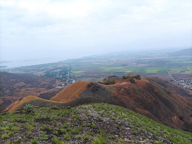
Desde la cima de esta montaña, podemos ver toda la población de San Francisco de Asis, la siembra de caña de azúcar, la comunidad de Tocoron, y también se ve el esplendor del lago de Valencia, sintiendo una brisa que se despliega en toda la montaña. Nos tomamos varias fotografías y nuevamente nos hidratamos para después comenzar el descenso. Después de terminar de descender, bajamos por otro camino, pasando por toda la cantera El Peñón.
From the top of this mountain, we can see the entire population of San Francisco de Asis, the sugar cane plantation, the community of Tocoron, and we can also see the splendor of Lake Valencia, feeling a breeze that spreads throughout the mountain. We took several photographs and hydrated again and then began the descent. After finishing descending, we went down another path, passing through the entire El Peñón quarry.
Asimismo llegamos a una carretera y comenzamos a subir para llegar a la parte alta donde se encuentran las antenas de telecomunicaciones, luego nos regresamos para bajar por la carretera de tierra que son como 3K, ya se comenzó a sentir algo de calor, al terminar de bajar, por estos lados se encuentra un manantial que se llama El Bracito, en la cual me la pasaba cuando era un niño.
We also reached a road and began to climb to reach the upper part where the telecommunications antennas are located, then we returned to go down the dirt road that is about 3K, we began to feel some heat, when we finished going down, on these sides there is a spring called El Bracito, in which I spent my time when I was a child.
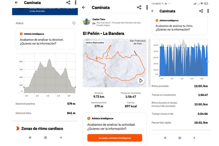
Después terminamos de salir de la montaña y llegamos a la avenida Bolívar, para llegar al mismo punto de salida con un tiempo de 2 horas 4 minutos con 56 segundos, con una distancia de 9.79K, con un desnivel positivo 579 m de y un desnivel máximo de 841 m, registrado en la aplicación Strava.
Afterwards we finished leaving the mountain and arrived at Bolívar Avenue, to reach the same starting point with a time of 2 hours 4 minutes and 56 seconds, with a distance of 9.79K, with a positive slope of 579 m and a maximum slope of 841 m, recorded in the Strava application.
Echa un vistazo a mi caminata en Strava: https://strava.app.link/ISr8buddbRb
Check out my walk on Strava: https://strava.app.link/ISr8buddbRb
Espero que les haya gustado, nos vemos en una próxima publicación.
I hope you liked it, see you in a next post.
Fotografías: Teléfono Redmi Note 10
Portada realizada en APP GridArt
Traductor utilizado: Traductor de Google
Logos utilizados de Hive y de @fulldeportes
Photos: Redmi Note 10 Phone
Cover made in The APP GridArte
Translator used: Translator used: Google Translate Used logos of Hive and @fulldeportes

Vote la-colmena for witness By @ylich

Excelente, que hermosa vista desde la colina amigo
Saludos amigo, gracias por comentar.
A nice view below. It looks breathtaking. Thanks for sharing.
!LADY
Hi friend, thanks for stopping by and commenting, happy weekend.
Impresionante como se ven los campos cultivados perfectamente rectangulares en el valle a esa altura profe, gracias por compartir estas fabulosas imágenes de la geografía local a través de su actividad deportiva, el hiking.