Good morning, fellow photography enthusiasts,
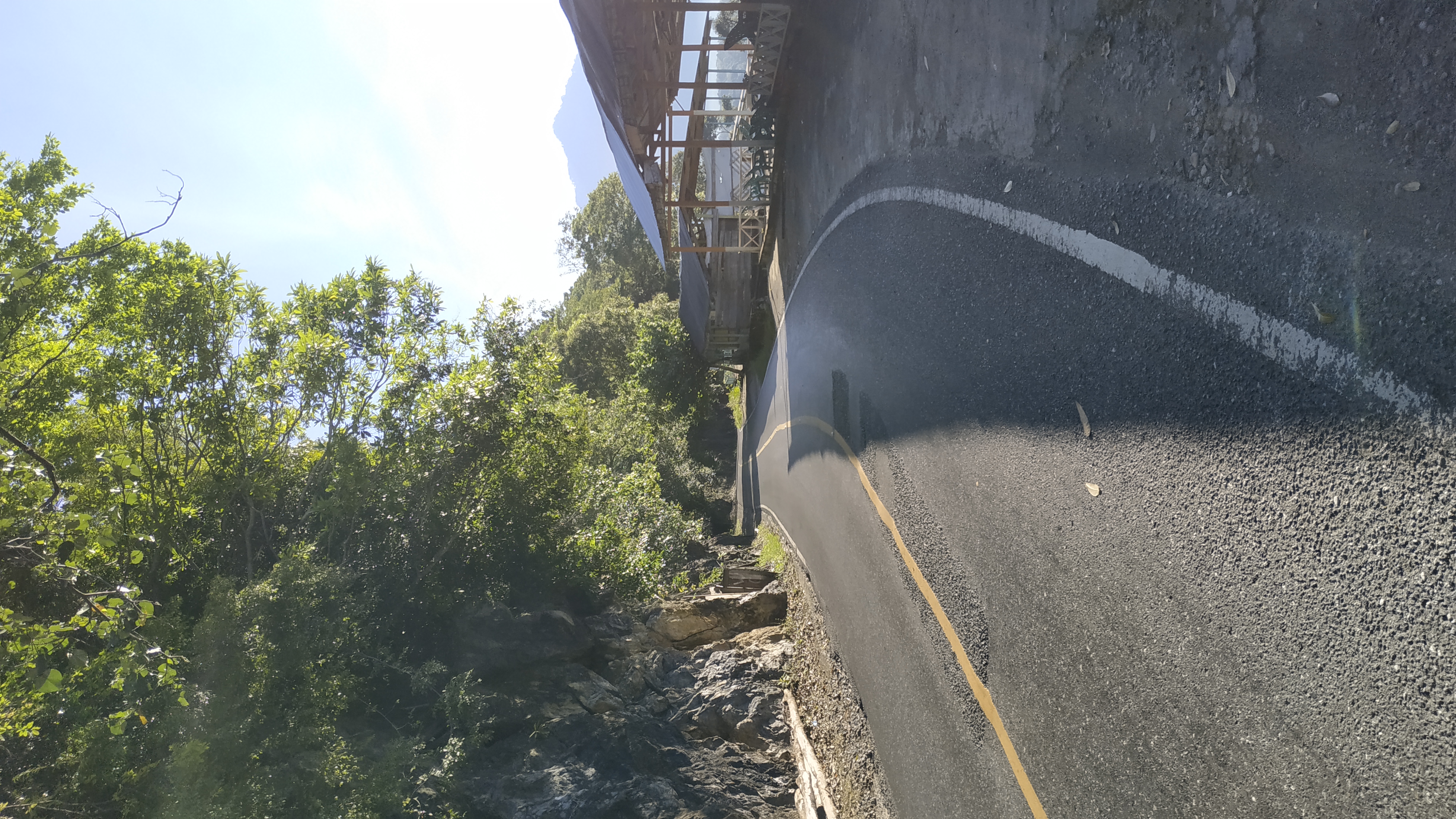
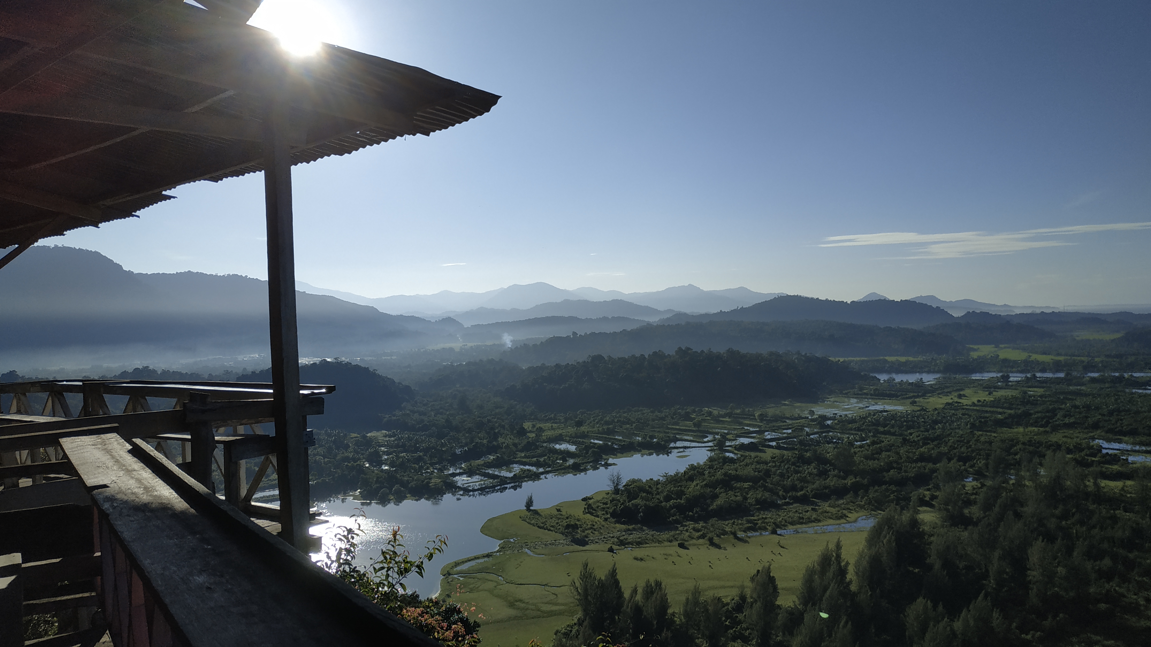
For those traveling along the southern-western route, the peak of Geurutee Mountain is no stranger. The stunning view captures the eyes with the deep blue expanse of the Indian Ocean, an enchanting sight for anyone passing through this road.
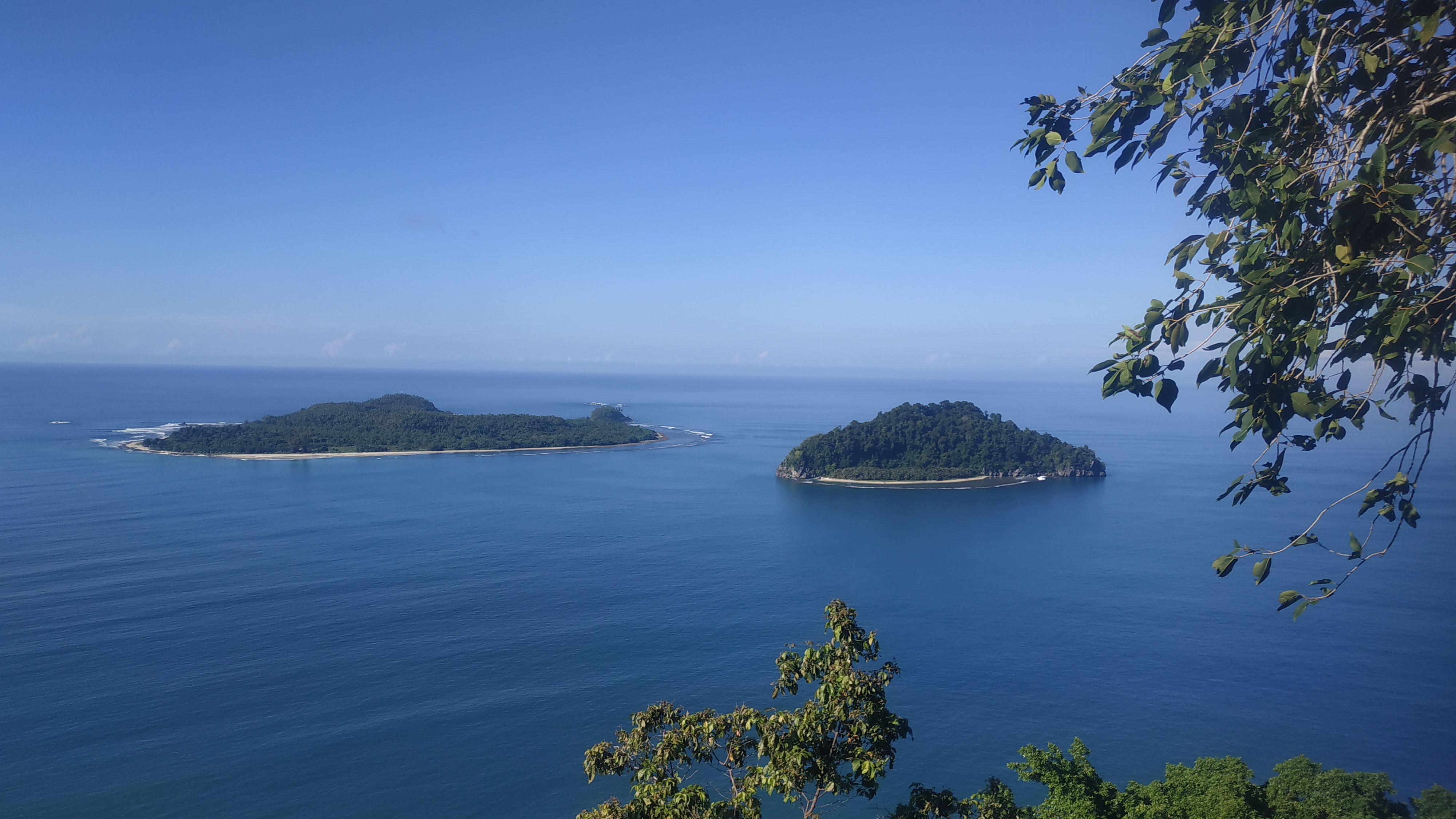
The peak of Geurutee indeed offers a breathtaking panorama. From its height, one can see a blend of the ocean, islands, beaches, and even residential areas. Visitors are treated to a live painting before their eyes. Standing at 1,080 meters above sea level, Geurutee is known not only for its natural beauty but also for its historical and cultural significance to the local community.
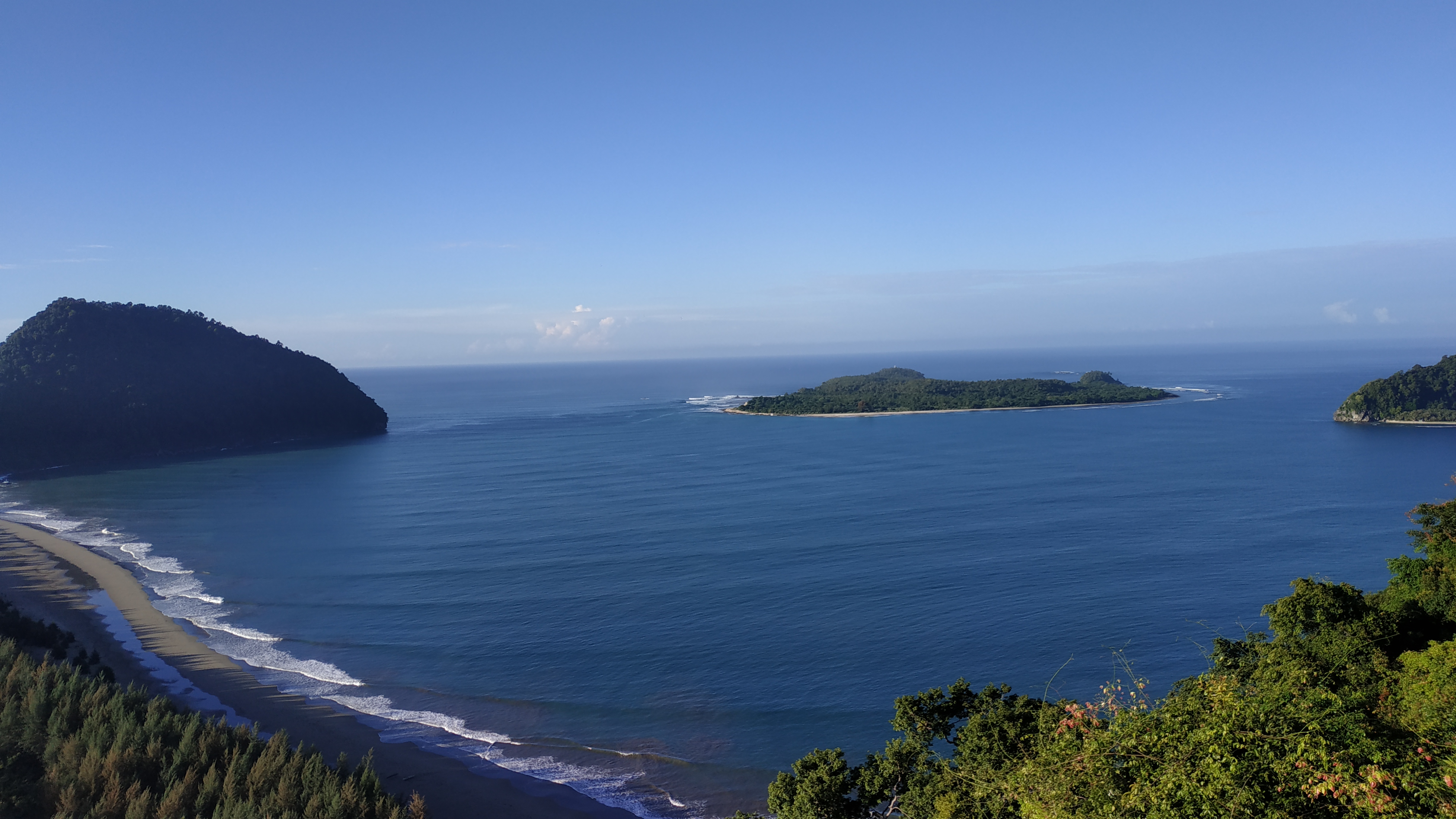
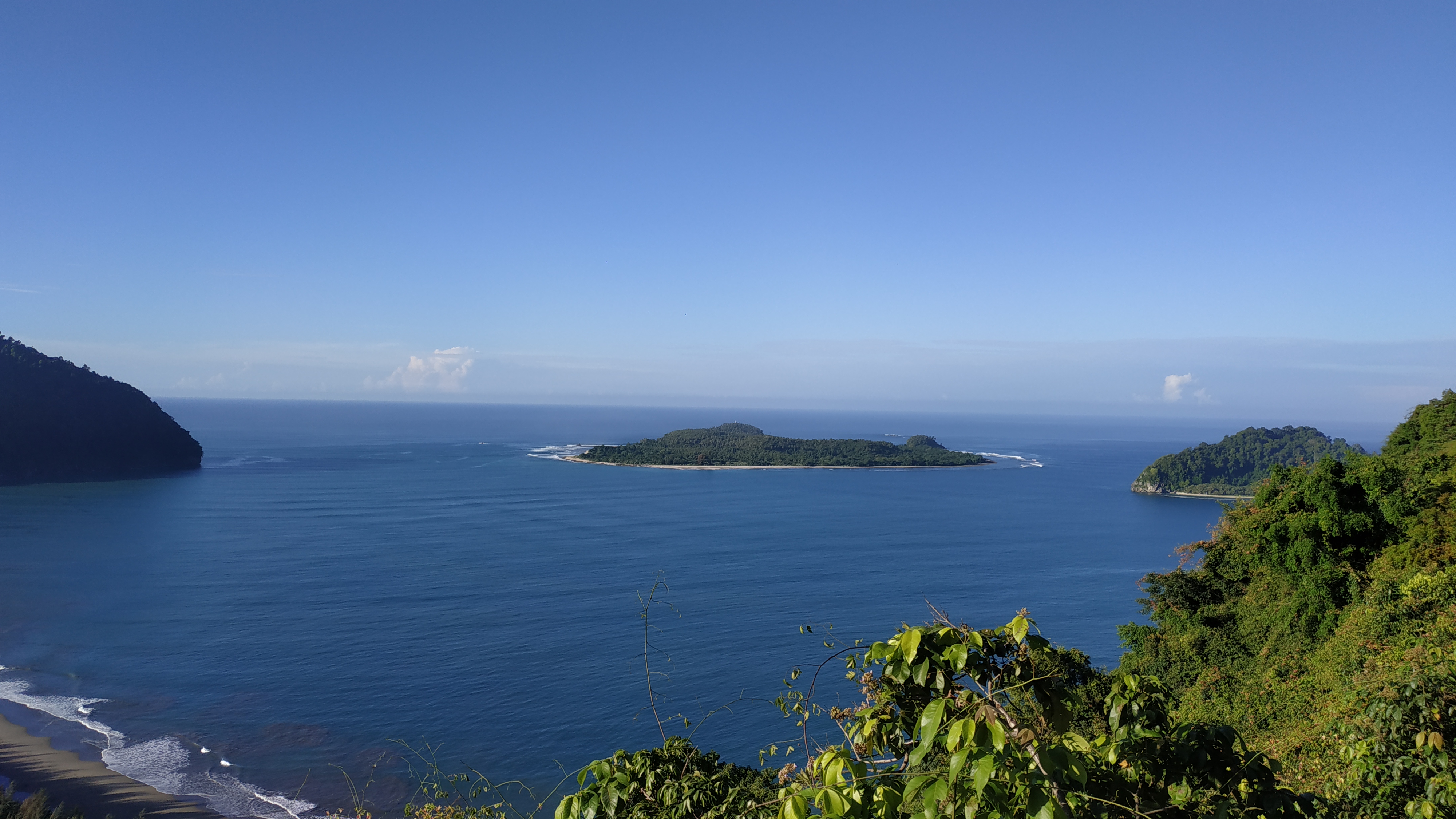
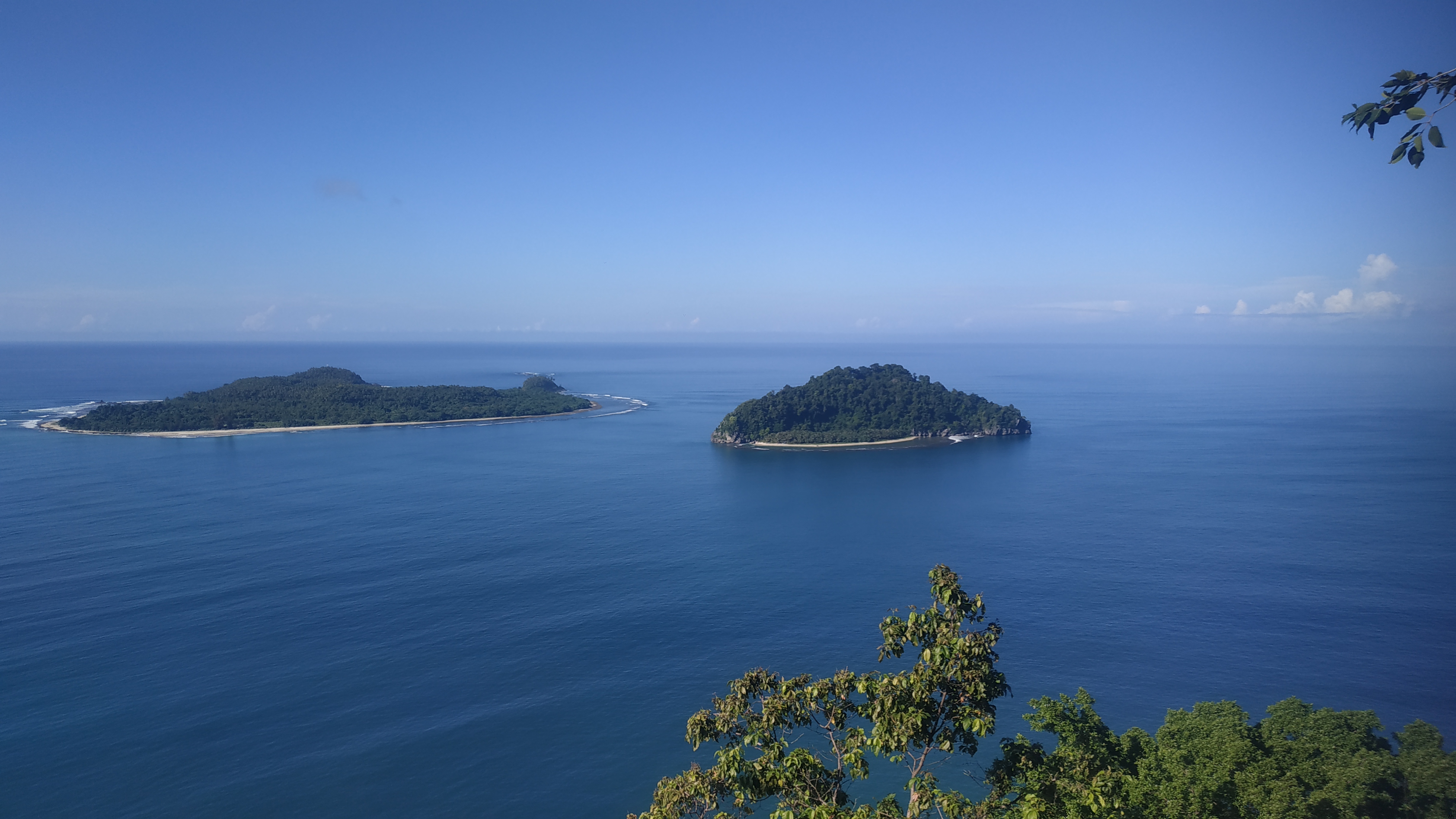
To reach the summit, one must pass through two mountains—Mount Paro and Mount Kulu—from the direction of Banda Aceh. In front of Geurutee Peak lies the beauty of Klah Island, an uninhabited island with white sandy beaches. This island is home to coconut plantations and is often used as a camping and fishing spot.
Historically, Geurutee Mountain plays a significant role in the context of natural disasters. It became widely known due to the devastating earthquake and tsunami that struck on December 26, 2004, affecting the entire Aceh region. This disaster caused massive destruction, including in the Lamno area, located not far from the base of Geurutee Mountain.
Almost all spots on the mountain offer seating areas that directly face the Indian Ocean. Visitors can enjoy an epic view and a serene atmosphere.


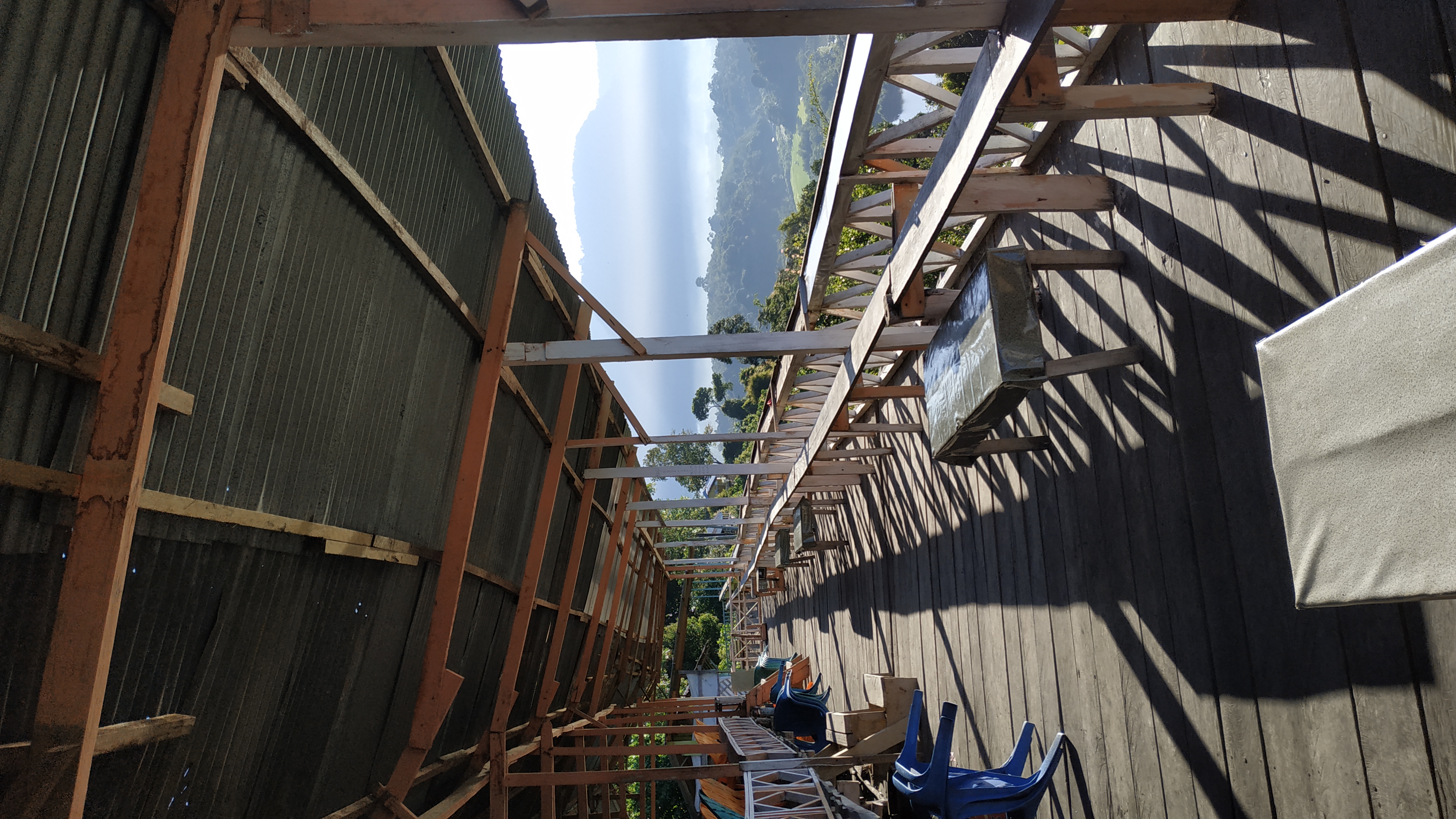
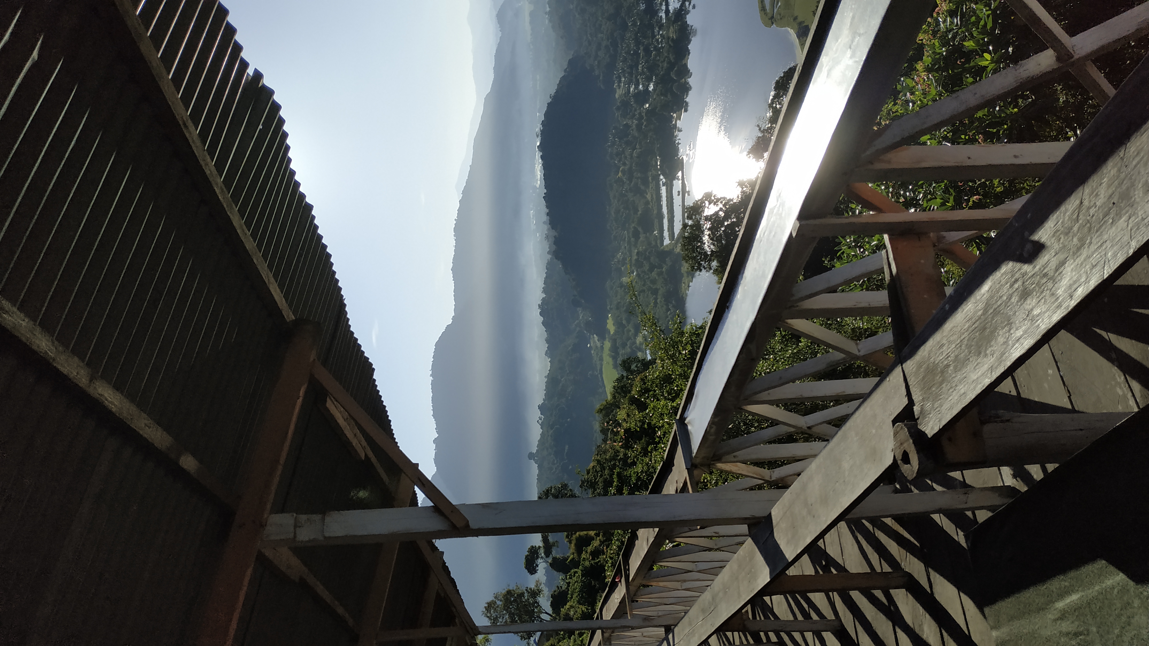
Today, Geurutee Mountain holds great potential as a natural tourist destination, particularly for hiking and ecotourism. Its pristine environment and tranquil ambiance make it an ideal spot for those wishing to experience the natural beauty of Aceh. However, reaching the summit requires extra attention due to the limited access and challengging terain.
These are the photos I captured with my phone. I hope to share more in the future with different themes. Please leave your votes and comments, as they will help me improve my writing. I apologize for any mistakes in my words.
Thank you… Best regards, photography enthusiasts!
This photo is an original work of mine, taken with my Xiaomi Redmi Note 5 camera.
You can check out this post and your own profile on the map. Be part of the Worldmappin Community and join our Discord Channel to get in touch with other travelers, ask questions or just be updated on our latest features.