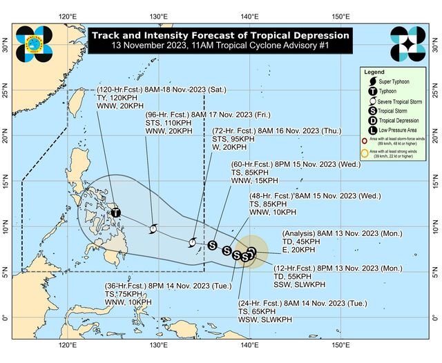
It was last observed at a distance of 1,540 km east of southeastern Mindanao. It carries maximum sustained winds of up to 45 kph, gustiness of around 55 kph, and is moving eastward at a speed of 20 kph.
According to the latest forecast track from PAGASA, the aforementioned storm may enter the Philippine Area of Responsibility on Wednesday or Thursday and will be named "Kabayan" locally
Source: GMA News