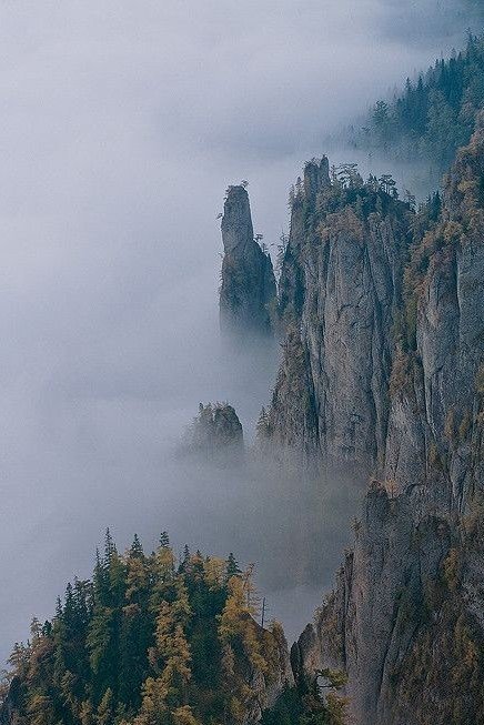
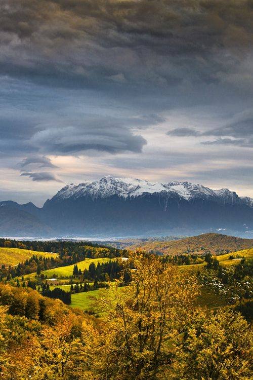
 ![Muntii Carpati.jpg]
The Carpathian Mountains are a mountain range belonging to the great central mountain system of Europe. The Carpathians, which are separated from the alpine chain between the Basin of Vienna and the Timok corridor (which separates it from Stara Planina in the Balkan Peninsula) form an arc with a length of 1500 km and a maximum width of 130 km, unfolding on 6 ° latitude and approximately 10 ° longitude. The mountains lie on the territory of eight countries: Austria, Czech Republic, Slovakia, Poland, Hungary, Ukraine, Romania and Serbia.
The highest peak of the entire Carpathian chain is the Gerlachovský peak, 2,655 m, in Slovakia - the Tatra Mountains. In Poland, the highest peak is the Rysy peak (2,499 m), in Hungary, the highest altitude is recorded at the peak of Kékes, 1,014 m, in Ukraine the highest peak is Hovârla peak (2.061 m) and in Romania is the peak Moldoveanu, 2,544 m, located in the Fagaras Mountains in the Southern Carpathians.
Etymology:
The name comes from the Dacian tribe of the Carpathians (Karpathos-Horos), who lived in Moldova, on the slopes of the Eastern Carpathians, a name that in turn probably came from an Indo-European word meaning stone.
Geography:
The Carpathians start from the Danube near Bratislava. They surround Transcarpathia and Transylvania in a broad semicircle, continuing to the southeast, and ending on the Danube near Orsova in Romania. The total length of the Carpathians is 1500 km and the width of the mountain range varies between 12 km and 500 km.
The highest width of the Carpathians corresponds to the highest altitude. The mountain range has the widest width in the hilly Depression of Transylvania, and at the foot of the Tatra Mountains (the highest elevation in the Carpathians, with Gerlachovský štít, which is 2 655 m altitude on the territory of Slovakia at the border with Poland. of 190 000 km2 and, after the Alps, is the most extensive mountain range in Europe.
Although the Carpathians are usually referred to as a mountain range, they do not actually form an uninterrupted chain of mountains. Rather, it consists of several distinct geological groups, presenting a large structural variety as the Alps. The Carpathians, which in only rare places exceed the altitude of 2500 m, do not have rocky peaks, extended snow zones, large glaciers, high waterfalls, or vast lakes that are common in the Alps. No area in the Carpathians is snowed all year and has no glaciers.
The Carpathians are separated from the Alps by the Danube. The two mountain ranges meet at one point: in the Leitha Mountains in Bratislava. The river also separates the Carpathians from the Balkan Mountains chain at Orsova.
Climate:
From the climatic point of view, the Carpathians enter the temperate-continental climate zone, showing different shades as a result of their latitude, longitude and altitude.
We can talk about a mountainous climate characterized by altitude elevation, which generates a decrease in temperature and an increase in the amount of precipitation as the altitude increases. Average annual temperatures fluctuate between 8 ° C at the foot of the mountains and -2 ° C at the highest peaks. The average annual rainfall varies between 750 mm and 2000 mm. At altitudes over 2000 m, precipitation is in most cases snow.
In the northern part there are the Baltic climate influences, in the west ocean, in the east climatic influences from the Russian Plain (cold and dry in winter), and in the southern Mediterranean.
waters:
The waters are very numerous. The most important rivers that have their springs in the Carpathians are: Nitra, Hron, Tisa (with its tributaries Bodo, Someş, Criş and Mureş), Jiu, Olt, Argeş, Ialomiţa, Siret (with its tributaries Moldova, Bistrita, Putna, Ramnicu Sarat and Buzau), Prut and Nistru.
On the highest peaks (especially in the North-Western Carpathians and the South-Eastern Carpathians) there are numerous glacial lakes. To this is added the anthropic lakes, in most cases accumulating lakes used for energy purposes.
geology:
The Carpathians formed in parallel with the entire alpine system, in the vast geosinclinal between the Russian Platform (in the East), the Caledon-Hercinic orogen (in the West) and the African Shield (in the South). Starting from the Cretaceous, in the formation of the Carpathians several phases of ascension movements belonging to the Alpine orogenetics took place.
Relief has gained its current appearance during the Quaternary, developing on a mosaic of rocks (crystalline shale, volcanic rocks, magma rocks and sedimentary rocks).
As in the Alps, the Apennines or the Scandinavian Mountains, the Carpathians contain numerous areas of karst and karst relief, relic glacial reliefs, a varied structural and petrographic relief.
Google Traducere pentru companii:Translator ToolkitInstrumentul de traducere a site-urilor web
Despre Google TraducereComunitateMobilDespre Googl (
( )
)
Sounds like an awesome place for a hike (At the lower altitude, that is)
iconic place
Good pot
This post has received a 0.55 % upvote, thanks to: @ionutciobanu.
You got a 0.55% upvote from @allaz courtesy of @ionutciobanu!
was twice in the Carpathians. very beautiful. clean air, not like in cities) went up to Hoverla. in one word, great. Upvoted
the @boomerang whitepaper.This post has received a 0.23 % upvote from @boomerang thanks to: @ionutciobanu@boomerang distributes 100% of the SBD and up to 80% of the Curation Rewards to STEEM POWER Delegators. If you want to bid for votes or want to delegate SP please read
mountains are beautful
mountans are always beaitful
nature is very beautful
nature is beautful
Very beautiful