For mountain climbers who want to satisfy the eyes, please come to Indonesia, because we have some mountains that really recommended by any tourist who ever come and see it live,
among others is refer to the news below.
Mount Rinjani

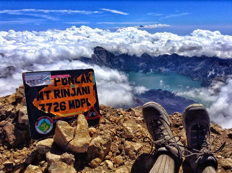
Mount Rinjani is a mountain located on the island of Lombok, West Nusa Tenggara. Mount is the second highest volcano in Indonesia with an altitude of 3726 m above sea level and located at latitude 8 º 25 'LS and 116 º28' BT is a favorite mountain for Indonesian climbers because of the beauty of the landscape. This mountain is part of Mount Rinjani National Park which has an area of about 41,330 ha and this will be proposed addition to 76.000 ha to the west and east.
Administratively, this mountain is located in three districts: East Lombok, Central Lombok and West Lombok.
Mount Rinjani with the highest point of 3,726 m above sea level, dominates most of the landscape of the northern island of Lombok.
To the west of the cone Rinjani there is a caldera with an area of about 3,500 m × 4800 m, extending towards the east and west. In this caldera there is Segara Anak (Segara = sea, lake) area of 11,000,000 sq. M with a depth of 230 m. The water that flows from this lake forms a very beautiful waterfall, flowing through a steep cliff. In Segara Anak there are many goldfish and mujair so often used for fishing. The southern part of the lake is called Segara Endut.

On the east side of the caldera there is a New Mountain (or Mount Barujari) which has a crater measuring 170m × 200 m with an altitude of 2,296 - 2376 m above sea level. This small mountain last erupted on October 25, 2015 and November 3, 2015 [2], having previously recorded the eruption in May 2009 and in 2004. [3] [4] If the 2004 eruption did not take any casualties, the 2009 eruption had killed 31 people indirectly, because of the flash floods in Kokok (Sungai) Tanggek due to lava pressure to Segara Anak. [5] Previously, Mount Barujari ever recorded erupted in 1944 (at the same time its formation), 1966, and 1994.
In addition to Mount Barujari there is also another crater that ever erupted, called Mount Rombongan.
Mount Bromo

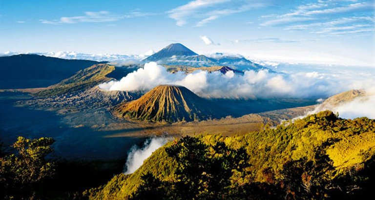
Mount Bromo is one of the active volcanoes in Indonesia, precisely in East Java and includes 4 districts of Probolinggo, Pasuruan, Lumajang, and Malang regency. As an active volcano, Bromo became a popular tourist destination in East Java and almost never deserted every day.
Its active status makes Mount Bromo more attractive to tourists. The height of Mount Bromo is 2,392 meters above sea level and has an interlocked body shape between the valley and the canyon with the surrounding caldera or a vast sea of approximately 5,300 hectares.

Mount Bromo is famous as the most beautiful and most visited tourist probolinggo icon. The word "Bromo" comes from the word "Brahma" which is one of the Hindu gods. Mount Bromo is not as big as other volcanoes in Indonesia but the view of Bromo is amazing. The magnificent beauty of Mount Bromo makes tourists amazed.
Mount Semeru

Mount Semeru or Mount Meru is a cone volcano in East Java, Indonesia. Mount Semeru is the highest mountain on Java Island, with its peak Mahameru, 3,676 meters above sea level (mdpl). Mount Semeru is also the third highest volcano in Indonesia after Mount Kerinci in Sumatra and Mount Rinjani in West Nusa Tenggara [1]. The crater at the top of Mount Semeru is known as Jonggring Saloko. Mount Semeru is administratively included in the territory of two districts, namely Malang Regency and Lumajang Regency, East Java Province. This mountain is included in the area of Bromo Tengger Semeru National Park.
Semeru has a Dipterocarp Hill forest area, Upper Dipterocarp Forest, Montane forest, and Ericaceous Forest or mountain forest.
Semeru's geographical position lies between 8 ° 06 'LS and 112 ° 55' BT.
In 1913 and 1946 Jonggring Saloka crater has a dome with an altitude of 3744.8 m until the end of November 1973. To the south, this dome breaks down the crater rim causing lava flows to lead to the south side covering Pronojiwo and Candipuro areas in Lumajang.


Please link your source content. This is actually Plagiarism content.
Similar Image found. https://www.quora.com/Backpacking-travel-Where-in-the-world-is-the-best-place-to-go-hiking-for-three-weeks-this-January
sorry I collected the data with wikipedia and I know that the mountain originated from Indonesia because I am Indonesian
@sharkanshakeel where a mount of karimata, really best view at sunset
Wonderful!
@latahzan, wait a momment im posting just for your request okey...