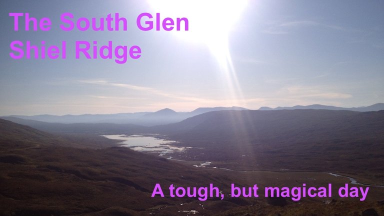
I returned to the beautiful, remote area of Kintail a couple of weeks ago, to do a walk I've been planning for most of this year.
Coincidentally, it brought me to my halfway point as a "Munro-bagger". I have now climbed 141 of the 282 Munros (Scottish mountains with an altitude in excess of 3,000 feet).
A centenary event
I pledged to do the Glen Shiel Ridge for a project called The Munro Table, that was set up to commemorate the 100th anniversary of the death of Sir Hugh Munro, after whom the Munros were named. Sir Hugh Munro was the first to compile a list of Scotland's highest mountains, over 3,000 feet, in the 1880s.
The organisers plan to present each climber's account of the ascent of their chosen Munro, or Munros, in a publication which will be presented on a table made out of wood from Lindertis, the family home of Sir Hugh Munro.
Many of the hills I wanted to choose were already taken, so I closed my eyes and scrolled down the list. The randomly-selected mountain I clicked on was Maol chinn-dearg.
I did an online search, and found out that this mountain is part of the South Glen Shiel Ridge, one of the most celebrated hillwalking routes in the Highlands, which takes in seven Munros.
I contacted the organisers of the Munro Table, and they said they would be happy for me to write about the entire route.
Oil filter hiatus
My initial intention was to do this walk during a hot spell in July, with an overnight camp on one of the summits – but unfortunately my car's oil filter exploded on the way up north, so that plan had to be shelved!
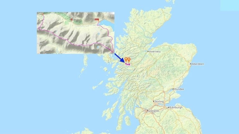
Map of the route and location. Larger image here.
The South Glen Shiel Ridge runs parallel to the A87 trunk road, with a distance of 12km (7.5 miles) between the start and the finish, so if you do the walk solo, you have to either cycle, hitch hike or walk almost 7km to the hamlet of Shiel Bridge to get one of the two or three buses a day back to the start.
Luckily, I found a friend, Oleysa, who was free to do the walk on the day I planned to go, and we were able to leave one car at the start and another at the finish.
We started the walk at about 8.30am, as sunset was at 7.30pm, and the entire walk takes an estimated 9 to 11 hours, covering a distance of almost 27km with a total ascent of 1818m. We started the walk close to the Cluanie Inn, having left my car at the other end of the walk, 12km away.

The path up to the ridge starts out as a vehicle track. To the right is the Cluanie Inn, with Aonach Mheadhoin, one of three hills that make up the Brothers ridge, behind it. Larger image here.
An "off day"
It was a beautiful day, and we both couldn't wait to get started. Unfortunately, shortly after we set out, I realised that I was struggling to keep up with Oleysa. I have walked with Oleysa a few times before, and I know that she is a very fit and quite fast walker. However I'm also generally quite a brisk walker, especially on the steep ascents. I build up my leg muscles on the climbing wall!
But this day was different. I began to get the horrible awareness that this was going to be an off day for me. I'm not sure why – I just hope it's not a lasting condition!
Luckily, Oleysa was really patient. She is passionate about plants, and has expert knowledge about them. Every time I stopped to take a breath, Oleysa would spot an interesting specimin to photograph. She explained how to tell the difference between a cowberry and a bearberry.
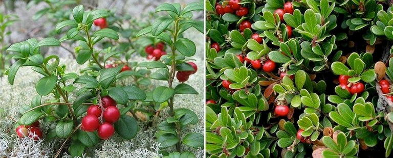
Left: cowberries (source); right: bearberries (source).
Both plants have small dark green leaves and bright red edible berries, and they can be differentiated by looking at the reverse of their small leaves. Cowberry leaves have straight, parallel veins on the reverse, while the reverse of bearberry leaves are randomly patterned, like a jigsaw.
It was a hot day, and we paused several times to grab handfuls of crowberries. These are small black berries, also edible, which are often confused with delicious blaeberries, though it's easy to tell them apart because their leaves are very different.
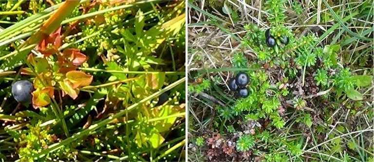
Left: blaeberry; right: crowberries.
Crowberries have a much blander taste. What I didn't realise was that in September, when the blaeberry season is over, crowberries become very juicy and refreshing. I copied Oleysa, cramming handfuls of them into my mouth, where they would burst with unexpected flavour.
I was surprised to find that they were actually quite tasty!
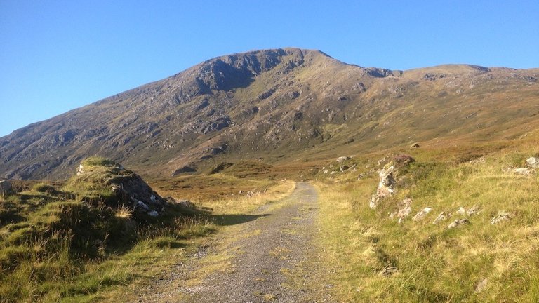
First view of the summit of Creag a' Mhaim, the first Munro of the day. Larger image here.
We reached the first summit of the day at about 11.20am. It had taken us almost three hours to get this far, but we'd already walked almost 9km, with a climb of almost 750m – not far off half of the total ascent for the whole day! That's quite an encouraging feeling.
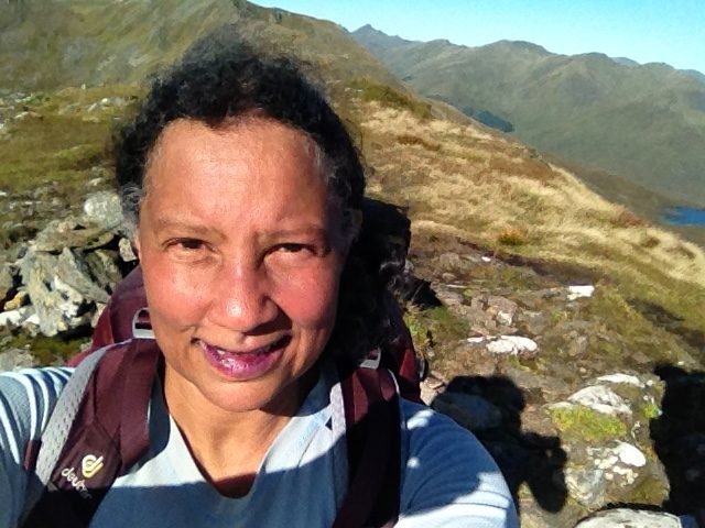
Summit selfie with purple crowberry lips!
At this stage, the realisation that we had another six summits still to climb did not dismay us, despite my unusual weariness, because it was such a beautiful day and we were just happy to be out in one of the loveliest parts of Scotland.
I was glad to take the first summit selfie of the day – until I looked at the photo, and saw that my lips were bright purple! I yelled in alarm, wondering if they'd gone blue with exhaustion!
Oleysa burst out laughing.
"It's the crowberries!" she said.
Clear summit views
To the south, the hills of Glen Nevis were clearly visible, with the prominent bulk of Ben Nevis, the UK's highest mountain, at the centre.
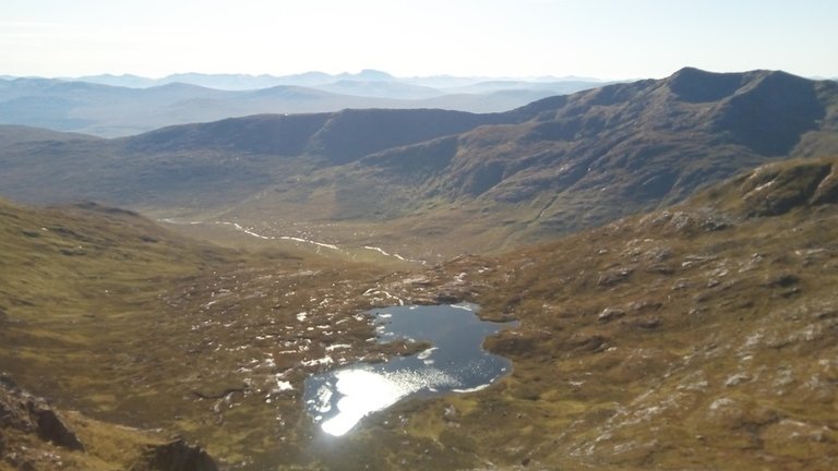
Coire nan Leac, with Ben Nevis directly beyond, the highest mountain on the horizon. Larger image here.
I spotted a very distinctive looking hill to the west, and my PeakFinder app told me that it was Dun Caan, the highest hill on the island of Raasay. It's just 444m high, but with a very unusual wedge-shaped summit. Definitely one for another day!
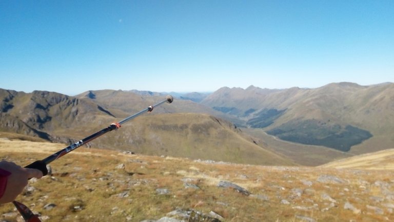
This was me trying to point out Dun Caan, but my camera hasn't managed to see as far as my eyes were able to! Larger image here.
We were now high enough to see the entire area of Loch Cluanie. Oleysa pointed out that we hadn't made much progress from our starting point at its western end!
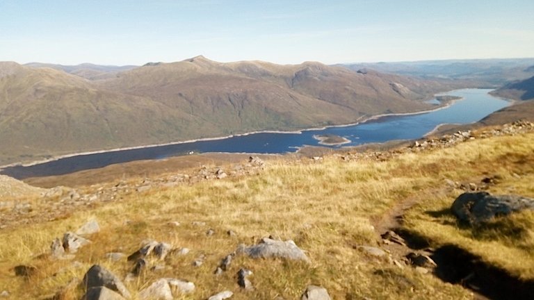
Loch Cluanie. We started out from its west end, at the left of the photo. Larger image here.
One and a half kilometers further on, with about 115m of ascent, and we were at the top of the second Munro of the day, Druim Shionnach ("The ridge of the fox"). We saw no foxes here, just more glorious views.
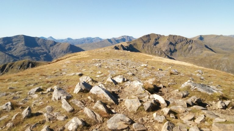
This was the view from the second Munro on the ridge, Drium Shionnach, towards the third Munro, Aonach Air Crith. Larger image here.
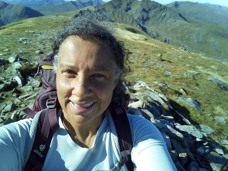
Summit selfie at Druim Shionnach.
Trembling ridge hill
We decided not to linger here, as we still had more than 14km to cover, with five more summits. The next one, Aonach Air Crith, "the trembling ridge hill", was just over 2.5km away over undulating terrain with a climb of about 170m.It's the high point of the ridge, at 1021m.
How Aonach Air Crith got its name, I have no idea. This area is not generally hit by earthquakes, but I can imagine that there may have been a few landslides over the years, which may have made the mountain look as if it was "trembling"!
Pinnacles and an airborne sitting mat
On the way to this rather ominous-sounding summit, Oleysa found a prominent rocky pinnacle to perch on.
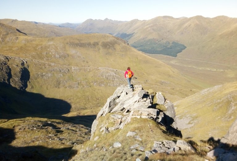
Larger image here.
I had to have a go too!
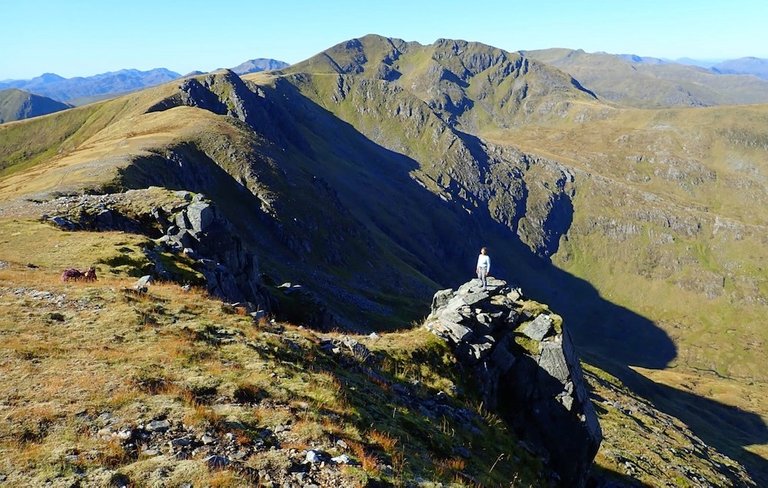
As we approached the "trembling ridge hill" I was just trembling with fatigue! At the summit, a couple caught up with us, and just after we exchanged a few friendly words, the man's plastic sitting mat was whisked away by a sudden gust of wind. As it drifted down a steep grassy incline, I said:
"Oh dear, what a pain! But maybe not worth risking an accident for."
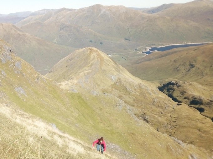
The words were barely out of my mouth before Oleysa started charging down the steep hillside in hot pursuit of the plastic mat. I suspect this was more because she didn't want to see litter in such a beautiful area, rather than an attempt to save the man the £2.99 or so it would cost to replace the mat.

I was also concerned that another gust of wind might whisk the mat away just before Oleysa could reach it, but thankfully that didn't happen. She was soon charging back up the hill with the mat in her hand.
Lunch, dehydration and fatigue
We were now more than halfway across the ridge, and it was 1.30pm, so we decided to take a break for lunch. Oleysa didn't look very tired, in spite of her unscheduled hillside dash, but I was feeling so fatigued I was starting to seriously wonder whether I'd manage to complete the ridge walk all in one go.
I was also much more thirsty than usual, and aware that I probably hadn't brought enough water with me. There were no signs of any likely places to refill our water bottles along the ridge.
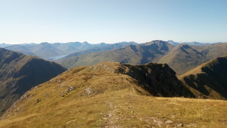
The ridge winding on ahead after Aonach air Chrith. Larger image here.
I hadn't told Oleysa that I was approaching my Munro-bagging halfway point, or that I was carrying a small bottle of Prosecco in my backpack.
I wondered if I'd be taking it back unopened, down one of the South Glen Shiel Ridge's "escape routes" that lead back to the main road.

To be continued...
Posted from my blog with SteemPress : http://ramblingandscrambling.co.uk/mountains/seven-munros-in-a-day-and-halfway-to-compleation/
long shadows and grand mountain views! Awesome berries, we got
some of the same ones here, oh those lip colors! :-)
Outstanding mountain walk and post!Wow what a fantastic walk, hike @natubat! So beautiful there, the
!BEER
Thanks @shasta! Really glad you enjoyed it. And thanks for the !BEER tip.
Sorry, you don't have enough staked BEER in your account. You need 6 BEER in your virtual fridge to give some of your BEER to others. To view or trade BEER go to steem-engine.com
I'm sure these grow on the roadsides and canals here.
As I kid I was always told.. 'poison, you will die if you eat those!'
You always listen to the grown-ups right?
I never ate them, even though they looked like toffee's... sulk
I'm the same - I was warned off colourful berries as a child, though I think the white ones are the most dangerous! You do have to make sure they're the right ones, so I'm not sure if these are the same ones that grow on roadsides. Check the leaves!
There are other red berries that you can eat - haw berries and rowan berries taste a bit yeuch, but they're nice in jam, as are rosehips. It might be haw berries that you see on the roadsides. They're the berries of the hawthorn tree, and you see them all over the place. They're not poisonous. But you won't like them!
Haw berries
Yes those are the ones!
If my dog wont eat them, they are generally not edible.., though he spits out blackberries.. fussy bugger!
Haha! He's got no taste. Blackberries are my favourite.
He's still dumb enough to take them, then spits em out.. fussy hound!
Congratulations, Your Post Has Been Added To The Steemit Worldmap!
Author link: http://steemitworldmap.com?author=natubatPost link: http://steemitworldmap.com?post=sevenmunrosinadayandhalfwaytocompleation-2xrsus2buj
Want to have your post on the map too?
Daily Travel Digest #659.
 Hiya, @LivingUKTaiwan here, just swinging by to let you know that this post made into our Top 3 in Your post has been manually curated by the @steemitworldmap team. If you like what we're doing, please drop by to check out all the rest of today's great posts and consider upvoting and supporting us.
WOW 141 done your really making great progress and amazing shot sin this post, we all have off days and it was good your friend was understanding
Thanks! Glad you liked the photos.
👍🙂👍
Thanks for taking us on another epic hike! And the Cluanie Inn, that brings back lovely memory of my one and only Scotland trip. Miss that..
@tipu curate
Upvoted 👌 (Mana: 5/20)
Thanks @livinguktaiwan! Even writing it was quite an epic, haha! I was reliving the exhaustion, and the exhilaration too :)
So much to take in, in this post! You say these are "walks", but it looks pretty steep and scrambly in some places!
Thanks @exhaust! It was quite a day. There are some steep bits, but it's really not as knife-edge as it looks. And there are two or three scrambly bits, but they can mostly be avoided.
View or trade
BEER.BEERfor you. Enjoy it! Hey @natubat, here is a little bit of