

Narail District (khulna division) area 978.76 sq km, located in between 23°02' and 23°19' north latitudes and in between 89°23' and 89°48' east longitudes. It is bounded by magura district on the north, khulna and bagerhat districts on the south, faridpur and gopalganj districts on the east, jessore district on the west.
Population Total 698447; male 353201, female 345246; Muslim 549702, Hindu 148339, Buddhist 186, Christian 21 and others 199.
Water bodies Main rivers: madhumati, chitra, nabaganga, bhairab.
Administration Narail district was formed in 1984. Of the three upazilas of the district narail sadar is the largest (381.76 sq km) and lohagara is the smallest (290.83 sq km). Narail Town stands on the bank of the Chitra.
District
Area (sq km) Upazila Municipality Union Mouza Village Population Density (per sq km) Literacy rate (%)
Urban Rural
990.23
3
2
37
445
651
85809
612638
705
45.56
Others Information of District
Name of Upazila
Area
(sq km)
Municipality
Union
Mouza
Village
Population
Density
(per sq km)
Literacy rate (%)
Kalia
317.64
1
12
111
187
208024
654
41.04
Narail Sadar
381.76
1
13
180
231
269423
706
54.73
Lohagara
290.83
12
154
233
221000
760
47.72
Source Bangladesh Population Census 2001, Bangladesh Bureau of Statistics.
NarailDistrict.jpg
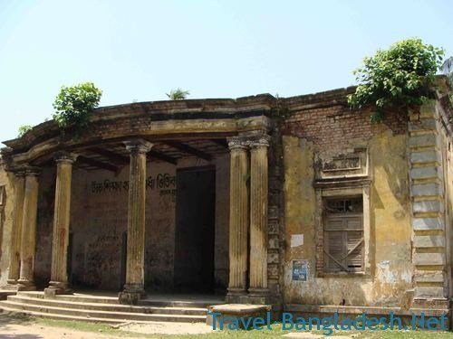
Archaeological heritage and relics Goal Bathan Mosque (1654), homestead of Raja Keshab Roy at Wazirpur (Narail Sadar), Kadamtala Mosque, ancient underground building at Banshgram, Math of Baradia (Kalia), Ghazir Dargah at Naldi, Radha Govinda Mandir at Jorbangla, Kalibari at Lakshmipasha (Lohagara).
History of the War of Liberation On 26 March 1971, the youths of Narail, under Professor Nur Mohammad Miah captured all arms and ammunitions of Narail Armoury and carried these to Lohagara. On 1 April a group of freedom fighters marched towards Jessore Cantonment to launch attack. On 2 April the freedom fighters raided the Rupganj military camp and, later on killed 60 Pak soldiers at the Narail ferry ghat while fleeing from the camp. On 3 April the Pak army launched an attack on Narail town. A number of establishments were damaged and the Town was virtually vacated due to air raids on Narail town by the Pak army on 6 April. On 13 April the Pak army established their camp at Narail. In early May the Pak army, in collaboration with the local razakars captured school teacher Sheikh Abdus Salam of Kalia Pilot High School from Ramsiddhi and killed him on 13 May in the Jessore Cantonment. On 23 May the Pak army killed 39 innocent people at Itna of Lohagara upazila. They conducted mass killing and plundering including violation of women in the upazila. On 17 July, the Pak army in collaboration with the local razakars captured 8 innocent persons from village Tularampur, took them to Water Development Board Camp and killed all of them. On 7 December the Pak army and razakars killed freedom fighter Mizanur Rahman at village Mahimdia. On 9 December the freedom fighters launched a concerted attack on the Pak military camp in which another freedom fighter Motiar Rahman was killed. On 10 December the freedom fighters attacked the Pak army from all sides and liberated Narail. On 14 December Major muhammad abul manzoor, Commander of Sector 8 of the war of liberation formally hoisted the flag of the Independent Bangladesh at the Dakbangalow of Narail.'
Marks of the War of Liberation Mass grave 2 (at the premises of the Water Development Board of Narail Sadar and at village Itna of Lohagara upazila).
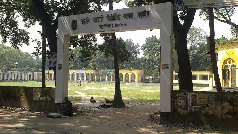
Literacy rate and educational institutions Average literacy 48.56%; male 52.38%, female 44.69%. Educational institutions: college 22, homeopathic medical college 1, agricultural and technical college 1, technical school and college 1, secondary school 115, primary school 458, satellite school 20, community school 7, orphanage 73, blind school 1, kindergarten 1, madrasa 190. Noted educational institutions: Narail Government Victoria College (1886), Lakshmipasha Ideal School (1889), Lohagara Model College, Munshi Manik Mia Degree College, Narail Victoria Collegiate School (1857), Itna High School and College (1900), Kalia Shaheed Abdus Salam Degree College (1972), Narail Boys' High School (1854), VC High School (1857), Kalia Pilot High School (1865), Itna Higher Secondary School, Narail Government High School (1903), Lohagara Pilot High School (1906), Maliat Secondary School (1906), Kalia PS Pilot Secondary Girls' School (1911), The Patna Academy (1912), Habakhali Hamidunnechha Secondary School (1916), Naldi BSS High School (1916), Kashipur AC High School (1916), KDRK Secondary School (1920), Singasolpur KP Secondary School (1921), Singia-Hatbalpur Secondary School (1921), Parbati Bidyapith (1923), Itna Secondary School (1930), Barai Para Primary School (1850), Babra Primary School (1895), Sahabad Majidia Aliya Madrasa (1950).
Main sources of income Agriculture 62.08%, non-agricultural labourer 2.51%, industry 1.48%, commerce 13.20%, transport and communication 3.47%, service 9.87%, construction 1.00%, religious service 0.20%, rent and remittance 0.86% and others 5.34%.
Newspapers and periodicals Daily: Ocean; weekly: Narail Barta; fortnightly: Kiran, Bhorer Alo (defunct); monthly: Prantik; periodical: Kalyani and Barujibi Samachar, Bhaskar, Gramer Bani, Jagriti, Raktarin, Hathchhani, Bijoy, Sahittakali, Fera, Shekorer Sandhane and Satabdir Alo.
Folk culture Notable folk songs of the district include Jarigan, Kabigan, Kirtan, Haloigan, Bhatiali, Meyeli geet (songs sung by women), etc; besides rhymes, riddle, mantra, proverbs and folk tale are also popular in the district. Folk traditions of the district include inviting rain by putting mud on the body and singing of songs and distribution of sirni (sweet), floating of flowers and leaves on water on the last day of Ashwin (BS) to avoid diseases, distribution of Sirney to protect epidemic of cattle etc. Folk games and sports prevalent in the district are boat race, Chiburi, Kutkut, Kabadi, Echingbiching, Kanamachhi, Ekkadokka, etc.
Amusement centres Shishu Sarga (Narail Sadar Upazila); Niribili Picnic Spot and Niribili Farmhouse (Lohagara Upazila); Eco-park 'Arunima' (Kalia Upazila). [Md. Hamidul Haq Munshi]
See also The upazilas under this district.
References Bangladesh Population Census 2001, Bangladesh Bureau of Statistics; Cultural survey report of Narail District 2007; Cultural survey report of upazilas of Narail District 2007.
Categories:
Districts of BangladeshLocal Government
Hi! I am a robot. I just upvoted you! I found similar content that readers might be interested in:
http://en.banglapedia.org/index.php?title=Narail_District
ohhh...yes
I interested...please give upvote in this post