Project Global Forest Watch (GFW) monitors changes in Earth's forest cover analysing satellite images with resolution 30 meters per pixel. Previous data set, released in 2013, revealed that area of forest cover has decreased since 2000 to 2013 by about 1.5 million km2 which is 1/3 of all EU area.

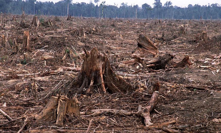
Image: Alain Compost/WWF-Canon
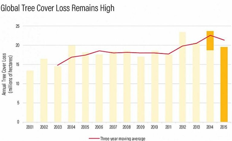
New GFW dataset shows that global tree cover loss remains high:

Image: Globalforestwatch - Deforestation rate 2000 - 2015
While the rate of forests loss decreased as compared to 2012-2014, still only in 2015 our planet lost about 20 million hectares (1 hectare=100x100m) which is about Uruguay's area.
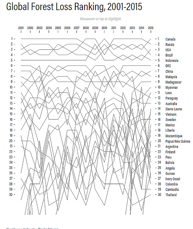
The next diagram reveals that leaders in deforestation rate are Northern countries - Canada and Russia

Image: Globalforestwatch - Intractive diagram is here
As was suggested earlier, the problems of Northern forests (taiga) are results of fires which are caused by global climate change (warming in Arctic). However new release says that these data need to be re-checked (new data on tree growing are expected in 2018).

Image: taigaclaymon - Burnt-out taiga
The map of forest cover changes in 2011 - 2015:

Image: Globalforestwatch
While in equatorial areas deforestation is mainly caused by human activities, in the Arctic regions fires do all work. Global warming is causing an increase in the frequency of forest fires in boreal coniferous forests. This means that deciduous trees, which generally only appear as pioneer plants, could potentially dominate the landscape in the long run. And these could potentially become even more serious by the end of the century, even if we do somehow manage to limit global warming to 2 degrees, the latest de facto target for global climate policy.
As a whole the last GFW report looks disappointing. The biosphere of our planet continues to transform into some unknown with lower biodiversity.
Sources:
[1] http://blog.globalforestwatch.org/
[2] https://www.mpg.de/10315240/taiga-fire-sibiria-climatechange