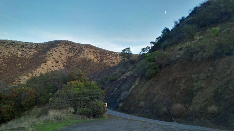
Lake Beryessa, located in Solano and Napa counties in rural northern California is a large manmade lake. I took a trip up to the edge over the weekend to walk on some of the trails surrounding it. Also in no small part I went for the drive. The road out to the lake from Winters has a lot of nice curves and hills and, rather surprisingly, a speed limit of 55 MPH. A speed like that on a road this twisty is rare, so it is one of my favorite driving roads. I have seen quite a few wrecked cars out here and pieces of them, plus the Wragg Fire a few years back that took out a lot of the forested area was caused by a car going off into some bushes here, so apparently I'm not the only one.
When you first get to the lake, it is by the Monticello Dam, which created the lake. It is named for the town of Monticello, CA that used to exist in the valley that is now under the river. I once saw a tricked out Lancer Evo that had crashed and been demolished right into the wall in front of it. Right by there is a giant spillway known as the Glory Hole.
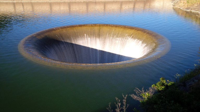
I wouldn't recommend trying to use it as a bathroom glory hole. The Glory Hole was not operational for years because of the drought in California, causing the water to not reach the spillway until earlier this year, when it operated for the first time in close to a decade. This picture was taken from a previous trip, it is currently non-operational again.
At the end of this stretch of road there is a marina where small watercraft can launch from. I've generally gone out on week days and found the lake nearly empty of water traffic. There are a few spots with trash cans where people sit on the beach, though from my experience, it has generally been quiet.
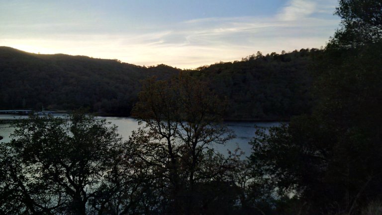
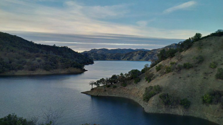
There are some trails around the water here forested off from the road but with good views of the lake. Be careful though, I once stepped on a rattlesnake I didn't see right by where this picture was taken. He rattled with much displeasure at me!
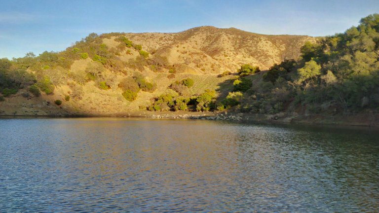
This is a shot taking from a spot with a nice flat beach where people occasionally swim and fish from. I didn't go in the lake this time, but at times it has been surprisingly warm enough to at least wade in. The rock is largely sandstone and will crumble when you walk in it. During the drought, the water level receded significantly, closing off a lot of the boating docks further down the road. During that time, you could walk around and find all kinds of things that had been underwater for probably many years. I found a can dating back to the '80s. I wish I took more pictures then. I actually found a pair of sunglasses I used for a while until I left them on my passenger's seat and they got sat on. The water level came way back up this spring, but has dropped off since. I found this unopened beer can that was probably underwater for a few months until the level receded.
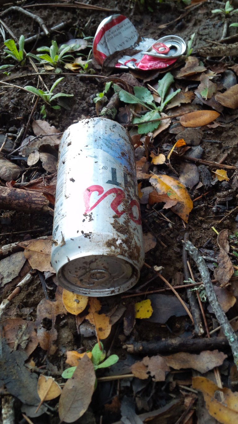
I declined to drink it. Maybe if it had been a better beer.
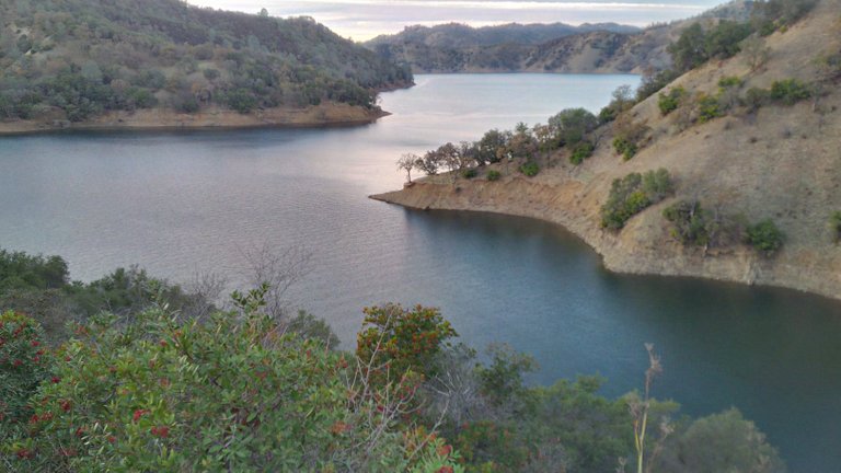
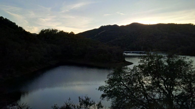
This is where it goes out to the main part of the lake. All of these pictures here are at the very edge, the lake itself is far, far bigger and has a couple of islands in it, along with something like 165 miles of coastline. It outflows from the dam and glory hole into Putah Creek and from there into Winters and Davis, CA.
