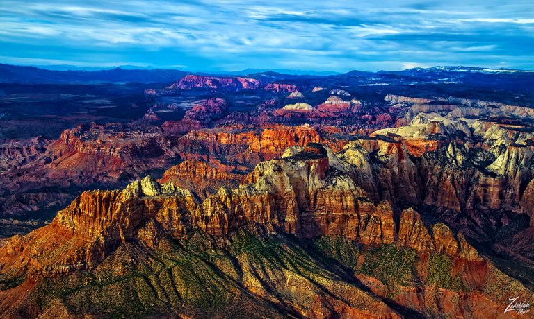
This is a unique aerial view of Zion National Park showing numerous landmarks across the distance. Spread out across the Markagunt Plateau and Kolob Terrace, Zion is located at the intersection of three geographic provinces: Colorado Plateau, the Great Basin, and the Mojave Desert.
 Mount Kinesava & Altar of Sacrifice ~ Click to Enlarge
These otherworldly looking formations are the jagged edge of a huge area that has been twisted, uplifted, tilted, and eroded over time, forming a geological feature known as the Grand Staircase; a series of colorful cliffs stretching up out of the Grand Canyon all the way up to Bryce Canyon and over to Zion National Park.
These remarkable geological wonders have formed together over hundreds of millions of years. The bottom layer of rock at Bryce Canyon is the top layer at Zion, and the bottom layer at Zion is the top layer at the Grand Canyon.
Zion and its surrounding wilderness started out as a flat basin with an elevation near sea level around 240 million years ago. As sands, gravels, and mud eroded from surrounding mountains, these materials ran into the basin and were deposited in layers. Each layer originated from a distinct source and so differs in thickness, mineral content, color, and eroded appearance. In this image you can see the stratified layers clearly along Mount Kinesava across to the Towers of the Virgin.
To read more about this and view a location key showing different places you can visit in this remarkable national park please visit my post about it here on "Where Eagles Fly".
About The Project
Where Eagles Fly - The American Wilderness Expedition is my personal mission to introduce people to these amazing locations that surround us. I am piloting a bush plane while exploring and filming throughout the remote back-country areas of North America to raise awareness of the 47% of the USA and 90% of Canada that remain unpopulated wilderness.
About The Author
My name is Zedekiah Morse and I'm a Bush Pilot, Photographer, Explorer and Filmmaker. I live in the Rocky Mountains and devote my time and resources to exploring as much of the world as I can by air. If you wish to watch a short film detailing how I do my work and this project, go here.
If you like what you see here upvote and resteemit so that others may experience these wondrous places.
And if you'd like these images to be part of your feed, follow me.
Thanks for your support and Yehaw!!
The cliff is colored, very beautiful if you can see it from a height. I just heard the name of the Grand Canyon, thanks to the project you are doing the more insight I get. Thanks for sharing @skypilot. Keep working and always success for you.
Thanks so much for your continued support... I am happy you enjoy reading about these places.
Ur welcome @skypilot. I am also glad to be able to give encouragement to extraordinary people like you, with all your projects and great work.
Beautiful view. I would be very satisfied if you can photograph the scenery in the air like mu, success for your photo friend
Thanks again Zedekiah for those remarkable geological wonders. As I already told you in coments before I saw some of those gorgeous places. Today you told me very interesting thing : The bottom layer of rock at Bryce Canyon is the top layer at Zion, and the bottom layer at Zion is the top layer at the Grand Canyon. I was there and I didn’t know that and all other interesting geological informations. When we visit these places next time, we will remember your exlanation for sure 😃👍🏻👋🏼
Hey that is pretty cool right? And you can really see this when you are flying around the area. I hope you will continue to follow my posts and enjoy the information!! That is exact;ly why I am doing this!