This is an aerial image I lensed of Sardis Lake while exploring the wilderness areas of Northern Mississippi and Arkansas during the early morning in the fall. Flying at an altitude of around 3,000 ft (914 m) I came upon this remarkable view of the Lake and its surrounding marshlands along the Tallahatchie River, which flows through the lake.
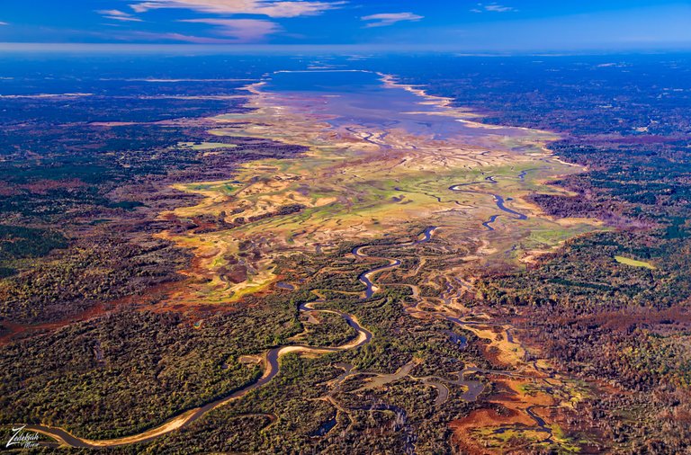 Sardis Lake & Little Tallahatchie River ~ Click to Enlarge
 Sardis Lake is a 98,520-acre (398.7 km2)man-made lake reservoir on the Little Tallahatchie River in Lafayette, Panola, and Marshall counties, in the US state of Mississippi. It is impounded by Sardis Dam, which is located nine miles (14 km) southeast of the town of Sardis, approximately an hour drive from Memphis, Tennessee. The dam which created the lake is 15,300 feet (4,700 m) long, has an average height of 97 feet (30 m), and a maximum height of 117 feet (36 m).
(Research Source)
This area is all part of the Yazoo River Headwaters, an area formed by the confluence of the Tallahatchie and the Yalobusha rivers and all part of the vast geographic region known as the Mississippi Delta. One thing for sure, when flying above this area, Sardis Lake stood out very clearly with its vibrant multi-colored hues, especially against the large green and lush delta landscape under such a deep blue sky!
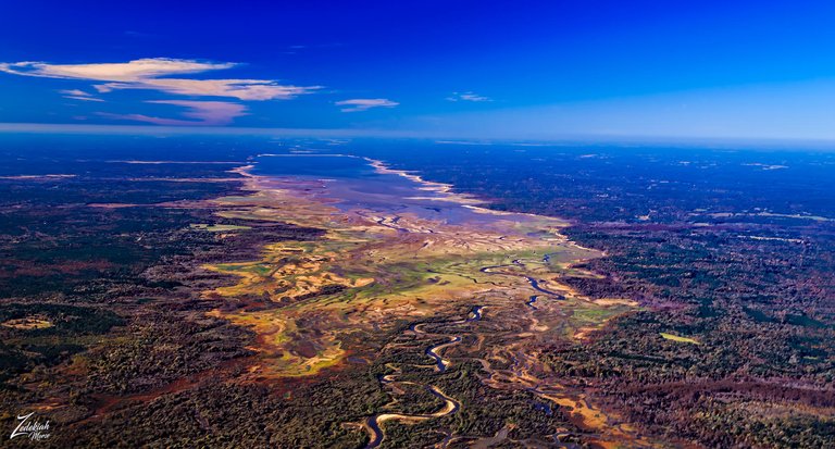 Sardis Lake & Surrounding Mississippi Delta ~ Click to Enlarge
 The Mississippi Delta is the distinctive northwest section of the U.S. state of Mississippi (and small portions of Arkansas and Louisiana) which lies between the Mississippiand Yazoo Rivers. The region has been called "The Most Southern Place on Earth" ("Southern" in the sense of "characteristic of its region, the American South"), because of its unique racial, cultural, and economic history. It is 200 miles long and 87 miles across at its widest point, encompassing circa 4,415,000 acres, or, some 7,000 square miles of alluvial floodplain.
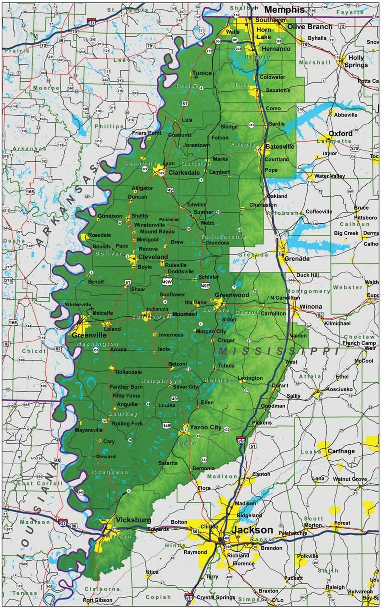
The Mississippi Delta is renowned for its dense and lush forests, swamps and marshes. Many times when flying across these lands I really would hate to lose my engine and have to make an emergency landing in this swampy area. I have heard of airplanes going down in here and never being found again!
The following image is a close up of the Little Tallahatchie River which flows into and from Sardis Lake. This image was lensed on the eastern side of the lake from al altitude of about 2,000 ft (609 m) and clearly shows the numerous rivulets and ambrosial marshes that propagate along the river as it shifts its course over time, building up sand and then altering a course around those sands to create new river paths. And in the course of this constant shifting, creating wetland marshes and swamps along the way.
 Little Tallahatchie River & Ambrosial Wetlands ~ Click to Enlarge
The different vibrant colors are due to a combination of me flying above this area and shooting it early in the morning, during the fall, which gives it some of its color. And the different colors of the various types of pond scrum such as floating macroscopic plants, floating cyanobacteria (blue-green algae), euglena and other flagellated algae, diatom blooms, filamentous green algae and zooplankton scums. (Research Source)
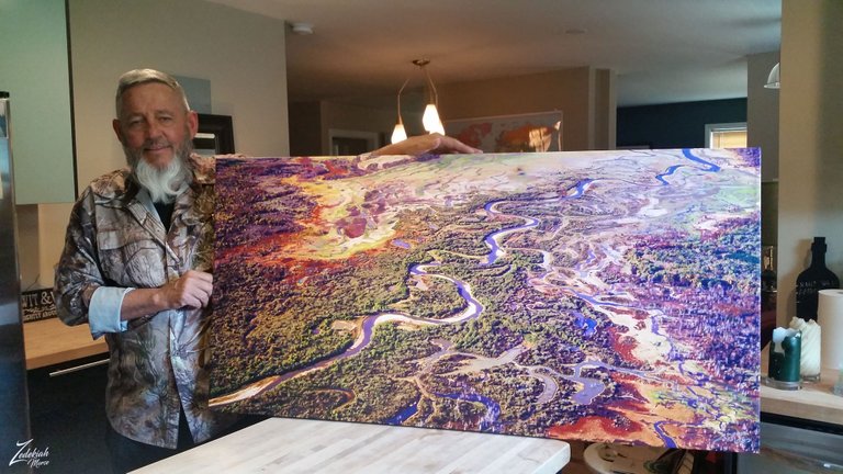
In this image below, I captured this as I was turning in the bush plane, and I just think it is a cool view like this... one of these days I would love to take a canoe trip along the river! I bet the fishing is awesome!
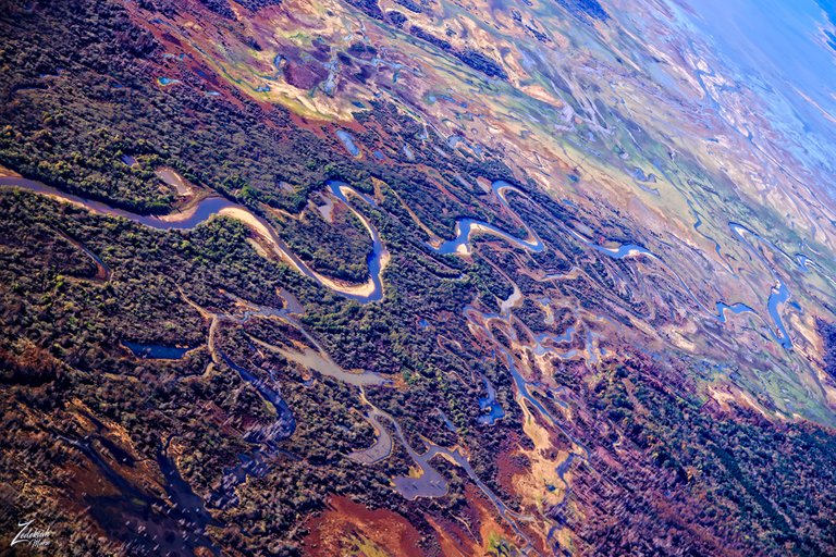 Skewed View of Little Tallahatchie River ~ Click to Enlarge
I actually printed a version of this image which my brother has hanging on his wall now. Here is a pic of me holding it up for the camera.
At the far end of the marsh area that lays next to the Little Tallahatchie River I discovered this small marsh area where you can see where the land has been flooded out. The remains of large trees still dot the land along the many rivulets that cross the landscape.
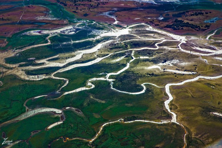 Close Up of Wetlands Surrounding the River ~ Click to Enlarge
And this following image is an even closer view I lensed while flying only a few hundred feet above ground. The bright sunlight is reflecting off of the water surfaces and you can see by the ripples on top of the water that it was pretty windy that day.
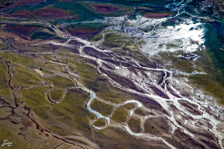 Another Close Up of Wetlands Surrounding the River ~ Click to Enlarge
And here is a google map of the location so you can visit this place yourself!
I lensed these images at different times while exploring this awe-inspiring wilderness area for my ongoing project, "Where Eagles Fly".
About The Project
Where Eagles Fly - The American Wilderness Expedition is my personal mission to introduce people to these amazing locations that surround us. I am piloting a bush plane while exploring and filming throughout the remote back-country areas of North America to raise awareness of the 47% of the USA and 90% of Canada that remain unpopulated wilderness.
About The Author
My name is Zedekiah Morse and I'm a Bush Pilot, Photographer, Explorer and Filmmaker. I live in the Rocky Mountains and devote my time and resources to exploring as much of the world as I can by air. If you wish to watch a short film detailing how I do my work and this project, go here.
If you like what you see here upvote & resteemit so that others may experience these wondrous places.
And if you'd like these images to be part of your feed, follow me.
Thanks for your support and Yehaw!!
Oh how incredible!! That is one of the most strikingly beautiful images I have ever seen! Resteemed!
Thanks Sally Beth! This place really is interesting with its vibrant colors juxtaposed against the surrounding green delta forests.
Woww amigo muy buenas imagenes
Gracias amigo mío, ¡me alegra que te gusten!
Para eso estamos:)
Ohhh. and we are complaining that the world is not enough. This is beautiful.
I could not agree with you more! People always complain yet don not realize places like this exist! Thanks for taking time to check it out!
wonderful photography dear friend @skypilot
and good travel, i love your #post, Finding void Random thoughts come to bother the mind when nature does not get any edge, then nature keeps me with its shadow.,,,thank you for sharing with #Us,,
Very nice of you to say! Thank you so much
Striking photography :) It looks like a painting!
Thanks for you kind words!
You have a good project, care about and care about the natural surroundings. In my place (Aceh) also has a beautiful nature, but many are destroying forests and nature. They think of money. I am very sad and I made some posts about the fate of Aceh forest.
Thank you and so do your posts remind people that the forests of Aceh also need to be preserved and protected!!! Post about it as much as you can, because only through continuous reminding will people become aware and care about this!
Ur welcome @skypilot. I often write news in the media where I work, Klikkabar.com, hopefully people are aware and able to keep the forest. Not necessarily in Aceh but all over the world.
I love the skewed view of Little Tallahatchie River! I didn't realize that the wetlands were so extensive. I think taking a canoe along this river would be a trip of a life time!
Thanks ! I like that view as well. Yes I agree, a trip though there on the river would be awesome!