[ENG]
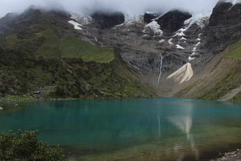
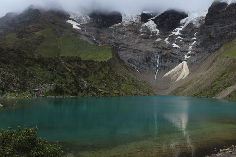
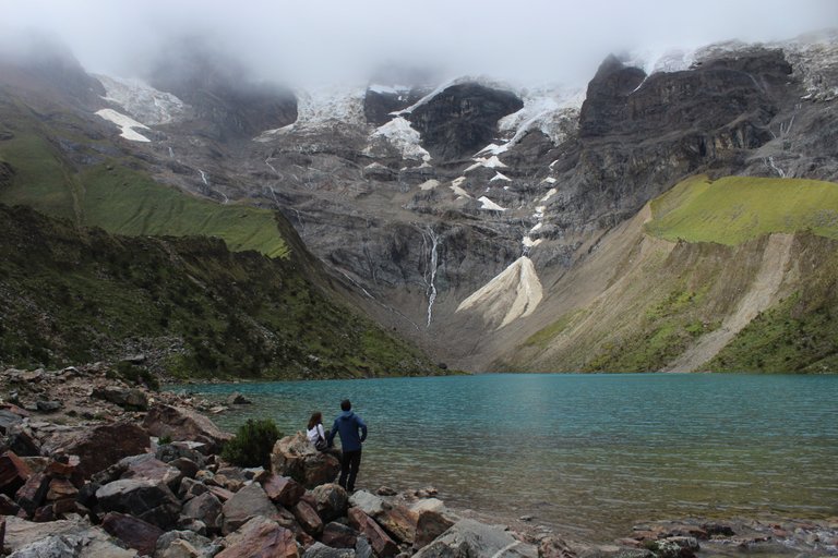
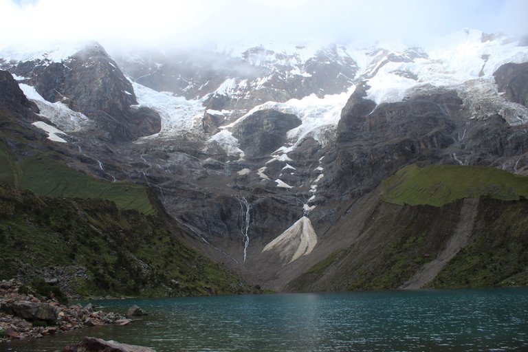
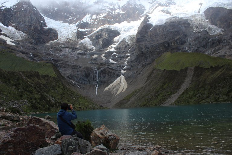
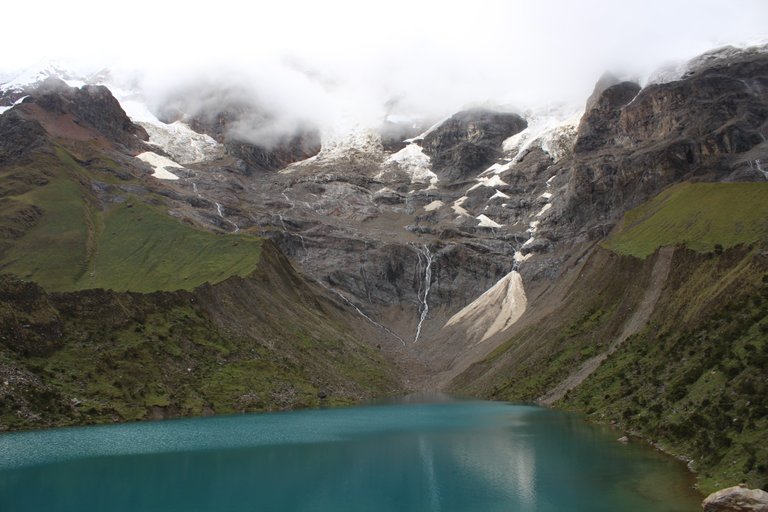
We complained about the Peruvian weather from the very beginning of our stay in this country, but this time we were not alone in this whining. Probably everyone who went to the Humantay Lagoon had to face poor visibility, or at least 99% of photos available on the Internet indicate it. In fact, if someone would like to see what the view from the lake's surface on the nearby six-thousandth meter looks like, it should go to one of the numerous tourist offices in Cuzco, because only there they presented photos taken in cloudless weather on promotional brochures.
However, it is detrimental to bring our entire two-day trip to this lake only to the weather or bad weather on the day of the trip!
This time, it can be said with a clear conscience that just getting to your destination was associated with perhaps a greater number of experiences than just a few hours of trekking! And it all started in Cuzco, at our host from couchsurfing Khaleks. Chaleks is a Peruvian mountaineer who guides tourists on the highest Andean peaks in Peru. It was he who ultimately prompted us to pour rain and, against the weather adversities, go to the mountains. The choice was to cover a small part of the famous Salkantay trekking. But how to do it? As I mentioned before, in Cuzco there are hundreds of tourist offices organizing such trips, but we were a bit sorry for the money, so we decided to go there on our own, because the matter is very simple. Chaleks lives right next to the national road number 3 and it is enough to drive it to the north, about 70 km, where you have to turn right into a tiny road, which becomes even smaller with each successive kilometer, and after 40 kilometers of incessant climbing a horse or a horse Soray village. It would seem a piece of cake, but unfortunately not. A piece of cake would come in handy so that Agatka could bite something light on her diseased stomach, because the mentioned 70 km and the subsequent 40 km in the vast majority of them led on extremely winding terrain. And while we traveled the first 70km in relative peace in a large truck with one break for lunch, the further road with this tiny reflection to the right turned out to be a real rollercoster. We get off the truck, say goodbye to the driver and Agatka tells me that we got off almost at the last minute, because she was already very sick and her stomach was approaching her throat more than once. Well, what to do? A moment of a break, a moment of standing in the fresh air and you have to go on. We start hitching and our future road looks like this: 10 kilometers up the road and we reach the village of Mollepata, then 30 kilometers of constant climbing between the wild mountains and we will be there. I don't think I've ever stopped to hitchhike, hoping that we will catch something, but this time it was because I wanted Agatka to have as much time as possible to catch her breath. It was unlucky, however, that the first car that appeared on the narrow winding road up stopped after us. It was strange because 5 people were already traveling in this car. The driver apparently decided that on this narrow, winding path, no one else would be able to offer us a chassis and his proposal to transport us in the trunk of an Opel Astra station wagon is a godsend for us. And maybe it was so, maybe this gentleman really saved us from standing at this small intersection all day. However, the consequences of driving in the trunk on a winding road were easy to predict ... After a few minutes Agatka turned green, stopped the car, jumped out of the trunk and vomited onto the side of the road. The sad sight of Agatka, regretting, moved our driver so much that for a further journey he invited Agatka to the honorary seat of the passenger, and the person who had been sitting there so far threw me into the back of the car in the trunk. We covered the further journey to the town of Mollepata at a slightly slower pace without any major problems. Unfortunately, Mollepata was not the end of our journey, but only a quarter of our climb along narrow paths between the mountains.
Here it is worth showing what tourism in Peru looks like. It is known that you cannot earn as well from anyone else as from foreign tourists. So when someone sees two stray tourists wanting to get to some tourist point, and when these two tourists ask about the prices of a taxi to that place in a town, it is obvious that the prices gain the magic multiplier 10 times. In short, for taking us by car 30 km upstream from the town, the drivers wanted an amount similar to the weekly salary of a typical Peruvian, which for us was definitely a prohibitive amount, but as we were determined to get to the Humantay Lagoon, we decided to go out of the city and look for luck in continuing to catch hitchhiking, and if it fails, we will camp somewhere in the bushes and try our luck the next day. Fortunately, after about an hour of standing in the bushes, a construction truck drove up all the way to the little hamlet of Soray. The driver's task was to drive to Soray, take some building materials there, turn around and pick up his colleagues on the way back to repair this poor path between the mountains. So you can say that happiness finally smiled at us. Although not quite, because when we got to our destination, it turned out that there is not much to be seen here, and the rain that falls every day begins to take on torrential forms. We just set up the tent patiently and went to sleep exhausted, in order to gain strength for the next day and then carry out the summit attack.
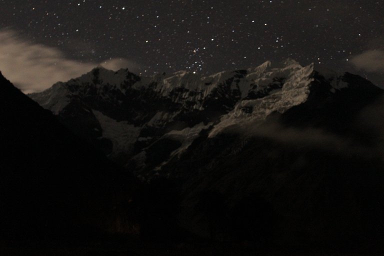
Something magical happened during the night. When I woke up to pee, it surprised me that I couldn't hear the rain hitting the flysheet at all. Glad that I would not get wet, I left the tent and it just hit me ... The view was beautiful like a million dollars! A cloudless starry sky and an enormous snow giant called Humantay, almost six thousand people, stood right in front of our tent. The base of this mountain was literally 500 meters away, and its top was 5,950 meters above sea level. Unfortunately, I am a poor photographer and I was completely unable to focus, so the photo commemorating this magical moment was completely unsuccessful.
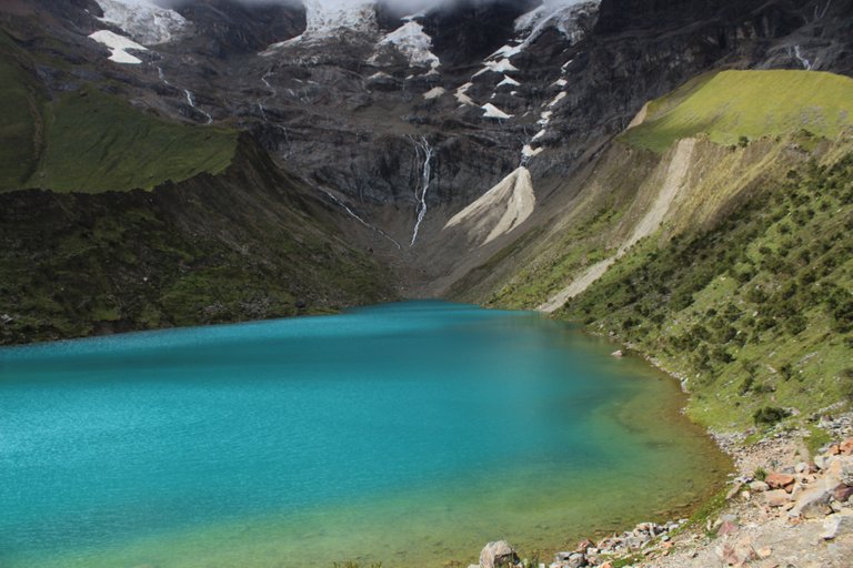
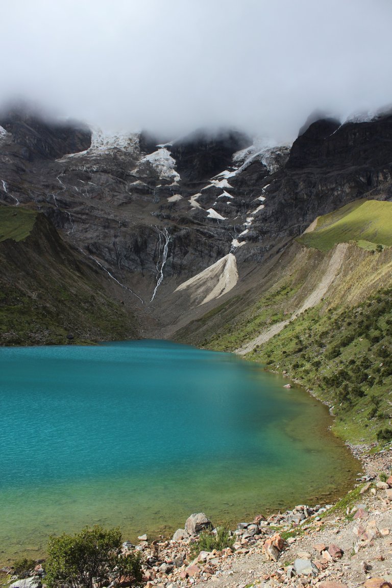
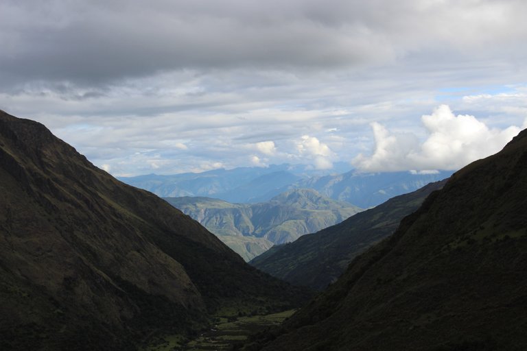
The next day, after leaving the tent, unfortunately the magic broke and we could only see clouds again, but undaunted by this, we launched an attack on the lake located at an altitude of 4200m above sea level. And I must admit that walking in the mountains above 4,000 meters is really an extreme sport. Walking without any load, we had only 300m to the ascent, I felt tired as if I had climbed Rysy. The worst climb in my life. Every two minutes of walking required me to rest for at least one minute. That is why the seemingly very innocent trekking finished me completely, but it was worth it. Anyway, judge for yourself.
[PL]
Na peruwiańską pogodę narzekaliśmy od samego początku naszego pobytu w tym kraju, ale tym razem nie byliśmy odosobnieni w tym marudzeniu. Chyba każdy kto wybrał się nad Lagunę Humantay musiał zmierzyć się z złą widocznością, a przynajmniej na to wskazuje 99% fotografii dostępnych w Internecie. Na dobrą sprawę, jeśli ktoś chciałby zobaczyć jak naprawdę wygląda widok znad tafli jeziora na pobliski sześciotysięcznik to powinien udać się do jednego z licznych biur turystycznych w Cuzco, bo tylko tam na folderach promocyjnych prezentowali zdjęcia wykonane w bezchmurna pogodę.
Krzywdzące jest jednak sprowadzanie całej naszej dwudniowej wyprawy nad to jezioro wyłącznie do pogody lub niepogody w dniu wycieczki!
Tym razem z czystym sumieniem można stwierdzić, że samo dotarcie do celu wiązało się z wydawać się może większa liczba przerzyć niż sam kilkugodzinny trekking!. A wszystko zaczęło się jeszcze w Cuzco u naszego gospodarza z couchsurfing Chaleksa. Chaleks jest Peruwiańskim alpinistą zajmującym się oprowadzaniem turystów po najwyższych Andyjskich szczytach w Peru. To właśnie on ostatecznie skłonił nas do tego aby olać deszcz i wbrew przeciwnościom pogodowym wybrać się w góry. Wybór padł na pokonanie małego fragmentu słynnego trekkingu Salkantay. Ale jak to zrobić? Jak już wspomniałem wcześniej w Cuzco są setki biur turystycznych organizujących takie wyjazdy, ale trochę szkoda było nam pieniędzy, więc postanowiliśmy wyruszyć tam na własna rękę, bo przecież sprawa jest banalnie prosta. Chaleks mieszka tuż przy drodze krajowej numer 3 i wystarczy podjechać nią na północ jakieś 70 km, gdzie trzeba skręcić w prawo w malutką drużkę, która z każdym kolejnym kilometrem staje się jeszcze mniejsza, a po 40 kilometrach nieustannego wspinania się pod górę koń czy się w miejscowości Soray. Wydawałoby się, że to bułka z masłem, ale niestety nie. Bułka z masłem by nam się przydała po to aby Agatka mogła przegryźć cos lekkiego na swój schorowany żołądek, no bo wspomniane 70 km oraz późniejsze 40 kilometrów w zdecydowanej większości prowadziły po niezwykle krętym terenie. I o ile te pierwsze 70km jechaliśmy we względnym spokoju w dużym samochodzie ciężarowym z jedną przerwą na obiad, to dalsza droga tym malutkim odbiciem na prawo okazała się istnym rollercosterem. Wysiadamy z TIRa, żegnamy się z kierowcą i Agatka oznajmia mi, że wysiedliśmy niemal w ostatniej chwili, bo było jej już bardzo niedobrze i żołądek nie raz podchodził do gardła. No ale co zrobić, Chwila przerwy chwila stania na świeżym powietrzu i trzeba jechać dalej. Zabieramy się do łapania stopa a nasza przyszła droga w skrócie wygląda tak: 10 kilometrów drogą do góry i docieramy do wioski Mollepata, a potem 30 kilometrów nieustannego wspinania się pomiędzy dzikie góry i będziemy u celu. Chyba nigdy nie stawałem do łapania autostopu z nadzieją, że nieprędkiego coś złapiemy, ale tym razem tak było, bo chciałem aby Agatka miała jak najwięcej czasu na złapanie oddechu. Pecha jednak chciał, że pierwsze auto które się pojawiło na wąskiej krętej dróżce w górę zatrzymało się po nas. Było to dziwne o tyle, że w tym aucie już podróżowało 5 osób. Kierowca najwyraźniej uznał, że na tej wąskiej krętej dróżce nikt inny nie będzie w stanie nam zaoferować podwózki i jego propozycja przewiezienia nas w bagażniku samochodu typu Opel Astra kombi to dla nas wybawienie. I może rzeczywiście tak było, może rzeczywiście ten pan uratował nas od całego dnia stania na tym małym skrzyżowaniu. Jednak konsekwencje jazdy w bagażniku po krętej drodze były łatwe do przewidzenia… Po kilku minutach Agatka cała zzieleniała, zatrzymała samochód, wyskoczyła z bagażnika i zwymiotowała na pobocze. Smutny widok żgającej Agatki tak mocno poruszył naszego kierowcę, że na dalszą podróż zaprosił Agatkę na honorowe miejsce pasażera, a osobę która siedziała tam dotychczas wywalił do mnie na tył samochodu do bagażnika. Dalszą podróż do miasteczka Mollepata już w trochę wolniejszym tempie pokonaliśmy bez większych problemów. Niestety Mollepata to nie był jeszcze koniec naszej drogi a dopiero ćwierć naszej wspinaczki wąskimi dróżkami pomiędzy górami.
Tu warto pokazać jak wygląda turystyka w Peru. Wiadomo, że na nikim innym nie da się tak dobrze zarobić jak na turystach zagranicznych. Więc gdy ktoś widzi zbłąkaną dwójkę turystów chcących dostać się do jakiegoś turystycznego punktu i gdy Ci dwaj turyści rozpytują się w miasteczku o ceny taksówki do tej miejscowości, to oczywiste jest, że ceny zyskują magiczny mnożnik 10 razy. W skrócie za przewiezienie nas autem 30 km w górę za miasteczko kierowcy życzyli sobie kwoty pokroju tygodniowej pensji statystycznego Peruwiańczyka, co dla nas było kwotą zdecydowanie zaporową, ale że byliśmy zdeterminowani aby dostać się nad Lagunę Humantay postanowiliśmy iść za miasto i szukać szczęścia w dalszym łapaniu autostopu, a jeśli to się nie uda, to zabiwakujemy gdzieś tutaj w krzakach i spróbujemy szczęścia kolejnego dnia. Całe szczęście po mniej więcej godzinie stania w krzakach nadjechała ciężarówka budowlana, która jechała w górę aż do tej małej osady Soray. Kierowca miał za zadanie przejechać się do Soray, zawieźć tam jakieś materiały budowlane, zawrócić i w drodze powrotnej pozbierać swoich kolegów pracujących przy remoncie tej lichej dróżki pomiędzy górami. Można wiec powiedzieć, że wreszcie szczęście się do nas uśmiechnęło. Choć nie do końca, bo gdy dotarliśmy do celu okazało się, że niewiele już tutaj widać no i codziennie padający deszcz zaczyna przybierać nawalne formy. My tylko cierpliwie rozbiliśmy namiot i wyczerpani poszliśmy spać, po to aby nabrać sił na kolejny dzień i wtedy przeprowadzić atak szczytowy.
W nocy stało się cos magicznego. Gdy zbudziłem się w celu zrobienia siusiu zdziwiło mnie to, że wcale nie słyszę deszczu stukającego w tropik. Ucieszony tym, że nie zmoknę wyszedłem więc z namiotu no i po prostu mnie wcięło… Widok śliczny jak milion dolarów! Bezchmurne gwieździste niebo i przepotężny śnieżny niemal sześciotysięczny gigant zwany Humantay stał tuż przed naszym namiotem. Podstawa tej góry znajdowała się dosłownie 500 metrów dalej, a jej wierzchołek sięgał wysokości 5950m n.p.m. Niestety słaby ze mnie fotograf i kompletnie nie potrafiłem ustawić ostrości, więc zdjęcie upamiętniające tą magiczną chwilę kompletnie się nie udało.
Kolejnego dnia po wyjściu z namiotu niestety magia prysła i znów było widać tylko chmury, ale niezrażeni tym ruszyliśmy w atak nad jezioro znajdujące się na wysokości 4200m n.p.m. No i musze przyznać rację, że chodzenie po górach powyżej 4 tysięcy metrów to jest już naprawdę sport ekstremalny. Idąc bez żadnego obciążenia mieliśmy do podejścia zaledwie 300m czułem się zmęczony tak jakbym zdobył Rysy. Najgorsza wspinaczka w moim życiu. Każde dwie minuty podejścia wymagały ode mnie co najmniej minuty odpoczynku. Dlatego tez zwykły z pozoru bardzo niewinny trekking wykończył mnie doszczętnie, ale warto było. Zresztą oceńcie sami.
Your content has been voted as a part of Encouragement program. Keep up the good work!
Use Ecency daily to boost your growth on platform!
Support Ecency
Vote for new Proposal
Delegate HP and earn more
The rewards earned on this comment will go directly to the person sharing the post on Twitter as long as they are registered with @poshtoken. Sign up at https://hiveposh.com.
Congratulations, your post has been added to Pinmapple! 🎉🥳🍍
Did you know you have your own profile map?
And every post has their own map too!
Want to have your post on the map too?
Piękne zdjęcia. Dodawaj więcej zdjęć z wypraw, nawet takich "zwykłych" miejsc.🙂
PS: Why not share your blog posts to your family and friends with the convenient sharing buttons on TravelFeed.io?