Are u so curious about how rain is being formed? do u really want to learn why some forms of precipitation are rapid, intense,infinitesimal or scanty? then this post will end your curiosity.
The understanding of precipitation has generally being misinterpreted with the understanding of rainfall.
Rainfall is only a form of precipitation amongst other forms of precipitation.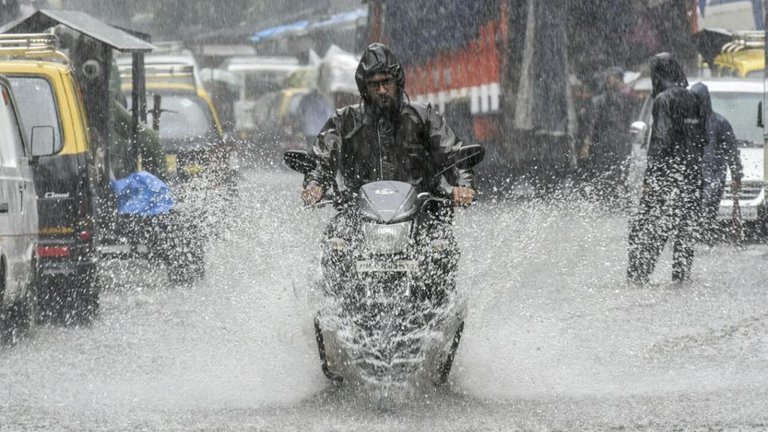
Source
Precipitation is described as any form of aqueous deposit derived from the atmosphere, its a very important concept in the study of surface water analysis.
forms of precipitation
According to my field of interest,The forms of precipitations can be studied under two subdivisions.
- ** Forms of appearance** : liquids and solids
- Method of formations :cyclonic, orographic, convectional.
Characteristics of some subdivisions
Liquids precipitations: e.g. rainfall, dew, fog,drizzle.
Solids precipitations :snows,ice pellet,sleet,hail
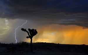
Convectional precipitations : it originates with the adiabatic cooling of buoyant air mass vertically upward.It consist of numerous cells of local upcurrent and downcurrent. They are usually localized and typified with thunderstorms and constitutes large amount of runoff due to it massive. downpour. its more intense than other forms of precipitation but shorter in duration (30mins - 1 hr).They are formed after an intense solar radiation has occurred,hence, the rate of evaporation and evapotranspiration is increased leading to increase in the atmospheric moisture and later falls as precipitation. There can be scattered and organised convective showers.
Source
Orographic: 
Source
Orographic or relief rainfall is caused when masses of air pushed by wind are forced up the side of elevated land formations, such as large mountains. The lift of the air up the side of the mountain results in adiabatic cooling, and ultimately condensation and precipitation. In mountainous parts of the world subjected to relatively consistent winds (for example, the trade winds ), a more moist climate usually Prevails on the windward side of a mountain than on the leeward (downwind) side. Moisture is removed by orographic lift, leaving drier air on the descending (generally warming), leeward side where a rain shadow is observed.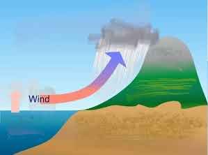
Source
Frontal or cyclonic: Frontal precipitation is caused by frontal systems surrounding extratropical cyclones or lows, which form when warm and often tropical air meets cooler air. Frontal precipitation typically falls out of nimbostratus clouds.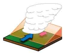
Sources
When masses of air with different density (moisture and colder air). The warmer air is forced to rise and if conditions are right becomes saturated, causing precipitation. In turn, precipitation can enhance the temperature and moisture contrast along a frontal boundary. Passing weather fronts cause sudden changes in general temperature, and in the humidity and pressure in the air at ground level.
Warm fronts occur where the warm air pushes out a previously lodged cold air mass. The warm air overrides the cooler air and moves upward. Warm fronts are followed by extended periods of light rain and drizzle, because, after the warm air rises above the cooler air (which remains on the ground), it gradually cools due to the air's expansion while being lifted, which forms clouds and leads to precipitation.
Cold fronts occur when a mass of cooler air dislodges a mass of warm air. This type of transition is sharper, since cold air is more dense than warm air. The rain duration is shorter, and generally more intense, than that which occurs ahead of warm fronts.
A wide variety of weather can be found along an occluded front, with thunderstorms possible, but usually their passage is associated with a drying of the air mass.
Mechanism of precipitation formations
Precipitation though frequent in some part of the world,certain conditions need to be met before it occurs. listed below are the four basics conditions.
- Sufficient atmospheric moisture : when evaporation and evapotranspiration occurs,The volume of atmospheric moisture increases due to the conversion of water into water vapours,water vapors hence increase in the atmosphere which is the first procedure before precipitation occurs.
The heavy water vapour is carried vertically upward from the earth surface by light air which in turn becomes saturated and the processes continues.
cooling of atmospheric moisture : As the atmospheric moisture ascends from the earth,they tends to loose temperature and becomes cold. air may be cooled by one or the combination of the processes (A.) Contact cooling or (B.) Adiabatic cooling.
Contact cooling occurs when warm moist air passes through a cool ground or water surface.
adiabatic cooling involves an increase in volume of air due to a decrease in pressure and a consequent lowering of temperature towards a due point and this process occurs when air is lifted to a lower pressure level without addition of heat energy.this is only natural process by which large air masses can be cooled rapidly enough to provide appreciable precipitation.Condensation of water vapour into liquids or solid form: After cooling,the water vapour will thereafter collides together to form various type of cloud,depending on the nature if the resulting temperature the precipitation will either be in solid or liquid forms.
Growth of condensation products to precipitation size : the cloud of water increases in volume by addition of other water molecule along it path,once the precipitation size is reached i.e. the maximum size which the air current can support, it falls as precipitation to the earth surface.
Provided this conditions remains constant,the process of precipitation reoccurs which is an important aspect of the hydrological cycle.
References^ "Quantification of cloud water interception". Elsevier .
Bibcode:2012AgFM..161...94P .
doi : 10.1016/j.agrformet.2012.03.018 . Retrieved 2008-08-18.^ Physical Geography. CHAPTER 8: Introduction to the Hydrosphere (e). Cloud Formation Processes. Retrieved on 2009-01-01.
^ B. Geerts. Convective and stratiform rainfall in the tropics. Retrieved on 2007-11-27.
^ Houze, Robert (October 1997).
"Stratiform Precipitation in Regions of Convection: A Meteorological Paradox?" (PDF).
Bulletin of the American Meteorological Society. 78 (10): 2179–2196.
Bibcode:1997BAMS...78.2179H .
doi : 10.1175/1520-0477(1997)078<2179:SPIROC>2.0.CO;2 .
ISSN 1520-0477 . Retrieved
2007-11-27.
i hope u enjoyed and learnt from this post.
Kindly drop comment and observations below
Thanks for reading
Source: http://www.balkanoglasi.com/Convection_rain
Not indicating that the content you copy/paste is not your original work could be seen as plagiarism.
Some tips to share content and add value:
Repeated plagiarized posts are considered spam. Spam is discouraged by the community, and may result in action from the cheetah bot.
Creative Commons: If you are posting content under a Creative Commons license, please attribute and link according to the specific license. If you are posting content under CC0 or Public Domain please consider noting that at the end of your post.
If you are actually the original author, please do reply to let us know!
Thank You!
More Info: Abuse Guide - 2017.