You might have seen this image before:

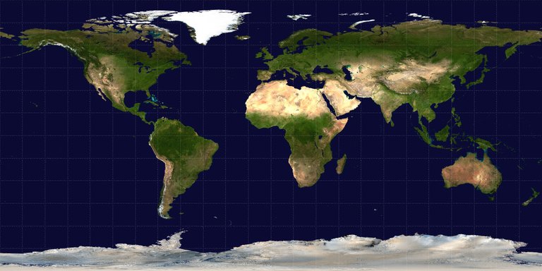
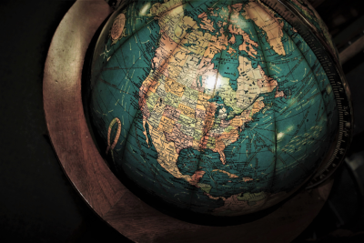
This is an equirectangular projection of the Earth, courtesy of NASA. You might notice that towards the poles, the area of the landmasses stretches out quite significantly. For example, in this picture of a globe, you can see that the USA and Canada aren't nearly as wide as they appear to be in this projection.

This is due to the fact that in an equirectangular projection, the coordinates of a location on Earth, given in latitude and longitude, are used as cartesian coordinates. Simply put, if your location is 51.48° N, 0° E (Greenwich, UK), your coordinates on an equirectangular projection are (0, 51.48), where the origin is the middle of the map.
However, this simple way to assign lat/long-coordinates to cartesian coordinates distorts the image more and more towards the poles. If you take another look at the globe, you see that the lines of longitude get closer and closer towards the poles. If you take two points near the poles and use their latitude and longitude values to determine their coordinates on the projection, you'll find that their distance looks larger, because in the projection, the lines don't intersect but run parallel to each other.
To account for this, other map projections use complicated mathematics to distort the image "the other way" and make the shapes of the landmasses look more similar to the way they actually do.
That's fine and all, but what does this have to do with 360° videos?
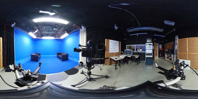
If you have only ever stumbled upon 360° videos on Facebook and/or Youtube, you probably never saw the way they are actually saved as video files. Most likely you've never thought about the intricacies of this technology in detail either. You see, when recording a photo or video in 360°, you use a camera that has two or more wide-angle lenses which record simultaneously. The raw footage you get from a camera like this usually looks a bit like this:

Now, given the fact that there are many different 360° cameras out there and that there is no standard as to the way 360° footage should be recorded, it is evident that there needs to be a way to convert the recording into a usable format. Moreover, to be able to play it back smoothly as well as quickly, there should be no complicated maths involved when playing back the video as a pannable sphere. This leads us back to our friend, the equirectangular projection.

When exporting a video you shot with a 360° camera, the manufacturer provides a tool to convert your shot into an equirectangular projection in a process called "stitching". The easy conversion from spherical lat/long coordinates to cartesian and back provides a quick and simple solution to play back the video on a platform such as Youtube without having to wait minutes for the video to convert from a different kind of projection to a sphere. The distortion that we spoke about earlier is not relevant in this case, because the viewer isn't supposed to watch the video in its projected form, but to dive into the action and watch the video as if he was there using a VR-Headset. Therefore, any other map projection would lead to unnecessary mathematical operations when watching the video, delaying playback, possibly by a lot, depending on the resolution of the video.
Image Sources:
Equirectangular Projection
Globe
Congratulations @sergejkarkarov! You have completed some achievement on Steemit and have been rewarded with new badge(s) :
Click on any badge to view your own Board of Honor on SteemitBoard.
For more information about SteemitBoard, click here
If you no longer want to receive notifications, reply to this comment with the word
STOPCongratulations @sergejkarkarov! You have completed some achievement on Steemit and have been rewarded with new badge(s) :
Click on any badge to view your own Board of Honor on SteemitBoard.
For more information about SteemitBoard, click here
If you no longer want to receive notifications, reply to this comment with the word
STOP