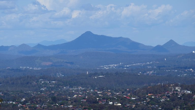
Flinder's Peak is in the center of this view from Mt Cootha in Brisbane's North Western suburbs
One of Brisbane's lesser known attractions is Flinder's Peak on the outskirts of the cities southwestern suburbs. It is an hour drive from the CBD (Central business district) and can be seen as a rather prominent peak from much of the city.
In world term's Flinders Peak it rises to a relatively diminutive 680 meters above sea level, but as it's base is near sea level it does actually meet the definition of "mountain" given in many geography text's (i.e an eminence greater than 600m ). It is nonetheless a beautiful location and worthy of a visit.
Flinder's Peak is part of the Teviot Range which contains a number of other interesting features, including Ivory's rock pictured below.
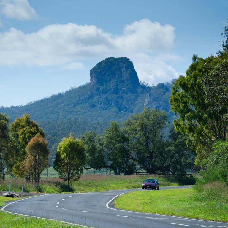
Ivory rock seems to almost be toppling over in this view on the road out to Flinders Plum Picnic Area
My walk to the Summit
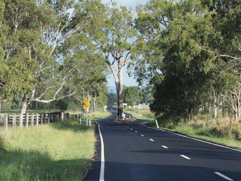
There is a walking track to the summit of Flinder's Peak which starts at the Flinders Plum Picnic Area. The Picnic Area is actually a nice spot itself and can be reached by turning off the Ipswich to Boonah Road near the town of Peak Crossing. It's well signposted but you know you're on the right road when you see the tree in the middle of the road.
Why chop down a tree when you can build the road around it!
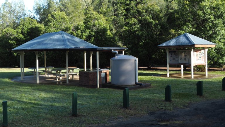
After reaching the turn off the sealed road transitions to gravel, but this is only for 2-3km. You then arrive at the picnic area as shown in the photo below.
Flinders Plum Picnic Area, the starting point for a number of walks including Flinders Peak
I attempted to walk on Easter Sunday, and although I got to the summit and back in one piece the 7km and the 550m vertical climb took their toll because not only was my general fitness not great but I took insufficient water and too much camera gear! I would recommend taking at least 2 litres of water for this trip. In any case, it was well worth the trip and the views were spectacular.
Near the start of the track, there is a good clearing that allows you to view the mountain itself. This here is a telephoto view showing the top from a previous weekend, with the radio tower at the top.
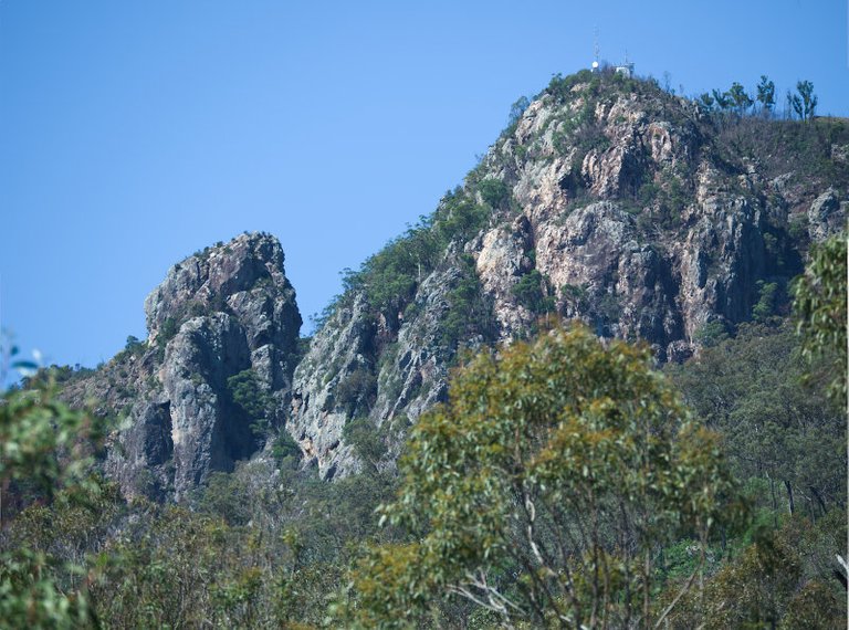
Telephoto shot to the peak from near the beginning of the track. How hard can it be?
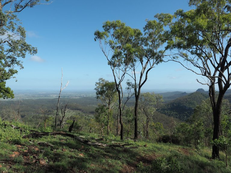
Not too long after setting off you get the first views back across the surrounding area. At this point, the trail has been relatively easy apart from a small amount of rock scrambling.
Nice views can be had less than hour into the walk, although the summit itself takes another 2 hours
The next section is steep, and I'm glad I took a photo stop to regain my stamina. Too slow to catch a kangaroo that was nearby I settled on photographing Lantana flowers. Lantana may be considered a weed, but the flowers are still very pretty.
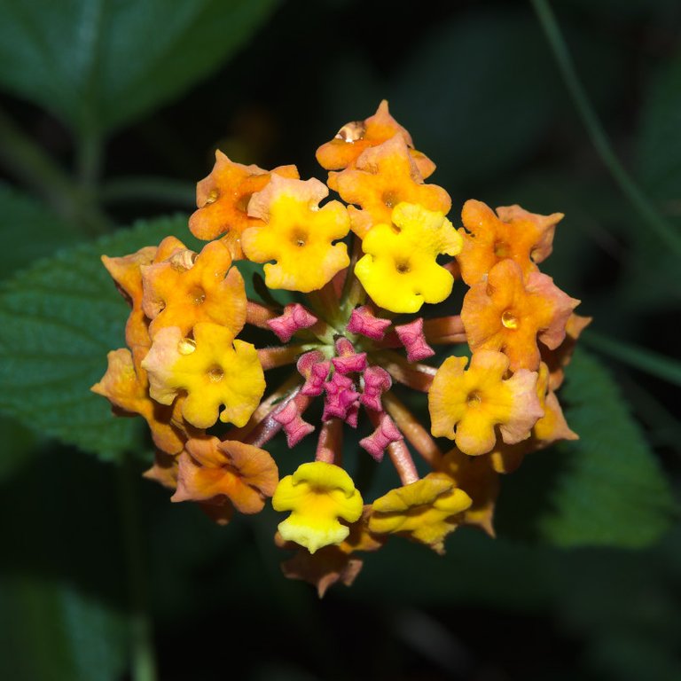
I've been getting some ideas from youtuber Rob Trek for flower photography. These are Lantana flowers
I don't know what these flowers are, maybe somebody can help me identify them in the comments.
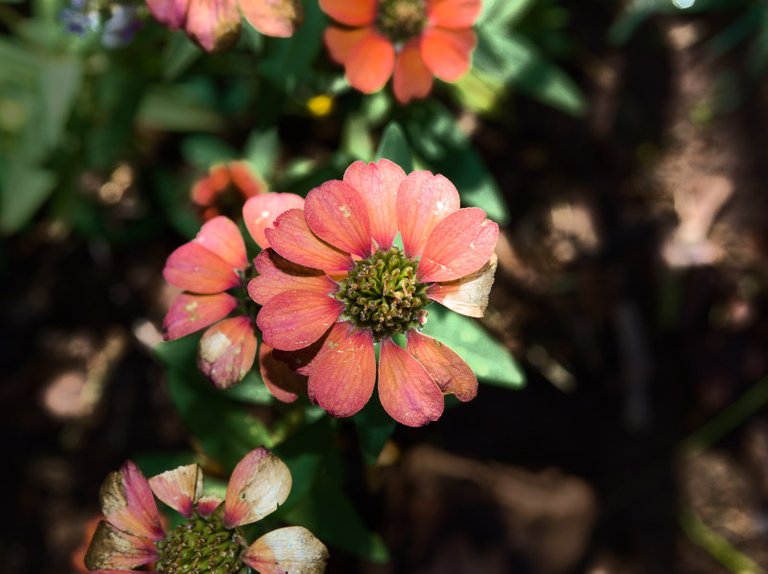
Anyone knows what type of flower this? Pity about the missing petal - oh well gives it a bit of character
After 2 hours of climbing a ridge line is reached which is crested by boulders. This means there is a lot of scrambling over boulders, which is not too difficult but just slows down the pace. At this point, the most physically difficult part of the climb is completed, although because of my general poor fitness I was close to the point of turning around.
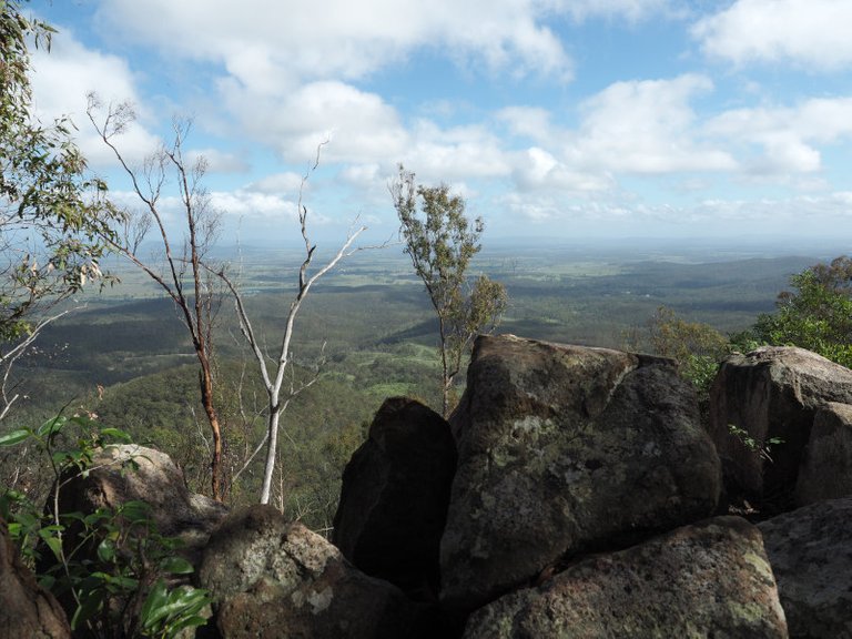
This is part of a boulder field that runs along a ridge running to the shoulder of the summit peak
After scrambling across rocks and a few ups (and downs) you come to a lovely lookout. This is a great time to take a breather for the final push to the top. The extinct volcanic peaks are Mt Goolman (453m), Mt Blaine (455m) and Mt Perry (351m).
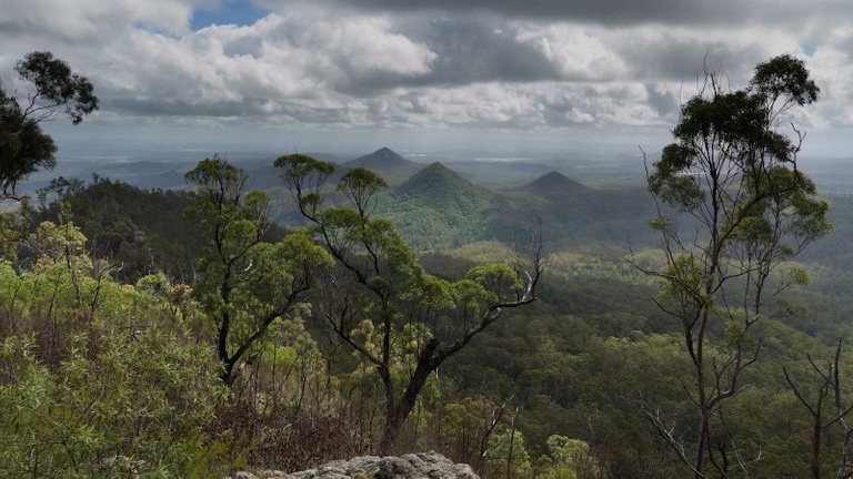
There is fine lookout about 30 minutes prior to reaching the summit
The final push is very steep, with a small part requiring a good foothold to get up a 60-degree rock face. But finally, you come to a helipad and a radio tower located at the top of the mountain. The views are great, although there was little light rain about that reduce visibility.
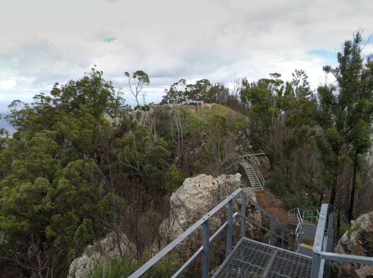
The summit area finally. Beautiful views from here.
There are reminders to stay on the track all the way up, for environmental and safety concerns. When near the summit there are some pretty steep cliffs.
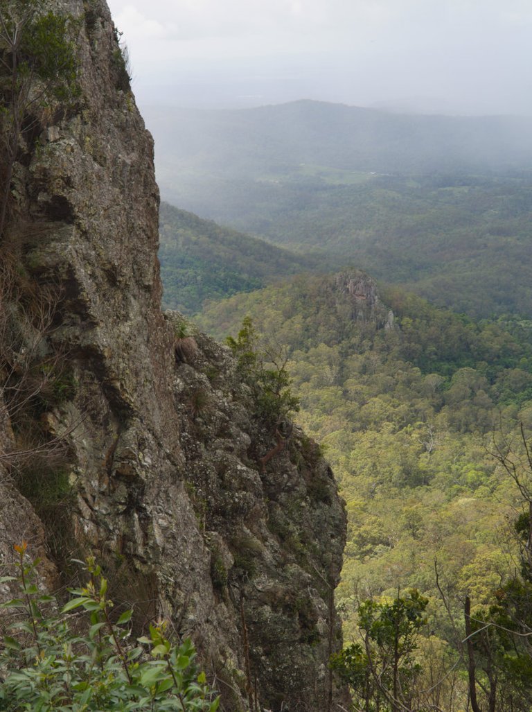
Its probably a good idea to stick to the track, there are some cliffs just off track like this one near the summit!
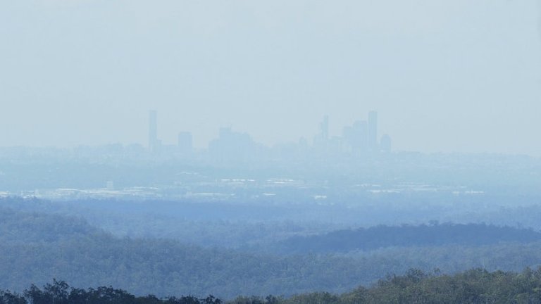
Because of the position of the sun in the sky and the hazy/rain about it was difficult to make out Brisbane itself from the top. On a clear day, you would get fantastic views of the city. Anyway here is my attempt through the haze, on the way back down from the top.
The view in the direction of Brisbane was very hazy, but here it is
Here is a quick panorama stitch I did from the station at the top of the mountain. Click here or on the image for a larger version.
All up this walk took me almost 6 hours with very frequent stops. However, a person with normal fitness should expect to do it in 4-5 hours. For Brisbanites and people visiting Brisbane, I would absolutely recommend this for a day trip. For reference here are some useful links:
- Aussie Bushworking Track Notes
- QTOPO topographic Map which is better quality than google maps.
PHOTO NOTES: The majority of these images were made with an Olympus OMD EM5 mk2 and 12-40 2.8 lens.
[//]:# (!steemitworldmap -27.793645 lat 152.798122 long Flinders Peak (Mountain near Brisbane) d3scr)

Hi terrylovejoy, these lovely scenes are sights for sore eyes for a Queenslander born in Brisbane.
Thank you Angie :)
Awesome shots, Terry :-)
Seems you have a lot of nature near the big city of Brisbane.
These views make me wish to climb a mountain as well.
Glad you enjoyed them, Kevin. I'm Feeling worse for wear today I can tell you!
I believe you, that was not a small tour. :-)
I would also be very tired after such a hike.
Well, I did get blitzed by most of the people on the track :) Lesson is not to let your fitness go :)
I would also make you a free steem account :-)If you like, I will invite you to @actifit, so you can do something for your walking condition :-)
This post has been voted on by @acropolis travels and culture in collaboration with the project @templo.
Congratulations, Your Post Has Been Added To The Steemit Worldmap!
Author link: http://steemitworldmap.com?author=terrylovejoyPost link: http://steemitworldmap.com?post=flinders-peak
Want to have your post on the map too?
The photo where the tree is in the middle of the road, is simply beautiful, is the one I liked the most, respected to the nature.
I thought it was pretty cool as well and I've seen other examples like that here as well. You just don't want to be half asleep driving down a road with a tree in the middle of it!
I hadn't thought of that last hahahaha.
partial upvote. We love your hard work and hope to encourage you to continue to publish strong travel-related content.
Thank you for being part of the TravelFeed community!
Learn more about our travel project by clicking on the banner above and join our community on Discord.
Travel Digest #492.Hiya, @lizanomadsoul here, just swinging by to let you know that this post made the Honorable mentions list in today's
Your post has been manually curated by the @steemitworldmap team, and if you like what we're doing, please drop by to check out all the rest of today's great posts and consider upvoting and supporting us.
Looks like a nice walk up and amazing view from the top!
Posted using Partiko iOS
Yes fantastic view from the top, and so close to Brisbane.
Congratulations @terrylovejoy! You have completed the following achievement on the Steem blockchain and have been rewarded with new badge(s) :
You can view your badges on your Steem Board and compare to others on the Steem Ranking
If you no longer want to receive notifications, reply to this comment with the word
STOPVote for @Steemitboard as a witness to get one more award and increased upvotes!