This post discloses an 8-day itinerary for exploring the Big Island, Hawaii. It is based on the expedition performed by @trang and I in January 2019. Of our 7 nights off the resort, we tent camped for six, which kept the combined lodging costs under $250.
Warning: these adventures are not for the weak. Instead, these feats should only be attempted by a strong and frugal traveler, who is prepared to leave no trace. We reject commercial tourism and those that desecrate the Hawaiin wilderness using motorized contraptions. Hike or bike, but avoid disturbing what remains of nature by financing trucks, helicopters, and motorboats.
Map
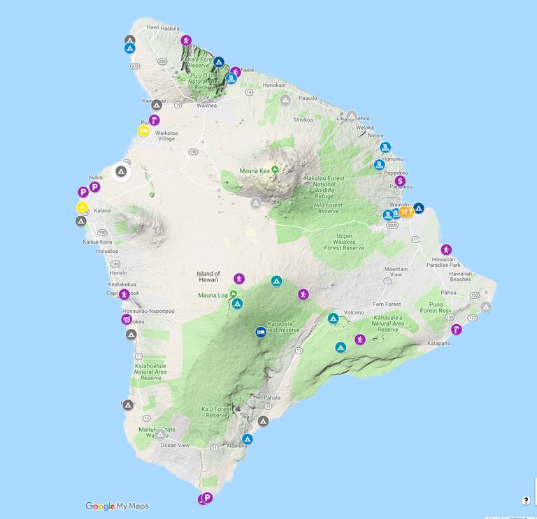
We planned our trip by creating a custom map of attractions:
We decided to circumnavigate the island clockwise, beginning at Kona airport, where we rented the weakest car available from Hertz, a Nissan Versa.
Day 1: Kealakekua Bay
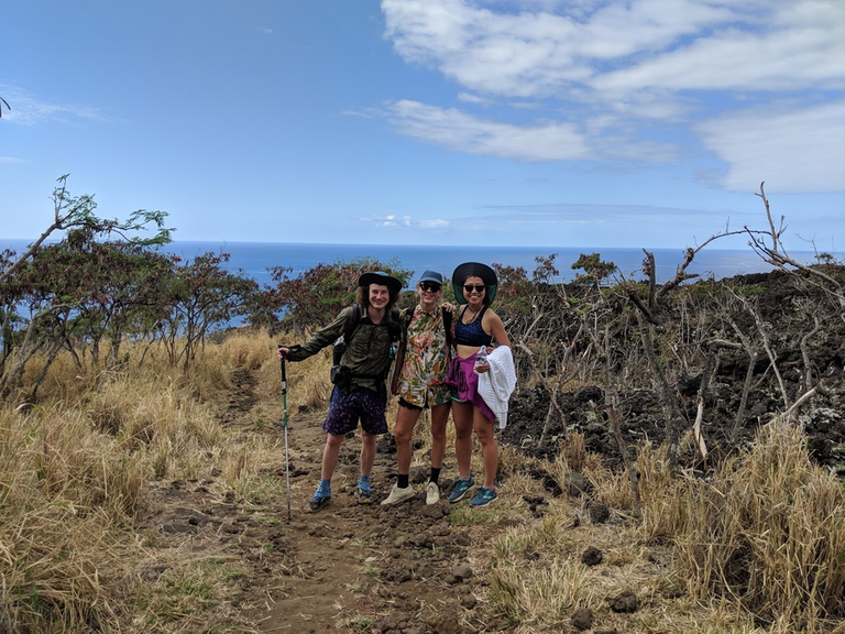
We hiked to Kealakekua Bay, with the Big Island's best snorkeling and Captain Cook's Monument. Here's our GPS track. The hike is about 2 miles each way and scenic:
Francesca joined us for this part of the journey. She's an Italian scientist currently living in Arizona, who performs some of the most advanced matrix computations for data integration in the world.
At the bay, we found a nice hammock spot:
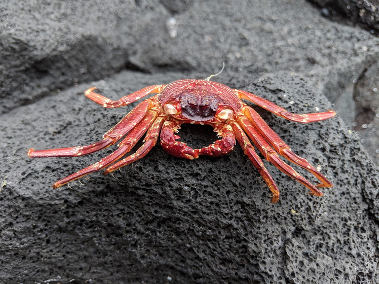
The main attraction however is the snorkeling. Put on some goggles, jump in, and witness your world transform into a colorful cacophony of marine mania. We didn't get any pictures of the underwater view, but on shore the sun gave birth to crustacean reds:
We drove north this night and camped at Mãhukona Beach Park, which was somewhat sketch especially considering its $42 price tag for 2 non-residents.
Day 2: Pololū Valley and Muliwai Trail
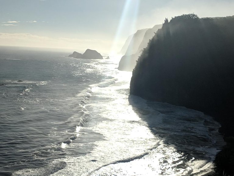
We started day 2 with a short hike down to the beach at Pololū Valley. The view looking out towards the 7 valleys of the Kohala Volcana was impressive and a nice reminder of the wilderness we were about to explore.
Next we drove around Kohala Volcana to reach Waipi’o Valley (the easternmost valley). From there we set out to hike the Muliwai Trail to Waimanu Valley (tracks).
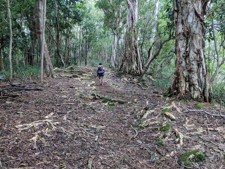
amazing video recounting our time at Waimanu Valley. The hike was scenic:Check out @trang's
And wet...
And by the time we reached camp, dark. We stayed at campsite 1 (map download), which was pretty good, although campsite 2 has the best view and fire pit, and served as the socialization venue for all the expeditions.
Day 3: Waimanu Valley
The view in the morning was worth it:
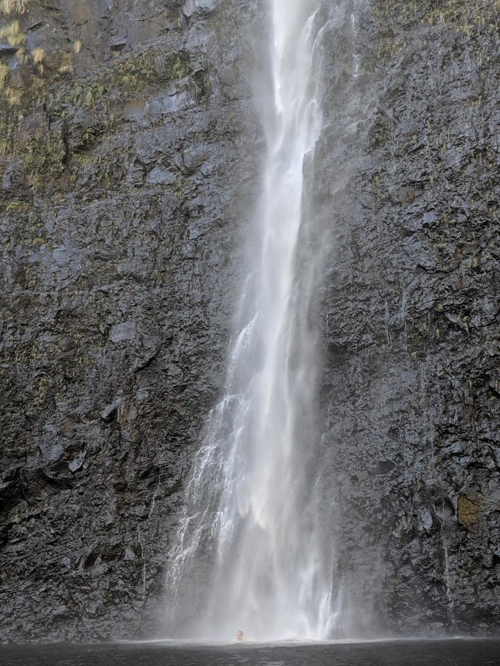
We continued along the valley perimeter along an unmaintained trail network to reach Waihilau Falls, the 14th tallest waterfall in the world.
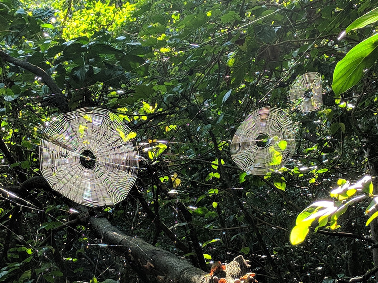
Remember this is the jungle and the trek is treacherous:
That night we had a gathering of the vibes with other attendees.
Day 4: Vacating the Valleys
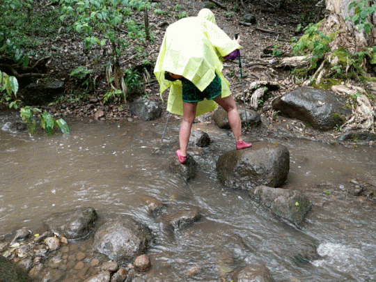
We hiked out early. By the way, did I mention there are two major water crossings: Waimanu Stream and Queen's River. The beauty however is that you get to experience where the fresh meets the salt waters. Watch @trang cross Waimanu Stream:
The hike out went smoothly. Overall, this outing comprised 22 miles of hiking and 10,600 feet of elevation gain.
That night we stayed at a cottage in Hilo, which despite costing over $100 was worse than every other spot we stayed. However, we were able to do laundry and rest up for our big ascent coming up.
Day 5: Mauna Kea
We drove to the visitors station at Mauna Kea at an elevation of 9,200 feet. The Nissan Versa struggled to perform internal combustion at the lowered oxygen levels. From there, we began the hike to the summit of Mauna Kea, the highest peak in Hawaii at 13,803 feet and the tallest mountain in the world if plucked from the root.
Despite augmentation with 10 milligrams of acetazolamide, I felt elevation weakness, even at the visitation centre. Step by step, we ascended this dormant volcano and sacred landmark via the Humu'ula Trail. We passed two other hikers on the way, who were unprepared in almost every way possible — inadequate sun protection, inadequate thermal layering, inadequate water supply, inadequate altitude acclimation. To the best of our knowledge, this couple never made it to the top.
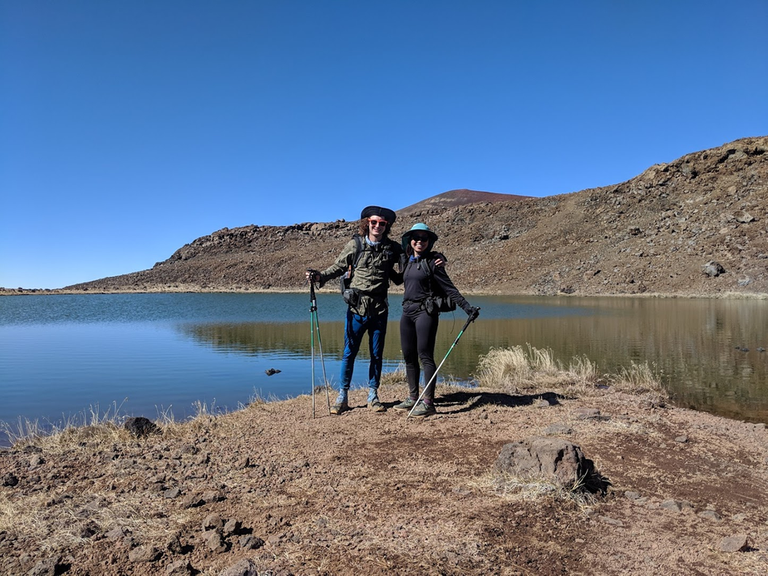
On the way, we stopped by Lake Waiau, Hawaii's only alpine lake and a place of great historical importance as ancient peoples would deposit umbilical cords of newborns here as a ritual to promote longevity.
A few other visitors stopped by and took a photo for us:
However, one of the visitors kept throwing rocks in the lake, which annoyed me because the lake already struggles enough with maintaining its depth.
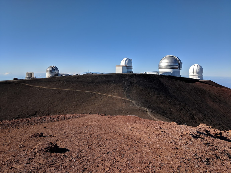
After a total of 6.5 miles, we reached the summit and enjoyed the views:
Mauna Kea is also special for being one of the premier sites on the earth for astronomical observation. The area surrounding the summit is currently home to 13 telescopic observatories:
A telescope much greater than any of the existing telescopes has been planned. Its name: the Thirty Meter Telescope. However, there has been much resistance to this telescope and protesters halted the construction in 2015. Recently, court rulings have sided with the telescope. On our drive around the island, we saw many "Save Mauna Kea" signs advocating against the telescope. While I generally side with preservationists, I don't see the merits of stopping this important eye into the sky and hence the history of the universe. Furthermore, the telescope will be recessed from the summit. Personally, I find the proposed design aesthetically pleasing and think it would contribute to the legacy and myth of the mountain.
We hitchhiked down and arrived to Nāmakanipaio Campground at Hawaii Volcanoes National Park. Due to special circumstances called partial government shutdown, the campground was not collecting fees. This happened to be the most luxurious car camping spot we stayed on the Big Island.
Day 6: Volcanoes National Park
Due to the longest government shutdown in U.S. history, a higher percent of the lands at Volcanoes National Park were forbidden than usual. Therefore, we are substituting this part with the itinerary we would have liked to do were the park fully open.
We had planned to hike the Nāpau Trail into the backcountry, where one can witness lava flows and steam vents:
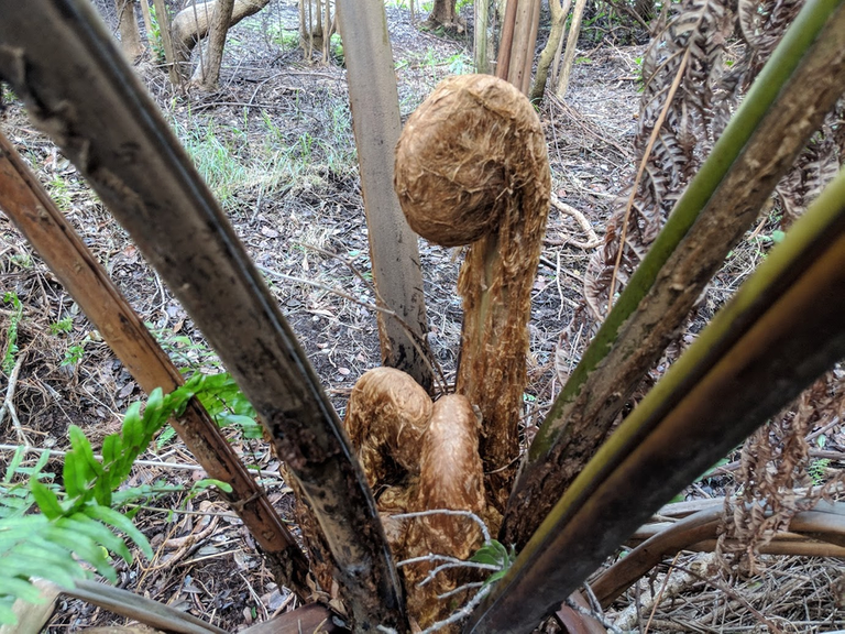
Behold the gigantic Cibotium menziesii (Hawaiian Tree Fern):
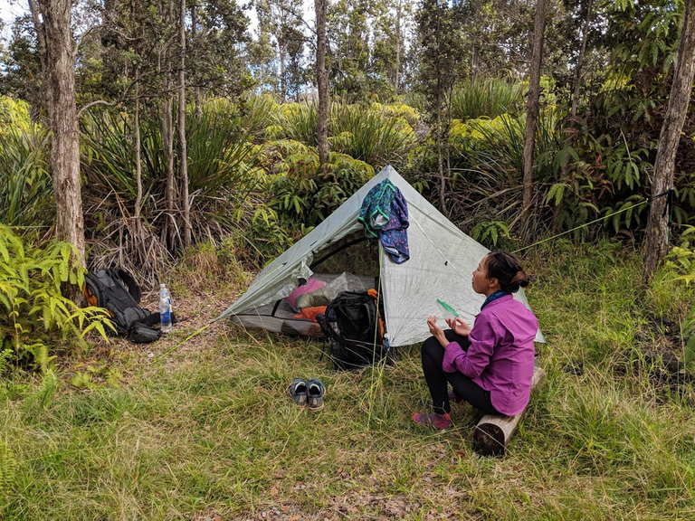
Instead we had to settle for some déjà vu backcountry solitude:
Day 7: Volcanoes National Park
We did get to walk along Rim Drive to get a nice vantage point of Kīlauea Crater.
After seeping lava continuously for 35 years, Kīlauea and its subordinates experienced increased volcanic activity last summer. During this period, the magma exhausted itself. Hence, there was no lava anywhere on the Big Island for the duration of our visit.
On the night of day 7, we camped at Whittington Beach Park, which was scenic and only very slightly sketch. We dined at both the southernmost bakery and southernmost restaurant in the United States (both recommended), located in the town of Naalehu.
Day 8
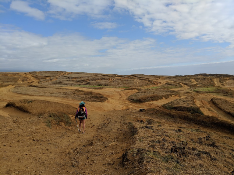
On day 8, we made it near the southernmost point in the United States. We hiked to the Green Sand Beach:
I was happy to see most other visitors hiking rather than purchasing a ride on a 4×4, since the automobiles do considerable damage to the landscape, which made for a nice photo:
On the hike we were reminded of the onslaught of plastic pollution humans are littering the ocean with:
The Ocean Cleanup's System 001, which was brought to Hilo Harbor for repairs a couple days after we passed through.We must all do our part to address this crisis. @trang and I pick up as much litter as possible when traveling and around the streets of Philly. On the bright side, people are waking up to the issue and are prototyping solutions. For the second time, we just missed sighting
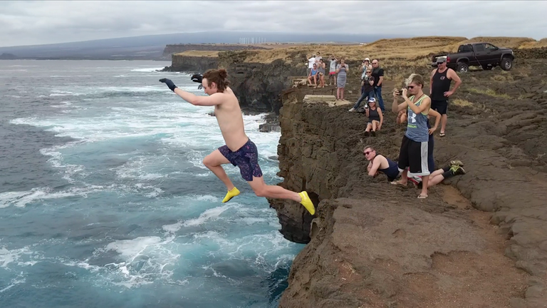
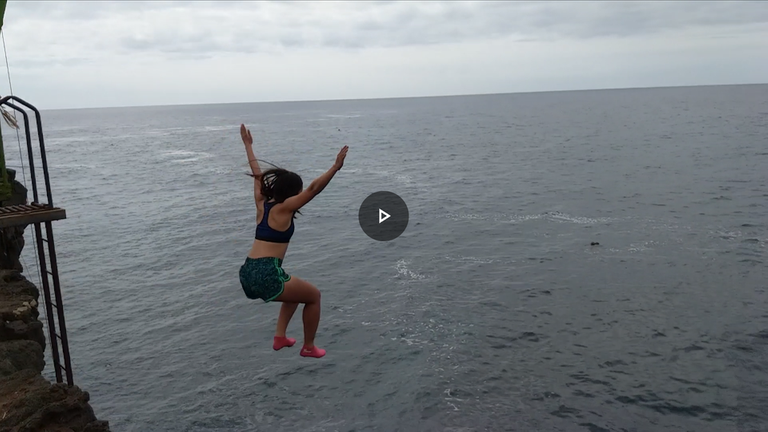
Then we went to the southernmost point cliff jump where there were many fishermen but few jumpers. I was worried that the moderately high surf would make connecting with the ladder following the 40-foot jump dangerous. But, @trang decided she was doing it regardless. I asked her whether she'd ever jumped from a high height. She said "no".
So we walked the plank, me then her.
We both enjoyed the jump. Although, I think @trang will make sure to have a more streamlined landing on her next jump! Finally we drove north, snorkeled at Honaunau Beach, and ate rambutan before hopping on a red eye flight back to the mainland.
Bonus
We were in Hawaii before this vacation for a conference called the Pacific Symposium on Biocomputing. At the conference, I led a working group on Manubot, where participants learned how to use Manubot for collaboratively writing a manuscript.
During this time we checked out some local attractions such as Hapuna Beach. We even rented convertible BMWs, which were free to borrow:
Makalawena Beach was nice and included a resident seal. We imitated petroglyphs with our shadows:
Sunset walking back from Makalawena Beach was picturesque:
We had parked at the southern trailhead. Apparently, the park closes at 7:00 PM. Be out by then. A security personal tailgated us for 10 minutes with great rage. To this person's dismay, we cleared the gates at 6:59 PM, so he was not able to ticket us.
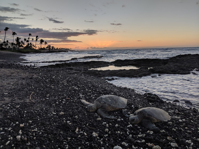
In conclusion, sea turtles:













Wow! Just wow! I love this post!
First, I love people who are so much eco-friendly and environmentally aware. Hiking instead of renting a car, leaving no trace yourself, picking other people´s trash - this is exactly what I do too! Thank you so much guys, you are awesome! Btw 1: there is an amazing project called @cleanplanet running on the Steem blockchain, feel free to use their tag whenever you "clean planet" ;)
Second, the Hawaii nature is just breathtaking! They say it is similar to that of the Canary Islands where I lived for some time but even though there is actually quite a lot of some similarites, I must admit this looks even more fascinating than what I remember from Tenerife. I must visit this place. Btw 2: there is an amazing project called @travelfeed running on the Steem blockchain, feel free to use their tag whenever you post a superb travel post like this ;)
Thanks @phortun for your comment and pointers to @cleanplanet and @travelfeed.
Didn't know you lived on Tenerife (before this I knew nothing of this island). Cool to see that it is also a volcanic island. Did you ever hike Mount Teide? Sounds like it erupts every couple hundred years.
Tenerife is a wonderful island. Some parts are usually crowded with tourists as the Canaries are a very popular subtropical getaway for people from continental Europe (especially in winter) but there are still large areas of beautiful pristine nature to be found there too. Yes, I have been to Mount Teide, it is an epic hike. The mountain is surrounded by the Del Teide National Park, a spectacular place. I am sure you guys would love hiking the Tenerife mountains. Here are two shots I took on the top and just below the top of Del Teide ;)
Wow. Truly magnificent shots.
Sounds like spring is the best season to hike? But winter is possible ...
I would say spring to fall is all good. In winter, you can have snow in the mountains, from some 2,000 m (6,560 ft) up. I will never forget how I was swimming in the ocean in Puerto de la Cruz in October, enjoying some 30°C (86°F) outside temperature while actually looking at the peak of Del Teide far up in the distance that was covered with snow already. Incredible experience.
Indeed! Running water, working bathrooms, moderate temperature (though a bit too humid), 2-bar LTE and would still be a lot cheaper than the others even when the government reopens.
We need to start a #leavenegativetrace movement!
DTube or YouTube:@trang has made another amazing video, primarily about our hike of Mauna Kea, which is available on
I forgot to mention what we didn't do but would have liked to. There are really only two things:
Hike Mauna Loa with an elevation of 13,679 feet, which unlike Mauna Kea has no road to the summit. We didn't do this hike since we couldn't get a permit due to the partial government shutdown. The shortest roundtrip hike, which starts from the observatory, is 13 miles with a 2700 elevation feet gain. Here are some resources:
Visit the summer of 2018 lava flows in the Lower East Rift Zone (LERZ). Apparently, a new beach was created from this activity.
Ah and here's the link to the latest earthquakes on the Big Island according to the USGS. Here's what the map looks like today. There are 100s of quakes per day, but mostly too small to feel with one's inborn senses.
Double Bonus Picture
@trang snorkels
Triple Bonus Picture
Hi, @dhimmel!
You just got a 72.55% upvote from SteemPlus!
To get higher upvotes, earn more SteemPlus Points (SPP). On your Steemit wallet, check your SPP balance and click on "How to earn SPP?" to find out all the ways to earn.
If you're not using SteemPlus yet, please check our last posts in here to see the many ways in which SteemPlus can improve your Steem experience on Steemit and Busy.
Hi @dhimmel, you have received an upvote from trang. I'm the Vietnamese Community bot developed by witness @quochuy and powered by community SP delegations.
Congratulations! Your post has been selected as a daily Steemit truffle! It is listed on rank 4 of all contributions awarded today. You can find the TOP DAILY TRUFFLE PICKS HERE.
I upvoted your contribution because to my mind your post is at least 6 SBD worth and should receive 257 votes. It's now up to the lovely Steemit community to make this come true.
I am
TrufflePig, an Artificial Intelligence Bot that helps minnows and content curators using Machine Learning. If you are curious how I select content, you can find an explanation here!Have a nice day and sincerely yours,

TrufflePigCongratulations @dhimmel! You have completed the following achievement on the Steem blockchain and have been rewarded with new badge(s) :
Click here to view your Board
If you no longer want to receive notifications, reply to this comment with the word
STOPLooks like a cool adventure.