Day 5, can you believe it? We've already seen like a million things in Iceland by this point and it had just kept getting better and better... Well Day 5 set us back a bit in our optimism since it rained. ALL. day... not too mention it was one of our longest days in the car, and ended up being one of the scariest drives I've ever been on.
So with that, before I get into the list of sites I'm going to tell you about our driving adventure. As you drive North from Hofn on the ring road you come across 2 options: follow the ring road along the coast and a few more fjords, or take a short cut that heads inland called Rd 939 also referred to as Öxi. If you take this shortcut, road 939, it saves you 60 km of driving at around 45 minutes.... in good weather.
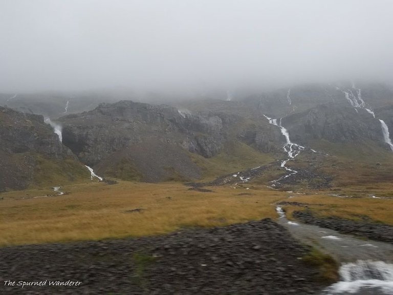
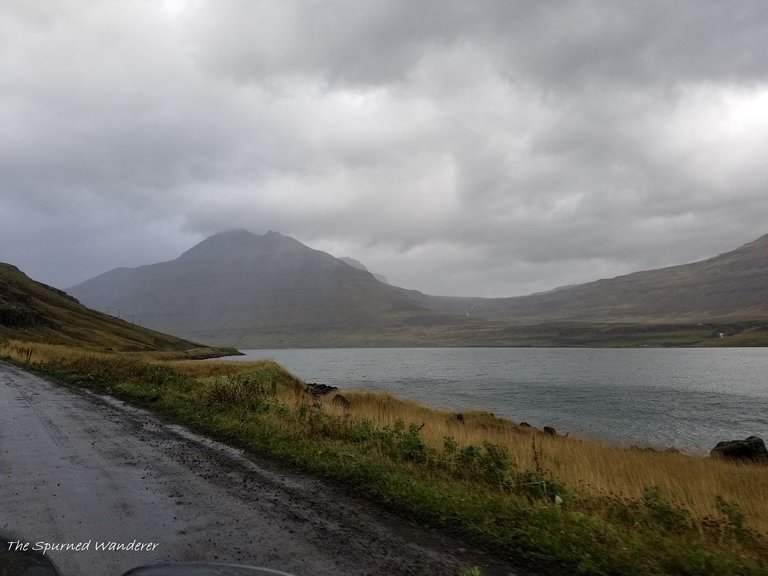
THIS ROAD SHOULD NOT BE TAKEN IN INCLEMENT WEATHER! It was pretty much pouring down rain on us for the first part of our drive, to the point where the ring road was flooded and were driving through pools that were up to the running board of the car. (we weren't insured for river crossings.. oops!) So on one side we had water flowing into and flooding the road, and the other side steep ocean drop offs... We thought we'd be better off heading inland. We were wrong.
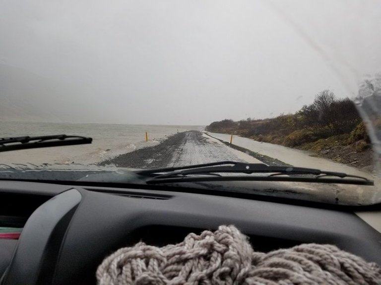
Above, part of the road that was getting flooded out.
As it turns out... Rd 939, Öxi pass, is a mountain road that is VERY dangerous in severe weather conditions and outside of the summer season due to ice, steep grades (sections up to 17% grade), and many MANY blind corners on a narrow road. To put this in perspective, the Going to the Sun Road in Glaicer NP is averaged at 5.7% grade and it's PAVED! We found out the hard way. As we headed up this "shortcut" of the ring road visibility was very low as a cloud sat right on top of the mountain making the blind corners even more BLIND. We even passed one car that was stopped although we didn't see anyone in it.
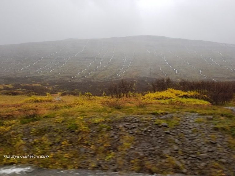
Finally the 18.5 km of DEATH dirt road was at an end and we were safely headed toward the town Egilsstaði.
Stops:
Stop 1: Hengifoss waterfall
2 waterfalls with cool basalt features, but DEFINITELY a hike. We had to skip this stop unfortunately due to unfavorable weather conditions (*cough, the devil's rain) but photos look amazing and it's another 2 for 1 waterfall hike. Just so you are prepared, the hike is 5 km round trip with pretty extensive up hill climbs. There are toilets at the car park but no other facilities. Right near to Hengifoss is the giant lake, Lagarfljot which is rumored to be similar to Loch Ness in that is has a monster living in its depths. Both amazing things to check out if you have the time.
Stop 2: Egilsstaðir for your grocery refill mostly.
This is a quick stop but if you like to live cheaply off sandwiches and breakfast foods like we do, you'll want to stop in the town to stock up. There's a great giant Bonus right off the ring road and you won't get another good grocery store until Akureyri in 2 days.
Stop 3: Gufufoss
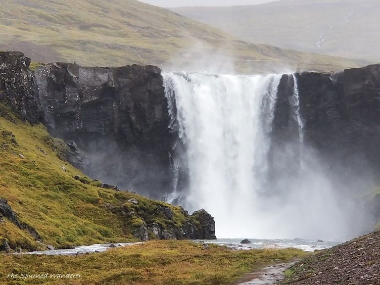
From Egilsstaðir, I highly recommend you turn off the ring road to drive 17 miles (27km) to the town of Seydisfjordur. You'll drive up and over a mountain pass and you'll pass Gufufoss right on the side of the road, as well as many other beautiful small falls.
Stop 4: Seydisfjordur
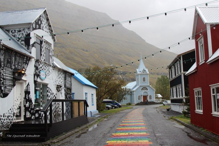
The town itself is charming. Walk the rainbow brick road, explore the cafes and shops, visit the tourism center for hiking info, and check out the little blue church.
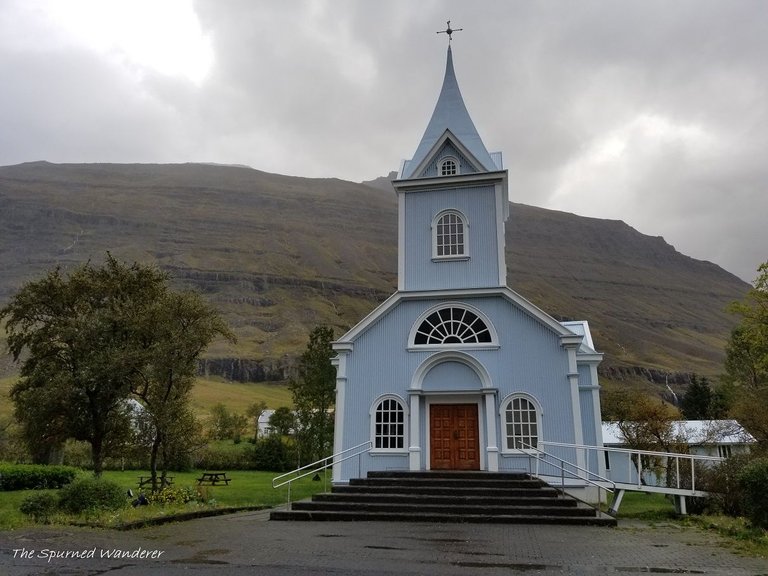
As we didn't have a ton of time to explore the Eastern fjords, we figured we better at least check out one and Seyðisfjörður was said to be one of the best. After our trek out there, I'm a believer! It is only 17 miles (27km) off the ring road and a pretty cool drive right over a mountain pass. (thankfully paved this time!) This town is well known as being one of the larger towns with a ferry port, booming (for the area) art scene, and well... the nature!
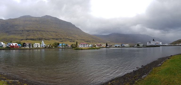
The town has viking connections that date back to the 8th century with the first known settler: Bjólfur. The main town was started in 1848 and was the site of the first world's first industrialized whaling station. In 1906, the first telegraph cable connecting Iceland to Europe was also located here making it a crucial town for international communications.
Today, this town has the only 2 cinemas in Eastern Iceland, an arts centre, a Technical Museum and local heritage museum, not too mention the adorable cafes and older hotels. It's also the site of the ferry terminal for the Smyril line connecting Iceland to the Faroe Islands and Denmark.
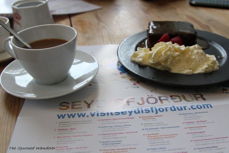
While we were disappointed the weather was keeping us from the amazing hiking trails in the area, it couldn't stop us from enjoying the rainbow brick road and warming up in a cafe.
For some seriously good coffee and the most AMAZING date cake with homemade whipped cream, check out hotel Aldan while in the area! Seriously worth the Iceland prices, it was SO good.
Also fun fact: Hotel Aldan and the road that takes you from Egilsstaðir to here was used in the long-board scene in the Secret Life of Walter Mitty.
Stop 5: Mt. BJÓLFUR
Supposedly a 5 km hike (but double check at tourist center) and on a beautiful day offers the most killer views down the Fjord.
I had my heart set on hiking MT. BJÓLFUR, one of the 7 peaks around the town and with an incredible view looking down the fjord. It was hard to get any information about this hike online however, with some sites saying it was a quick hike while others making it seem longer. There is a visitor center at the port in town where you can ask about trails and when we did... we were told it was 2ish hours each way of hiking! Yikes. Would be worth it on a beautiful day but we weren't blessed with good weather so we missed out on some incredible hiking.
Stop 6: Monument to Þorbjörn Arnoddsson
If hiking is out, definitely check out this monument which is a quick stop and provides the best views of the town/ fjord combo.
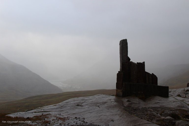
The clouds were so thick and the wind was so strong, it was hard to even pose for a picture. Needless to say, the stop at the monument was short lived for us.
Stop 7: Dettifoss/ Selfoss
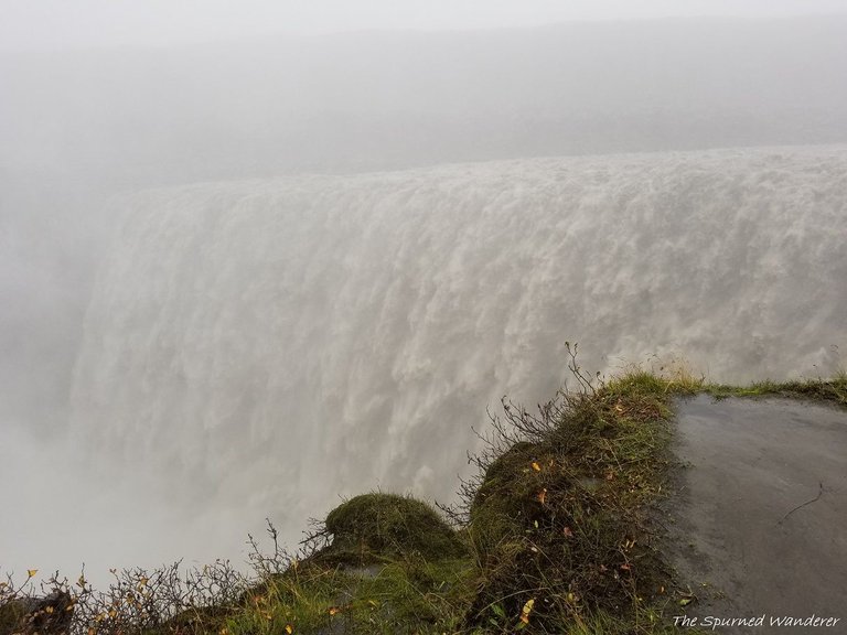
After joining back up with the ring road, you'll continue N until you hit the turn offs for Dettifoss, Europe's most POWERFUL waterfall. Dettifoss is run off flowing down from Vatnajökull glacier and collects water as it goes from a large area in Northeast Iceland. The falls are 100 m (330 ft) wide and have a drop of 44 m (144 ft). There are 2 access points with 2 completely different views. I had originally gunned for the EAST side as you can get CLOSER to the waterfall and actually SEE the entire thing from top to bottom. However the road is said to be horribly bumpy and on a wet day.. probably not the best idea.
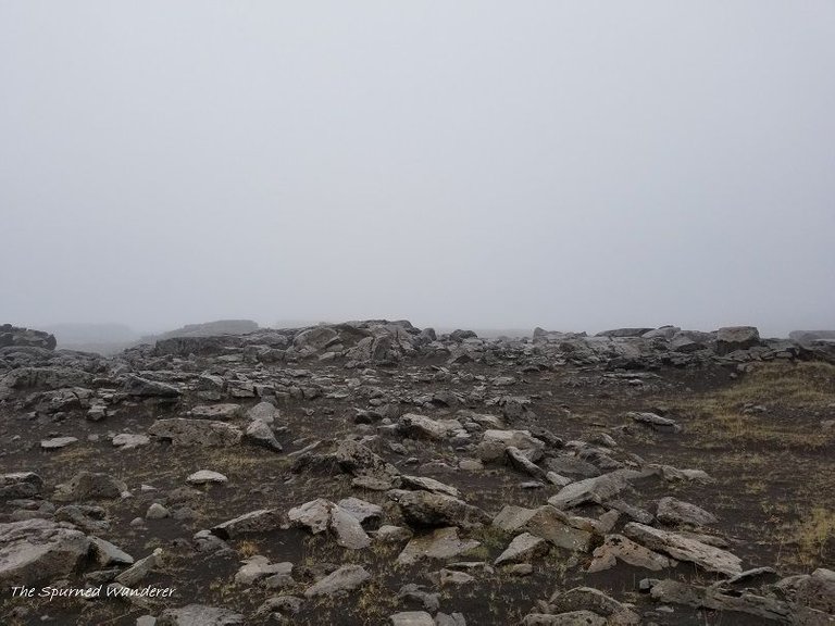
The view we had walking out to the falls on the West Side. You seriously couldn't see anything, even as you began to hear the roar of a powerful waterfall.
The WEST side however is a smooth, easy, paved road with still great views, just expect a 10-15 minute walk from the parking area to the falls vs a short <5 minute walk on the Eastern approach.
For a better explanation for the pros and cons of each side, I found this post to be VERY helpful.
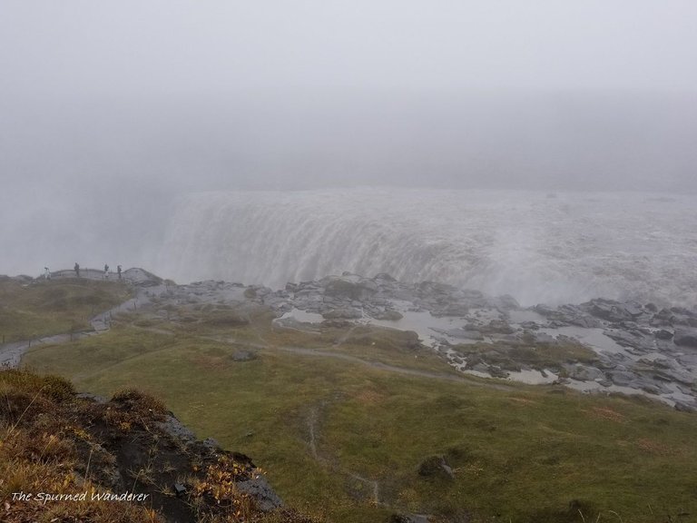
Needless to say, the weather really only permitted us to visit the West side... and what a view we had!
lol glad we didn't torture ourselves with the bumpy scary road out to the East bank when you could hardly see the falls through the mist and clouds! That being said, the falls had quite the roar and were still amazing to see! Just hard to photograph!
Not to mention FREEZING. There is actually a nice walking path to another set of beautiful falls further up river called Selfoss. (the previous link will give more info on that) as our walk out to the falls and 5 minutes of picture taking left us THOROUGHLY drenched... we hit a new low point and decided against walking out to Selfoss. lol
Rain clothes and all couldn't protect you from the heavy wet rain of this day. The water just clung to everything and like I said.. new low. We were ready to get back to the warm car.
Stop 8: Mývatn
Luckily after this stop, our guesthouse for the night was a mere hour away (short in comparison to the rest of our drive) in the lake town of Mývatn. Once we checked in, we unloaded and headed to cook our grocery dinner. And lo and surprise! While the place advertised a beautiful kitchen, the one that is supplied was small and lacking equipment... especially considering how many people were trying to use it. It was in this small kitchen, I microwaved our $2 oven pizzas and then fried them into a calzone... Most interesting travel dinner I've had yet but hey, only cost $4 for dinner that night! haha
That being said, location was great and room was comfortable enough, especially considering ours had a private bathroom.... But note: the FAMILY ROOM which we shared had 2 pretty small bunkbeds... that were a little scary with 2 adults sleeping on them but hey, we made do! The breakfast in the morning (cooked in the fancy kitchen from the photos no doubt) was also fantastic.
Tips:
- Don't take Rd 939 in ANY sort of inclement weather.
- If you have the time and like to hike, stay a night in Seyðisfjörður that way you have more time to hike around and enjoy a very charming town. Also make sure to visit the Tourism Center in town before heading out on any hikes. That way you can get the most accurate information. (Online resources thus far were pretty useless when it comes to trail guides in that area)
- Read up on your options for visiting Dettifoss. The 2 access roads give very different perspectives of a magnificent waterfall so look at which side would be best for you, or even better, do both!
Budget:
All the stops are FRREEEEEEE
Lodging:
Skútustadir Guesthouse: $294 for 4 people so $147 for 2
Food:
Breakfast/ lunch: previous groceries
Groceries in Egilsstaðir: $35
Hotel Aldan 2 coffees and Date cake: $16
Rental Car:
Daily rate split with another couple $66
Daily Gas rate split $18
Day 5 Costs: $282 for 2 people
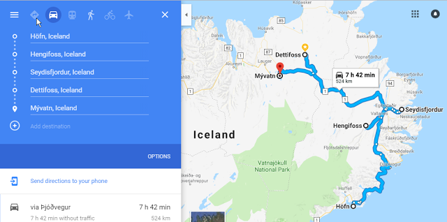
Total driving time: 7.5 hours, 524 km
[//]:# (!steemitworldmap 65.252108 lat -14.026794 long d3scr)
Beautiful photos. I appreciate the challenges you endured in getting these photos.
Visiting Iceland is an item on my Bucket List. Your article has given me some valuable real-life experience to aid me in that upcoming adventure. Thanks.
lol I do hope I get the idea of preparing for rain across :D It is such a beautiful country, I hope you make it soon! If there's any additional info you would like I'd be happy to include in future posts or reply directly :) Happy wandering ~Amanda
Looks like a great adventure! I definitely want to go there. @spurnedwanderer
You should definitely! Next time I go to Iceland, I'm budgeting like the entire trip to hang out just in the Eastern Fjords ;) Seriously if you think it looks cool shrouded in clouds, just imagine how epic it is when you an see all the way down the fjord! Let me know if you need any help planning your trip or how it goes when you make it out there! Happy wandering! ~Amanda
Hiya, just swinging by to let you know you're being featured in today's #TravelDigest!
You guys are awesome! Thanks for the feature :D ~Amanda
Your post was mentioned in the Steemit Hit Parade for newcomers in the following category:Congratulations @spurnedwanderer!
I also upvoted your post to increase its reward
If you like my work to promote newcomers and give them more visibility on Steemit, feel free to vote for my witness! You can do it here or use SteemConnect
Thank you for the promotion! I appreciate any help I can get in getting my posts out there! ~Amanda
Congratulations, Your Post Has Been Added To The Steemit Worldmap!
Author link: http://steemitworldmap.com?author=spurnedwandererPost link: http://steemitworldmap.com?post=follow-the-rainbow-brick-road-to-gorgeous-fjords-in-iceland
Want to have your post on the map too?
Hey there,
My human master, @markangeltrueman, absolutely loved this post. He was in Iceland last year and spent 3 weeks camping around the whole of the island. The Eastfjords are beautiful, as you said in one of your comments below but he though the north west of the island was even more spectacular.
Congrats on the curie upvote, its great to see a good travel writer get some reward
I have re-steemed this on my @steemsearch blog
The Curator
I'm still making my way to the North West of Iceland. It is definitely beautiful but again... different. This country is so unique and diverse! Thanks for liking my post ~Amanda
I made the trip all around 12 years ago for my 18th birthday. Gift from my aunt and uncle.
So much fun and so beautiful.
Dident ser the rainbow brick road but i guess next time.
Have a great sunday
That has to be the coolest gift ever! :D I don't know how new the rainbow road so it may not have been there on your visit. I'm glad you were able to appreciate such a beautiful country! Happy wandering, Amanda