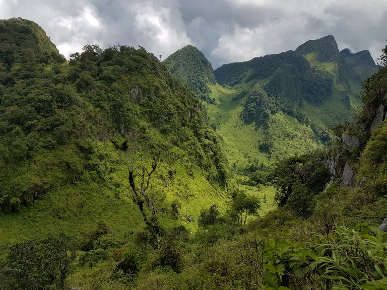
Chiang Dao is 2 hours north of Chiang Mai, Thailand and is the countries 3rd highest peak at 2,186 meters. Due to its very steep terrain, it boasts much more dramatic and breathtaking views than #1 and #2. It's also a great place for people who have not done much trekking before. If you fit in to this category and leave from the main park office, you will be accompanied by a park ranger, porters to carry your bag! and given a slow 3 day 'up and return' camping trip! I felt my pace would be a little faster and decided to go alone.
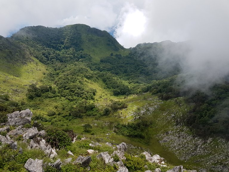
Concerns of getting lost were minimal- to reach the peak, trekkers just had to navigate through a narrow valley, walled in by steep jagged cliffs until you reach the end. As the valley floor gained height the end would be signified by a huge drop to low lying flat land (as well as being the highest visible point). A lack of turn offs meant you couldn't really take a wrong turn- well so I thought.
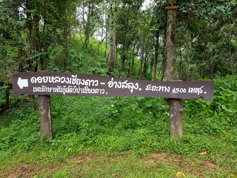
My trip began with an early start and departure from a local village. A wooden sign would mark the start of one of the routes. 6.5 km to the peak.
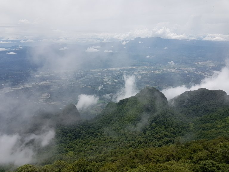
Early morning fog covered parts of the mountain and made me wonder if my view from the top would be clouded over!
I was aware of the route from internet maps- for this trip, Google Maps only offered satellite images of the land but not footpath routes. The first climb rose up along the exterior wall before leading you over a southern ridge into the valley.
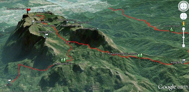
Image source: Google Earth
My start point was the lower left hand side flag, with the red flag marking the peak. It turned out that the most dramatic peaks were mid-valley on the left.
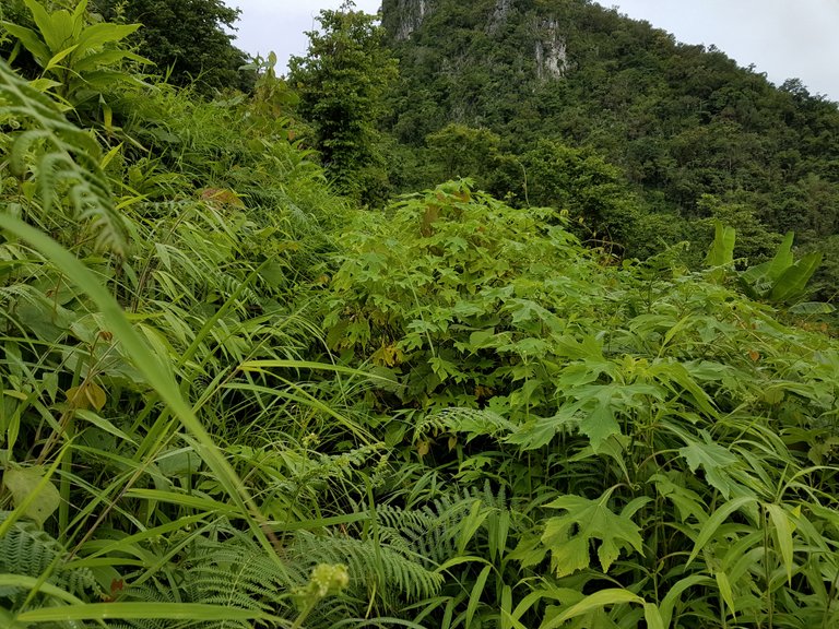
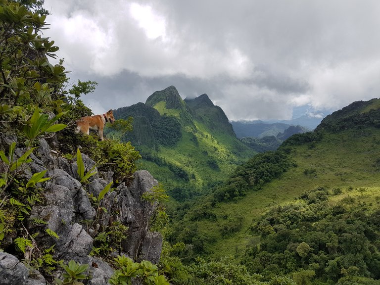
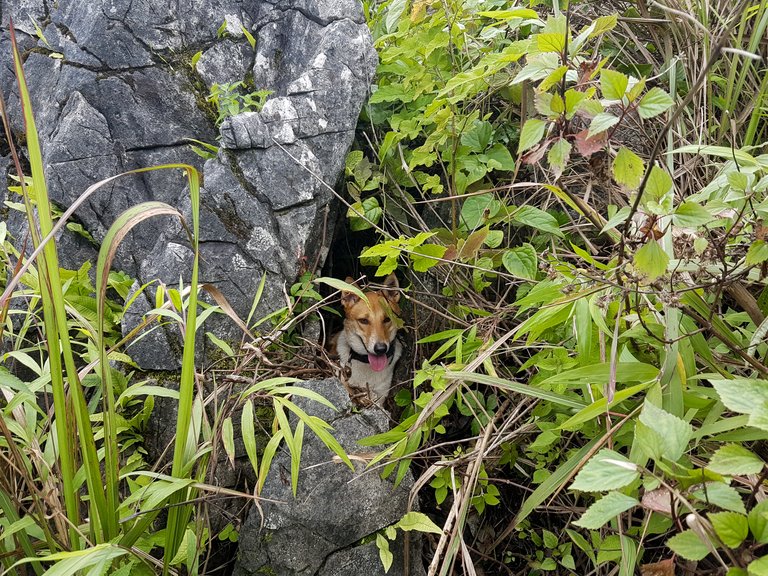
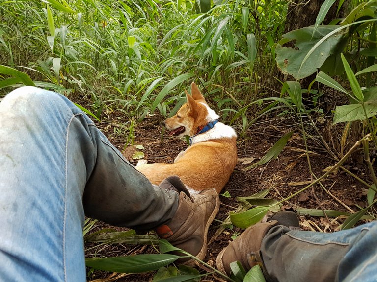
Almost instantly I knew the track I had taken had not been walked for a long time. It was the end of the rainy season and treks were usually cancelled due to bad weather conditions and slippery tracks. Vegetation had over grown and covered all paths. From my height the muddy footpaths were impossible to see- fortunately for me, I had taken my dog with me. As the tall grass and leafy bushes covered the path, they created a tunnel down below. All I had to do was follow my dog as she guided me down the tunnels she was following. Pushing through the vegetation became tiring once I added this onto the rugged terrain I was walking.
To give you an idea of the footpath, take a look below. The path is right in the middle of the photo, somewhere!
.png)
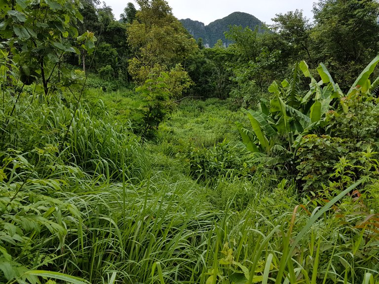
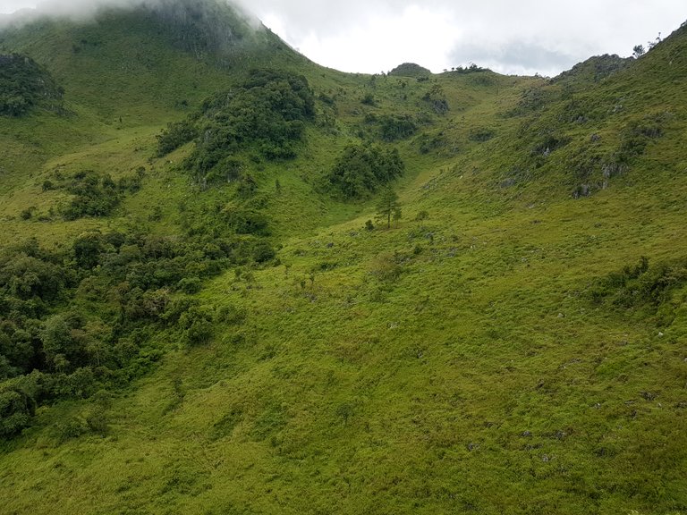
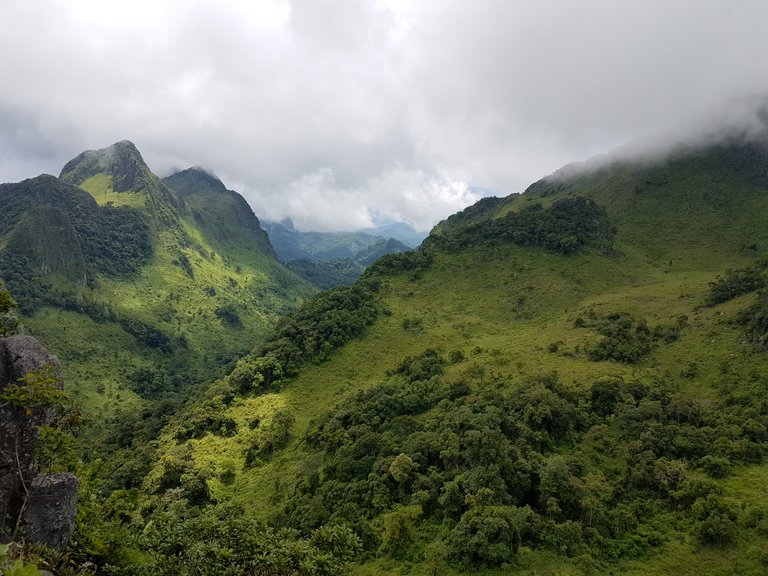
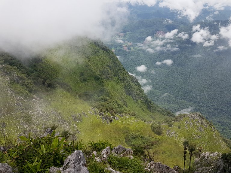
As I made some distance through the valley floor, the view back behind me got more and more impressive. The last part of the climb was the steepest and plant life began to change quite a lot. With stronger winds and a cooler climate compared to down below, trees and bushes became very scrub like.
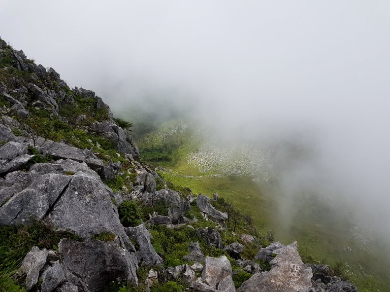
Shorter scrub like vegetation gave way to limestone rocks and broken boulders. Gusts of wind were cold and brought pockets of fog.
At some point I lost the footpath and was wandering wild aiming for the highest point. Looking back at this, I followed my dog for most of it. With long grass initially covering the tracks she didn't run off far, but now that she could see where she was going and had more smells to smell, I think she picked up a scent or trail of some animal and took us off the main path.
Trying to find the path again wasn't high on my priorities, after all, I could see the peak. The only problem was, it was a steep rocky climb up- it was also the most direct route and just added to the adventure.
.png)
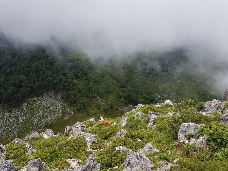
I spotted wild deer in the grassland down below. Their calls and noisy rustling as they pushed through the grass gave them away. They also left a parted line through the grass- I guess they had no idea they were being watched. The photo below is of a deer, but without a zoom lens, good luck trying to spot it, sorry!
My dog spotted the deer moving around and edged closer to the cliff to get a better look, it was quite amazing watching them down below but made me feel a little uneasy seeing her inch closer to the edge.
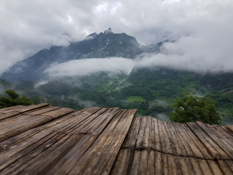
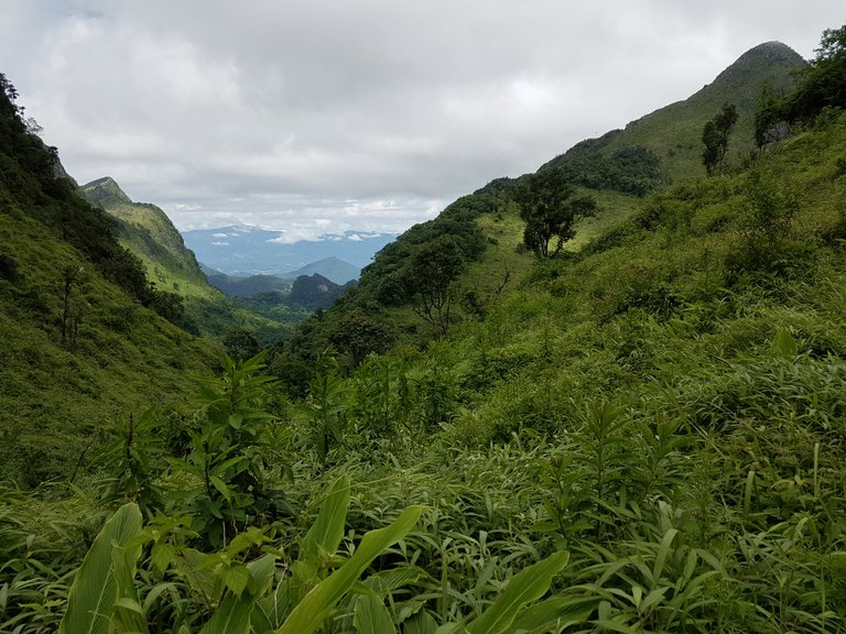
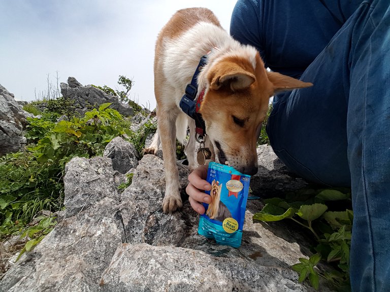
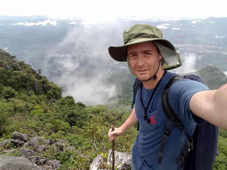
After a hard climb I reached the top, we had a snack and enjoyed the view. Fog passed over intermittently, but 360 views could be timed and they were breathtaking.
A view to one side looked down over green national park forest. To the other side, towns and farm land.
Knowing I had another 6.5ish kilometers to get back down, I headed back. I tried to find a more direct route and one that would pass another peak. This turned out not to be the best idea. As we dropped down the grass and vegetation was thicker than before. To make things worse, my dog and I were following the mountain side, rather than the valley floor. The ground was potted with limestone caverns and gullies hidden under the plant life and quickly turned dangerous.
After twisting my leg slipping into a gully and having to carry my dog over some of the gully cracks I decided to give up trying to scale another peak and headed back down to the center of the valley. Without a path to follow, my dog relied on me to clear a path for her to walk through.
.png)
My dog did manage to find some rock tunnels in among the gullies and disappered from time to time only to pop out as I was climbing down.
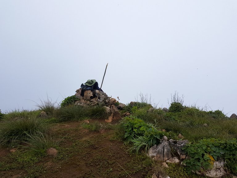
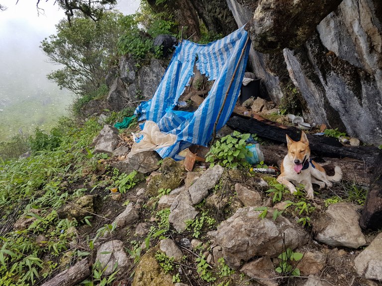
We came across a small shelter and had another rest. At the shelter there were cooking pots and old rubbish. It was way off from the main track and away from the campsites hiking groups would use. I wondered if it was a poachers camp or somewhere rangers would stay when out surveying the land and wildlife.
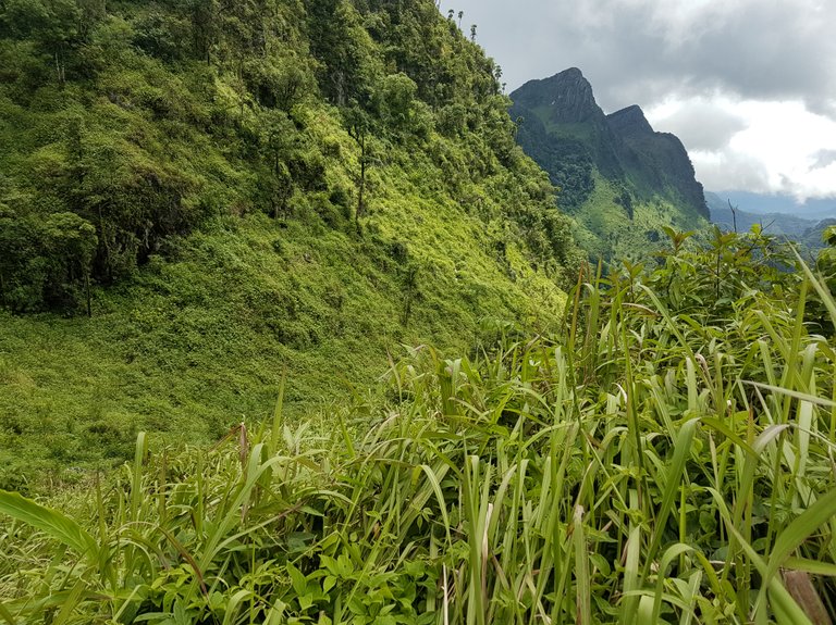
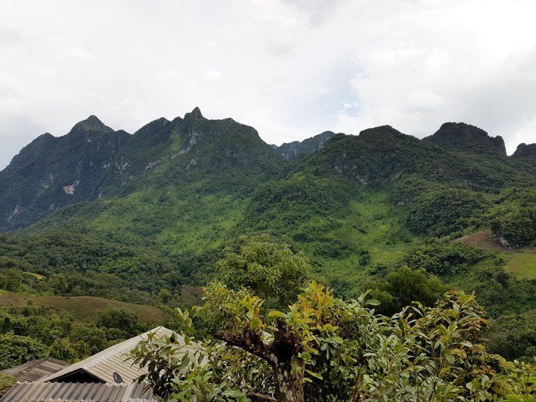
Making my way to the lower valley gave me one last view looking back up to the towering peaks before I entered back into the forest.
I'm sure by doing this trek alone made it even more memorable and turned it into the adventure it was rather than resting every 100 yards for stragglers in a large group and guides suggesting every footstep!
I would suggest to anyone thinking of doing something similar to always let someone know your itinerary before hand and clearly sharing a rough time frame of check points along the way. Thailand is pretty good for mobile data service and although internet and phone signal was lost while walking in the valley, I did ping my location as and when I could. Taking more water than anticipated it also a good idea.
And finally, the best view of all was from the top standing on the edge looking down across the 'outside' national park. It also showed my starting point that same morning- somewhere near the cleared farm land in the distance.
Making it back that evening showed the mountains in all their glory. The fog had cleared and there was still an hour of sun light.
If you liked my post, please don't forget to follow and upvote for more :)
Lovely post and lovely dog.
Thanks :)
That area is so lush! I appreciated the map of the hike, gave a good feel for the distances covered. Your dog is a pretty good trailfinder, if you don't mind side excursions every now and then.
haha yeah, maybe she wondered why I was following her the whole time! We were both really tired once we got back, but well worth it.
Great post for a great adventure!! I really like the first image, but all of them are awesome ;)
Thanks, glad I made the right choice for the thumbnail image then lol
What a cracking adventure, made possible by man's best friend!
My dog was in her element, loved the whole day.
That's a great way to discover Thailand's nature! So cool that your dog did the tour with you :)
Thank you, its good there are still lots of places like this
looks like God is living there. thinkit we discover Thailand with you !!! we must really come there and enjoy all these amazing places you show us .
Lots of places here to discover, the more remote, the better.
This could have been quite dangerous if you had injured yourself seriously! Your dog is wonderful companion! Both you and your dog extremely adventurous!
Very nice post!
You got a 75.00% upvote from @greengrowth thanks to @thinkit! You too can use @GreenGrowth by sending your post URL in the memo field to the bot. Minimum bid is 0.01.
If you feel this post is spammy or not worthy of @Greengrowth you can contact a moderator in our Discord Channel https://discord.gg/6DhnVTQ.