Hello, Steemians! When I was backpacking through Ecuador earlier this year I went rock climbing with a few people from the hostel I was staying at in Baños and they had just arrived from Latacunga after finishing a three day trek of the Quilatoa Loop and they were raving about how beautiful and serene it was so I decided to give it a shot. Later that evening while cooking dinner in the hostel I bumped into a couple of people who coincidentally were heading to do the trek the following morning and said I was welcome to join so I jumped at the offer. The next day we headed from Baños to Latacunga, a small city just south of Quito, and found a hostel for the night and booked a bus to Sigchos the following day. Let me give you some background on the trek before I continue.
The lake in all it's glory
About the Trek
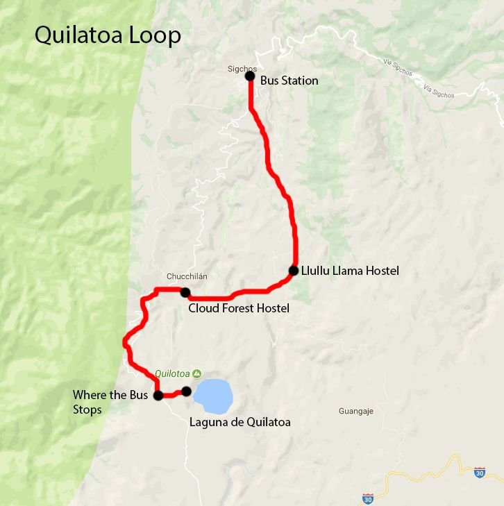
A map of the route and hostels I stayed at
This trek can be done in 3 or 4 days and can be done in 2 directions, north or south, from Sigchos to Quilatoa or reverse. We opted to start in Sigchos and work our way up in elevation as opposed to the easier way of going down to make it more of a physical challenge. You can even start in Latacunga and walk to Quilatoa then continue on to Sigchos. Our route was as follows:
Sigchos >> Insilivi (Llullu Llama Hostel) >> Chugchilan (Cloud Forest Hostel) >> Quilatoa
This trek takes you through a variety of rural Andean villages where the main language is Quechua so it can be a bit difficult to communicate with some of the older people who don't speak Spanish but you can always find a way to sort it out. The trek is actually pretty hard to navigate because of all the small goat roads on these farm roads so you should try and get a map from the Tiana Hostel in Latacunga before you start the trek. Ok, let's get back into the trek itself!
Day 1 - Latacunga to Sigchos by Bus and Sigchos to Insilivi by Foot
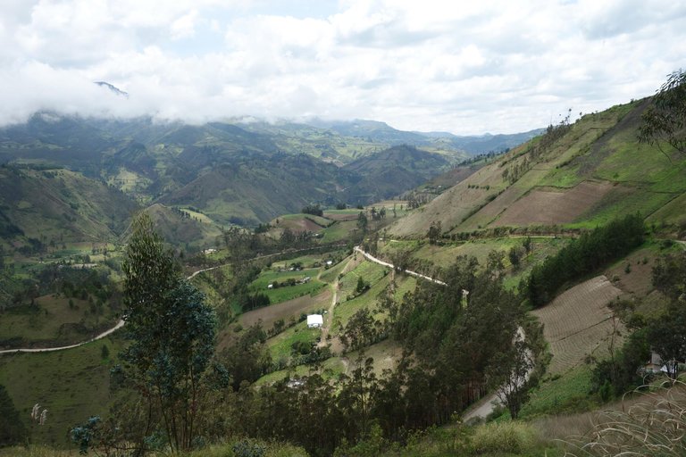
Endless valleys
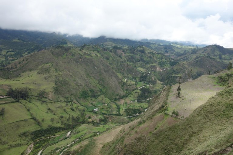
These views never get old
We got on the 8AM bus from Latacunga to Sigchos after a quick breakfast in town and headed off into the mountain roads of rural Ecuador. The bus ride was extremely bumpy and uncomfortable but I did manage to get a bit of sleep along the way, I can't say the same for my companions though, I think they got a bit sick from all the motion. The ride was about 2 hours and we arrived shortly after 10AM and set out on the trail, it was only about 10km to Inisilivi so we expected a short day but that was wishful thinking.
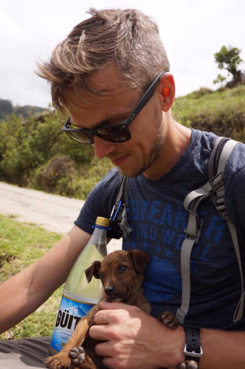
Took a break to play with a bunch of puppies!
The first three quarters of trek went really well, it was a beautiful day and we managed to find our way just fine but we then we had some trouble. When we crossed a valley we thought we were going the wrong way but we ended up getting lost on some of the farm roads and got way off track and it also started raining. We walked around for about 3 hours in the rain trying to find our way to no avail until finally a local woman pointed us in the right direction. Once we found our way we hiked for another hour to reach the Llullu Llama Hostel in Insilivi. This hostel was very unique compared to others I have stayed at and it was quite expensive but I think it was worth it in the end. It cost $18USD per night but it included a 3 course dinner and breakfast which was amazing and served family style so everyone got a chance to eat together and chat into the night. They also had a massive Saint Bernard for a hostel dog who was a blast to play with after we finished our meal.
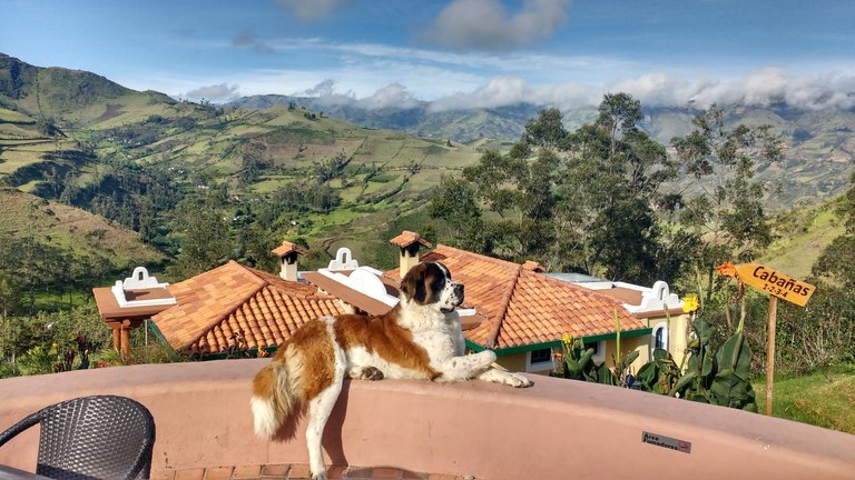
This was the best shot of that dog I think there has ever been taken
Day 2 - Insilivi to Chugchilan by Foot
The next morning we rose and set off after breakfast, however today we were not going to get lost as we got an extremely detailed map (it was a godsend) from the hostel that guaranteed we were on the right track. We hiked through the gorgeous valleys and ridges for about 4 hours before arriving at noon in Chugchilan and getting a room in Cloud Forest Hostel. This hostel is similar to the last (all included meals) but was quite a bit cheaper. Because we arrived so early, a few of us set out to do the cloud forest trek which takes you to one of the highest ridges in the area and offeres beautiful views of the surrounding area and all said and done it takes about 3 hours, definitely worth it if you have the energy. We got back to the hostel after the hike and ate a huge meal then headed off to bed to rest for the final day's hike.
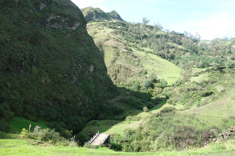
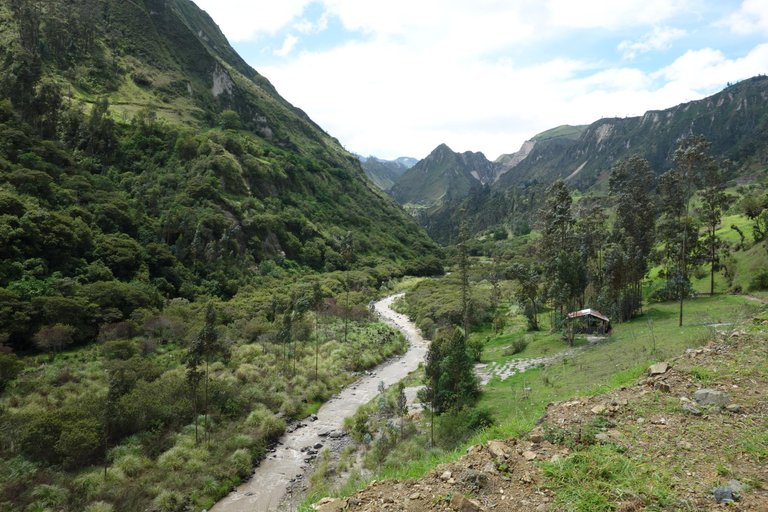
In the bottom of the valley
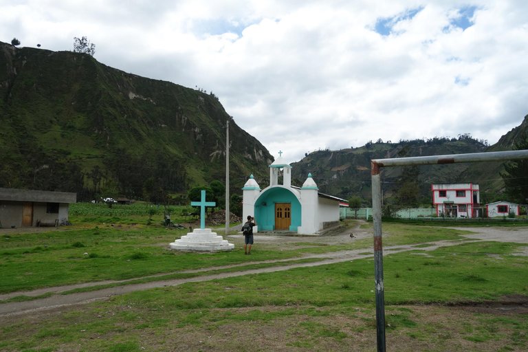
Small church along the way
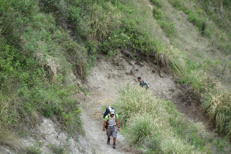
Waiting on the boys to catch up

A nice panorama
Day 3 - Chugchilan to the Quilatoa Crater's Edge
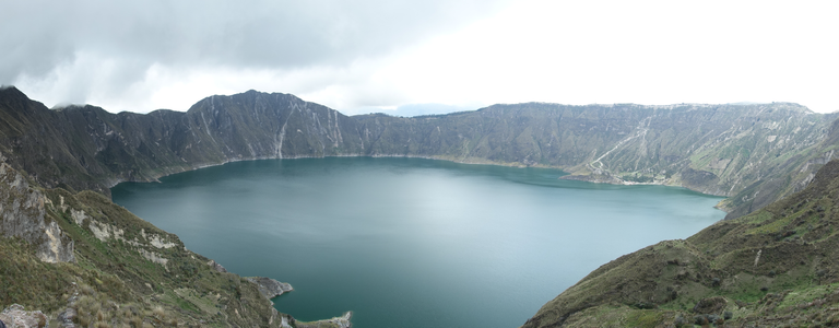
This was by far the most difficult day as you ascend about 750m in elevation but ti was far from impossible. We set out early after breakfast and following our map we made our way up and over several ridges and into several valleys before we were at the base of the crater. Along the way we passesd through many small villages and had tons of extrordinary views of sweeping valleys and canyons, this day was by far the most scenic of the three and I won't soon forget it. The last push up the side of the crater was difficult but we all made it and when you reach the edge you recieve a wonderful gift, the turquoise-blue waters of Laguna de Quilatoa. It was honestly one of the most beautiful sights I have ever witnessed and we all stared in wonder at this beautiful scene. The lake was formed about 600 years ago when the volacano below erupted and the top of the mountina collapsed on itself creating a massive crater that eventually became the beautiful lake it is today.
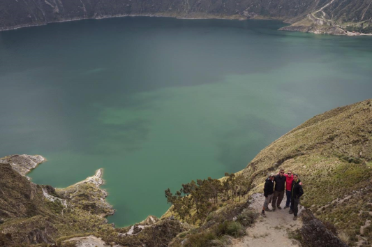
Strangers yesterday, friends today, we made it!
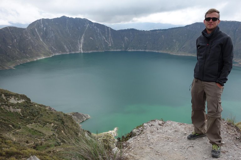

We spent 20 minutes enjoying the view before setting off to walk to the village proper, there are two ways to get there, along the lip of the canyon or the more difficult way, along the inside ridge. We opted for the latter so we could continue seeing this beutiful lake but the hike was tough for a few of my new friends and it took us about two hours to get to Quilatoa. Once we arrived we went to eat a big meal to celebrate finishing the hike with a well deserved beer, we folowed that by one last look at the lake from the giant viewing platform in the village. We had to run to catch the last bus back to Latacunga which picks you up on the highway about 700m from town but we made it just in time. We got back to Latacunga and shared a final meal before we all split up to head in different directions, it's sad to say goodbye to new friends you meet in various places in the world but we will always have the experiences we shared on those dusty trails through rural Ecuador.
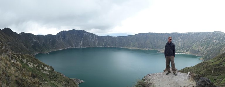
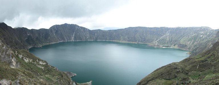
It really is a beautiful lake
Really a nice post and great Pictures 😁👍
Great pics!
This post recieved an upvote from minnowpond. If you would like to recieve upvotes from minnowpond on all your posts, simply FOLLOW @minnowpond
Loads of information. Thanks. Love it. @travelstheworld Followed
I appreciate that, thanks for reading!
Epic views man!
Yeah they were quite amazing I wish I could have taken a bit better pictures but I tried, thanks for reading!
Great views and cute to have a puppy break. :)
Yeah the puppies were the best part of that day! We were walking along a farm road past a small house and all of a sudden these seven little puppies came running out barking and squeaking so we ended up sitting there for the better part of half an hour playing with them while the people on the farm laughed, its a great memory for me. Thanks for reading!
Upvote & follow .... totally awesome ...
I appreciate that! Thanks for reading!
What a great photoblog. The images were perfect, the place fabulous, and the writing good. Followed.
I appreciate the kind words! Thanks for reading
That was a fantastic log of your journey! I thoroughly enjoyed reading through it as well as seeing the pictures!
Beautiful place....great captures....!
when I first saw the lake, I guess it is a lake formed near a volcano. After reading your post, I know I am right ^^ The view is so beautiful (Y)
I came across an interesting thing in your post: Quechua - a famous Decathlon's brand is originated from a tribe in the Andes ^^
THat's look like an amazing trek. At the en how many Km did you hike?
Wow, that looks like an incredible trip. The photo spot looks a little treacherous though!
I'm going to put this on my list of things to do in South America. Thanks for sharing your trip.
So beautiful!
why did steemcleaner downvote this?