By any standard and from any perspective, the Leh Manali journey has epic written all over it. With roads that open up for only a few months a year, these 470 km will test you, scare you, shock you and leave you spellbound. You will believe life is beautiful!
Tanglang la
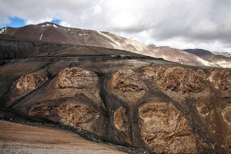
A couple of hours after Leh, all civilisation just vanished. Suddenly, we were on Tanglang la, the mountain pass with its peak at over 5300 m. This is where we crossed the highest point – of not just this journey, but of our lives!
The view at the top was spectacular! The entire pass was laid out before us. We were at level with the snow clad peaks surrounding us. Colourful prayer flags were strung around.
A sign board proudly announced that we indeed were at the highest point of the Leh Manali highway. We felt on top of the world!
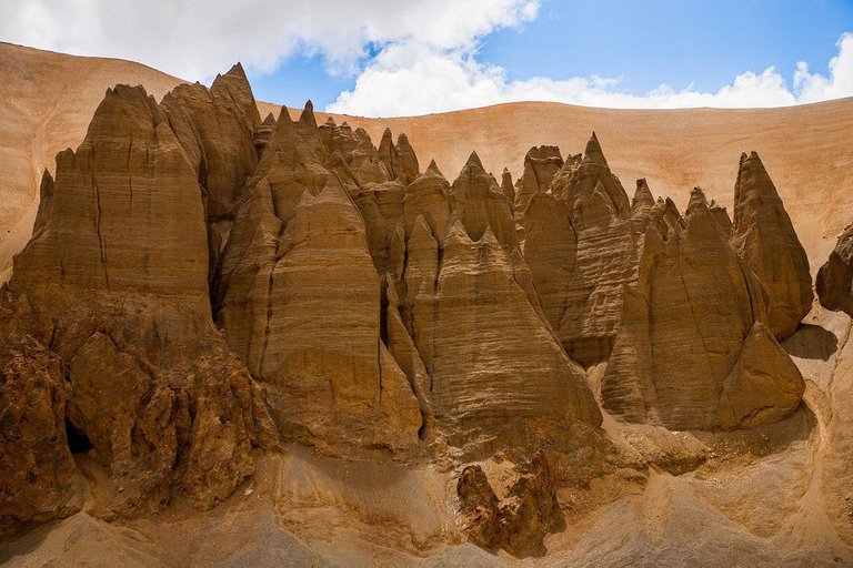
They looked like needles rising in the sky, reminding us of the sand castles we built on the beach as kids.
Except that they were gigantic! And this wasn’t really the sand at the beach.
These were the mighty Greater Himalayas, withered with age by their only constant companion – the ferocious winds.
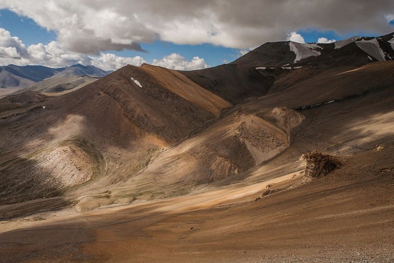
This was our view for most of the Leh Manali journey.
Being in the presence of such raw nature – these mountains without as much as a trace of life – was overwhelming.
Only because there was a road here, we had the privilege to witness this magnanimity. This thought was even more overwhelming.
This road didn’t get here by magic. Brave men and women had braved rough weather, toiled hard to create it.
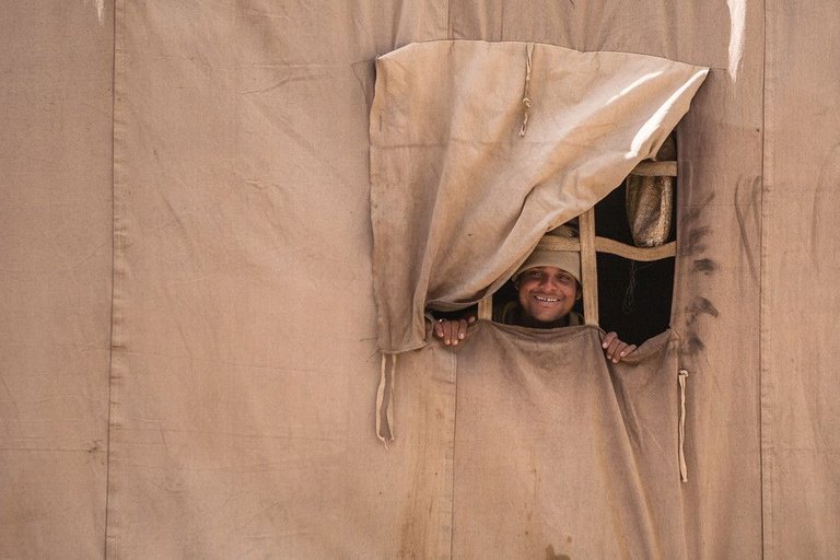
Like this man, we saw from our bus on Tanglang la.
They come from far off places where they have no real employment opportunity. When the road opens for traffic, these road maintenance workers come here for work. They stay on these mountain passes for 4-5 months a year.
In these months, they earn around Rs.20K (roughly 300$) to take back home.
The only highlight of their day is the 2-3 buses that cross this road. Otherwise they are completely disconnected from civilisation.
Hats off to their endurance!
Lachung la
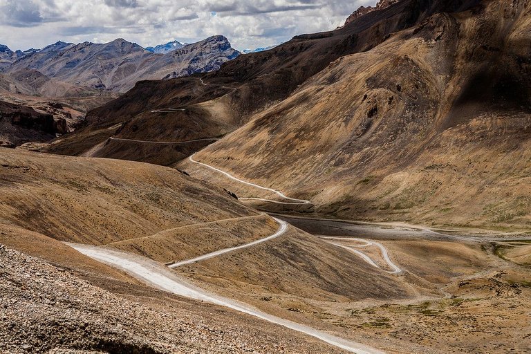
Long and meandering, with its peak at 4891 m, the Lachung la was the second pass of the Leh-Manali route.
Mountains the shades of browns you didn’t know and land formations you didn’t think possible are the characteristic of this pass!
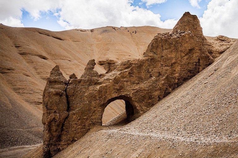
Like this natural tunnel we saw on Lachung la.
Opposite the motor-able road, this is probably part of the trekking route from Leh to Manali.
Nakee la
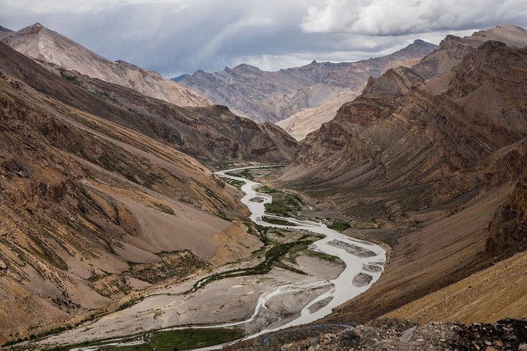
By the time we reached Nakee la, our third pass, we had come to terms with our “heart in mouth” condition.
Every glimpse of the Indus river flowing below brought with it a green oasis.
Our minds started to wander.
To the people who crossed these mountains by foot. Years ago. Not by choice. Out of necessity.
To the people who have set up camps here, the BRO employees—the ones who maintain these roads. What makes them choose this job? How do they stay connected? How do they get their supplies?
How does this place look in the winter? Covered in snow?
Do the mountains ever get lonely? But they always have winds for company!
Wandering and wondering.
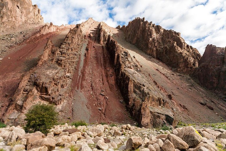
It was now time for the reds of the Leh-Manali highway. The wind-battered mountain faces with their powdered rocks seemed like gigantic sand dunes.
This also makes the Leh-Manali highway vulnerable to massive landslides. The landscape is all very stunning; but with such strong forces of nature at play, there is never really a guaranteed safe passage!
Gata loops
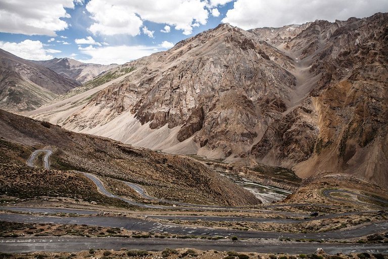
These are the Gata Loops, a series of hairpin bends looping down.
It was a roller coaster ride we will never forget.
As if the thrill of just scraping by the bend wasn’t enough, the driver decided to add some fun. A short cut was what he needed. He got off the tarmac road. Onto the ground, in between the loops.
The bus rattled. As did our teeth.
We were just hoping this short cut doesn’t cut short dear life!
Baralacha la
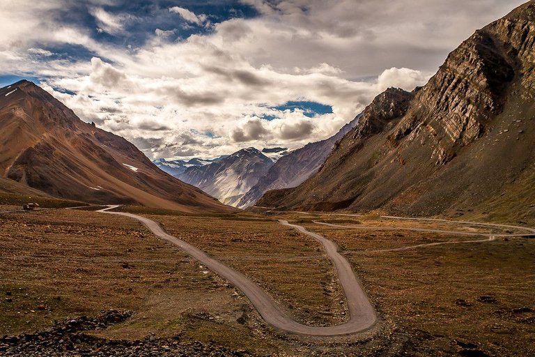
The Baralacha la was our last pass of the day. We were now one state lower, in Himachal Pradesh.
Deep valleys, hairpin bends and steep curves were now “just another day in office”.
The sun was high above our head and the glaciers were melting in full flow. Our bus crossed through what feel like rivers.
Towards the end we crossed a lake Suraj Taal.
We realised we were coming close to civilisation. Soon we would see people! And shockingly, the thought of seeing more people gave us joy!
Coming from Mumbai, a city of over 20 million, we never ever thought that was possible!
Soon after, we reached Keylong where the day’s journey ended.
Rohtang Pass
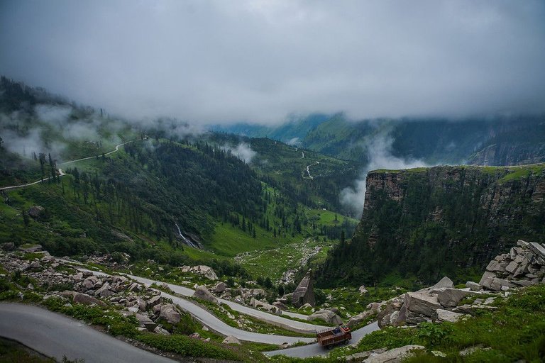
Early next morning, while it was still dark, we resumed the journey. Our minds were already in the lush greens of Manali, by the Beas river.
But before that—there was the Rohtang. A pass no driver dares to cross in the night.
After a couple of hours, in broad daylight, we were at the start of the Rohtang Pass. The crowned prince of the Leh-Manali route. Or a dreaded monster!
Imagine the bus (rickety, with smooth tyres!), negotiating a hairpin bend on bumpy gravel at a gradient of what feels over 60 degrees. Suddenly, there’s a truck in front of you. And the bus has to reverse.
But we couldn’t see any of it, because, well, the valley was covered in fog. Or mist. Or were they clouds? We didn’t care! And were we glad! It was all just too much to handle!
“If the bus falls off now, at least I have seen the most majestic place on earth.” Yes, this did cross our minds.
We firmly believed our driver was a magician. And our bus, The Chariot of the Gods!
This experience is worth remembering !!!