Saludos mis queridos amigos y lectores me motiva poderles comentar de mis vivencias e historias de mi querido pueblo un lugar muy especial para mí y muchos de los que vivimos en él, es muy acogedor y un sitio muy pintoresco y como muchos de los pueblos en este caso, él se niega morir.
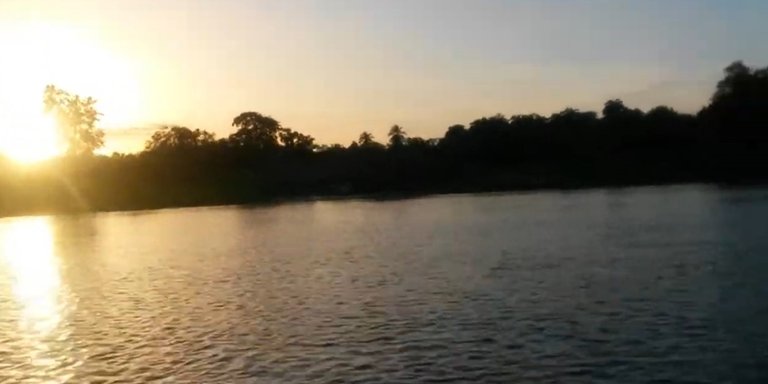
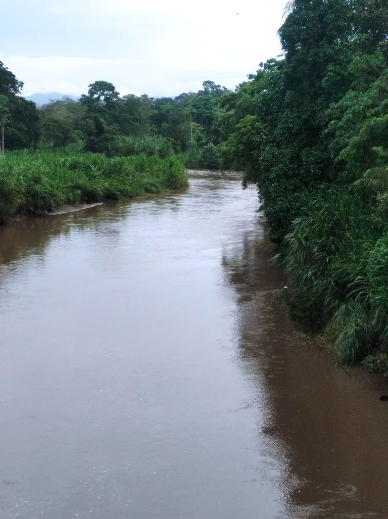
En esta oportunidad les hablare del municipio Bolívar y el mío es conocido como Caripito, un pueblo con una población de unos sesenta mil habitantes aproximadamente y está ubicado al norte del estado Monagas, ciertamente es muy especial por su gente, costumbres, tradiciones y su río san Juan que tiene salida al golfo de paria.
Fue fundado en 1940 como municipio pero mucho antes era unos de los puertos más importantes y productivos de Venezuela por tener acceso a otros estados también conocido como oriente de igual forma somos productores de petróleo y por donde salía todo ese material tan primordial para la economía de nuestra nación.
No podía pasar todo este movimiento sin algo tan impresionante para nuestros pobladores como lo es nuestro río, que nace en las montañas del turimiquire el cual se encuentra en el municipio Caripe y el mismo se encuentra con el caño San Juan a través de su caudal pero muchas veces nos sorprende cuando en sus cabeceras llueve mucho como es el caso en este momento que tienen que abrir las compuertas de la represa de caripe y nos vemos amenazados porque siempre observamos a el río tranquilo y con poca agua y cuando eso sucede sus aguas entran al pueblo y sus habitantes debemos de tomar todas las previsiones y así evitar consecuencias graves como pérdidas materiales.
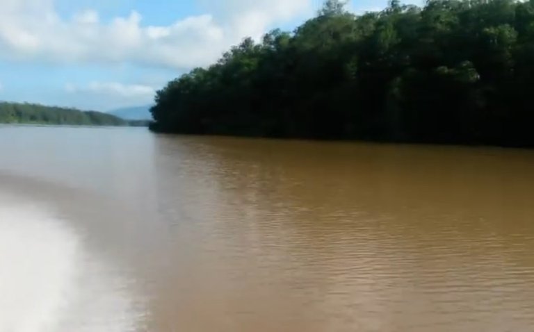
Este famoso caño que tiene una longitud de ciento ocho kilómetros de largo y es la división del límite del estado Sucre con Monagas y un ancho considerable en su momento tenía una muy buena profundidad este era muy viable para sacar los productos de el estado sin tener que ir a otros teniendo ya que contamos con un puerto confiable de navegación.
Solo que esté es muy confiable para navegar y tiene un sistema de mareas que pocos ríos en el mundo poseen todos estos tienen mareas no como este que solo duran cuatro horas su sistema le permite a los lugareños transitar de un lado a otro con muy poco esfuerzos debido a que este sube su caudal o va en sentido de cuatro horas y el otro sentido por cuatro horas garantizandoles a las embarcaciones moverse con poco esfuerzos debido a que la corriente te ayudará.
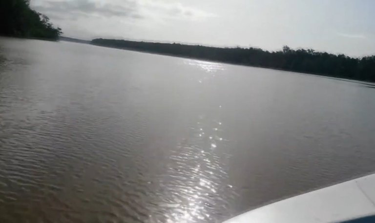
Cuando el río cumple su tiempo de llenar lo vas a ver en su pleno máximo como también al bajar lo observarás que en muchas de sus partes no es navegable por embarcaciones de mayor calado que por estás situaciones fue retirado el muelle petrolero y transferido a la localidad de puerto la cruz y este cuenta con puertos directo al mar y facilita el libre trabajo en todo momento.
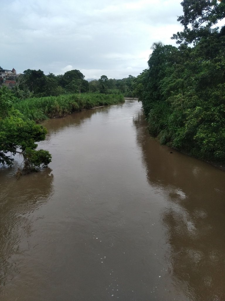
En estos momentos tan importante para la economía de nuestro municipio seguimos contando con este recurso tan importante para nosotros y es utilizado como salida al mar se programa paseos turísticos y competencias de lanchas y pesca de sábalo y de esa manera existen muchos pescadores artesanales que hacen vida en esta aguas y es su forma de subsistir económicamente.
También se debe acotar que en las faldas de este río hacen vida varias comunidades indígenas que son autóctono de este lugar y comunidades que pertenecen al estado Sucre cómo son agies, guanoco, mucubinas y caño la brea son asentamientos que se fundaron desde la llegada de la industria petrolera hasta los actuales momentos y estás comunidades viven de la agricultura y de la pesca.
Muchas gracias por acompañarme hasta este punto espero que le sea de su agrado este relato que he tenido con todos ustedes, bendiciones.
Greetings my dear friends and readers, it motivates me to tell you about my experiences and stories of my beloved town, a very special place for me and many of us who live in it, it is very cozy and a very picturesque place and like many of the towns in this case, it refuses to die.
This time I will talk about the municipality Bolivar and mine is known as Caripito, a town with a population of about sixty thousand inhabitants approximately and is located north of the state of Monagas, it is certainly very special for its people, customs, traditions and its San Juan river that has access to the Gulf of Paria.
It was founded in 1940 as a municipality but long before it was one of the most important and productive ports of Venezuela for having access to other states also known as east in the same way we are oil producers and where all this material so essential for the economy of our nation came out.
All this movement could not happen without something as impressive for our people as our river, It is born in the mountains of Turimiquire which is located in the municipality of Caripe and it meets with the San Juan river through its flow but many times it surprises us when it rains a lot in its headwaters as it is the case at this moment when they have to open the gates of the Caripe dam and we are threatened because we always observe the river calm and with little water and when that happens its waters enter the town and its inhabitants must take all the precautions and thus avoid serious consequences such as material losses.
This famous pipe that has a length of one hundred and eight kilometers long and is the division of the limit of the state of Sucre with Monagas and a considerable width at the time had a very good depth this was very viable to get the products of the state without having to go to other having to have a reliable port of navigation.
Only this is very reliable to navigate and has a tidal system that few rivers in the world have all these have tides not like this one that only lasts four hours its system allows the locals to move from one side to another with very little effort because this increases its flow or goes in one direction for four hours and the other direction for four hours guaranteeing the boats to move with little effort because the current will help you.
When the river fills its full time you will see it at its maximum as well as when going down you will observe that in many of its parts it is not navigable for vessels of greater draft that because of these situations the oil dock was removed and transferred to the town of Puerto La Cruz and this has direct ports to the sea and facilitates free work at all times.
In these moments so important for the economy of our municipality we continue counting on this resource so important for us and it is used as an outlet to the sea, tourist trips and competitions of boats and shad fishing are programmed and in this way there are many artisanal fishermen who live in these waters and it is their way of subsisting economically.
It should also be noted that in the foothills of this river live several indigenous communities that are indigenous to this place and communities belonging to the state of Sucre how are agies, guanoco, mucubinas and caño la brea are settlements that were founded since the arrival of the oil industry until the present time and these communities live from agriculture and fishing.
Thank you very much for accompanying me to this point I hope you like this story that I have had with all of you, blessings.
Your post has been curated by us! Received 20.00% upvote from @opb. Do consider delegate to us to help support our project.
Do join our discord channel to give us feedback, https://discord.gg/bwb2ENt
* This bot is upvoting based on the criteria : 1. Not plagiarised, 2. Persistent previous quality posts, 3. Active engagement with other usersDo upvote this commment if you 💚 our service :)