As you know here in Germany autumn has begun already which means it's the perfect time to go out with our dog for long walks in the area because it is not too hot, not too cold and also not as crowded as in summertime.
So whenever we have some time off, we decide to explore some new area here in Bavaria and go for a long walk.
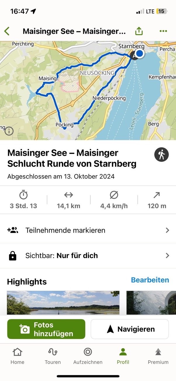
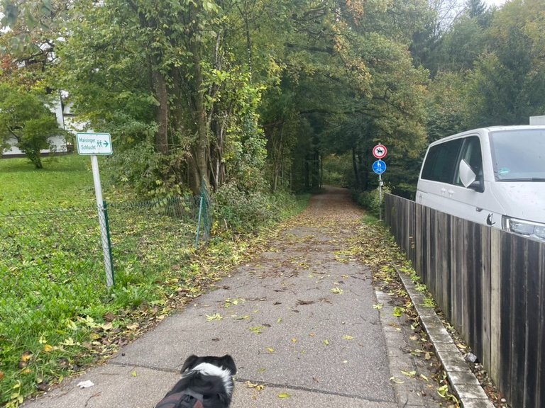
The original plan was to go hiking to the top of a mountain next to Lake Tegernsee, but as it was raining a little bit we decided to do that another day. Instead, we went to do a Circular track from Starnberg to Pöcking to Lake Maisinger See and then crossed the Maisinger Gorge on our way back.
Como saben aquí en Alemania el otoño ya ha comenzado, lo que significa que es el momento perfecto para salir con nuestro perro haciendo largos paseos por la zona porque no hace demasiado calor, ni demasiado frío y tampoco hay tanta gente como en verano.
Así que cada vez que tenemos tiempo libre, exploramos alguna zona nueva aquí en Baviera.
El plan original era subir una montaña junto al lago Tegernsee, pero como estaba lloviendo un poco decidimos hacerlo otro día. En cambio, hicimos una ruta circular desde Starnberg a Pöcking y al lago Maisinger See y luego cruzamos el desfiladero de Maisinger en el camino de regreso.
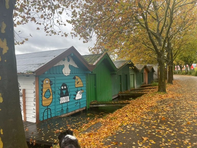
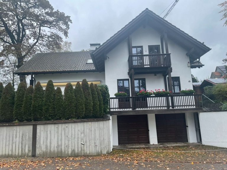
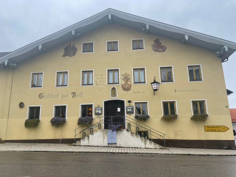
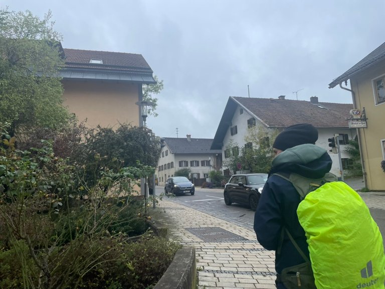
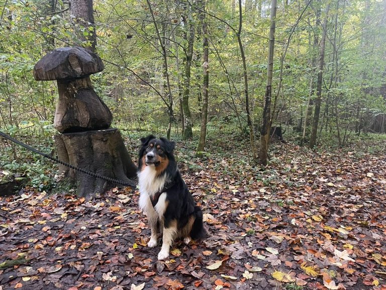
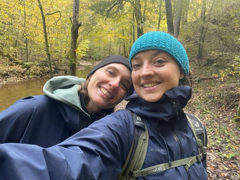
So we put on our rainproof clothes and drove to the village of Starnberg. It is a small city next to the lake Starnberger See. The medium-sized town is located around 25 km southwest of Munich at the northern end of Lake Starnberg and is a destination for excursions and relaxation. But most important. Starnberg is my birthplace. 😎
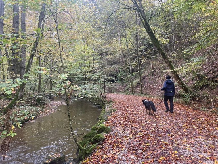
There we parked at the central station and started walking along the lake.
Así que nos pusimos ropa impermeable y fuimos al pueblo de Starnberg. Es una pequeña ciudad junto al lago Starnberger See. Esta ciudad de tamaño medio se encuentra a unos 25 km al suroeste de Múnich, en el extremo norte del lago Starnberg, y es un destino para hacer excursiones y relajarse. Pero lo más importante. Starnberg es mi lugar de nacimiento. 😎
Allí aparcamos en la estación central y comenzamos a caminar junto al lago.
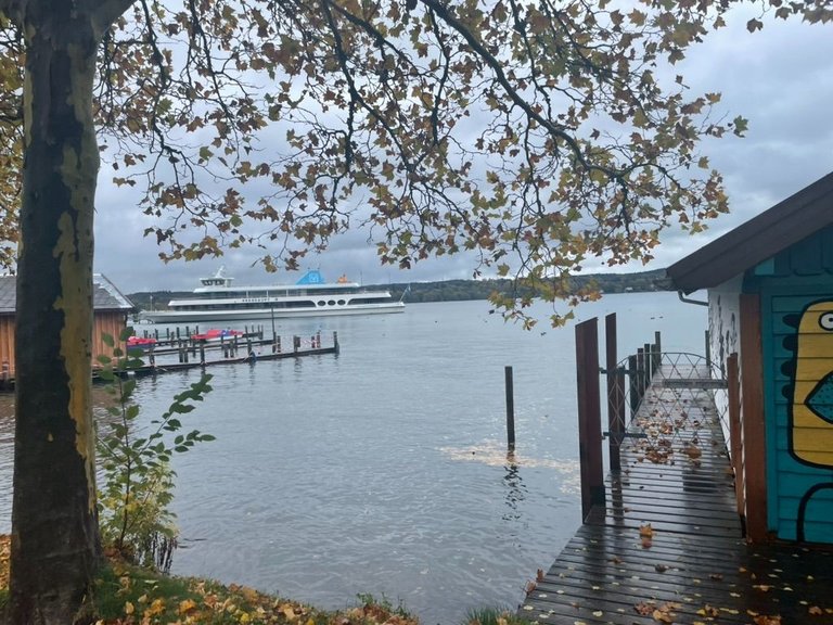
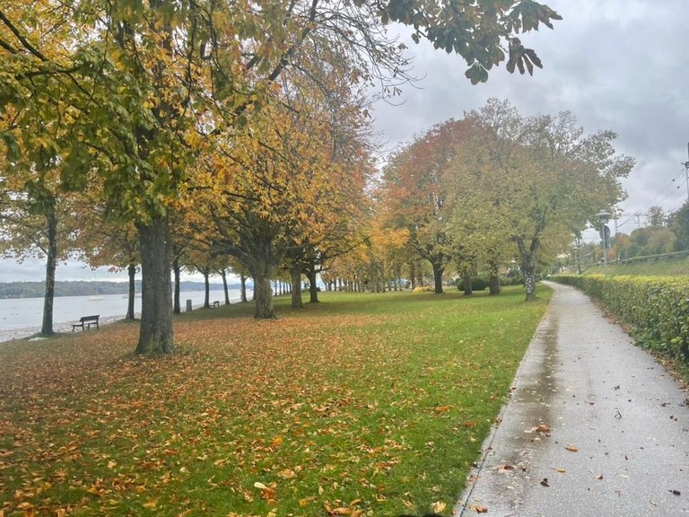
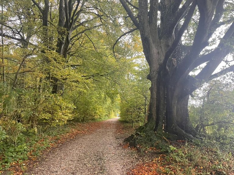
I love the colors of the trees around this time, even though the streets can get very slippery when wet and full of leaves.
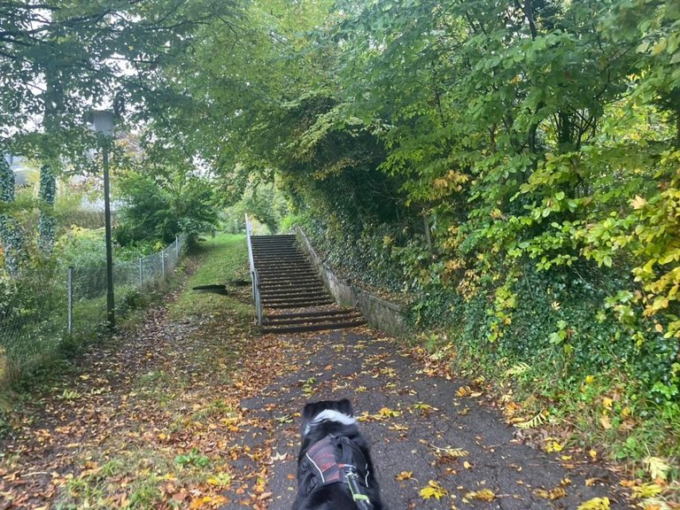
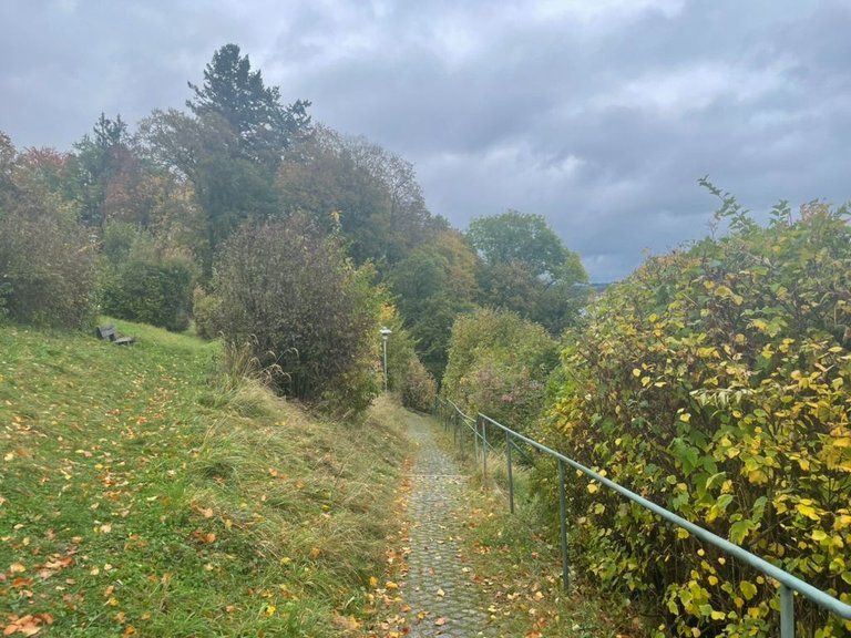
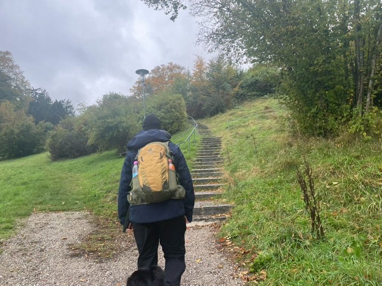
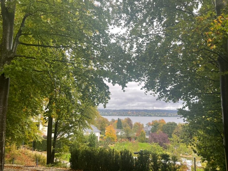
After passing the promenade I was surprised that we had to go uphill.. many stairs! - not a big fan of stairs :D.. but once we went up we had a great view towards the lake.
Me encantan los colores de los árboles en esta época, aunque las calles pueden volverse muy resbaladizas cuando están mojadas y llenas de hojas.
Después de pasar el lago me sorprendió que tuviéramos que subir... ¡muchas escaleras! - No soy una gran fanática de las escaleras 😁. Pero una vez que subimos tuvimos una gran vista hacia el lago.
Of course in Bavaria at every lake, there are mostly rich people living, cause it's pretty expensive. So walking along them is very interesting in terms of architecture as well.
Por supuesto, en Baviera, en cada lago vive principalmente gente rica, porque es bastante caro. Así que caminar por esas calles también es muy interesante desde el punto de vista arquitectónico.
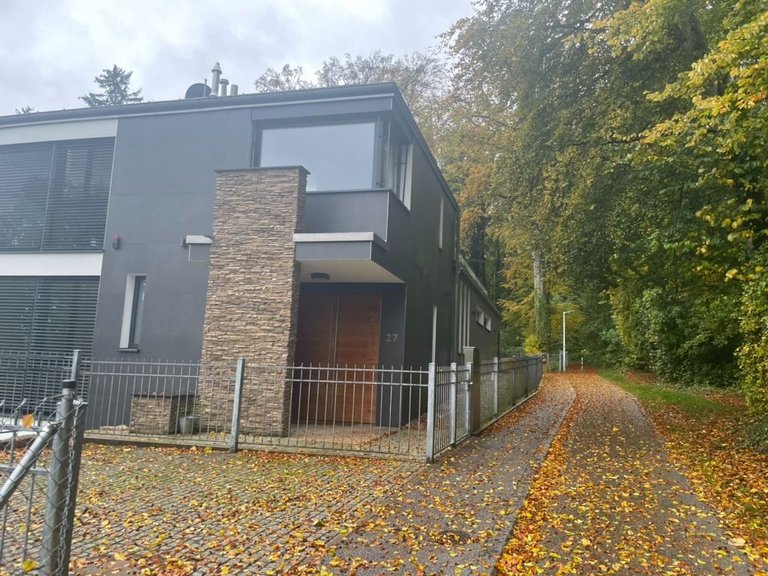
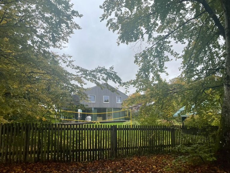
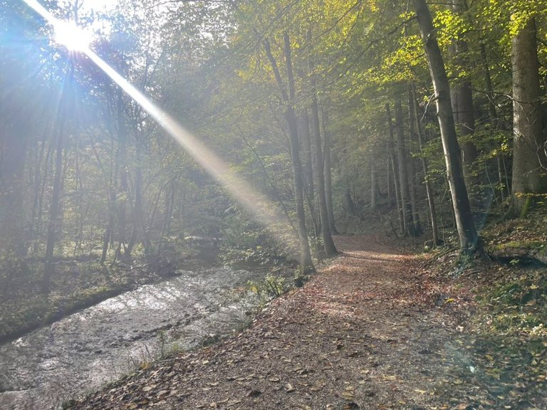
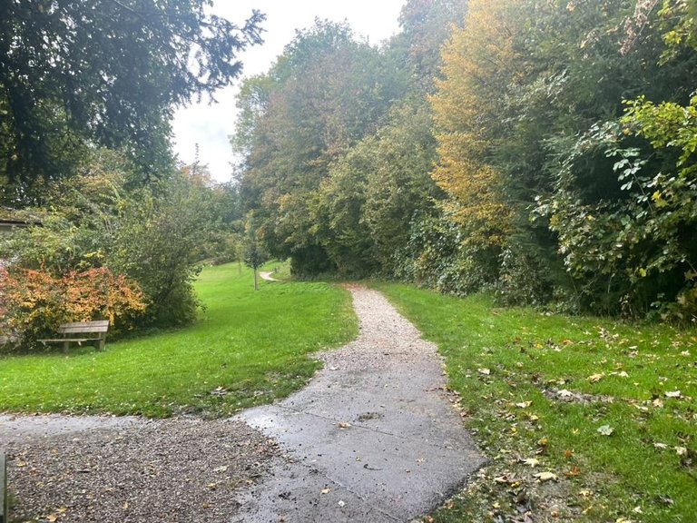
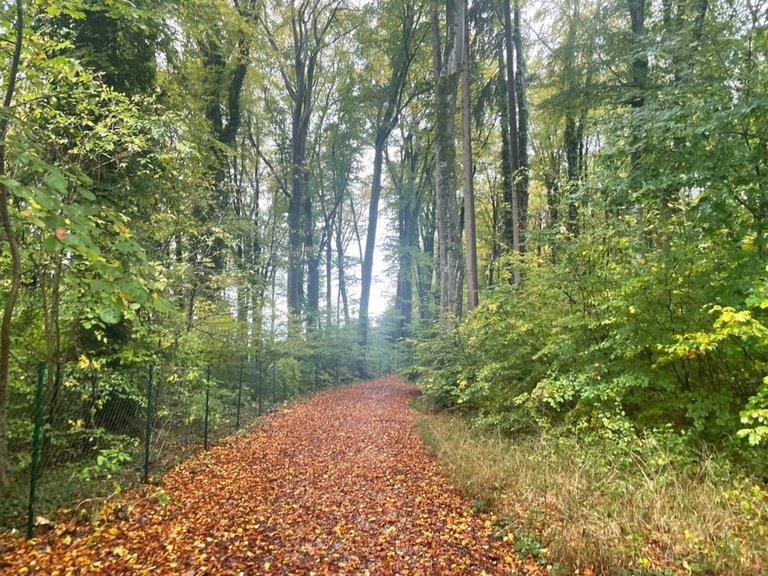
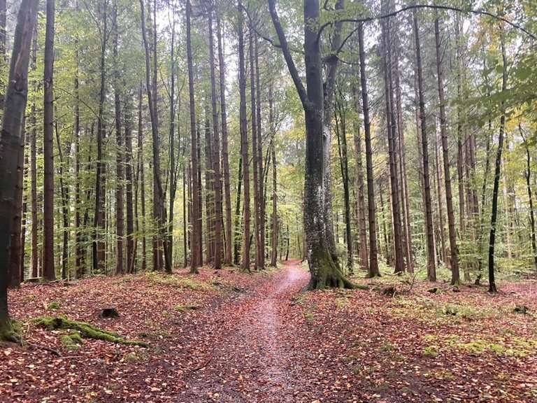
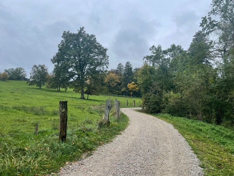
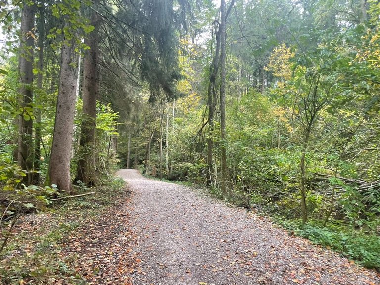
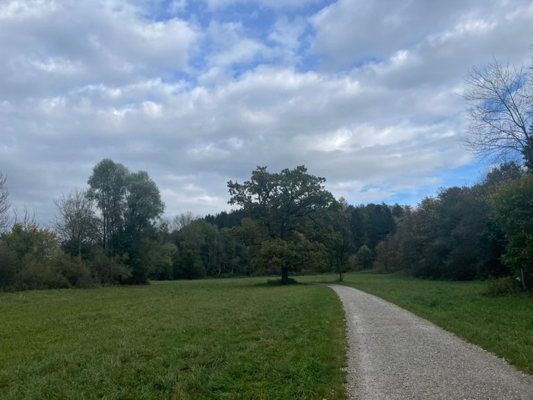
Also always nice to guess who could be living there. Football players, artists, famous people, etc. - But I prefer walking in nature, so I was glad when after only 30 minutes we finally entered the forest.
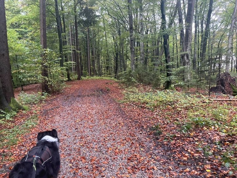
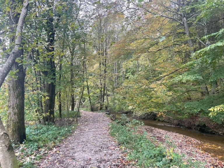
I just love walking in the forest, enjoying the tranquility, breathing the fresh air, the smell of wet leaves, and listening to some birds while walking through pure nature.
También siempre es bueno adivinar quién podría vivir allí. Futbolistas, artistas, personajes famosos, etc. - Pero prefiero caminar en la naturaleza, así que me alegré cuando después de sólo 30 minutos finalmente entramos en el bosque.
Me encanta caminar por el bosque, disfrutar de la tranquilidad, respirar el aire fresco, el olor a hojas mojadas y escuchar algunos pájaros mientras camino por la naturaleza pura.
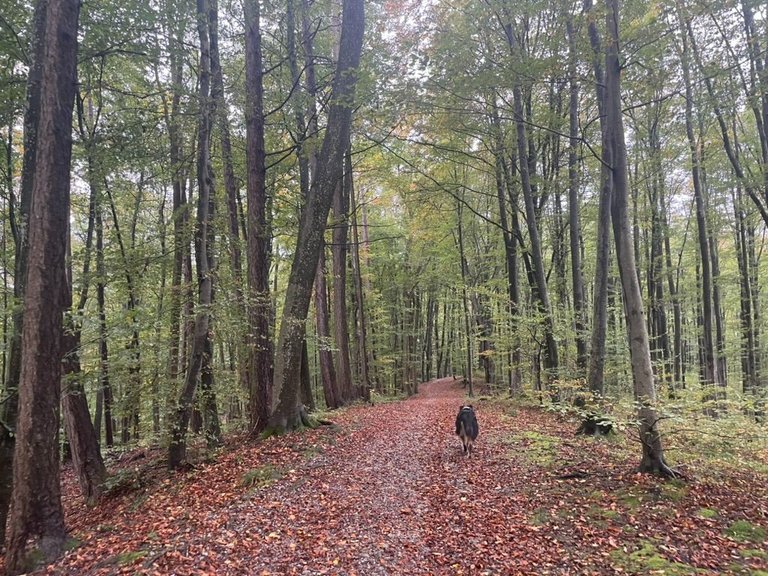
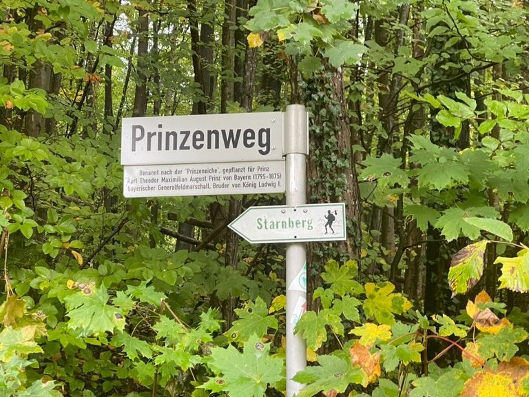
As we learned from the sign, the path was called Prinzenweg: Named after the prince oak planted by Karl Theodor Maximilian August prince of Bavaria (1795-1875) - bavarian field marshal and brother of King Ludwig the First. - How interesting 🤓. After one hour we arrived at the next town: Pöcking.
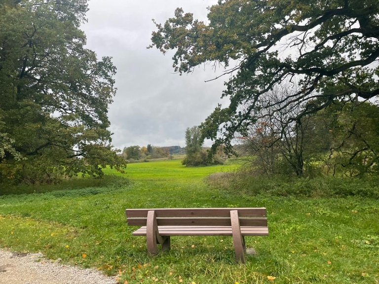
We crossed part of it and then were in the countryside once again walking towards Maisinger Lake. Now without the forest around us, it was freshened up a little bit, as we had some wind coming from the side. But still perfect for us as the view was beautiful and we were the only ones walking there on a weekend! - incredible how quiet it was!
Como supimos por el cartel, el camino se llamaba Prinzenweg: lleva el nombre del roble príncipe plantado por Karl Theodor Maximilian August, príncipe de Baviera (1795-1875), mariscal de campo bávaro y hermano del rey Luis I. - Qué interesante 🤓. Después de una hora llegamos al siguiente pueblo: Pöcking.
Cruzamos parte de él y luego nos encontramos de nuevo en el campo caminando hacia el lago Maisinger See. Ahora sin el bosque a nuestro alrededor, se refrescó un poco, ya que teníamos algo de viento proveniente de un lado. ¡Pero aún así fue perfecto para nosotras. La vista era hermosa y éramos las únicas que caminábamos allí un fin de semana! - ¡Increíble lo silencioso que estaba!
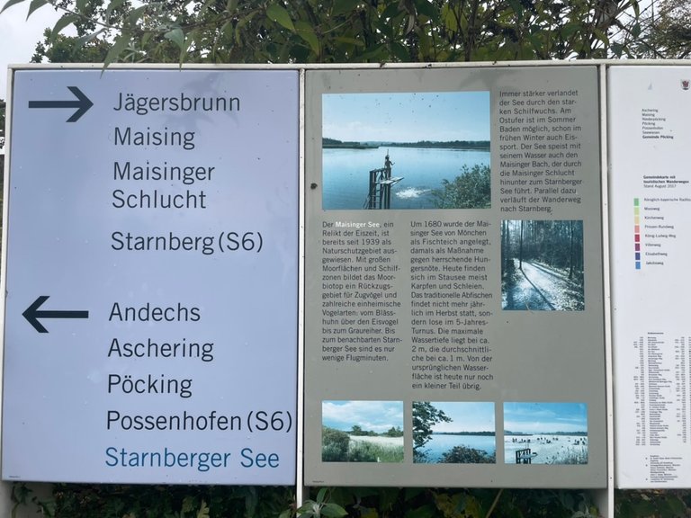
I love how in Germany we find signs everywhere explaining the specialty of the region, its history, and what you can look for. - giving some explanations. Just like on this sign:
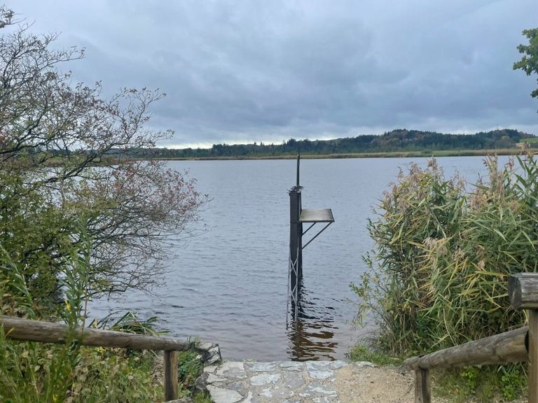
The Maisinger See, a relic of the Ice Age, has been designated as a nature reserve since 1939. With large moor areas and reed areas, the moor biotope forms a refuge for migratory birds and numerous native bird species: from coots to kingfishers to gray herons. It's only a few minutes' flight to the neighboring Lake Starnberg. Around 1680, the Maisinger See was created as a fish pond by monks, at that time as a measure against the prevailing famine. Today carp and tench are mostly found in the reservoir. The traditional fishing no longer takes place annually in autumn, but loosely every 5 years. The maximum water depth is around 2m, the average is around 1m. Today only a small part of the original water surface remains. The lake is becoming increasingly silted up due to the heavy growth of reeds. Swimming is possible on the east bank in summer, and ice sports are also possible in early winter. The lake also feeds the Maisinger Bach with its water, which leads through the Maisinger Gorge down to Lake Starnberg. The hiking trail to Starnberg runs parallel to this.
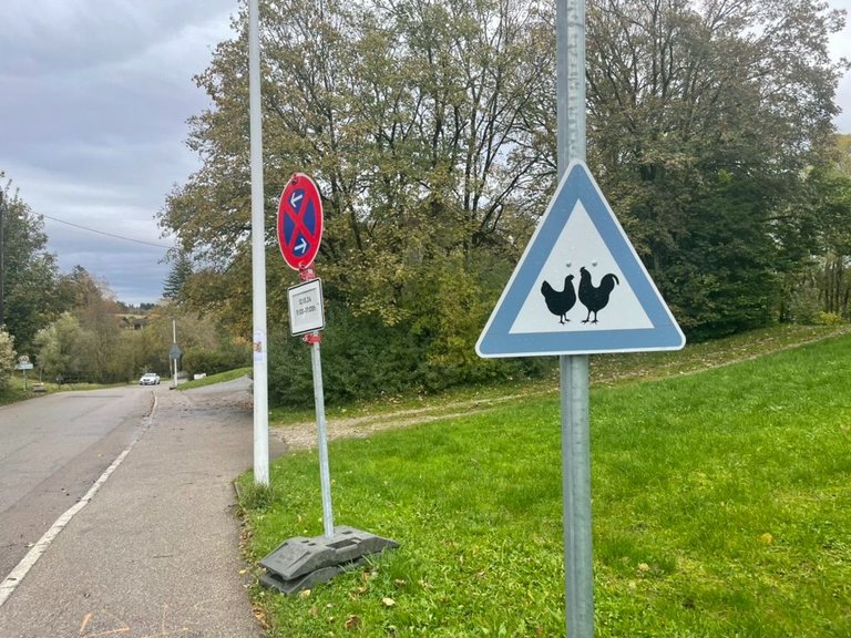
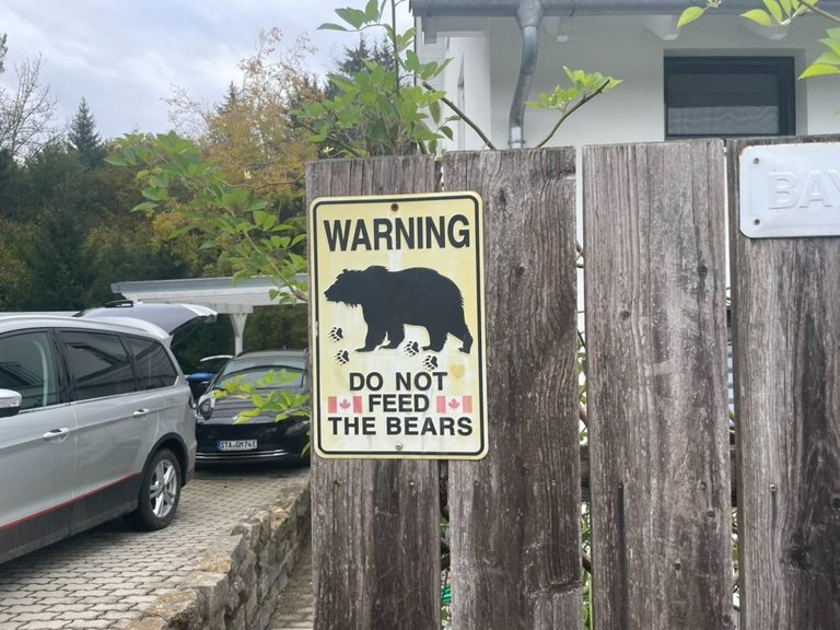
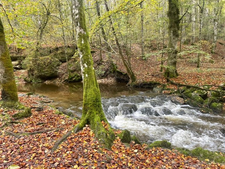
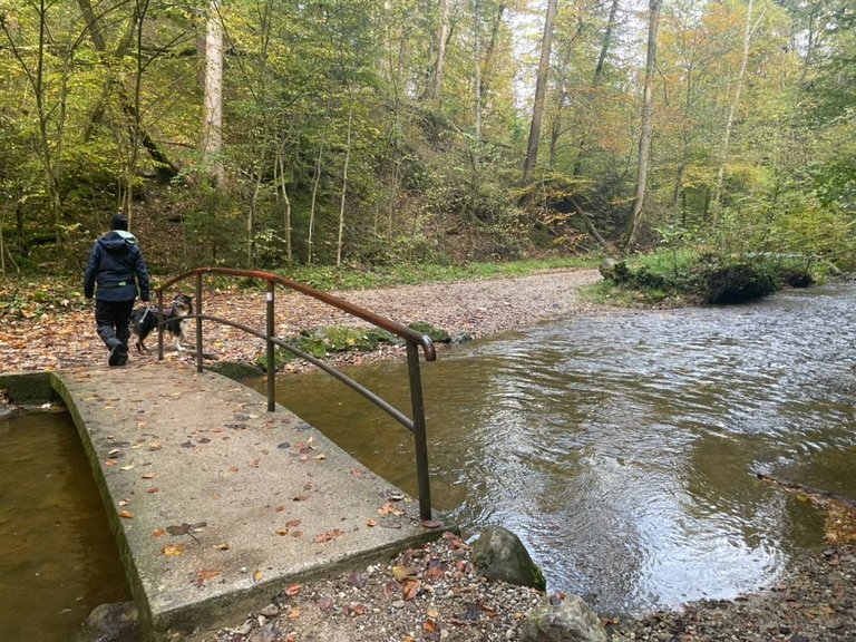
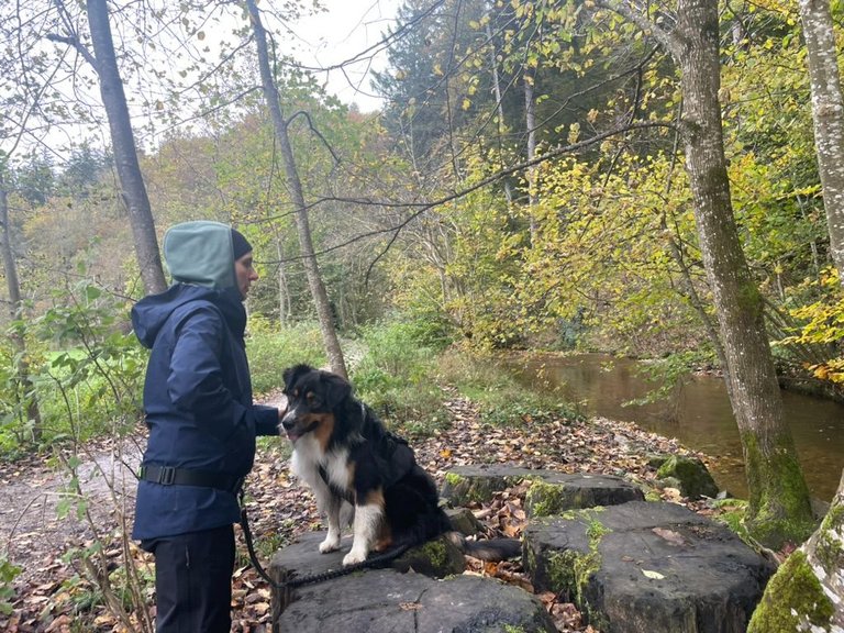
Just as in this description after a short break with snacks and water we decided to follow the stream to get to the Maisinger Gorge, the highlight of our walk that we were very much looking for already. But before we entered we got warned by the wild animals walking around in this area hahaha
Me encanta cómo en Alemania encontramos carteles por todas partes que explican la especialidad de la región, su historia y lo que puedes encontrar. - dando algunas explicaciones. Como en este cartel:
El lago Maisinger, una reliquia de la Edad del Hielo, está declarado reserva natural desde 1939. Con grandes zonas de páramos y cañaverales, el biotopo de los páramos constituye un refugio para aves migratorias y numerosas especies de aves autóctonas: desde fochas hasta martines pescadores y garzas grises. El vuelo hasta el vecino lago Starnberg está a sólo unos minutos. Alrededor de 1680, los monjes crearon el Maisinger See como estanque de peces, en aquel momento como medida contra la hambruna reinante. Hoy en día, en el embalse se encuentran principalmente carpas y tencas. La pesca tradicional ya no se realiza anualmente en otoño, sino cada 5 años. La profundidad máxima del agua es de unos 2 m, la media es de alrededor de 1 m. Hoy en día sólo queda una pequeña parte de la superficie de agua original. El lago se está llenando cada vez más de sedimentos debido a la gran cantidad de juncos. En la orilla este se puede nadar en verano y practicar deportes sobre hielo a principios de invierno. El lago también alimenta con su agua al Maisinger Bach, que conduce a través del desfiladero de Maisinger hasta el lago Starnberg. Paralelamente discurre la ruta de senderismo a Starnberg.
Tal como en esta descripción, después de un breve descanso con refrigerios y agua, decidimos seguir el arroyo para llegar a Maisinger Gorge, el punto culminante de nuestra caminata que ya estábamos esperando. Pero antes de entrar carteles nos avisaron los animales salvajes que andaban por esta zona jajaja
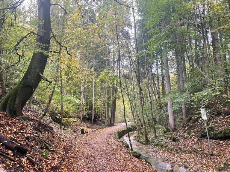
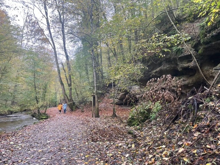
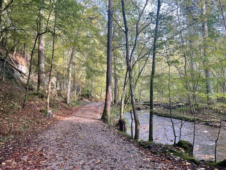
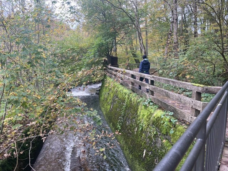
And then finally we entered the gorge! It is around 30 meters deep, a gorge-like structure, and a relic of the Ice Age. As beautiful as nature is here, you can't compare this gorge with the deep rocky gorges in the Alps: the rocks there are usually higher and more rugged. I think it is especially beautiful to walk here in autumn as there is a forest around and the leaves give the path a beautiful color.
¡Y finalmente entramos al desfiladero! Tiene unos 30 metros de profundidad, una estructura en forma de desfiladero y una reliquia de la Edad del Hielo. Por muy hermosa que sea la naturaleza aquí, no se puede comparar este desfiladero con los profundos desfiladeros rocosos de los Alpes: las rocas allí suelen ser más altas y escarpadas. Para mi es especialmente bonito caminar aquí en otoño ya que hay un bosque alrededor y las hojas le dan al camino un color precioso.
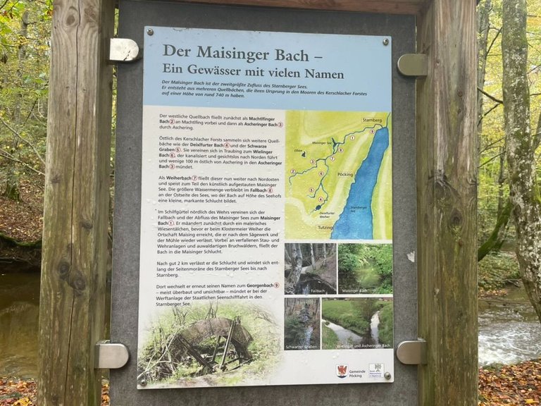
And of course, as we are in Germany we get another sign with interesting facts to know about the surroundings :D - perfect for my clever smurf!
The Maisinger Bach - A body of water with many names: The Maisinger Bach is the second largest tributary of Lake Starnberg. It arises from several spring streams that originate in the moors of the Kerschlacher Forest at an altitude of around 740m. The western source stream initially flows past Machtlfing as Machtlfinger Bach and then through Aschering as Ascheringer Bach. To the east of the Kerschlacher Forest, other source streams such as the Deixlfurter Bach and the Schwarze Graben gather. They unite in Traubing to form the Wielinger Bach, which, channeled and faceless, leads north and flows into the Ascheringer Bach a few 100m east of Aschering. As Weiherbach, this now flows further to the northeast and feeds part of the artificially dammed Maisinger See. A larger amount of water remains in the falling stream on the east side of the lake, where the stream forms a small, striking gorge at the level of the Seehof. In the reed belt north of the weir, the Fallbach and the outflow of the Maisinger See unite to form the Maisinger Bach. It first meanders through a picturesque meadow valley before reaching the village of Maising at the Klostermeier Weiher, which it leaves again after the sawmill and the mill. Past dilapidated dams and weirs and riparian forests, the stream flows into the Maisinger Gorge. After a good 2km it leaves the gorge and winds along the lateral moraine of Lake Starnberg to Starnberg. There it changes its name again to the Georgenbach - usually at all and invisible - it flows into Lake Starnberg at the shipyard of the State Lakes Shipping.
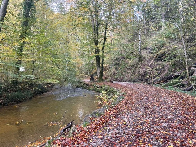
While walking through the gorge all of a sudden the sun came out and it was getting a little bit warmer. The air was fresh and the view was just beautiful. I felt very blessed that now in the favorite part of the hike, we also had great weather. We kept walking along the stream and had to cross it many times walking over bridges.
Y por supuesto, como estamos en Alemania, recibimos otro cartel con datos interesantes que conocer sobre los alrededores :D - ¡Perfecto para mi inteligente pitufo!
El Maisinger Bach: un estanque con muchos nombres: El Maisinger Bach es el segundo afluente más grande del lago Starnberg. Nace de varios manantiales que nacen en los páramos del bosque de Kerschlacher, a unos 740 m de altitud. La corriente principal occidental pasa primero por Machtlfing como Machtlfinger Bach y luego por Aschering como Ascheringer Bach. Al este del bosque de Kerschlacher se reúnen otros arroyos, como el Deixlfurter Bach y el Schwarze Graben. Se unen en Traubing para formar el Wielinger Bach, que, canalizado y sin rostro, conduce hacia el norte y desemboca en el Ascheringer Bach, unos 100 m al este de Aschering. Como Weiherbach, ahora fluye más hacia el noreste y alimenta parte del Maisinger See, represado artificialmente. Una mayor cantidad de agua permanece en el arroyo que cae en el lado este del lago, donde el arroyo forma un pequeño y llamativo desfiladero al nivel del Seehof. En el cinturón de juncos al norte de la presa, el Fallbach y el desagüe del Maisinger See se unen para formar el Maisinger Bach. Primero serpentea por un pintoresco valle de pradera antes de llegar al pueblo de Maising en el Klostermeier Weiher, del que se abandona después de la serrería y el molino. Más allá de presas y bosques ribereños en ruinas, el arroyo desemboca en el desfiladero de Maisinger. Después de unos buenos 2 km se sale del desfiladero y se serpentea a lo largo de la morrena lateral del lago de Starnberg hasta Starnberg. Allí vuelve a cambiar su nombre por el de Georgenbach, normalmente invisible y desemboca en el lago Starnberg en el muelle de barcos.
Mientras caminaba por el desfiladero, de repente salió el sol y hacía un poco más de calor. El aire era fresco y la vista era simplemente hermosa. Me sentí muy bendecida de que ahora, en la parte favorita de la caminata, también tuviéramos un clima excelente. Seguimos caminando a lo largo del arroyo y tuvimos que cruzarlo muchas veces caminando por puentes.
Of course, we also learned some more things on our way about the gorge, the fish and the plants that we can find here. I translated it for you:
Por supuesto, también aprendimos algunas cosas más en el camino sobre el desfiladero, los peces y las plantas que podemos encontrar aquí. Aqui la traduccion:
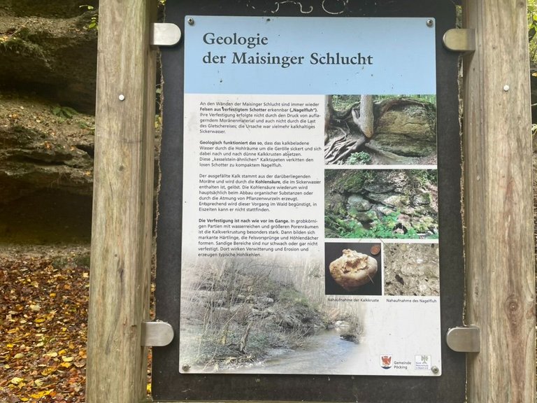
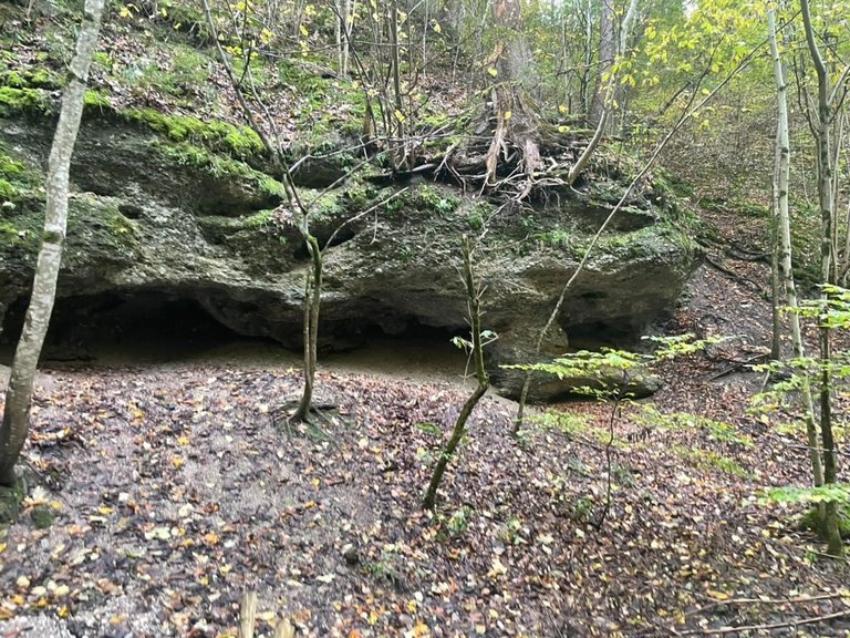
Geology of the Maisinger Gorge: Rocks made of solidified gravel can often be seen on the walls of the Maisinger Gorge. Their consolidation did not occur due to the pressure of overlying moraine material or the load of the glacial ice; The cause was rather calcareous seepage water. Geologically, this works in such a way that the lime-laden water seeps through the cavities around the rubble and gradually deposits thin lime crusts. These lime wallpaper cement the loose gravel into compact Nagelfluh. The precipitated lime comes from the moraine above and is dissolved by the carbonic acid contained in the seepage water. Carbon dioxide, in turn, is mainly produced by the breakdown of organic substances or by the respiration of plant roots. Accordingly, this process is favored in the forest; it cannot take place in ice ages. Solidification is still ongoing. The lime incrustation is particularly strong in the coarse-grained areas with water-rich and larger pore spaces. Distinctive hardlings then form, forming rock outcroppings and cave roofs. Sandy areas are only weakly or not consolidated at all. Weathering and erosion take effect there and create typical hollows.
Geología del desfiladero de Maisinger: En las paredes del desfiladero de Maisinger se pueden ver a menudo rocas de grava solidificada. Su consolidación no se produjo debido a la presión del material de morrena suprayacente ni a la carga del hielo glacial; La causa fue una filtración de agua bastante calcárea. Geológicamente esto funciona de tal manera que el agua cargada de cal se filtra a través de las cavidades alrededor de los escombros y deposita gradualmente finas costras de cal. Estos papeles pintados de cal cementan la grava suelta hasta formar Nagelfluh compacto. La cal precipitada proviene de la morrena de arriba y se disuelve con el ácido carbónico contenido en el agua de filtración. El dióxido de carbono, a su vez, se produce principalmente por la descomposición de sustancias orgánicas o por la respiración de las raíces de las plantas. En consecuencia, este proceso se ve favorecido en el bosque; no puede tener lugar en edades de hielo. La solidificación aún está en curso. La incrustación de cal es especialmente fuerte en las zonas de grano grueso con espacios porosos más grandes y ricos en agua. Luego se forman distintivos hardlings, formando afloramientos rocosos y techos de cuevas. Las zonas arenosas están poco o nada consolidadas. Allí actúan los agentes atmosféricos y la erosión, formando las típicas oquedades.
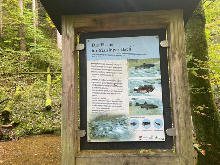
The fish in the Maisinger Bach: As a fish habitat, the Maisinger Bach can be assigned to the so-called trout region. In addition to the brown trout as the key species, the Mühlkoppe and the Aitel are its defining fish species. Brook trout: The brown trout, whose appearance is characterized by a fatty fin between the dorsal and caudal fins as well as brightly outlined red dots on the sides of the body, prefers cool, fast-flowing, oxygen-rich waters with gravel and gravel bottoms. Their main food is insects and small fish. As a gravel spawner, it lays its eggs in self-made spawning pits from October to January. Mühlkoppe: The Mühlkoppe has a club-shaped, scaleless body with a broad, flattened head and bulging lips. It lives in clear, cool waters with high oxygen levels and rocky bottoms. It is nocturnal and feeds on insect larvae, small crustaceans and fish spawn. During the spawning season from February to May, it lays its eggs in spawning caves under stones. The male carries out brood care by caring for and guarding the clutch. Aitel: The Aitel, whose typical characteristics are a broad body with a powerful head and mouth as well as large scales with net-like markings, can be found in almost every type of water. Depending on its age, its diet ranges from insects and small crustaceans to fish and amphibians. As a clinging spawner, it sticks its eggs to stones and aquatic plants in May and June.
Los peces en Maisinger Bach: Como hábitat de peces, Maisinger Bach se puede asignar a la llamada región de la trucha. Además de la trucha común como especie clave, las especies de peces más importantes son la Mühlkoppe y la Aitel. Trucha de arroyo: La trucha marrón, cuyo aspecto se caracteriza por una aleta grasa entre las aletas dorsal y caudal, así como por puntos rojos de contorno brillante a los lados del cuerpo, prefiere aguas frescas, rápidas y ricas en oxígeno con grava. Su alimento principal son los insectos y los peces pequeños. Como desova en grava, pone sus huevos en fosos de desove hechos por ella misma de octubre a enero. Mühlkoppe: El Mühlkoppe tiene un cuerpo sin escamas en forma de maza con una cabeza ancha y aplanada y labios abultados. Vive en aguas claras y frescas con altos niveles de oxígeno y fondos rocosos. Es de hábitos nocturnos y se alimenta de larvas de insectos, pequeños crustáceos y huevos de peces. Durante la temporada de desove, de febrero a mayo, pone sus huevos en cuevas de desove debajo de piedras. El macho realiza el cuidado de la cría cuidando y custodiando la nidada. Aitel: El Aitel, cuyas características típicas son un cuerpo ancho con una cabeza y boca poderosas, así como grandes escamas con marcas en forma de red, se puede encontrar en casi todos los tipos de agua. Dependiendo de su edad, su dieta abarca desde insectos y pequeños crustáceos hasta peces y anfibios. Como desovador adherente, pega sus huevos a piedras y plantas acuáticas en mayo y junio.
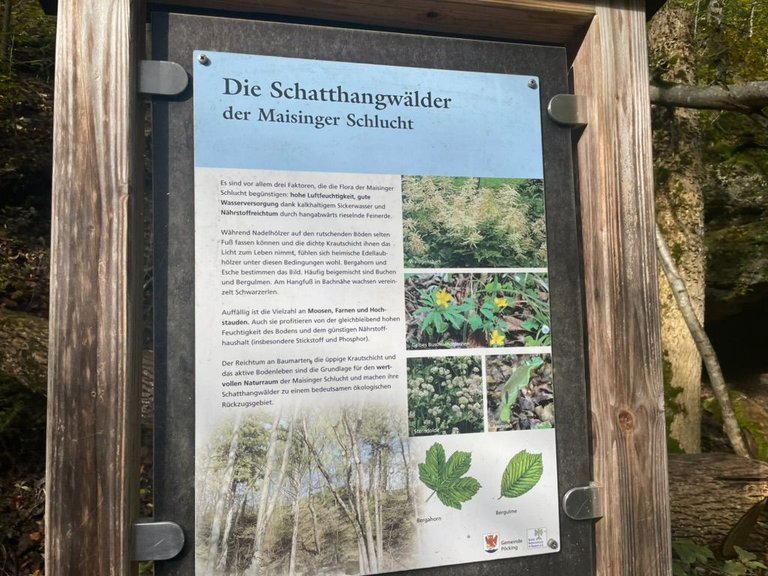
The shady slope forests of the Maisinger Gorge. Three main factors favor the flora of the Maisinger Gorge: high air humidity, good water supply thanks to calcareous seepage water and nutrient richness thanks to fine earth trickling down the slope. While conifers can rarely gain a foothold on the slippery floors and the dense herb layer deprives them of the light to live, native hardwoods feel comfortable under these conditions. Sycamore and ash dominate the picture. Beech and mountain elm are often added. A few black alders grow at the foot of the slope near the stream. The variety of mosses, ferns, and tall shrubs is striking. They also benefit from the consistently high moisture content of the soil and the favorable nutrient balance. The wealth of tree species, the lush herbaceous layer, and the active soil life are the basis for the valuable natural area of the Maisinger Gorge and make its shady slope forests an important ecological retreat area.
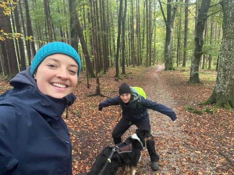
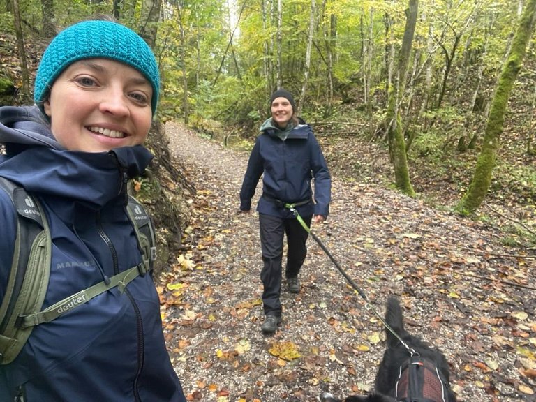
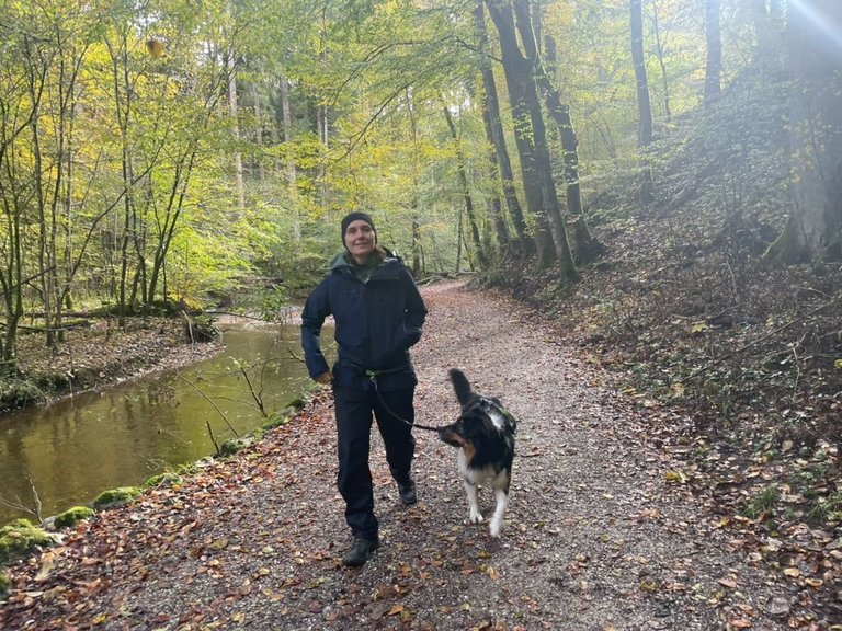
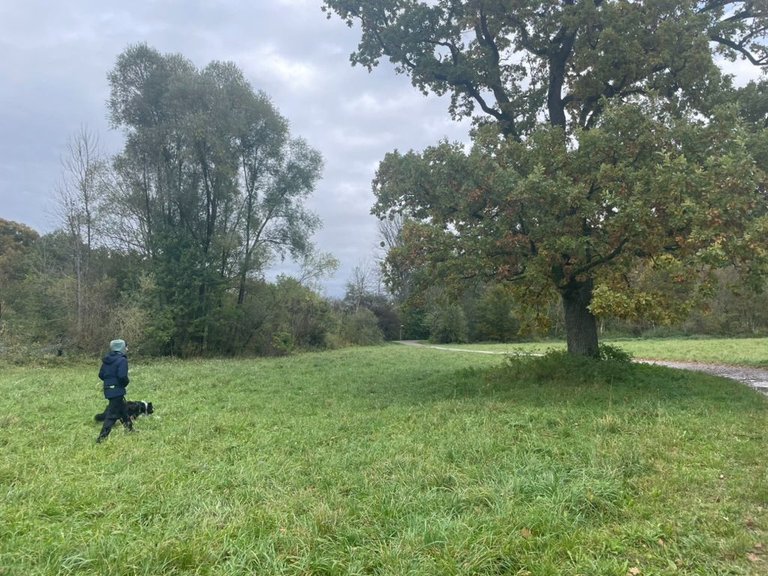
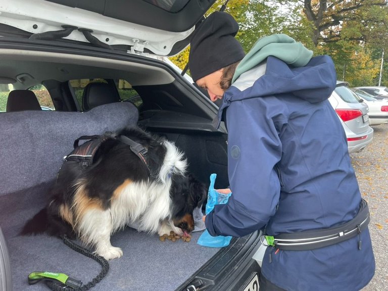
Walking along the stream was also perfect for our dog chapo, as he could swim and drink whenever he needed to. After we passed about 12km he started to get very tired and we did another short break.
Los bosques de laderas umbrías del desfiladero de Maisinger. Tres factores principales favorecen la flora del desfiladero de Maisinger: la alta humedad del aire, un buen suministro de agua gracias a las filtraciones de agua calcárea y la riqueza de nutrientes gracias a la fina tierra que gotea por la pendiente. Mientras que las coníferas rara vez logran afianzarse en suelos resbaladizos y la densa capa de hierbas las priva de luz para vivir, las maderas duras nativas se sienten cómodas en estas condiciones. El sicomoro y el fresno dominan el cuadro. A menudo se añaden hayas y olmos de montaña. Al pie de la ladera, cerca del arroyo, crecen algunos alisos negros. Llama la atención la variedad de musgos, helechos y arbustos altos. También se benefician del alto contenido de humedad constante del suelo y del favorable equilibrio de nutrientes. La riqueza de especies arbóreas, la exuberante capa herbácea y la vida activa del suelo son la base del valioso espacio natural de Maisinger Gorge y hacen de sus bosques de laderas umbrías una importante zona de retiro ecológico.
Caminar por el arroyo también fue perfecto para nuestro perro chapo, ya que podía nadar y beber cuando lo necesitara. Después de pasar unos 12 km empezó a cansarse mucho e hicimos otro breve descanso.
From there we walked until the end of the George crossing some more meadows, bridges, and forests until we arrived back in the city of Starnberg. From there we only had to walk 15 minutes back to the car. Our feet was hurting already and Chapo was destroyed.. he couldn´t even jump into the trunk anymore :D
Desde allí caminamos hasta el final del George cruzando algunos prados, puentes y bosques más hasta llegar de regreso a la ciudad de Starnberg. Desde allí sólo tuvimos que caminar 15 minutos hasta llegar al coche. Ya nos dolían los pies y el Chapo estaba destrozado.. ya ni siquiera podía saltar a la cajuela :D
We were very glad that we picked that circular track for that day as it was the perfect hike with this weather. It is highly recommended in terms of nature and of course to learn new stuff! 😎🤓
Hope you liked it as well! - If you want to see more about it, feel free to also check out the video of our walk:
Nos alegramos mucho de haber elegido esa pista circular para ese día, ya que era la caminata perfecta con este clima. Es muy recomendable en cuanto a naturaleza y por supuesto para aprender cosas nuevas! 😎🤓
¡Espero que a ustedes también lo haya gustado! - Si quieren ver más, pueden ver también el vídeo de nuestro paseo:
Cheers & Un abrazo
Liz
You can check out this post and your own profile on the map. Be part of the Worldmappin Community and join our Discord Channel to get in touch with other travelers, ask questions or just be updated on our latest features.
Thanks @worldmappin - awesome to have another post on my map 👍😎
Hiya, @ybanezkim26 here, just swinging by to let you know that this post made it into our Honorable Mentions in Travel Digest #2354.
Your post has been manually curated by the @worldmappin team. If you like what we're doing, please drop by to check out all the rest of today's great posts and consider supporting other authors like yourself and us so we can keep the project going!
Become part of our travel community:
Awesome! Thanks @ybanezkim26! I feel very honored to be part of today's TD 😎😘
Schuat super aus - das hast wieder viel Arbeit in den Inhalt gesteckt wie früher schon - nice nice
Danke @uwelang :) - Ich geb immer mein Bestes <3
Hola Liz. Me encantan los paseos de otoño, los paisajes siempre se ven más hermosos con todos esos colores. Espero que la hayan disfrutado y me alegra que no se cruzaron con ningún oso jajaja. Saludos ❤️
I love that kind of forest, hiking with that view is so nice. Beats any kind of therapy when you need to relax! !BEER
View or trade
BEER.Hey @lizanomadsoul, here is a little bit of
BEERfrom @pardinus for you. Enjoy it!Did you know that <a href='https://dcity.io/cityyou can use BEER at dCity game to buy cards to rule the world.
!PIZZA