Seems so quite unusual but as here it was!
Made me wonder in this wonderland
Somewhere deep in the Himalayan Valleys.
Julley Everyone,
Around 15 Minutes North the Jawara Campsite, Hampta Pass Expedition. This post being the continuation of my Hamta Pass Expedition where at this particular point of the time we decided to just wonder and wodner for while.
Where life at certain points gets like this that we can’t push ourselves more further, A moment when we had thoughts of giving up. Something just like this happened with us that I will be sharing with you guys through this post.
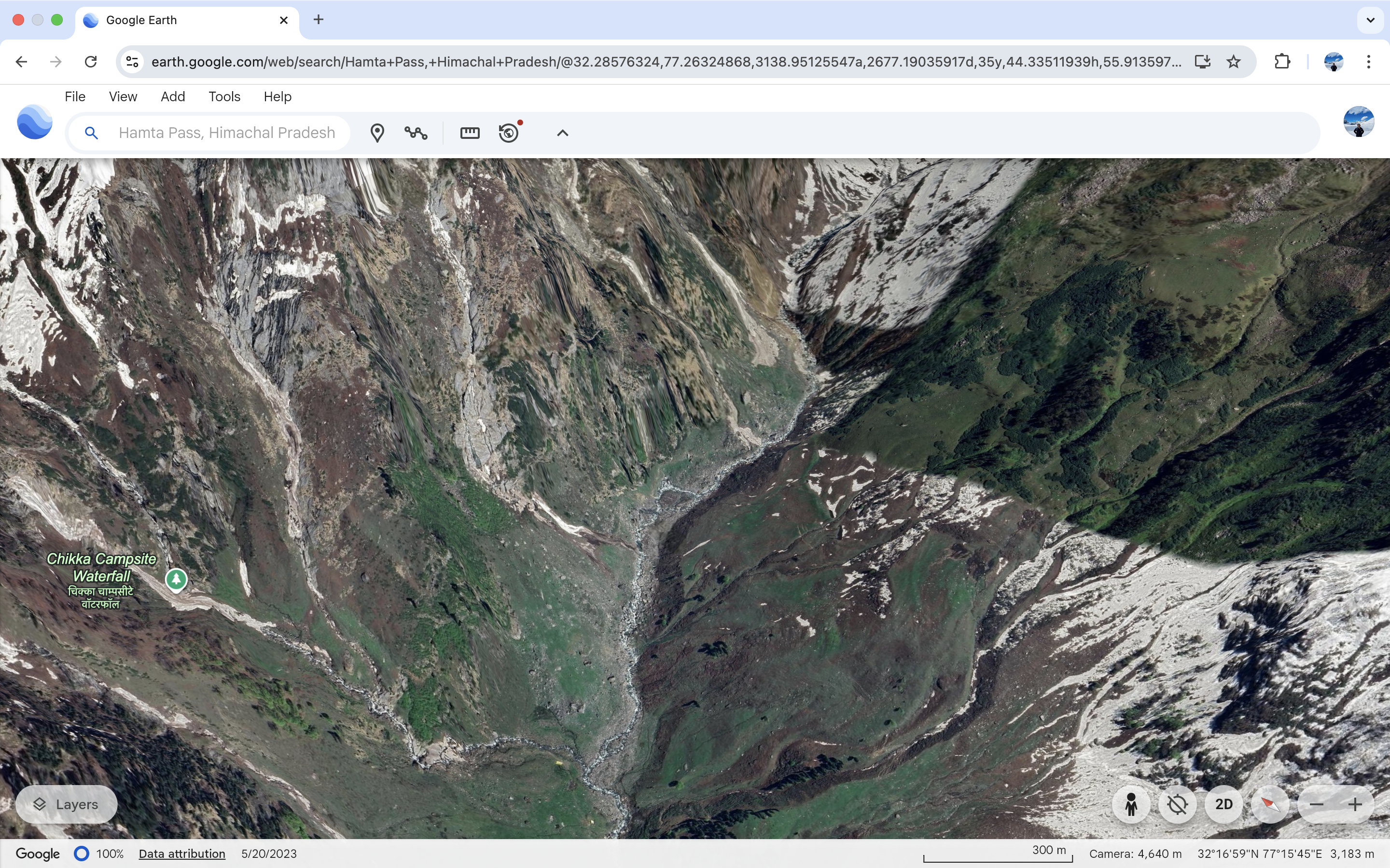
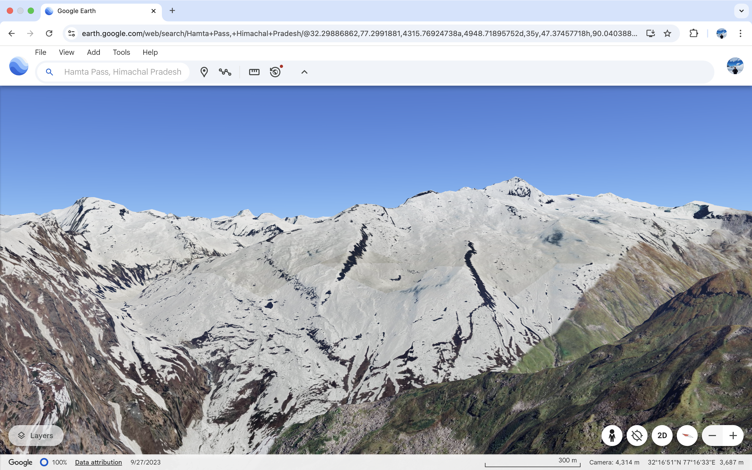
GPS Maps being our friend.
Thanks to Gogle Earth.
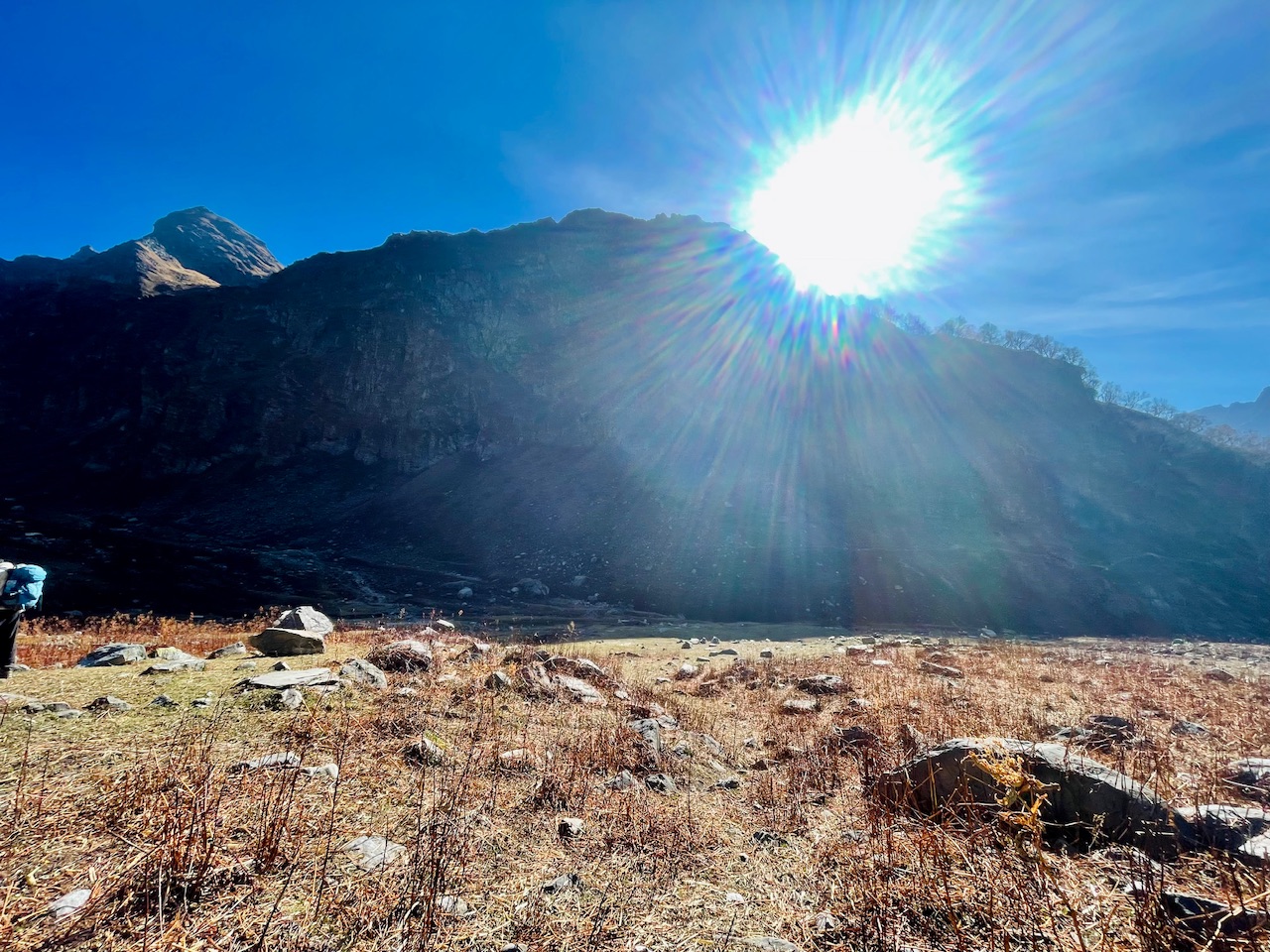
The story began something like this when we were wondering this magical valley of Hamta as this whole region in the Himalayas was called the Hamta Belt. In the Pir Panjal Himalayan Range of Mountains.
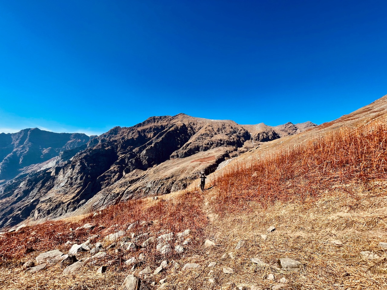
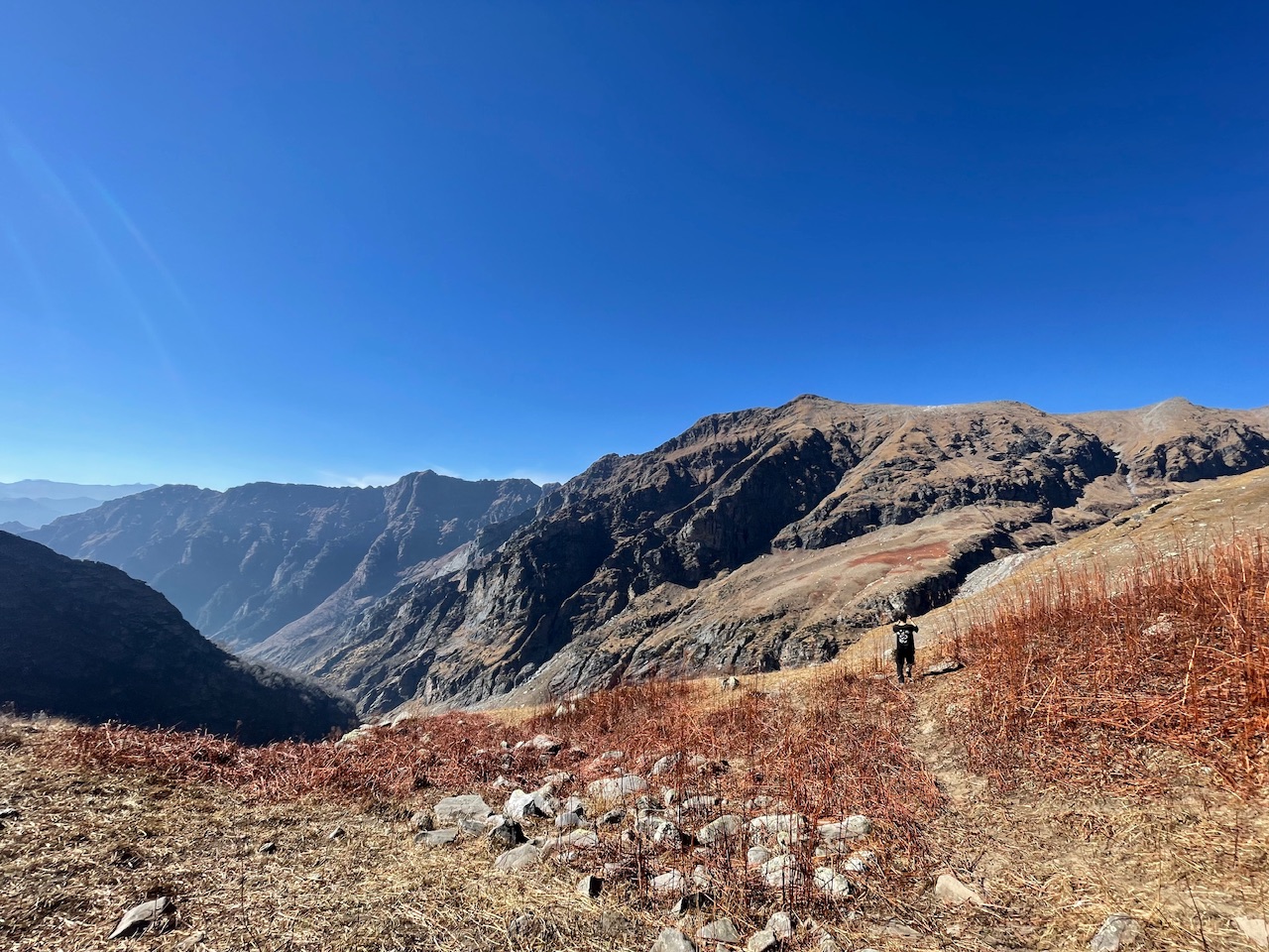
Where at this particular point of the day when hiking for more than 6-7 Hours since morning from our Base Camp when we reached this place around 15 Minutes towards North of Jawara Campsite when we decided that not to go further but to hike and summit the particular mountain which could be seen right in front of us!
The summit not the top of the mountain for sure but we decided atleast we could reach at the side end of the mountain peak and capture the view of the whole valley and insted of even checking the Google Earth Map we stared our Speed Hike by keeping our belongins at a point before this.

Withour thinking much we statred with our speed hike about just running the peak and reach the summit. We were not even carrying water bottle and at the mid way of the speed hike of more than 90 Minutes were were literally dehydrated but the fire which was inside our blood was just to reach the top.
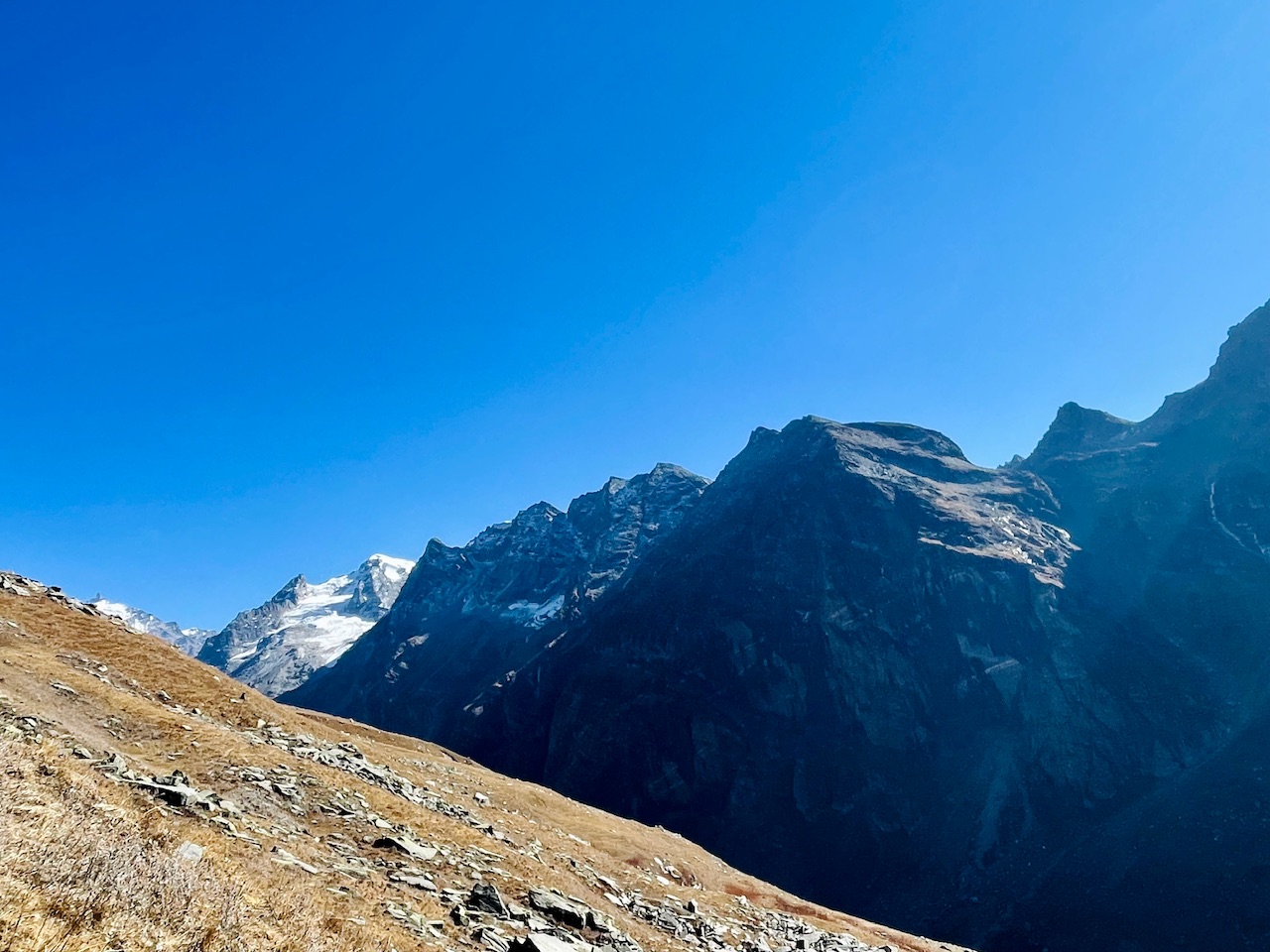
The top of the mountain was at quite a height that we were not aware of as the summit seemed at a closer height.
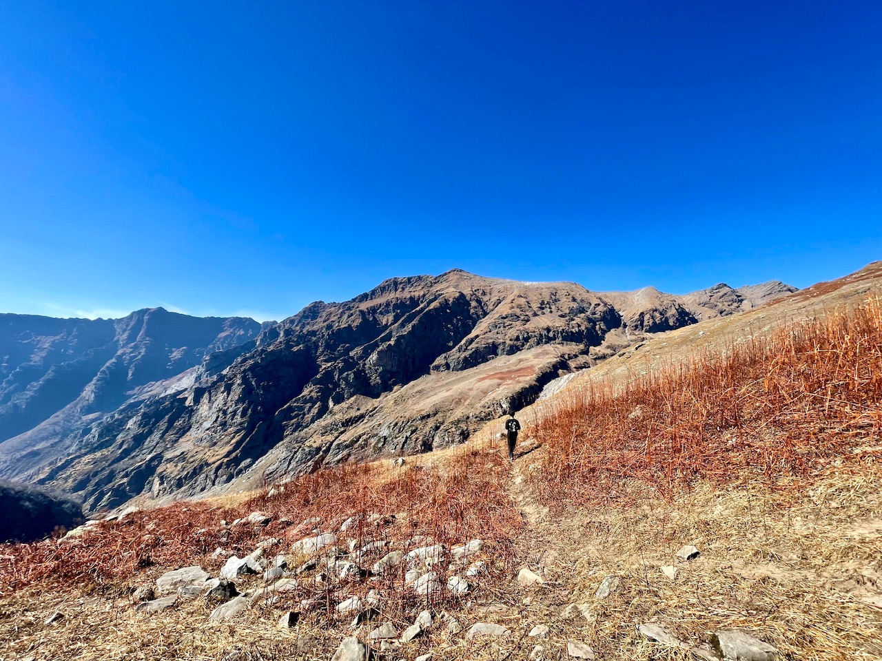
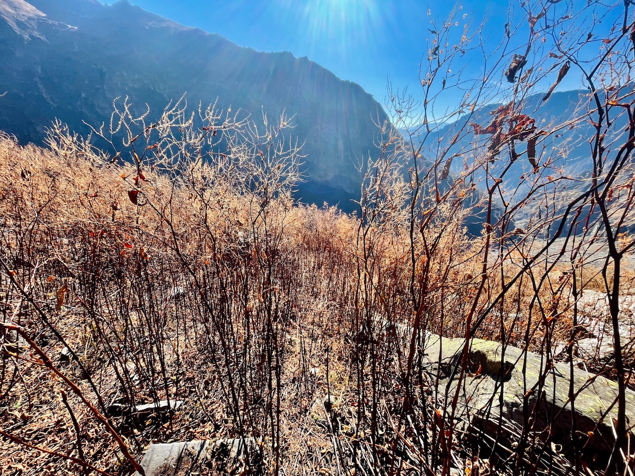
The view that we were getting at the point of the hike where we were at the moment was something like this.
But as we were getting closer and close to the mountain summit and the top of the mountain more and more far was the summit getting from us.
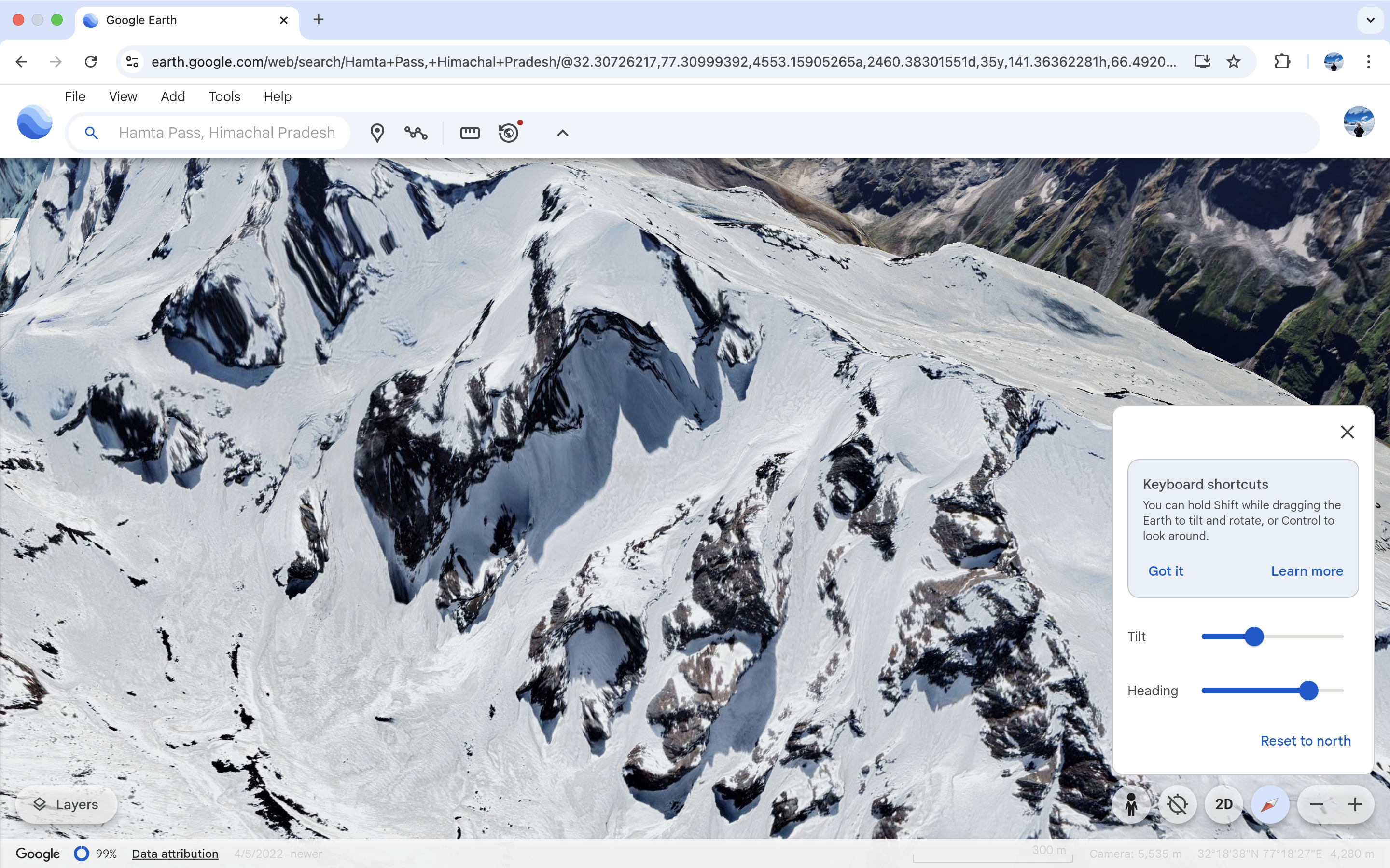
When I came back from the expedition and checked the whole region in Google Earth I got to know that we were literally thinking about summiting the highest peaks of this whole Region which was not possible without the technical equipment and especially without water too. As we were not even carying water-bottle with us to hydrate us.
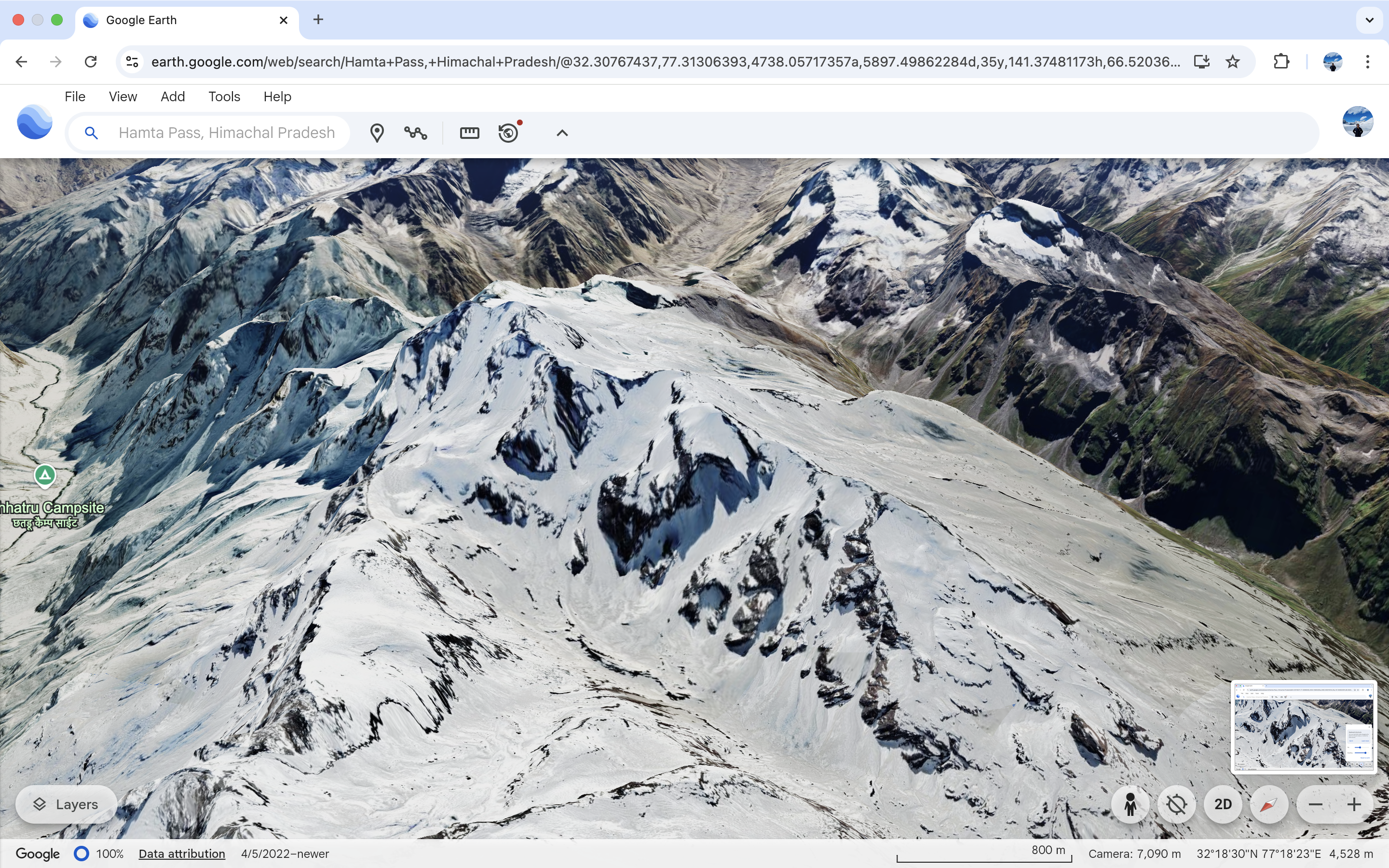
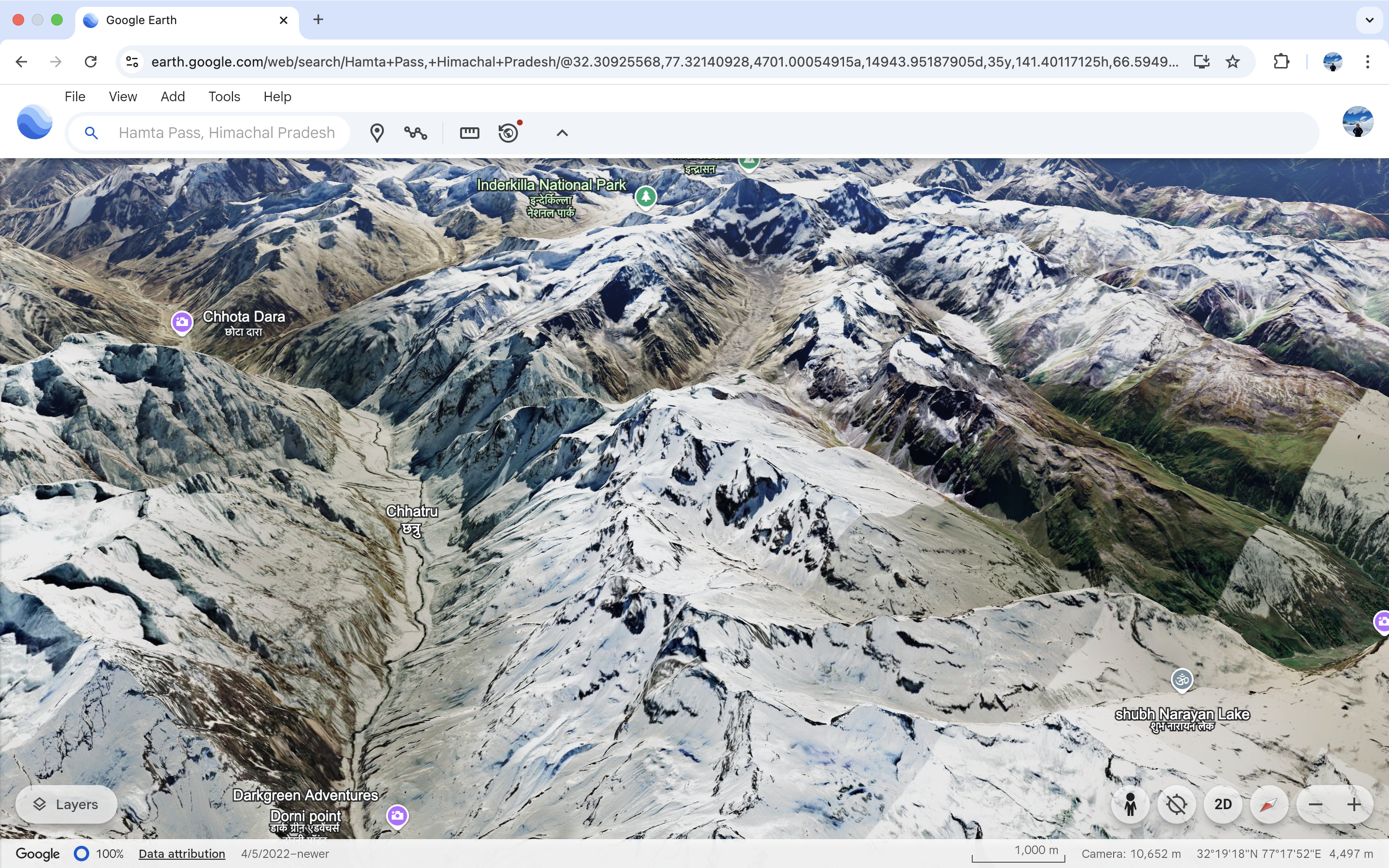
It just made me think about guys that we that day we would have not faced dehydration we would have summited the peak in just a single day not even knowing about that is was the highest point and just right at the backside of the same was a steep fall which could be seen the the GPS Picture that I captured a screenshot of Google Earth.
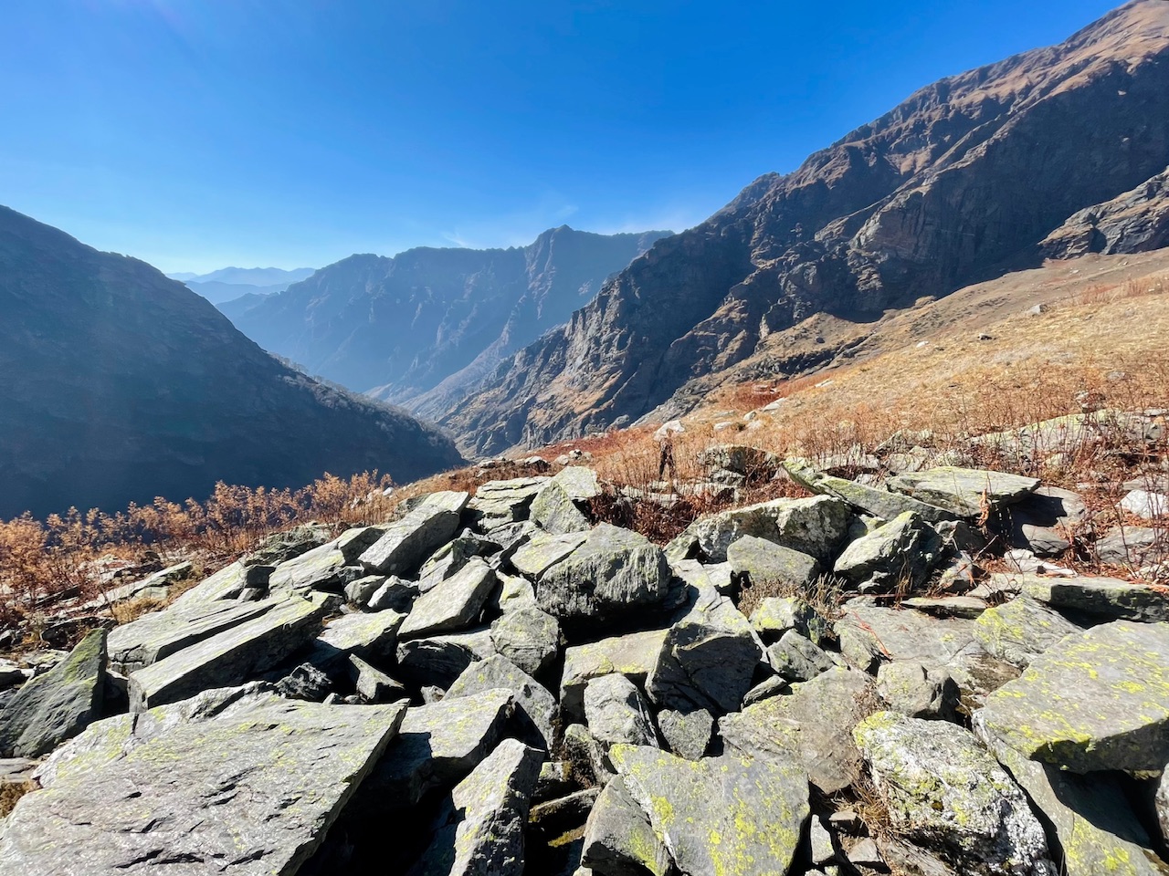
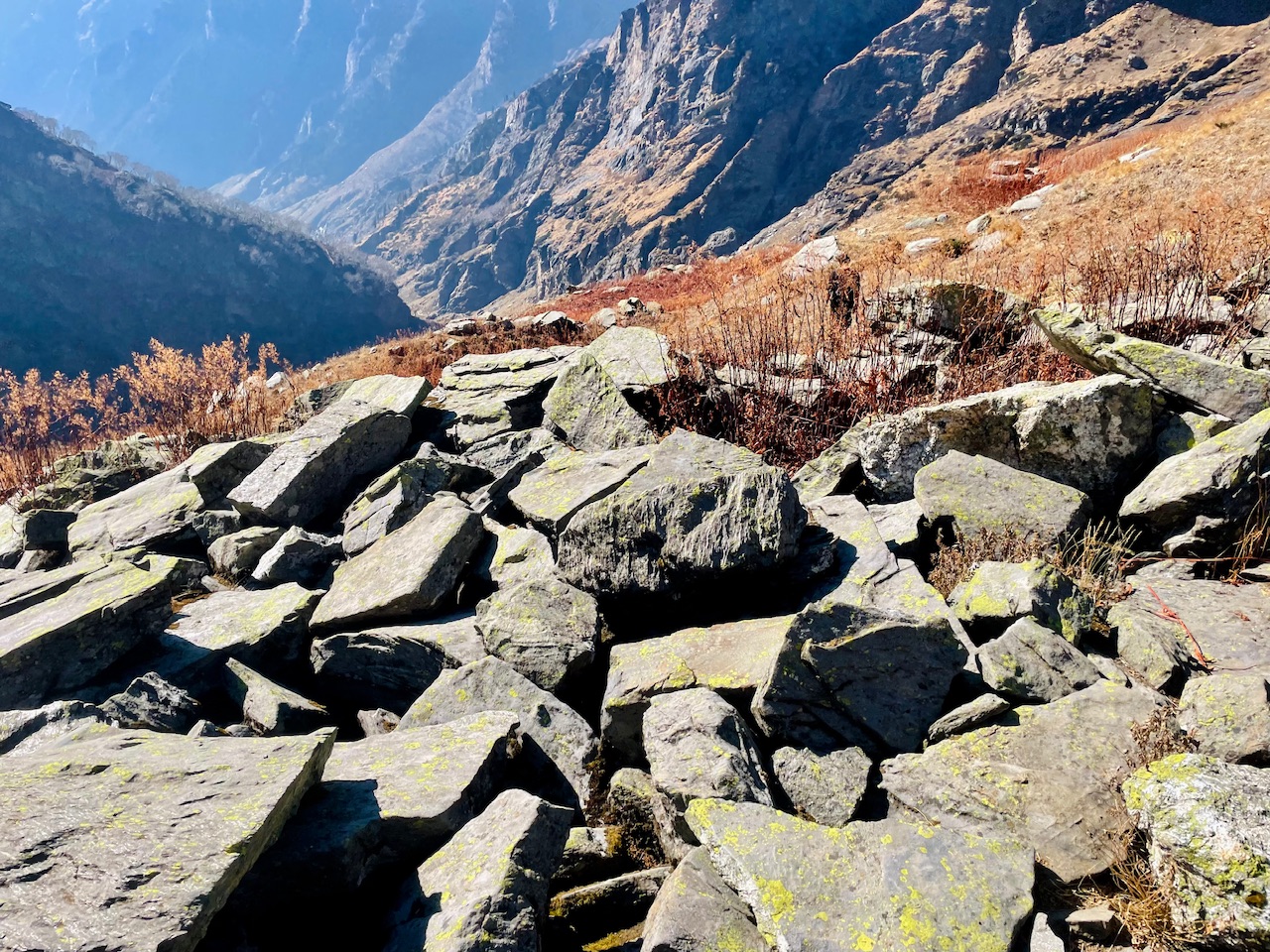
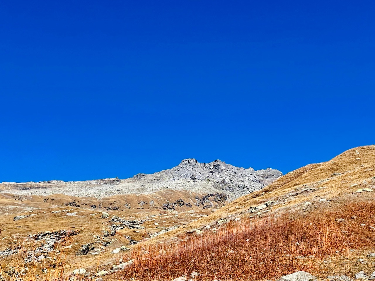
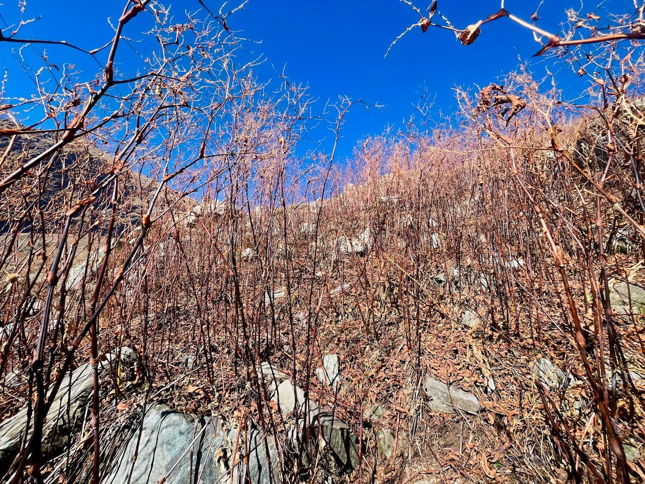
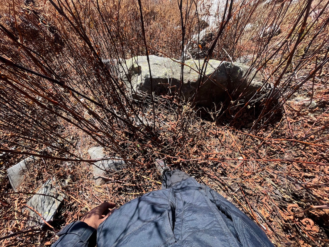
Just reaching the midpoint where we were It was really a difficult task guys as the elevation was just so steep that I literally had to fetch the grass which was dry and red taking the help lifting us.
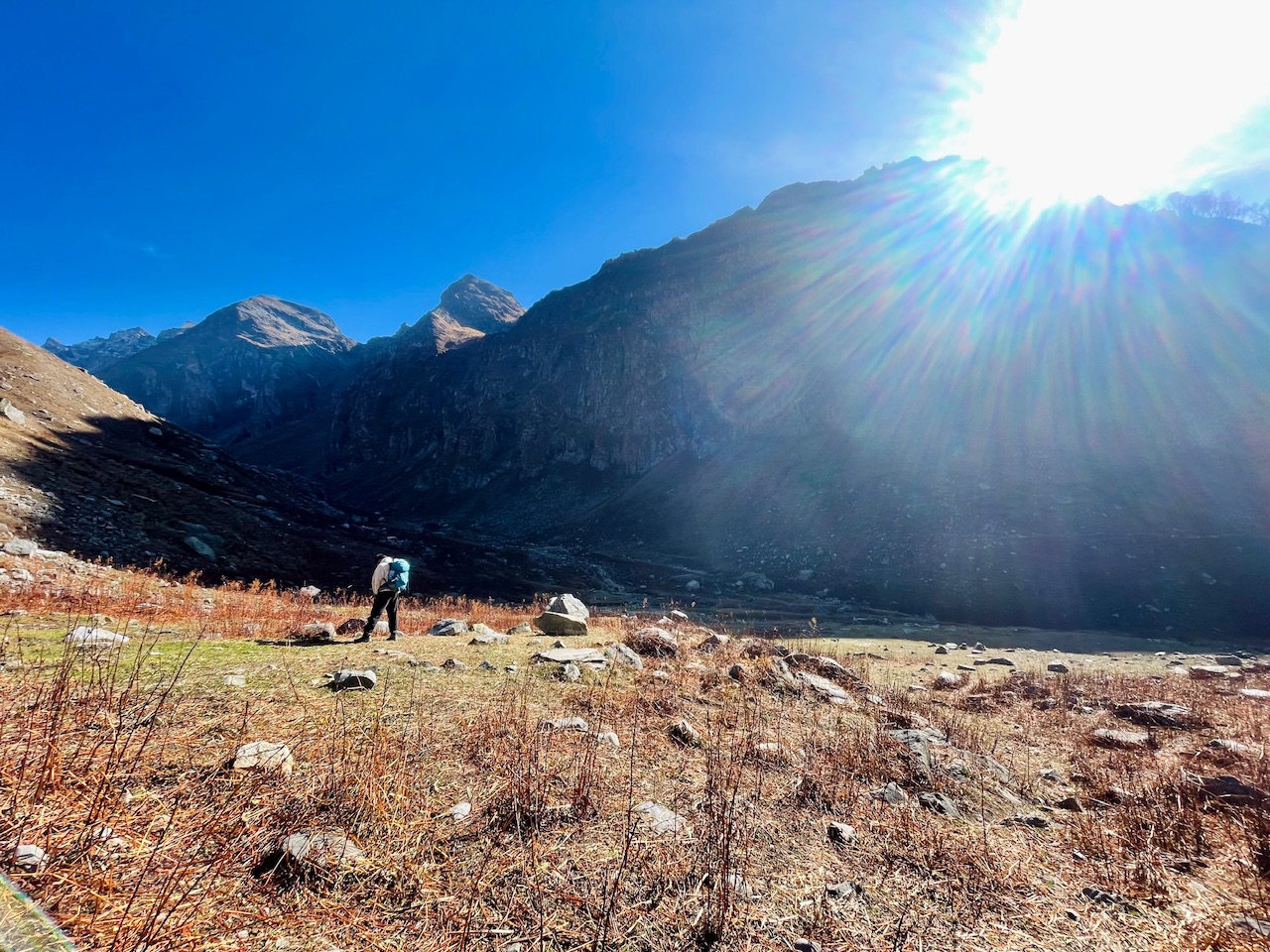
But at this point where we found a trail that too a never ending trail as the title of the Post suggests formed up by the melting of snow was acutally a small strem which was formed up due to the melting of glecial snow when this place used to get covered under a thick sheet of snow and the snow being lasted for more than 8 months.
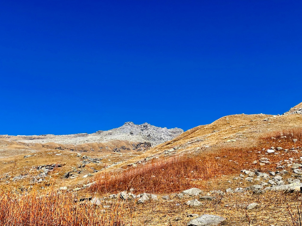
We were literally in a middle of a deep valley guys and there were steep mountain right in front of us.
The Tall Vegetation.
Guys when we decided to just take the way of the trail when we finally decied not to summit the mountain as due to the less sunlight that we had and less resources and body being dehydrated we decided to not hike throught the trail which was formed us due to melting of snow and descend snlowy so that we could reach the lower altitude region without taking a steep descent as the accent till the mid way was too steep insted we took the pathway but the side of the mountain.
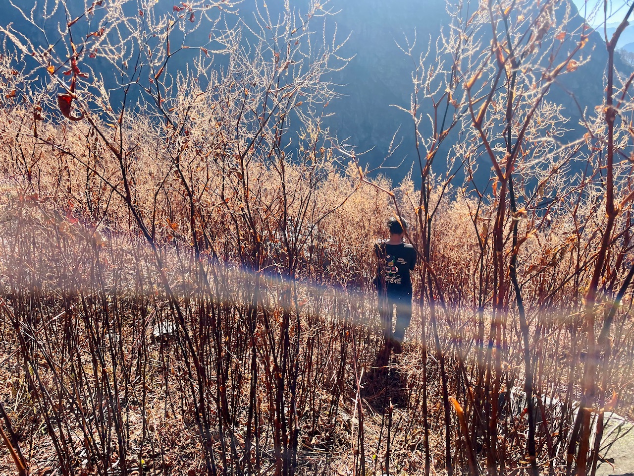
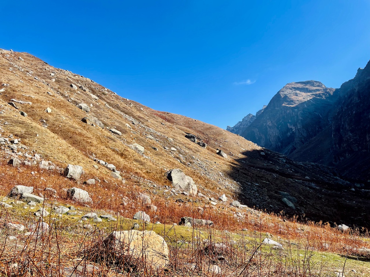
Even though we were at the region of NTZ ( Non Tropical Zone ) Where there was no vegitation due to the harsh Climatic conditions and high altitude. But still I was amazed to see that how there was this dry crass of some other name we call such plants more taller then us totally burnt due to direct sunlight and excessive cold.
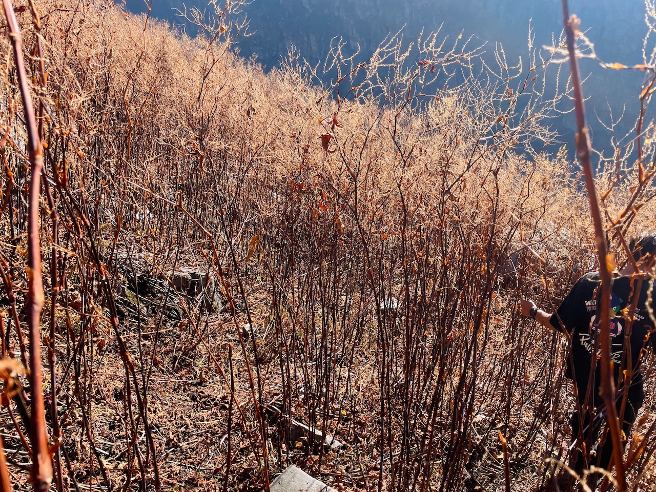
I tried capturing as many photographs as I could and share it with you guys so that even you guys could get the first hand experience wondering this wonderland along with me.
So thats all for today guys, I hope you liked it. I have captured all of these photographs using my iPhone 12 and the Software that I have used for nevigation and wondering the Himalayas is Google Earth. Which I often use to navigate and plan such expeditions.
Love from the Himalayas. ❤️

You can check out this post and your own profile on the map. Be part of the Worldmappin Community and join our Discord Channel to get in touch with other travelers, ask questions or just be updated on our latest features.
Very stunning beauty that looks very beautiful ❤️
Thanks a lot for your words 🙏❤️
Discord Server.This post has been manually curated by @steemflow from Indiaunited community. Join us on our
Do you know that you can earn a passive income by delegating to @indiaunited. We share more than 100 % of the curation rewards with the delegators in the form of IUC tokens. HP delegators and IUC token holders also get upto 20% additional vote weight.
Here are some handy links for delegations: 100HP, 250HP, 500HP, 1000HP.
100% of the rewards from this comment goes to the curator for their manual curation efforts. Please encourage the curator @steemflow by upvoting this comment and support the community by voting the posts made by @indiaunited.
Travel Digest #2462.
Become part of our travel community:
- Join our Discord
Hiya, @lauramica here, just swinging by to let you know that this post made it into our Honorable Mentions in Your post has been manually curated by the @worldmappin team. If you like what we're doing, please drop by to check out all the rest of today's great posts and consider supporting other authors like yourself and us so we can keep the project going!Thanks for the mention @lauramica and @worldmappin and many congratulations to the others too means a lot :) 🙏😊😊
Keep up the great work 💪