[ENG] A sand buried church, wandering dunes (ie. it's the dunes that are wandering, not I...), the very top of Denmark, navy seal, bunkers from WWII - I saw all of these during my Nordsøstien (North Sea Trail) hike on cold Saturday in December. Join me in my hike "På toppen af Danmark". This is part one of my article.
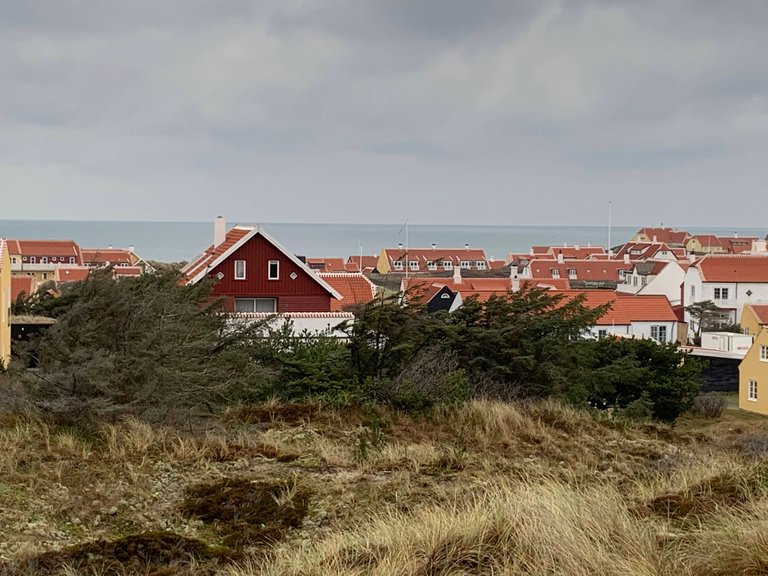
[POL] Kościół zasypany przez piasek, wędrujące wydmy, najsampółnocniejszy koniec Danii, foka na straży, bunkry z IIWŚ - to wszystko w czasie jednego dnia na szlaku Nordsøstien (Szlak Morza Północnego) w grudniową sobotę. Zapraszam na pierwszą część wędrówki "På toppen af Danmark".
Plan
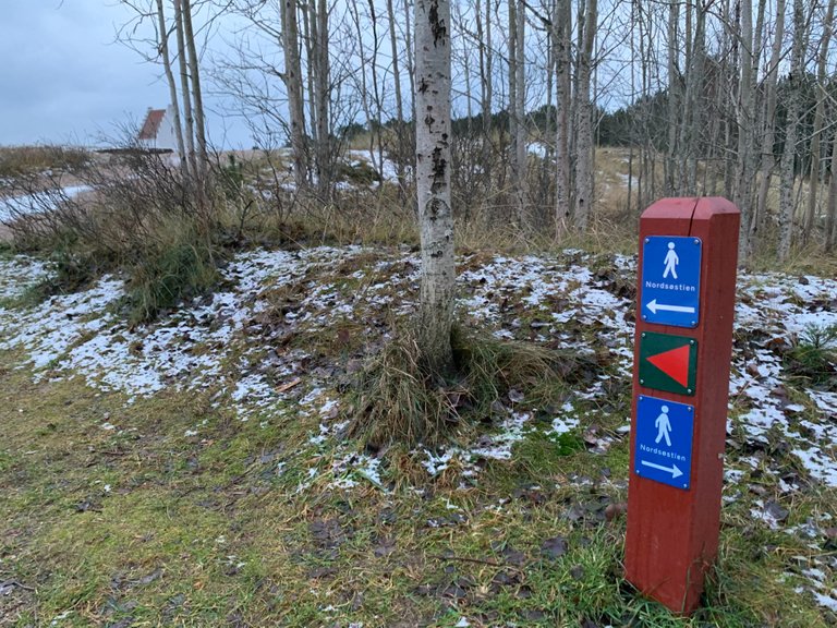
[POL] Mój plan to pętla 22km z północnym przylądkiem Danii jako główną atrakcją. Początek i koniec to ciekawe miejsce na południe od Skagen - kościół zasypany przez piasek. Parkuję (parking darmowy) pod zasypanym kościołem i tuż po wschodzie słońca (czyli o 9:00...) ruszam w trasę. Będę szedł - mniej więcej - ścieżkami w ramach Nordsøstien (część Szlaku Morza Północnego w północnej Danii).
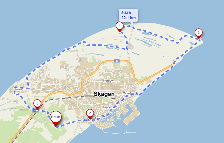
[ENG] My plan is a 22km loop with Denmark's northernmost tip as my main destination. My start and finish points is the parking (free) at the Sand Buried Chruch, just south of Skagen. I will - mostly - follow trails that make up Nordsøstien (part of the North Sea Trail in northern Denmark).
Den Tilsandede Kirke
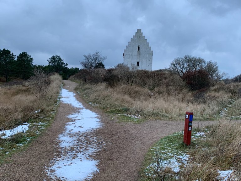
[POL] Kościół wyłania się zza wydm. Na pierwszy rzut oka nic specjalnego - takich białych, murowanych kościołów jest w Danii mnóstwo. Zbliżając się zauważymy jednak, że coś z tym kościołem jest nie tak. Po pierwsze - ma tylko wieżę - gdzie jest nawa? Po drugie - dlaczego kościół zbudowany jest na odludziu?
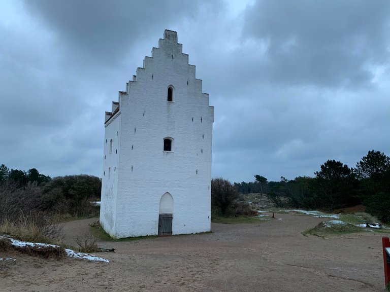
[ENG] I set off and soon see the church appearing from behind the dunes. At first - nothing extraordinary. There are plenty white, brick churches in Denmark. However, as I come closer, something is wrong with the church. Firstly, it's only the tower. Where is the main nave? Secondly - why would anyone build a church in the middle of nowhere?
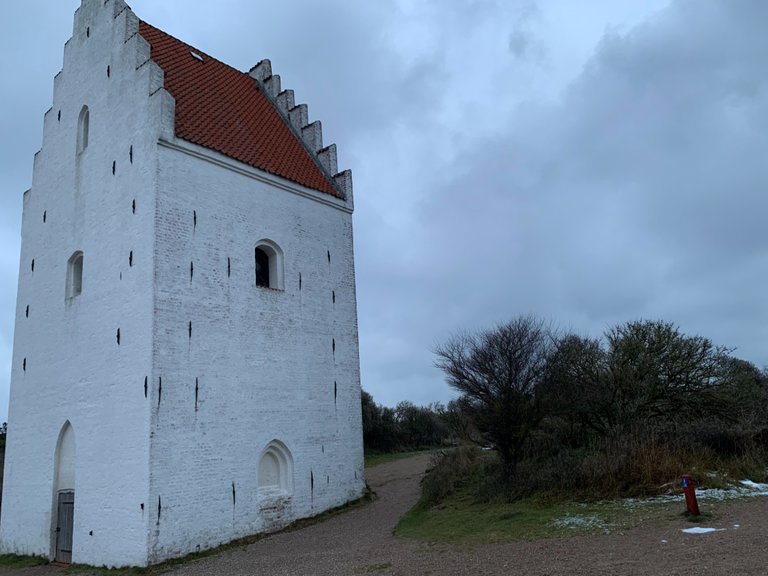
[POL] Pierwsze wzmianki o kościele św. Wawrzyńca pochodzą z XIVw. Przez wieki służył lokalnej społeczności. Jednakże wędrujące wydmy zasypywały kościół aż wreszcie w 1795r. kościół został zamknięty. Wieżę pomalowano na biało, by była widoczna dla żeglarzy.
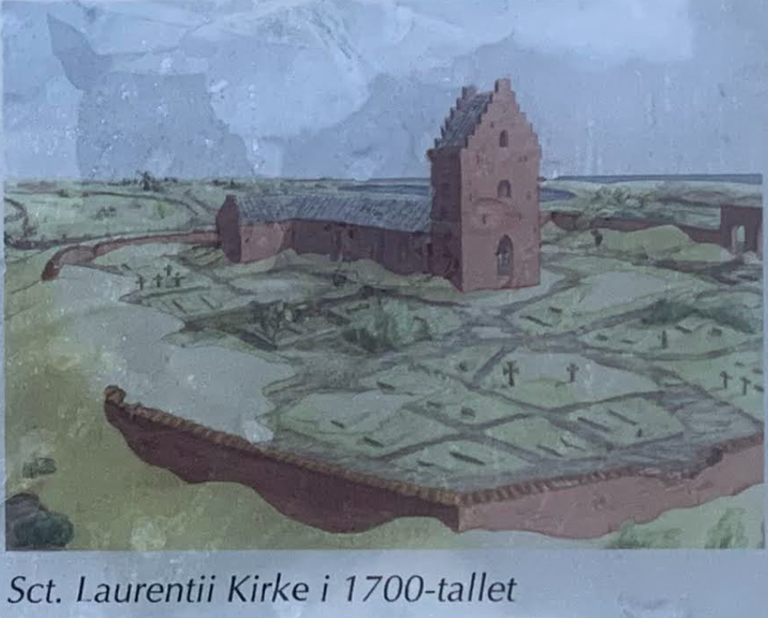
[ENG] First known mentions of St. Lawrence church date back to the XIV century. It served the local community for centuries. However, wandering dunes buried it partially and finally in 1795 the church was closed. The tower was whitewashed to serve as signal post for seamen.
Skagen
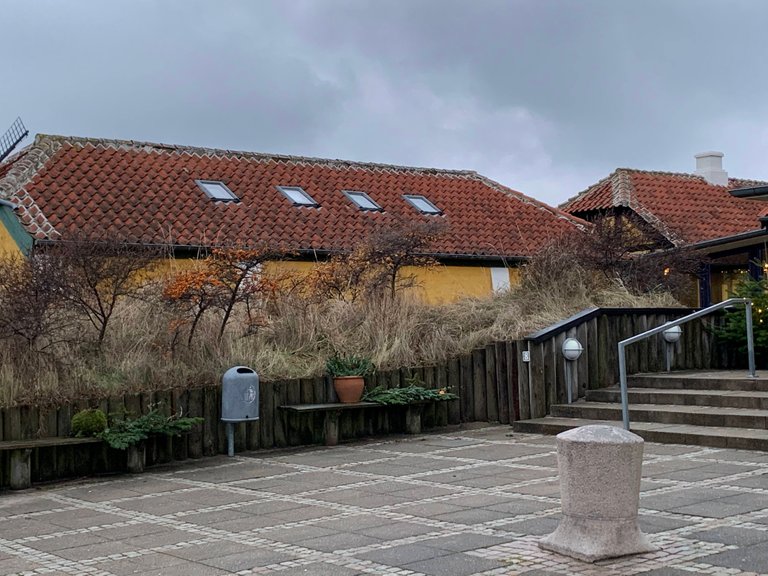
[POL] Od kościoła przyjemną ścieżkę dochodzę do miastecka Skagen. Latem jest tu mnóstwo turystów. Przyciąga ich najbardziej na północ wysunięty punkt Danii. W grudniowy, sobotni ranek, jednakże, miasteczko jest pustawe i zaspane. Przechodzę obok żółtych domów (dlaczego na północy Danii domy są w większości malowane na żółto?), starego wiatraka, portu.
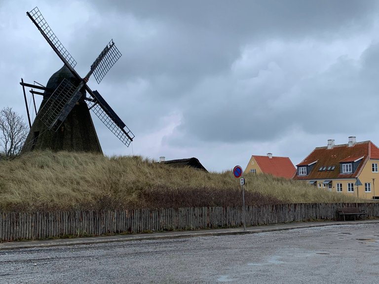
[ENG] A pleasant trail leads me from the church into Skagen. The town is bustling with tourists in high summer. However, on a December Saturday morning it looks empty and sleepy. I pass by an old windmill, houses painted yellow (I noticed that most houses in northern Denmark are painted yellow - why?), the port.
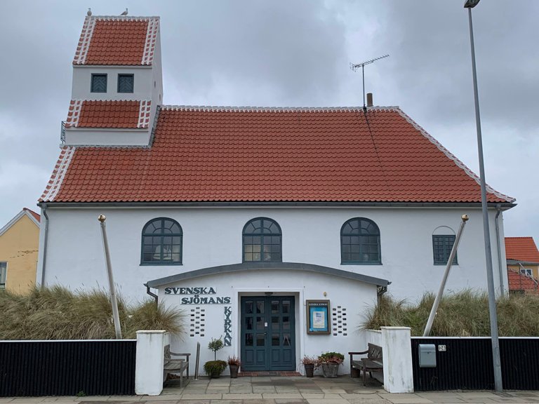
[POL] Mijam kościół szwedzkich marynarzy. W porcie trwa wyładunek dużego statku "Artemis". Dalej stoi pomnik duńskich rybaków. Przechodzę przez miasteczko kierując się na północ - w stronę przylądka Grenen.
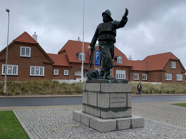
[ENG] I pass by a church of Swedish seamen. In the harbor a large ship named "Artemis" is being unloaded. I found a monument dedicated to Danish fishermen. My trail is north-bound, towards Denmark's northernmost tip - Grenen.
Kattegat
[POL] Wychodzę nad morze. A dokładnie jest to cieśnina Kattegat - dla jednych część Bałtyku, wg innych zatoka Morza Północnego, a dla Duńczyków po prostu "Kattegat". Chodzenie po piasku idzie mi kiepsko. Dokonuję odkrycia: "ziemia niczyja", na granicy morza i lądu, to idealna ścieżka. Piasek jest ubity, noga nie zapada się. Tylko uważam, żeby nie iść zbyt blisko morza - nie jestem przekonany, że moje górskie buty trekkingowe były pomyślane jako gumiaki do słonej wody...
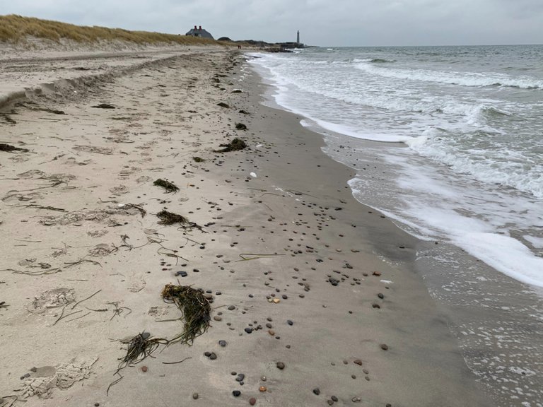
[ENG] The trail reaches the sea. To be precise, it's Kattegat. Some say it's part of the Baltic Sea, for other it's a bay of the North Sea. For the Danish it's simply "the Kattegat". I struggle walking on the sand. But I made a discovery - the "no man's land", just between the sea and the shore, makes a perfect surface. Wet sand is springy, but hard enough to keep a good pace. I am only careful not to get to close to the water - I am not quite sure my trekking boots are seawater proof.
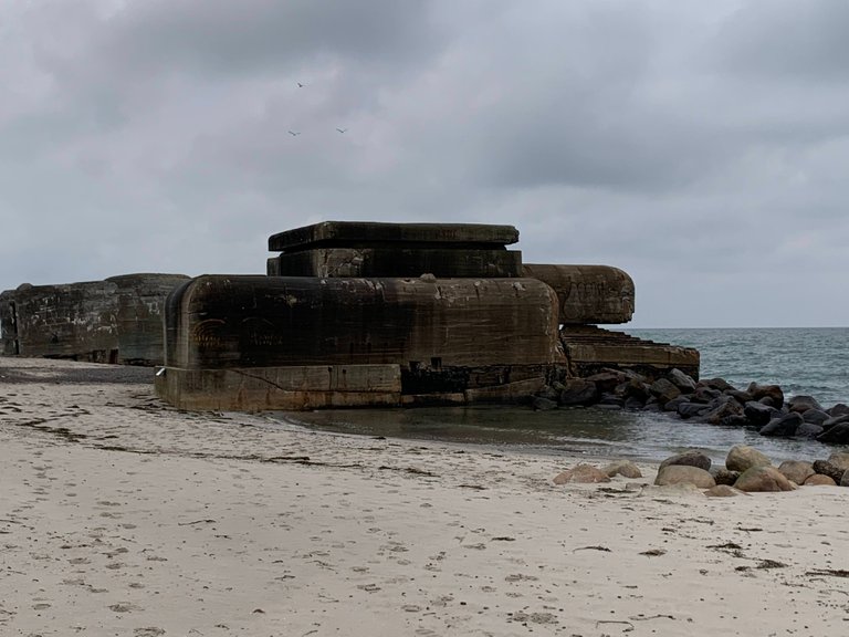
[POL] Wzdłuż plaży ciągną się umocnienia z II WŚ. To część "Atlantyckiego Muru". Przylądek Grenen miał strategiczne znaczenie. Niemcy zbudowali tam 28 bunkrów wyposażonych w 12cm działa o zasięgu do 10km. Co ciekawe, od czasu wojny morze pochłonęło ok. 40m plaży więc obecnie bunkry są bezpośrednio poddane uderzeniom fal.
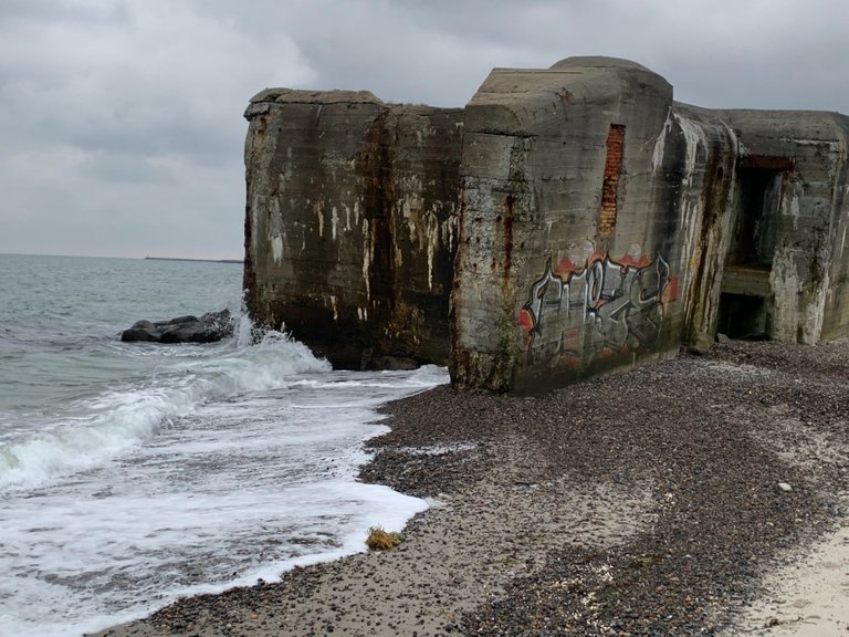
[ENG] Along the shore there are bunkers from WWII. Originally 28 of them, with 12cm cannons, watched over the entrance to Kattegat. They were part of "Atlantic Wall" - fortification build by Germany as protection against allied sea-borne attack. Interestingly, since the end od the was, the sea has moved some 40m inland and now the bunkers are directly washed by waves.
Det Grå Fyr
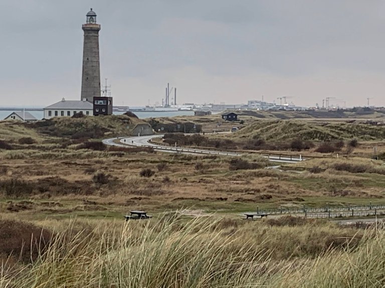
[POL] Idąc dalej na północ mijam "Szarą Latarnię" (Det Grå Fyr). Latarnia została zbudowana w połowie XIXw. Spojrzenie na mapę pozwala sobie uzmysłowić jak ważna była. Obecnie służy bardziej turystom i przyrodnikom zamiast marynarzom. Oprócz widoków na morze i ląd, latarnia jest doskonałym punktem do obserwacji ptaków, które dwa razy w roku przelatują tędy w swoich sezonowych migracjach.
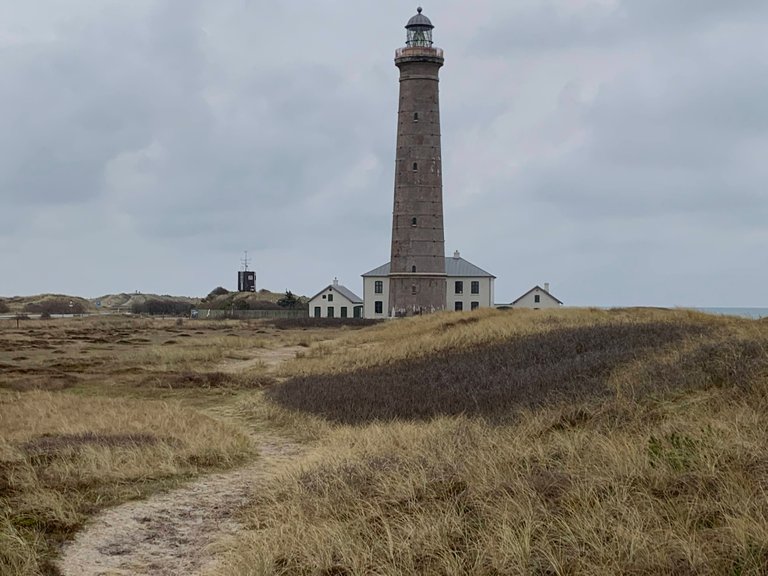
[ENG] Going further north I encounter the Grey Lighthouse (Det Grå Fyr). Built in XIX century it was crucial in making the passage into Kattegat safe. Nowadays it is more of tourist attraction, serving as a viewing point and observatory for lovers of migrating birds. Two times each year birds cross the strait in their season voyages.
[POL] Sporo jak na jedną wyprawę, prawda? A to nawet nie połowa mojej wędrówki. W drugiej części posta "På toppen af Danmark" dojdę do końca Danii. Potem będzie długi spacer brzegiem Morza Północnego. A na koniec odwiedzimy wydmy, które zawędrowały w głąb lądu.
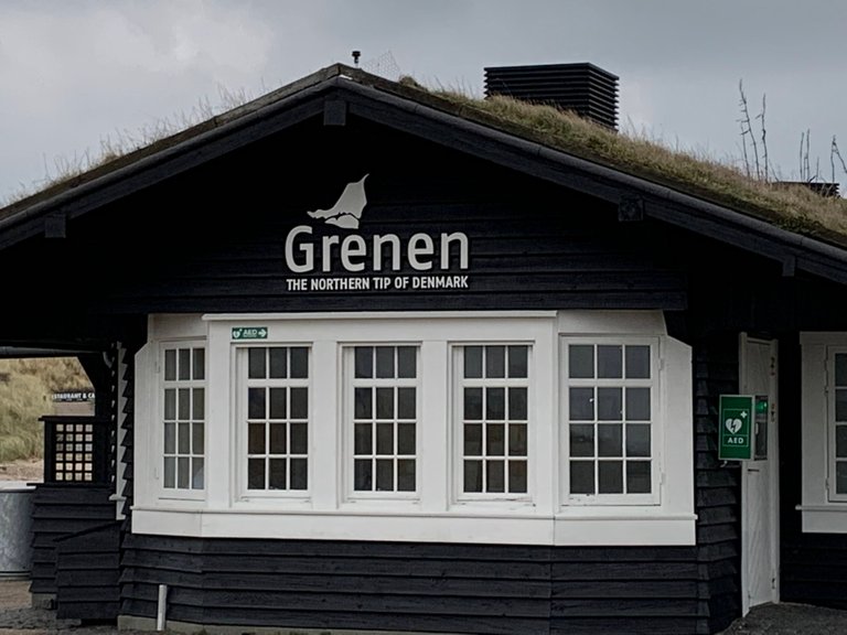
[ENG] Quite a few attractions for one hike, isn't it? However, it's not even half of my hike. In the second part of my blog post "På toppen af Danmark", I will reach the very top of Denmark. The I will have a long walk along the coast of the North Sea. Finally, I will visit dunes which have wandered far from the sea.
Congratulations, your post has been added to Pinmapple! 🎉🥳🍍
Did you know you have your own profile map?
And every post has their own map too!
Want to have your post on the map too?
Congratulations @merthin! Your post made the TravelFeed team happy so we have sent you our big smile. Keep up the good job. 😃
Thanks for using TravelFeed!
@smeralda (TravelFeed team)
PS: TravelFeed is in social media to reach more people, follow us on Facebook, Instagram, and Twitter.
Thank you for sharing this amazing post on HIVE!
non-profit curation initiative!Your content got selected by our fellow curator @stevenson7 & you just received a little thank you via an upvote from our
You will be featured in one of our recurring curation compilations and on our pinterest boards! Both are aiming to offer you a stage to widen your audience within and outside of the DIY scene of hive.
Join the official DIYHub community on HIVE and show us more of your amazing work and feel free to connect with us and other DIYers via our discord server: https://discord.gg/mY5uCfQ !
If you want to support our goal to motivate other DIY/art/music/homesteading/... creators just delegate to us and earn 100% of your curation rewards!
Stay creative & hive on!