It's not just coastal areas that will be affected by rising waters, and the US might be hopelessly underprepared unless planning starts now.
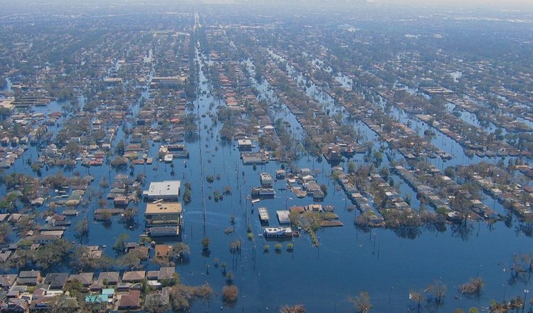
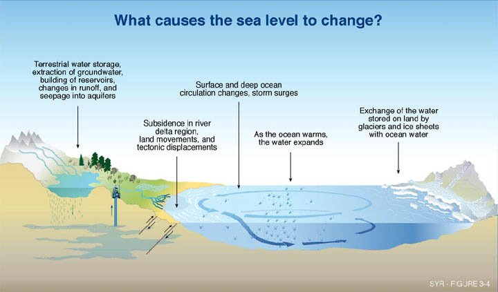
It’s an obvious truth that rising seas are going to displace a lot of people. How many, and how fast, depends on many factors, especially the stability of marine-based glaciers in west Antarctica.

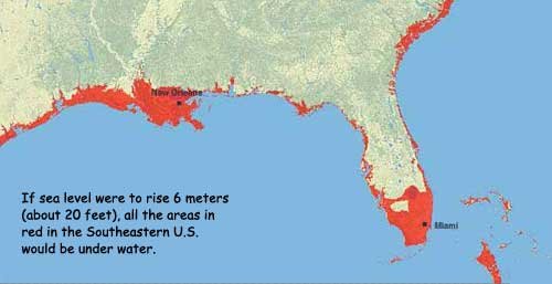
Recent studies indicate that nearly 190 million people are directly at risk from sea-level rise, and that in more extreme scenarios over 1 billion people who live at lower elevations would be put in jeopardy. Where exactly will these people go? What impact will they have on the cities and states they flee to?

Mathew Hauer, a geographer at the University of Georgia in Athens, has taken a stab at answering these questions in a paper published this week. Focusing on the US, he has looked at studies identifying populations at risk if sea level rises 1.8 metres by 2100, and has scrutinised 319 counties where more than 13 million people are likely to be displaced.
Hauer reasons that they are likely to follow paths of earlier migrants and refugees, those paths often defined by location of family, friends and economic opportunity.

To try to predict the patterns, he has used Internal Revenue Service figures that show county-to-county migration from 1990 to 2013. The most compelling and thought-provoking result is that rising seas are not just a problem for coastal elites with their beach houses and waterfront condos. Every state in the US will be impacted, either by residents fleeing or by people seeking refuge.
That's cute, but I wouldn't worry about it too much. Keep reading, you'll figure it out.
How high is the water rising? How high has it risen in the last year?
3mm a year?
By the way..what's the depth of a typical tide?